Category:Haveri district
Haveri district (Kannada: ಹಾವೇರಿ) is a district in the Indian state of Karnataka. The town of Haveri is the district headquarters. The district is bounded by Dharwad district on the north, by Gadag district on north east, by Bellary district on East, by Davangere district on south, by Shimoga district on southwest and by Uttara Kannada on west and north west. Before it was made a separate district, it was part of Dharwad district.14°48′0″N 75°24′0″E / 14.8°N 75.4°E
district in Karnataka, India   | |||||
| Upload media | |||||
| Instance of | |||||
|---|---|---|---|---|---|
| Location | Belgaum division, Karnataka, India | ||||
| Capital | |||||
| Official language | |||||
| Population |
| ||||
| official website | |||||
 | |||||
Subcategories
This category has the following 6 subcategories, out of 6 total.
*
Media in category "Haveri district"
This category contains only the following file.
-
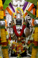 Rattihalli Virabhadra.png 1,024 × 1,546; 2.87 MB
