Category:Heathfield, Heathfield and Waldron
town in East Sussex, UK  | |||||
| Upload media | |||||
| Instance of |
| ||||
|---|---|---|---|---|---|
| Location | Heathfield and Waldron, Wealden, East Sussex, South East England, England | ||||
| Different from | |||||
| official website | |||||
 | |||||
English: Heathfield is a small market town, and the principal settlement in the civil parish of Heathfield and Waldron in the Wealden District of East Sussex, England.
Italiano: Heathfield è un paese dell' East Sussex, in Inghilterra. Si trova nella parrocchia civile di Heathfield and Waldron.
Română: Heathfield este un oraş în comitatul East Sussex, regiunea South East, Anglia. Oraşul se află în districtul Wealden.
Subcategories
This category has the following 9 subcategories, out of 9 total.
C
- Cumming's Wood (5 F)
H
- Heathfield railway station (6 F)
- Heathfield Tunnel (5 F)
O
- Oasts in Heathfield (1 F)
R
- St Richard's Church, Heathfield (18 F)
S
- State Hall, Heathfield (8 F)
U
- Union Church, Heathfield (12 F)
W
Media in category "Heathfield, Heathfield and Waldron"
The following 41 files are in this category, out of 41 total.
-

-
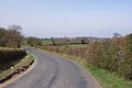 A country lane near Old Mill Farm - geograph.org.uk - 48311.jpg 640 × 427; 73 KB
-
 A265 at Heathfield - geograph.org.uk - 2875227.jpg 1,496 × 2,256; 764 KB
-
 A265 out of Heathfield towards Cross in Hand - geograph.org.uk - 2880436.jpg 4,000 × 3,000; 3.44 MB
-
 A267 near Heathfield - geograph.org.uk - 2387273.jpg 640 × 533; 74 KB
-
 A267 on the edge of Heathfield - geograph.org.uk - 2387282.jpg 640 × 430; 69 KB
-
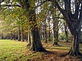 Autumnal Tree Lined Drive - geograph.org.uk - 1554260.jpg 640 × 480; 172 KB
-
 Bay Tree Close, Heathfield - geograph.org.uk - 656097.jpg 640 × 480; 105 KB
-

-
 Buses in Heathfield, 3 September 2012.jpg 2,048 × 1,536; 1.54 MB
-
-
 Cottage, School Hill, Old Heathfield - geograph.org.uk - 1247965.jpg 640 × 430; 90 KB
-
 Countryside Old Heathfield East Sussex - geograph.org.uk - 157970.jpg 640 × 480; 148 KB
-
 Cuckoo Accident AC Elliott.jpg 1,296 × 768; 306 KB
-
 Heathfield Village Flag.svg 2,500 × 1,500; 14 KB
-
 Footpath south of Old Heathfield - geograph.org.uk - 1251628.jpg 640 × 430; 109 KB
-
 Gibraltar Tower, Heathfield Park (geograph 1880221).jpg 683 × 1,024; 186 KB
-
 Heathfield Art and Books - geograph.org.uk - 1627195.jpg 640 × 480; 62 KB
-
 Heathfield banner High Street.jpg 2,800 × 400; 480 KB
-
 Heathfield fire station - geograph.org.uk - 471983.jpg 640 × 427; 200 KB
-
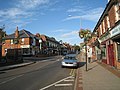
 Heathfield high street.jpg 3,648 × 2,736; 2.36 MB
-
 Heathfield Park Cricket Club - geograph.org.uk - 1247989.jpg 640 × 430; 88 KB
-
 Heathfield Youth Club - geograph.org.uk - 1318422.jpg 640 × 480; 86 KB
-
 High Street in Heathfield, East Sussex.jpg 3,648 × 2,736; 2.36 MB
-
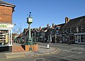
 High Street, Heathfield, East Sussex.jpg 640 × 480; 79 KB
-

-

-

-
 Prince of Wales pub, Heathfield - geograph.org.uk - 1975342.jpg 640 × 480; 64 KB
-
 School Hill. Old Heathfield - geograph.org.uk - 1247957.jpg 640 × 430; 95 KB
-
 Seats, Millennium Green - geograph.org.uk - 1318383.jpg 480 × 640; 219 KB
-
 Stile Old Heathfield East Sussex - geograph.org.uk - 119962.jpg 640 × 480; 144 KB
-

-

-
 Woodland Way - Heathfield - geograph.org.uk - 656124.jpg 640 × 480; 63 KB
-
 Footpath Punnets Town - geograph.org.uk - 83374.jpg 640 × 480; 154 KB
-
 Orchard House - geograph.org.uk - 393835.jpg 640 × 418; 363 KB
-
 St Dunstan's Wood Cade Street East Sussex - geograph.org.uk - 157961.jpg 640 × 480; 157 KB
-
 The Runt In Tun - geograph.org.uk - 333115.jpg 640 × 480; 74 KB
-
 Thorpe Gardens - geograph.org.uk - 333106.jpg 640 × 480; 77 KB
-
 Tigers Haven - geograph.org.uk - 393860.jpg 640 × 419; 431 KB


.jpg)


