Category:Hebden Royd
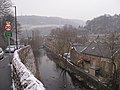
English: Hebden Royd is a civil parish with a town council in the Metropolitan Borough of Calderdale in West Yorkshire, England. According to the 2001 census it had a population of 9,092. It includes Hebden Bridge, Mytholmroyd and Cragg Vale.
Nederlands: Hebden Royd is een civil parish in het bestuurlijke gebied Calderdale, in het Engelse graafschap West Yorkshire. De civil parish telt
civil parish in West Yorkshire, England, UK  | |||||
| Upload media | |||||
| Instance of | |||||
|---|---|---|---|---|---|
| Location | Calderdale, West Yorkshire, Yorkshire and the Humber, England | ||||
 | |||||
Subcategories
This category has the following 13 subcategories, out of 13 total.
B
C
H
- Hebble End (20 F)
M
S
- Stoney Royd Farm (2 F)
T
- Te Deum stone (9 F)
W
- Wadsworth Banks Farm (5 F)
Media in category "Hebden Royd"
The following 200 files are in this category, out of 3,200 total.
(previous page) (next page)-
 "Drew Forsyth" 27 West End, Hebden Bridge, West Yorkshire - geograph.org.uk - 2244450.jpg 3,072 × 2,304; 1.35 MB
-
 "Inn on the Bridge" (Pub) 1 Old Gate - geograph.org.uk - 2244438.jpg 3,072 × 2,304; 1.25 MB
-

-
-
-
 'Follow the stream up' - geograph.org.uk - 2840043.jpg 1,024 × 768; 232 KB
-
 'Fork left on a heather clogged track' - geograph.org.uk - 2838991.jpg 1,024 × 768; 157 KB
-

-
 'Walk on at the edge of the tree line' - geograph.org.uk - 2839877.jpg 1,024 × 768; 208 KB
-
 22, New Road - geograph.org.uk - 3958012.jpg 4,608 × 3,456; 3.43 MB
-
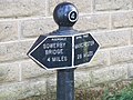 4 Miles - geograph.org.uk - 2670020.jpg 4,000 × 3,000; 3.39 MB
-
 8.38 km to the top, Cragg Road - geograph.org.uk - 3561396.jpg 2,000 × 1,453; 1.08 MB
-
 8km to the top, Cragg Road - geograph.org.uk - 3567821.jpg 2,000 × 1,495; 1.15 MB
-
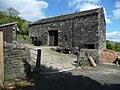 A barn at Lower Ewood, Mytholmroyd - geograph.org.uk - 4485379.jpg 2,048 × 1,536; 979 KB
-
 A bend on Upper Lumb Lane - geograph.org.uk - 3007275.jpg 2,000 × 1,482; 950 KB
-
 A bit of mud on Hebden Royd FP47 - geograph.org.uk - 4258980.jpg 1,500 × 2,000; 1.34 MB
-
 A boggy area in Broad Head Clough - geograph.org.uk - 2584424.jpg 800 × 600; 312 KB
-
 A boggy area in Martin Wood, Mytholmroyd - geograph.org.uk - 2848375.jpg 800 × 536; 198 KB
-
 A book of dovecotes (1920) (20210182969).jpg 1,552 × 2,244; 1,019 KB
-
 A branch of Hebden Royd Footpath 122 at Blackstone Edge Road - geograph.org.uk - 2947487.jpg 2,000 × 1,410; 1.31 MB
-
 A branch of Hebden Royd Footpath 122 at Blackstone Edge Road - geograph.org.uk - 2947529.jpg 2,000 × 1,357; 1.29 MB
-
 A branch of Hebden Royd FP112 below Owlet Hill - geograph.org.uk - 3562343.jpg 2,000 × 1,500; 1.57 MB
-
 A branch of Hebden Royd FP22 - geograph.org.uk - 4273839.jpg 2,000 × 1,500; 1.18 MB
-
 A branch of Hebden Royd FP24 at Little Moor - geograph.org.uk - 3691726.jpg 2,000 × 1,500; 1.28 MB
-

-
 A branch of Hebden Royd FP36, Mytholmroyd - geograph.org.uk - 4483979.jpg 2,048 × 1,536; 735 KB
-

-
 A branch of Hebden Royd FP59 at Scout Road, Mytholmroyd - geograph.org.uk - 5144994.jpg 1,482 × 2,000; 1.75 MB
-
 A carved stone gathers much moss - geograph.org.uk - 6157913.jpg 768 × 1,024; 343 KB
-

-
 A corner on Hebden Royd FP17 - geograph.org.uk - 3120897.jpg 2,000 × 1,500; 1.41 MB
-
 A corner on Twine Lane, Mytholmroyd - geograph.org.uk - 4483965.jpg 2,048 × 1,536; 729 KB
-
 A footpath at New Burlees - geograph.org.uk - 3653064.jpg 2,000 × 1,500; 1.46 MB
-

-
 A library on a tree^ - geograph.org.uk - 4739712.jpg 1,024 × 881; 232 KB
-
 A little stream crossing Hebden Royd FP 67 - geograph.org.uk - 2686908.jpg 2,000 × 1,500; 1.02 MB
-

-
 A lone tree above Mytholmroyd - geograph.org.uk - 2847025.jpg 800 × 533; 138 KB
-

-
 A narrow part of Hebden Royd Footpath 67 - geograph.org.uk - 3185659.jpg 1,500 × 2,000; 1.17 MB
-
 A passing train on the Caldervale Lane - geograph.org.uk - 2848563.jpg 800 × 533; 185 KB
-
 A puzzling waymark - geograph.org.uk - 3500570.jpg 2,000 × 1,500; 1.07 MB
-
 A resurfaced part of Crow Nest Road - geograph.org.uk - 4197629.jpg 2,000 × 1,500; 1.2 MB
-
 A rocky area on Turley Holes and Higher House Moor - geograph.org.uk - 2881852.jpg 2,000 × 1,500; 1.11 MB
-
 A slack in the hillside, Brearley Wood, Mytholmroyd - geograph.org.uk - 4488355.jpg 1,536 × 2,048; 1.5 MB
-
 A soggy patch on Erringden Moor - geograph.org.uk - 3536341.jpg 3,872 × 2,592; 6.01 MB
-
-
 A stile of sorts, Hathershelf Scout Wood, Mytholmroyd - geograph.org.uk - 2642870.jpg 2,000 × 1,500; 957 KB
-
-
 A View over Red Dyke Flat - geograph.org.uk - 6205804.jpg 5,184 × 3,456; 5.49 MB
-
 A waymark on the Calderdale Way, Mytholmroyd - geograph.org.uk - 4478234.jpg 2,000 × 1,490; 1.29 MB
-
 A wet corner in a patch of woodland, Cragg Vale - geograph.org.uk - 2732028.jpg 2,000 × 1,500; 1.45 MB
-
 A wet part of Hebden Royd FP63 - geograph.org.uk - 3181756.jpg 2,000 × 1,542; 1.3 MB
-
 A wet patch on a footpath, Cragg Vale - geograph.org.uk - 2732023.jpg 2,772 × 1,977; 1.76 MB
-

-

-
 A wide stile near Round Hill Wood, Cragg Vale - geograph.org.uk - 2881994.jpg 2,000 × 1,492; 1.42 MB
-
 A646 Burnley Road, Brearley - geograph.org.uk - 6086596.jpg 1,024 × 769; 131 KB
-

-
 A646 passing under railway arches - geograph.org.uk - 5008767.jpg 640 × 481; 64 KB
-
 A646 towards Halifax - geograph.org.uk - 3467689.jpg 640 × 480; 66 KB
-
 A646 towards Halifax - geograph.org.uk - 3467700.jpg 640 × 480; 78 KB
-
 A646, Mytholmroyd - geograph.org.uk - 2684874.jpg 1,024 × 705; 119 KB
-
 Access point onto Libery Rush Bed - geograph.org.uk - 3226040.jpg 2,000 × 1,500; 861 KB
-
 Access track to Crumber Hill, Cragg Vale - geograph.org.uk - 2792393.jpg 2,000 × 1,500; 970 KB
-
 Access track to Deacon Hill - geograph.org.uk - 2766726.jpg 2,000 × 1,500; 1.09 MB
-
 Adelaide Street, Bankfoot - geograph.org.uk - 5048706.jpg 640 × 480; 74 KB
-

-
 Agricultural building at Twine, Mytholmroyd - geograph.org.uk - 4487245.jpg 1,986 × 1,464; 1.34 MB
-
 Air valve marker on Hebden Royd FP63 - geograph.org.uk - 3188789.jpg 2,000 × 1,500; 1.22 MB
-
 Albert Street, Hebden Bridge - geograph.org.uk - 5100502.jpg 640 × 480; 82 KB
-
 Alder catkins - Wood Hey, Hebden Bridge - geograph.org.uk - 2844815.jpg 598 × 800; 142 KB
-
 Allotments - Sandy Gate - geograph.org.uk - 1142824.jpg 640 × 480; 354 KB
-
 Along the Rochdale Canal - geograph.org.uk - 5264111.jpg 3,240 × 4,320; 4.57 MB
-
 Alongside Sunderland Pasture - geograph.org.uk - 1957343.jpg 2,560 × 1,920; 717 KB
-
 Alternative paths - geograph.org.uk - 2644954.jpg 2,000 × 1,500; 1.68 MB
-
 And now there is only one - geograph.org.uk - 1867025.jpg 480 × 640; 122 KB
-
 Annibut Lee from Cove Hill - geograph.org.uk - 2882174.jpg 2,000 × 1,500; 833 KB
-

-
 Approaching Brearley Upper Lock - geograph.org.uk - 6073791.jpg 5,184 × 3,456; 4.56 MB
-
 Approaching Churn Milk Joan from the west - geograph.org.uk - 6073251.jpg 1,024 × 768; 229 KB
-
 Approaching Far Moorside Farm - geograph.org.uk - 4845416.jpg 1,600 × 1,200; 431 KB
-
 Approaching Hebden Bridge - geograph.org.uk - 1914550.jpg 960 × 536; 146 KB
-
 Approaching Knowl Farm on Cragg Road - geograph.org.uk - 4295188.jpg 1,600 × 1,200; 457 KB
-
 Archway to the former Grove Brewery, Burnley Road - geograph.org.uk - 3027094.jpg 2,000 × 1,795; 1.15 MB
-
 Arriving in Hebden Bridge - geograph.org.uk - 2793748.jpg 3,072 × 2,304; 1.68 MB
-
 Arts Centre, Market Street, Hebden Bridge - geograph.org.uk - 6288615.jpg 1,024 × 768; 186 KB
-
 Ashley Villas - Moss Lane - geograph.org.uk - 1142366.jpg 526 × 640; 239 KB
-
 At the bottom of the lane to Old Cragg Hall - geograph.org.uk - 2875999.jpg 2,000 × 1,500; 1.21 MB
-
 Autumn evening view in Mytholmroyd - geograph.org.uk - 2653704.jpg 4,000 × 2,493; 2.54 MB
-
 Awkward gate on Hebden Royd FP114 - geograph.org.uk - 3733052.jpg 2,000 × 1,500; 1.53 MB
-
 Awkward gate on the footpath down Cock Hill Clough - geograph.org.uk - 2883727.jpg 2,000 × 1,500; 935 KB
-
 B6138 Turvin Road - geograph.org.uk - 5454371.jpg 5,184 × 3,888; 3.9 MB
-
 B6318 heading north - geograph.org.uk - 3467628.jpg 640 × 480; 121 KB
-
 B6318 heading north - geograph.org.uk - 3467637.jpg 640 × 480; 75 KB
-
 Bamboo - Bridge Gate - geograph.org.uk - 1859745.jpg 490 × 640; 75 KB
-
 Bank House and New Delight, Hall Bank Lane - geograph.org.uk - 4216489.jpg 2,000 × 1,466; 583 KB
-
 Bank Terrace, Glen View Road, Hebden Bridge - geograph.org.uk - 6288548.jpg 1,024 × 768; 153 KB
-
 Bank Top Farm, Cragg Vale - geograph.org.uk - 2766699.jpg 2,000 × 1,500; 1.02 MB
-
 Bankfield Avenue, Mytholmroyd, at Midgley Road - geograph.org.uk - 3632087.jpg 2,000 × 1,500; 1.2 MB
-
 Banksfield Estate, Mytholmroyd - geograph.org.uk - 1837079.jpg 2,000 × 1,406; 887 KB
-
 Banksfield Mill, Mytholmroyd - geograph.org.uk - 2162483.jpg 640 × 480; 132 KB
-
 Banksfield Terrace, Mytholmroyd - geograph.org.uk - 1835313.jpg 2,000 × 1,380; 655 KB
-
 Bankside, Hebden Bridge - bottom - geograph.org.uk - 6073345.jpg 1,024 × 768; 293 KB
-
 Bankside, Hebden Bridge - descending - geograph.org.uk - 6073340.jpg 768 × 1,024; 327 KB
-

-
 Bar place - Crown Street - geograph.org.uk - 1858900.jpg 480 × 640; 71 KB
-
 Barbed wire fence across Miry Lane - geograph.org.uk - 3501435.jpg 2,000 × 1,500; 1.01 MB
-
 Barn at Withens Clough Reservoir - geograph.org.uk - 3244873.jpg 2,048 × 1,536; 599 KB
-

-

-
 Beacon at Mytholmroyd - geograph.org.uk - 3188919.jpg 1,500 × 2,000; 916 KB
-
 Beauty by Grace - Albert Street - geograph.org.uk - 1858699.jpg 480 × 640; 70 KB
-
 Bee Hive Mills, Hebden Bridge - geograph.org.uk - 2136951.jpg 640 × 480; 89 KB
-
 Bee Hive Mills, Hebden Bridge, Sign - geograph.org.uk - 2136952.jpg 640 × 480; 139 KB
-
 Beehive emblem on the former Co-operative store - geograph.org.uk - 2687309.jpg 1,706 × 2,000; 538 KB
-
 Bell House - geograph.org.uk - 3471721.jpg 2,000 × 1,493; 885 KB
-
 Bell House - geograph.org.uk - 4476863.jpg 4,320 × 3,240; 5.74 MB
-
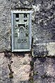
 Bench mark, Stake Lane - geograph.org.uk - 3567852.jpg 1,500 × 2,000; 1.59 MB
-
 Bench on platform 1 - geograph.org.uk - 2586181.jpg 800 × 600; 87 KB
-
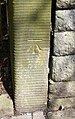
 Benchmark on a gatepost beside Water Stalls Lane - geograph.org.uk - 3246828.jpg 2,048 × 1,536; 627 KB
-
 Benchmark on building at Carr Farm - geograph.org.uk - 5977021.jpg 668 × 1,024; 284 KB
-

-

-
 Benchmark on Crown Inn - geograph.org.uk - 5659481.jpg 683 × 1,024; 300 KB
-
 Benchmark on gatepost at ^6 Burnley Road - geograph.org.uk - 5659644.jpg 668 × 1,024; 297 KB
-
-
-
 Benchmark on Kimbo Cottage, Midgley Road - geograph.org.uk - 6307430.jpg 683 × 1,024; 290 KB
-
 Benchmark on Mytholmroyd Methodist Church - geograph.org.uk - 5977427.jpg 651 × 1,024; 204 KB
-
 Benchmark on railway bridge, New Road - geograph.org.uk - 5977459.jpg 1,024 × 683; 293 KB
-
 Benchmark on Rochdale Canal lock - geograph.org.uk - 5977106.jpg 675 × 1,024; 283 KB
-

-
 Benchmark on St John's Church, Cragg Vale - geograph.org.uk - 3244892.jpg 2,048 × 1,536; 673 KB
-
-
-
 Benchmark on wall at approach to Carr Bridge - geograph.org.uk - 5973756.jpg 1,024 × 683; 340 KB
-

-

-

-
 Benchmark on wall outside Brook House - geograph.org.uk - 5977049.jpg 1,024 × 683; 285 KB
-
 Benchmark on ^26 Town Gate - geograph.org.uk - 6307802.jpg 1,024 × 683; 331 KB
-
 Bent Close Lane - geograph.org.uk - 1275606.jpg 640 × 480; 57 KB
-
 Bent Close Lane - geograph.org.uk - 3744240.jpg 2,000 × 1,500; 1.17 MB
-
 Bent Close Lane, Mytholmroyd - geograph.org.uk - 990528.jpg 640 × 480; 95 KB
-
 Bent Close, Mytholmroyd - geograph.org.uk - 994063.jpg 640 × 480; 92 KB
-
 Bethel Terrace - geograph.org.uk - 4330683.jpg 2,495 × 1,797; 997 KB
-
 Bethel Terrace, Brearley Lane - geograph.org.uk - 3261980.jpg 2,000 × 1,500; 892 KB
-
 Bethesda Row - geograph.org.uk - 1889409.jpg 1,024 × 768; 154 KB
-
 Beware Live Bees^^ - geograph.org.uk - 6086546.jpg 1,600 × 900; 573 KB
-
 Beware of the cat^ - geograph.org.uk - 2732004.jpg 1,493 × 2,000; 752 KB
-
 Bike and Go, Hebden Bridge - geograph.org.uk - 6157903.jpg 1,024 × 768; 375 KB
-
 Bilberry on a post - geograph.org.uk - 980690.jpg 477 × 640; 98 KB
-
 Birch and bilberry at Wood Hey - geograph.org.uk - 4294898.jpg 1,024 × 420; 103 KB
-
 Birchcliffe Baptist Chapel war memorial, Hebden Bridge - geograph.org.uk - 1910527.jpg 2,000 × 2,000; 984 KB
-
 Birchcliffe Baptist Chapel, Hebden Bridge - geograph.org.uk - 1910519.jpg 1,487 × 2,000; 765 KB
-
 Birchcliffe Road - Commercial Street - geograph.org.uk - 1858674.jpg 640 × 480; 62 KB
-
 Birchcliffe Road, Hebden Bridge - geograph.org.uk - 1868862.jpg 640 × 480; 148 KB
-
 Birchcliffe Road, Hebden Bridge - geograph.org.uk - 1868864.jpg 640 × 480; 130 KB
-
 Birchcliffe Road, Hebden Bridge - geograph.org.uk - 2215751.jpg 800 × 600; 130 KB
-
 Birchcliffe, Hebden Bridge - geograph.org.uk - 5708920.jpg 3,706 × 4,982; 3.78 MB
-
 Bird Nest Hill - geograph.org.uk - 3128363.jpg 640 × 480; 80 KB
-
 Black Pit lock - geograph.org.uk - 6288606.jpg 1,024 × 768; 251 KB
-
-
 Black Pit Lock, Rochdale Canal, Hebden Bridge - geograph.org.uk - 4027958.jpg 1,064 × 1,600; 473 KB
-
 Blackpit Lock - geograph.org.uk - 2970458.jpg 800 × 600; 156 KB
-
 Blackstone Edge Road - geograph.org.uk - 4949777.jpg 5,184 × 2,981; 1.92 MB
-
 Blaith Royd Fields - geograph.org.uk - 2382426.jpg 3,872 × 2,592; 4.43 MB
-
 Blaith Royd Fields - geograph.org.uk - 5406829.jpg 640 × 427; 103 KB
-
 Blaith Royd Lane at Blaith Royd, Mytholmroyd - geograph.org.uk - 2876461.jpg 2,000 × 1,500; 994 KB
-
 Blake Moor - geograph.org.uk - 6185007.jpg 1,024 × 768; 160 KB
-
 Blind Lane approaching Wheatley Royd - geograph.org.uk - 4930871.jpg 2,048 × 1,536; 1.03 MB
-
 Blind Lane at Upper Blind Lane, Mytholmroyd - geograph.org.uk - 4930831.jpg 2,048 × 1,536; 1.17 MB
-
 Blind Lane, Mytholmroyd - geograph.org.uk - 4930865.jpg 1,536 × 2,048; 736 KB
-
 Blocked footpath at Catherine House - geograph.org.uk - 2883737.jpg 2,000 × 1,500; 628 KB
-
 Blocked Footpath at Hall Bank, Mytholmroyd - geograph.org.uk - 2631170.jpg 2,000 × 1,500; 1.23 MB
-
 Blocked footpath at Will Clough - geograph.org.uk - 2948159.jpg 2,000 × 1,500; 1.35 MB
-
 Blocked footpath near Annibut Lee - geograph.org.uk - 2948153.jpg 2,000 × 1,500; 1.14 MB
-
 Blocked footpath near Annibut Lee, Mytholmroyd - geograph.org.uk - 2922129.jpg 2,000 × 1,500; 735 KB
-
 Blocked footpath near Brink Top, Mytholmroyd - geograph.org.uk - 2480310.jpg 2,000 × 1,500; 1.09 MB
-
 Blocked footpath near Moorside Cottages - geograph.org.uk - 2947441.jpg 2,000 × 1,500; 1.46 MB
-
 Blocked footpath off Cock Hill Road - geograph.org.uk - 2949164.jpg 2,000 × 1,483; 1.24 MB
-
 Blocked footpath off Scout Road, Mytholmroyd - geograph.org.uk - 2626006.jpg 2,000 × 1,500; 1.05 MB
-
 Blocked gateway on Hebden Royd FP111 - geograph.org.uk - 4726399.jpg 2,048 × 1,536; 728 KB
-
 Blocked path off Frost Hole Lane - geograph.org.uk - 3471772.jpg 2,000 × 1,500; 1.56 MB
-
 Blocked path, Mytholmroyd - geograph.org.uk - 2497827.jpg 1,500 × 2,000; 1.19 MB
-
 Blocked stile - geograph.org.uk - 3471755.jpg 2,000 × 1,500; 1.07 MB
-

-
 Bluebells alongside the cycle route - geograph.org.uk - 6157918.jpg 1,024 × 768; 472 KB
-

-
 Boggy field on Sunderland Pasture - geograph.org.uk - 2381394.jpg 3,872 × 2,592; 5.67 MB
-
 Boggy field, Hill House Clough, Mytholmroyd - geograph.org.uk - 2644867.jpg 2,000 × 1,500; 1.26 MB
-

-
 Booth's - New Road - geograph.org.uk - 1860234.jpg 640 × 559; 80 KB
-
 Boots - Crown Street - geograph.org.uk - 1858959.jpg 640 × 511; 90 KB
-
 Boots - Valley Road - geograph.org.uk - 1860253.jpg 640 × 480; 86 KB
-
 Bottom end of footpath to Cragg Road - geograph.org.uk - 3550882.jpg 1,500 × 2,000; 1.65 MB
-
 Boundary Gate detail - geograph.org.uk - 1957420.jpg 2,560 × 1,920; 823 KB
-
 Boundary Gate detail - geograph.org.uk - 1957426.jpg 2,560 × 1,920; 735 KB
-
 Boundary Gate, near the Te Deum Stone - geograph.org.uk - 1957414.jpg 2,560 × 1,920; 562 KB

_1_Old_Gate_-_geograph.org.uk_-_2244438.jpg)


_(20210182969).jpg)


