Category:Heidmark
Deutsch: Die Heidmark ist eine Bezeichnung für zwei Gebiete in der südlichen Lüneburger Heide.
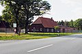
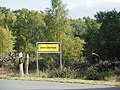
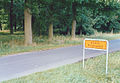
English: The Heidmark is an area of the Lüneburg Heath, much of which has not been accessible to the population since about 1935/1936. The establishment of a large military training area (Truppenübungsplatzes Bergen) by the German armed forces, the Wehrmacht, as part of their rearmament and preparation for war resulted in the evacuation of 24 villages and, since then the training area has been out-of-bounds to non-military personnel. Today it has become the Bergen-Hohne Training Area, the largest of its kind in Europe.
| Upload media | |||||
| Instance of | |||||
|---|---|---|---|---|---|
| Location |
| ||||
| |||||
Subcategories
This category has the following 8 subcategories, out of 8 total.
A
- Achterberg (Osterheide) (17 F)
E
- Heinrich Eggersglüß (3 F)
G
O
- Obereinzingen (Osterheide) (18 F)
- Old maps of Heidmark (30 F)
W
Media in category "Heidmark"
The following 28 files are in this category, out of 28 total.
-
2009-08-23-Oberndorfmark.ogg 2.8 s; 51 KB
-
2009-08-23-Oelfke.ogg 4.0 s; 43 KB
-
 2009-j-Ostenholz02-b.JPG 997 × 1,135; 140 KB
-
 Boehme01.jpg 520 × 342; 58 KB
-
 Böstlingen ehem.@Trp Übg Platz Bergen (1).JPG 4,486 × 3,122; 12.5 MB
-
 Böstlingen ehem.@Trp Übg Platz Bergen (3).JPG 4,600 × 2,901; 8.75 MB
-
 Böstlingen TrÜbPl Bergen@20160710 01.jpg 4,608 × 3,456; 10.57 MB
-
 Böstlingen TrÜbPl Bergen@20160710 02.jpg 4,608 × 3,456; 7.41 MB
-
 Dorfstraße ehem Ettenbostel.JPG 3,648 × 2,736; 4.37 MB
-
 Ettenbostel TrÜbPl Bergen@20160710 01.jpg 4,608 × 3,456; 7.67 MB
-
 Ettenbostel TrÜbPl Bergen@20160710 02.jpg 4,608 × 3,456; 7.56 MB
-
 Fahrenholz ehem.@Trp Übg Platz Bergen 20180805 (2).JPG 3,881 × 3,103; 7.89 MB
-
 Fahrenholz ehem.@Trp Übg Platz Bergen 20180805 (3).JPG 3,881 × 3,103; 8.79 MB
-
 Fahrenholzer Bach@Trp Übg Platz Bergen 20180805 (1).JPG 4,608 × 3,456; 7.36 MB
-
 Fahrenholzer Bach@Trp Übg Platz Bergen 20180805 (2).JPG 4,608 × 3,456; 11.09 MB
-
 Fritschdenkmal.JPG 3,264 × 2,448; 2.4 MB
-
 Fuhrhop - Böhmebrücke.jpg 1,920 × 1,080; 2.2 MB
-
 Karte1935 2002.jpg 2,470 × 1,787; 3.66 MB
-
 Oberhode@20180929 (1).JPG 4,073 × 2,684; 8.44 MB
-
 Oberhode@20180929 (3).JPG 4,608 × 3,456; 10.39 MB
-
 Pröbsten Schild.jpg 722 × 502; 284 KB
-
 Pröbsten Weg.jpg 745 × 515; 540 KB
-
 TrpÜbPlBergenStallGbd.jpg 3,264 × 2,448; 7.69 MB
-
 Trueplbergen.jpg 2,239 × 2,808; 482 KB
-
 Umsiedlung.jpg 1,517 × 2,145; 411 KB
-
 Warnau bei Bomlitz-Borg 1.JPG 2,542 × 1,888; 1.9 MB
-
 Warnau bei Bomlitz-Borg 2.JPG 2,560 × 1,920; 2.14 MB
-
 Wüstung Hormannshof.jpg 891 × 693; 275 KB


.JPG)
.JPG)


.JPG)
.JPG)
.JPG)
.JPG)


.JPG)
.JPG)


