Category:Heinz-Weißmann-Hof
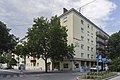
Deutsch: Wohnhausanlage Mexikoplatz 1: Heinz-Weißmann-Hof

| Object location | | View all coordinates using: OpenStreetMap |
|---|
public housing in Leopoldstadt  | |||||
| Upload media | |||||
| Instance of | |||||
|---|---|---|---|---|---|
| Location |
| ||||
| Street address |
| ||||
| Architect |
| ||||
| Inception |
| ||||
 | |||||
Subcategories
This category has only the following subcategory.
Media in category "Heinz-Weißmann-Hof"
The following 2 files are in this category, out of 2 total.
-
 Brunnenmitwasserspiel.JPG 4,000 × 3,000; 2.68 MB
-
 Wohnhausanlage Mexikoplatz 1.jpg 4,934 × 3,289; 3.26 MB
