Category:Hembury
This is a category about listed building number 1018850. |
| Object location | | View all coordinates using: OpenStreetMap |
|---|
hillfort in Devon  Vollene inne Hembury bygdeborg  | |||||
| Upload media | |||||
| Instance of | |||||
|---|---|---|---|---|---|
| Location |
| ||||
| Owned by |
| ||||
| Heritage designation |
| ||||
| Significant event |
| ||||
| official website | |||||
 | |||||
Media in category "Hembury"
The following 8 files are in this category, out of 8 total.
-

-
 Hembury Digital Terrain Model.jpg 1,920 × 1,080; 1.14 MB
-
 Hembury Hill I.jpg 2,592 × 1,552; 1.53 MB
-
 Hembury Hill II.JPG 1,024 × 768; 405 KB
-
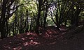 Hembury Hill III.jpg 2,592 × 1,552; 1.25 MB
-
 Hillfort gate-mechanisms, figure 17.jpg 1,200 × 1,891; 408 KB
-
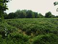
 Payhembury, Hembury hillfort - geograph.org.uk - 47183.jpg 640 × 423; 248 KB
-


