Category:Herengracht 573, Amsterdam
| Object location | | View all coordinates using: OpenStreetMap |
|---|
building in Amsterdam, the Netherlands  | |||||
| Upload media | |||||
| Instance of | |||||
|---|---|---|---|---|---|
| Location | Amsterdam, North Holland, Netherlands | ||||
| Street address |
| ||||
| Located on street | |||||
| Occupant | |||||
| Heritage designation |
| ||||
 | |||||
|
This is a category about rijksmonument number 1682
|
| Address |
|
Subcategories
This category has only the following subcategory.
M
Media in category "Herengracht 573, Amsterdam"
The following 10 files are in this category, out of 10 total.
-
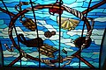 Amsterdam-Museum of bags and purses-ceiling.jpg 3,072 × 2,048; 2.79 MB
-
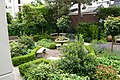 Amsterdam-Museum of bags and purses-garden.jpg 3,072 × 2,048; 3.14 MB
-
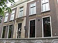
 Amsterdam-Museum of bags and purses.jpg 2,048 × 3,072; 2.99 MB
-
 Armsterdam - panoramio (2).jpg 1,024 × 680; 295 KB
-
 De huizen Herengracht 565-573, tussen Reguliersgracht en Utrechtsestraat.jpg 2,046 × 1,332; 507 KB
-
 Gevelwand aan gracht - Amsterdam - 20329128 - RCE.jpg 1,200 × 781; 208 KB
-
 Herengracht - Amsterdam (19).JPG 2,048 × 1,536; 1.31 MB
-
 Herengracht 563(ged.) t-m 573 (v.l.n.r.).jpg 1,686 × 1,162; 307 KB
-
 Herengracht 563-573 (v.l.n.r.) tussen Thorbeckeplein en Utrechtsestraat.jpg 6,948 × 4,392; 3.51 MB
-
 Tassenmuseum 002.JPG 2,592 × 1,944; 866 KB


.jpg)


.JPG)
_t-m_573_(v.l.n.r.).jpg)
_tussen_Thorbeckeplein_en_Utrechtsestraat.jpg)