Category:Herne Bay, Kent
seaside town in Kent, South East England .jpg) | |||||
| Upload media | |||||
| Spoken text audio | |||||
|---|---|---|---|---|---|
| Instance of | |||||
| Location | Canterbury, Kent, South East England, England | ||||
| Official language | |||||
| Population |
| ||||
| Area |
| ||||
 | |||||
Herne Bay is a coastal town, about 20 miles from the city of Canterbury. Canterbury Council administers Herne Bay, but they are completely different towns.
Subcategories
This category has the following 20 subcategories, out of 20 total.
A
B
- Herne Bay Bandstand (46 F)
C
- Herne Bay Cemetery, Kent (7 F)
E
H
- Herne Bay High School (2 F)
K
M
- Mayfair Court (8 F)
P
R
S
W
- Herne Bay Water Tower, Kent (3 F)
Media in category "Herne Bay, Kent"
The following 200 files are in this category, out of 337 total.
(previous page) (next page)-

-
 1904-08-06 back Bathing Machines Herne Bay.jpg 3,292 × 2,152; 660 KB
-
 1904-08-06 front Bathing Machines Herne Bay.jpg 3,328 × 2,132; 959 KB
-
 1904-08-13 front Paint cartoon.jpg 3,312 × 2,072; 729 KB
-
 64-65, Central Parade, Herne Bay - geograph.org.uk - 3815785.jpg 1,141 × 851; 195 KB
-

-
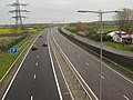 A299 Dual Carriageway to Herne Bay - geograph.org.uk - 1827586.jpg 3,072 × 2,304; 1.76 MB
-
 A299 Thanet Way towards Herne Bay - geograph.org.uk - 2009507.jpg 3,072 × 2,304; 2.15 MB
-
 A299 Thanet Way towards Herne Bay - geograph.org.uk - 2439997.jpg 3,072 × 2,304; 1.52 MB
-
 Air ambulance at Herne Bay - geograph.org.uk - 2564786.jpg 4,000 × 3,000; 1.98 MB
-
 Air vents at Herne Bay - geograph.org.uk - 3092543.jpg 640 × 480; 70 KB
-
 Air vents at Herne Bay - geograph.org.uk - 3092544.jpg 640 × 480; 65 KB
-
 Albany Drive, Herne Bay - geograph.org.uk - 1469199.jpg 640 × 430; 122 KB
-
 Approaching Herne Bay from the east - geograph.org.uk - 2113979.jpg 1,280 × 960; 643 KB
-
 Art Deco houses in Grand Drive Herne Bay Kent.JPG 4,000 × 3,000; 5.35 MB
-
 B' Side the C' Side, Herne Bay - geograph.org.uk - 2105044.jpg 3,488 × 2,616; 2.13 MB
-
 Bandstand pavilion, Herne Bay - geograph.org.uk - 3625248.jpg 640 × 427; 52 KB
-
 Barnes Wallis looks out to sea - geograph.org.uk - 1471226.jpg 480 × 640; 81 KB
-
 Barnes Wallis Statue.jpg 480 × 640; 57 KB
-
 Base of Clock Tower - geograph.org.uk - 858142.jpg 640 × 473; 86 KB
-
 Beach east of Herne Bay - geograph.org.uk - 1470429.jpg 640 × 430; 124 KB
-
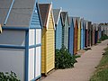
 Beach huts and grass slope by Western Esplanade - geograph.org.uk - 3221948.jpg 1,500 × 969; 109 KB
-
 Beach huts and incoming tide, Herne Bay - geograph.org.uk - 31519.jpg 715 × 477; 105 KB
-
 Beach huts at the bottom of the grass slope - geograph.org.uk - 3221946.jpg 1,500 × 990; 100 KB
-
 Beach huts looking out to sea - geograph.org.uk - 3221947.jpg 1,500 × 982; 99 KB
-
 Beach Huts near Hampton Pier - geograph.org.uk - 1251513.jpg 640 × 480; 91 KB
-
 Beach huts near Herne Bay - geograph.org.uk - 2114017.jpg 1,280 × 960; 615 KB
-
 Beacon Hill, Herne Bay - geograph.org.uk - 2103694.jpg 3,488 × 2,616; 2.44 MB
-
 Beltinge cliffs near Herne Bay - geograph.org.uk - 2627747.jpg 640 × 451; 56 KB
-
 Beyond Reculver - geograph.org.uk - 982459.jpg 640 × 480; 32 KB
-
 Beyond Reculver - geograph.org.uk - 982468.jpg 640 × 480; 34 KB
-
 Bishopstone Glen, Beltinge - geograph.org.uk - 925475.jpg 640 × 427; 94 KB
-
 Boats and beach huts - geograph.org.uk - 2445727.jpg 640 × 480; 84 KB
-
-
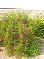 Bottle Brush Shrub, Walpole Gardens, Herne Bay - geograph.org.uk - 1898867.jpg 2,304 × 3,072; 2.68 MB
-
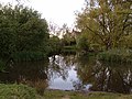 BroomfieldPond.JPG 400 × 300; 156 KB
-
 Bungalow High View Avenue Herne Bay.JPG 2,836 × 1,644; 2.04 MB
-
 Busy B's, Beach Street, Herne Bay - geograph.org.uk - 2093585.jpg 475 × 640; 99 KB
-
 Car park Swalecliffe Avenue Herne Bay.JPG 3,992 × 1,744; 3.17 MB
-
 Cartwright Point, Herne Bay - geograph.org.uk - 2627616.jpg 640 × 479; 55 KB
-
 Central Parade Gardens - geograph.org.uk - 502968.jpg 640 × 480; 161 KB
-
 Central Parade, Herne Bay - geograph.org.uk - 2106689.jpg 3,330 × 2,497; 2.06 MB
-
 Charles Street, Herne Bay - geograph.org.uk - 1959729.jpg 640 × 480; 97 KB
-
 Cliffs by Bishopstone Glen, Beltinge - geograph.org.uk - 925495.jpg 640 × 434; 86 KB
-
 Clock tower at Herne Bay - geograph.org.uk - 2026297.jpg 1,280 × 960; 619 KB
-
 Cloud Cover captured off the coast of Herne Bay.jpg 2,048 × 1,536; 1.62 MB
-
 Coastal Slope, Beltinge - geograph.org.uk - 1470480.jpg 640 × 430; 118 KB
-
 Coastguard buildings, Herne Bay - geograph.org.uk - 1960574.jpg 640 × 480; 97 KB
-
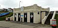
 Coastguard Lookout Station - geograph.org.uk - 1470459.jpg 640 × 430; 115 KB
-
 Concrete shelter Hampton Herne Bay 002.JPG 2,960 × 988; 1.41 MB
-
 Concrete shelter Hampton Herne Bay 003.JPG 4,000 × 1,944; 3.37 MB
-
 Concrete shelter Hampton Herne Bay.JPG 4,000 × 2,696; 5.08 MB
-
 Cottages - geograph.org.uk - 858218.jpg 640 × 480; 68 KB
-
 Curved Sea wall and Promenade, Herne Bay - geograph.org.uk - 1470421.jpg 640 × 430; 113 KB
-
 Demolition Work, Herne Bay Pier - geograph.org.uk - 2918193.jpg 1,024 × 682; 227 KB
-
 Dinosaur Bones - Herne Bay - geograph.org.uk - 5501.jpg 480 × 640; 112 KB
-
 Divers Arms, Central Esplanade - geograph.org.uk - 1469416.jpg 640 × 424; 78 KB
-
 Dolphin Court - geograph.org.uk - 1469382.jpg 640 × 430; 134 KB
-
 Drained shellfish hatching pools - geograph.org.uk - 1470061.jpg 640 × 430; 131 KB
-
 Drinking fountain, Herne Bay.JPG 640 × 480; 69 KB
-
 East Cliff Parade - geograph.org.uk - 1470495.jpg 640 × 430; 102 KB
-
 East Cliff Parade - geograph.org.uk - 1470499.jpg 640 × 430; 106 KB
-
 East end of Herne Bay - geograph.org.uk - 1960555.jpg 640 × 441; 102 KB
-
 East from the pier, Herne Bay - geograph.org.uk - 1960507.jpg 640 × 480; 98 KB
-

-
 End of Herne Bay Pier - geograph.org.uk - 4332408.jpg 640 × 480; 37 KB
-
 End of Herne Bay Pier - geograph.org.uk - 5581046.jpg 640 × 428; 104 KB
-

-
 Express Garage, Herne Bay - geograph.org.uk - 2112848.jpg 4,320 × 3,240; 3.96 MB
-
 Farmland, Reculver Country Park - geograph.org.uk - 1470670.jpg 640 × 430; 129 KB
-
 Farmland, Reculver Country Park - geograph.org.uk - 1470678.jpg 640 × 430; 129 KB
-
 Farmland, Reculver Country Park - geograph.org.uk - 1470691.jpg 640 × 430; 125 KB
-
 Finger post, Herne Bay seafront - geograph.org.uk - 2106446.jpg 3,420 × 2,565; 2.53 MB
-
 First & Last, Herne Bay.JPG 2,048 × 1,536; 2.01 MB
-
 Flats on Herne Bay seafront - geograph.org.uk - 1469348.jpg 430 × 640; 77 KB
-
 Floral display near the pier, Herne Bay - geograph.org.uk - 1469368.jpg 640 × 430; 119 KB
-
 Floral Display, near Herne Bay Pier - geograph.org.uk - 2378064.jpg 3,072 × 2,304; 2.66 MB
-
 Floral Gardens, Herne Bay, Kent - geograph.org.uk - 1478843.jpg 640 × 435; 63 KB
-
 Footpath in Herne Bay Golf Course - geograph.org.uk - 1827768.jpg 3,072 × 2,304; 1.37 MB
-
 Footpath to Herne Bay railway station - geograph.org.uk - 2440075.jpg 3,072 × 2,304; 1.99 MB
-
 Four Fathoms, Herne Bay - geograph.org.uk - 2106637.jpg 3,167 × 2,375; 1.89 MB
-
-
 From Promenade, Herne Bay - geograph.org.uk - 858151.jpg 640 × 480; 82 KB
-
 Garages High View Avenue Herne Bay.JPG 4,000 × 3,000; 5.5 MB
-
 Gardens by the bandstand - geograph.org.uk - 3221963.jpg 1,500 × 1,000; 270 KB
-
 Gatefield Sounds, Herne Bay - geograph.org.uk - 2105055.jpg 2,095 × 2,378; 1.52 MB
-
 Group of Edwardian maids? Herne Bay, 1907 (7054650803).jpg 2,048 × 1,397; 255 KB
-
 Groyne at Herne Bay - geograph.org.uk - 2445729.jpg 640 × 480; 91 KB
-
 Groynes at Herne Bay - geograph.org.uk - 2441000.jpg 640 × 480; 131 KB
-
 Groynes on the beach - geograph.org.uk - 3221964.jpg 1,500 × 970; 165 KB
-
 Guest houses on Herne Bay seafront.jpg 2,816 × 2,112; 1.29 MB
-

-
 Hampton Pier - geograph.org.uk - 3221940.jpg 1,500 × 1,000; 191 KB
-
 Hampton Pier Avenue, Herne Bay - geograph.org.uk - 980583.jpg 390 × 640; 35 KB
-
 Hampton Pier Yacht Club - geograph.org.uk - 1457741.jpg 640 × 430; 141 KB
-
 Motor scooter riders in Herne Bay, Kent.jpg 640 × 480; 78 KB
-
 Herne Bay (34229806823).jpg 4,000 × 3,000; 2.93 MB
-
 Herne Bay (34652994480).jpg 4,000 × 3,000; 2.95 MB
-
 Herne Bay - geograph.org.uk - 819588.jpg 640 × 428; 81 KB
-
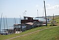
 Herne Bay Amateur Rowing Club - geograph.org.uk - 2438968.jpg 640 × 271; 51 KB
-
 Herne Bay Amateur Rowing Club.JPG 2,048 × 1,536; 2.01 MB
-

-
 Herne Bay Beach - geograph.org.uk - 1440566.jpg 640 × 480; 100 KB
-
 Herne Bay Beach Huts - geograph.org.uk - 2440978.jpg 640 × 480; 75 KB
-
 Herne Bay Beach Huts - geograph.org.uk - 2440979.jpg 480 × 640; 100 KB
-
 Herne Bay Beach Huts - geograph.org.uk - 2440999.jpg 640 × 480; 75 KB
-
 Herne Bay Beach Huts - geograph.org.uk - 2448687.jpg 480 × 640; 88 KB
-
 Herne Bay beach huts and pier - geograph.org.uk - 2447497.jpg 640 × 480; 82 KB
-
 Herne Bay Beach Huts ^ Pier - geograph.org.uk - 2436060.jpg 640 × 480; 84 KB
-
 Herne Bay from the end of Neptune's Arm - geograph.org.uk - 2033491.jpg 1,280 × 960; 614 KB
-
 Herne Bay from the pier - geograph.org.uk - 2093347.jpg 640 × 480; 46 KB
-
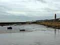
 Herne Bay Harbour - geograph.org.uk - 1469360.jpg 640 × 430; 127 KB
-
 Herne Bay in Kent - aerial image (33123717208).jpg 2,974 × 1,985; 3.44 MB
-
 Herne Bay Junior School 001.JPG 2,792 × 2,376; 3.17 MB
-
 Herne Bay library (28648434894).jpg 1,024 × 768; 313 KB
-
 Herne Bay Memorial Park.jpg 640 × 480; 70 KB
-
 Herne Bay pier after storm damage - geograph.org.uk - 2195926.jpg 640 × 452; 181 KB
-
 Herne Bay Premier Inn - geograph.org.uk - 1898545.jpg 3,072 × 2,304; 1.47 MB
-
 Herne Bay Rowing Club (2) - geograph.org.uk - 1457738.jpg 640 × 430; 132 KB
-
 Herne Bay Rowing Club - geograph.org.uk - 1457732.jpg 640 × 430; 116 KB
-
 Herne Bay Sailing Club - geograph.org.uk - 1470451.jpg 640 × 430; 129 KB
-
 Herne Bay Sailing Club - geograph.org.uk - 1470454.jpg 640 × 430; 128 KB
-
 Herne Bay sea front circa 1979 - geograph.org.uk - 2595073.jpg 640 × 452; 181 KB
-
 Herne Bay Seafront - geograph.org.uk - 2106625.jpg 3,488 × 2,616; 2.41 MB
-
 Herne Bay seafront - geograph.org.uk - 982706.jpg 640 × 480; 51 KB
-
 Herne Bay shore - geograph.org.uk - 1959691.jpg 640 × 474; 100 KB
-
 Herne Bay shoreline - geograph.org.uk - 1959672.jpg 640 × 480; 95 KB
-
 Herne Bay Table Table restaurant-pub - geograph.org.uk - 1898533.jpg 3,072 × 2,304; 1.39 MB
-
 Herne Bay water in December 2007.JPG 563 × 422; 218 KB
-
 Herne Bay, Kent.jpg 2,048 × 1,536; 2.13 MB
-
 Herne Bay, low tide - geograph.org.uk - 2093295.jpg 640 × 480; 66 KB
-
 Herne Bay, the beach.JPG 2,028 × 1,508; 1.13 MB
-
 Herne Bay, the sea front. - geograph.org.uk - 665473.jpg 640 × 425; 70 KB
-
Herne Bay.ogg 35 min 25 s; 13.89 MB
-
 High View Avenue Herne Bay 002.JPG 4,000 × 3,000; 4.8 MB
-
 Hillborough Caravan Site today - geograph.org.uk - 1497292.jpg 640 × 480; 28 KB
-

-
 House on Manor Close - geograph.org.uk - 1470626.jpg 640 × 430; 151 KB
-
 House on top of Beltinge Cliff - geograph.org.uk - 1470558.jpg 640 × 430; 128 KB
-
 Houses - geograph.org.uk - 858219.jpg 640 × 480; 85 KB
-
 Hungry Seagulls in Herne Bay - geograph.org.uk - 2492580.jpg 1,024 × 768; 94 KB
-
 Huts, Herne Bay. - geograph.org.uk - 665475.jpg 640 × 425; 63 KB
-
 In a row (5966741023).jpg 3,500 × 2,329; 4.96 MB
-
 In Herne Bay library (29192905891).jpg 1,024 × 768; 240 KB
-

-

-
 Kentish Flats Wind Farm - geograph.org.uk - 748279.jpg 480 × 640; 26 KB
-
 Kentish Flats Wind Farm - geograph.org.uk - 748334.jpg 640 × 512; 23 KB
-
 King Edward Avenue, Herne Bay, Kent - geograph.org.uk - 858112.jpg 640 × 480; 79 KB
-
 Kingsbury Villas Herne Bay Kent.JPG 3,892 × 2,124; 3.76 MB
-
 Lamp post and houses on Beacon Hill - geograph.org.uk - 1496139.jpg 640 × 480; 43 KB
-
 Lifeguard hut in Herne Bay (geograph 4383000).jpg 640 × 480; 41 KB
-
 Lifeguard Station on Western Esplanade - geograph.org.uk - 1469313.jpg 640 × 430; 123 KB
-
 Looking towards Hampton Pier - geograph.org.uk - 1457695.jpg 640 × 430; 102 KB
-

-
 Low coastal slope west of Herne Bay - geograph.org.uk - 1459058.jpg 640 × 430; 112 KB
-
 Mickleburgh Hill, Herne Bay - geograph.org.uk - 858114.jpg 640 × 480; 60 KB
-
 Mickleburgh Hill, Herne Bay - geograph.org.uk - 858123.jpg 640 × 480; 69 KB
-

-
 New houses for sale - geograph.org.uk - 858228.jpg 640 × 480; 60 KB
-
 New road works^ - geograph.org.uk - 479017.jpg 640 × 480; 70 KB
-
 Niwani, Western Esplanade - geograph.org.uk - 1469207.jpg 640 × 430; 134 KB
-
 Northern Sea Wall east of Reculver - geograph.org.uk - 1470045.jpg 640 × 430; 127 KB
-

-
 On The Downs at Herne Bay - geograph.org.uk - 2113948.jpg 1,280 × 960; 643 KB
-

-

-
 Path to Reculver - geograph.org.uk - 1470661.jpg 640 × 430; 127 KB
-
 Path up Bishopstone Glen - geograph.org.uk - 1470569.jpg 640 × 430; 110 KB
-
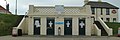
 Peter Newman Factory Shop, Herne Bay - geograph.org.uk - 1426056.jpg 640 × 480; 56 KB
-
 Pier Arcade, Western Esplanade - geograph.org.uk - 1469328.jpg 640 × 430; 133 KB
-
 Pier St, Herne Bay - geograph.org.uk - 1469334.jpg 640 × 430; 125 KB
-
 Pill box on the hillside - geograph.org.uk - 479063.jpg 640 × 480; 62 KB
-
 Plaque under tower - geograph.org.uk - 858187.jpg 640 × 488; 117 KB
-
 Pleasure boat moored to slipway - geograph.org.uk - 326648.jpg 640 × 480; 78 KB
-
 Post Office, Sea Street, Herne Bay.JPG 2,048 × 1,536; 2.04 MB
-
 Promenade and sea wall, Herne Bay - geograph.org.uk - 1470405.jpg 640 × 430; 126 KB
-
 Promenade below Bishopstone Glen - geograph.org.uk - 1470564.jpg 640 × 410; 71 KB
-
 Promenade east of Herne Bay - geograph.org.uk - 1470462.jpg 640 × 430; 121 KB
-
 Promenade east of Herne Bay - geograph.org.uk - 1470465.jpg 640 × 430; 115 KB
-
 Promenade east of Herne Bay - geograph.org.uk - 1470471.jpg 640 × 430; 121 KB
-
 Promenade east of Reculver - geograph.org.uk - 1470826.jpg 640 × 430; 117 KB
-
 Promenade on Sea Wall - geograph.org.uk - 1251466.jpg 640 × 480; 45 KB
-
 Promenade, Beltinge - geograph.org.uk - 1470514.jpg 640 × 430; 111 KB
-
 Promenade, Beltinge - geograph.org.uk - 1470541.jpg 640 × 403; 69 KB
-
 Promenade, Beltinge - geograph.org.uk - 1470546.jpg 640 × 417; 77 KB
-
 Promenade, Beltinge - geograph.org.uk - 1470552.jpg 640 × 417; 72 KB
-
 Promenade, Herne Bay - geograph.org.uk - 858131.jpg 640 × 452; 73 KB
-
 Promenade, Herne Bay - geograph.org.uk - 858133.jpg 640 × 381; 71 KB
-
 Promenade, Herne Bay - geograph.org.uk - 858138.jpg 640 × 480; 78 KB
-
 Promenade, Herne Bay - geograph.org.uk - 858148.jpg 640 × 480; 88 KB
-
 Promenade, Herne Bay - geograph.org.uk - 858159.jpg 640 × 480; 81 KB
-
 Prospect Hill, Herne Bay.JPG 2,048 × 1,536; 671 KB
-

-
-
 Railway bridge - geograph.org.uk - 817280.jpg 510 × 342; 123 KB
-
 Reculver Caravan Park - geograph.org.uk - 1470725.jpg 640 × 430; 133 KB
-
 Reculver Country Park - geograph.org.uk - 1470664.jpg 640 × 430; 134 KB
-
 Reculver II, Kent - geograph.org.uk - 982478.jpg 640 × 480; 37 KB
-
 Reculver Lane, Reculver - geograph.org.uk - 982500.jpg 640 × 480; 43 KB


.jpg)


.jpg)
.jpg)


.jpg)


_-_geograph.org.uk_-_1457738.jpg)


.jpg)
.jpg)


.jpg)


