Category:Herne and Broomfield
English: Herne and Broomfield is a civil parish within the City of Canterbury. The parish is situated to the north of Canterbury in Kent. The seaside town of Herne Bay is the other side of the A299 road, Thanet Way that marks the northern boundary of the parish. Greenhill, part of Herne Bay, lies to the west, the parishes of Hoath and Chislet are to the east and Sturry parish is to the South.
civil parish in Kent, UK  | |||||
| Upload media | |||||
| Instance of | |||||
|---|---|---|---|---|---|
| Location | Canterbury, Kent, South East England, England | ||||
| Population |
| ||||
 | |||||
Subcategories
This category has the following 2 subcategories, out of 2 total.
B
- Broomfield, Herne Bay (10 F)
H
Media in category "Herne and Broomfield"
The following 200 files are in this category, out of 293 total.
(previous page) (next page)-
 A lonesome bush - geograph.org.uk - 2767164.jpg 640 × 430; 29 KB
-
 A pair of weatherboarded cottages. - geograph.org.uk - 2761770.jpg 640 × 430; 54 KB
-
 A291, Canterbury Rd - geograph.org.uk - 2783927.jpg 640 × 430; 81 KB
-
 A291, Canterbury Rd - geograph.org.uk - 2783930.jpg 640 × 430; 96 KB
-
 A299 Road, Thanet Way - geograph.org.uk - 1821143.jpg 1,024 × 768; 160 KB
-
 A299 Thanet Way - geograph.org.uk - 3723318.jpg 640 × 480; 225 KB
-
 A299 Thanet Way towards Herne Bay - geograph.org.uk - 2439997.jpg 3,072 × 2,304; 1.52 MB
-
 A299 Thanet Way towards Thanet - geograph.org.uk - 5674797.jpg 640 × 428; 86 KB
-
 A299 Thanet Way towards Thanet - geograph.org.uk - 5674807.jpg 640 × 428; 85 KB
-
 A299, near Herne Bay - geograph.org.uk - 4051758.jpg 3,488 × 2,616; 2.44 MB
-
 A299, Thanet Way near Broomfield - geograph.org.uk - 3723084.jpg 640 × 480; 238 KB
-
 A2990 Thanet Way - geograph.org.uk - 5674758.jpg 640 × 428; 99 KB
-
 Belsey Cottage - geograph.org.uk - 2761767.jpg 640 × 430; 76 KB
-
 Bend in Ford Road - geograph.org.uk - 4342767.jpg 640 × 480; 53 KB
-
 Bird Watchers in East Blean Wood - geograph.org.uk - 1830507.jpg 3,072 × 2,304; 3.08 MB
-
 Blean Walk - geograph.org.uk - 3091000.jpg 640 × 480; 146 KB
-
 Blean Walk - geograph.org.uk - 3091005.jpg 480 × 640; 183 KB
-
 Blean Walk - geograph.org.uk - 3091007.jpg 640 × 480; 194 KB
-
 Blean Walk - geograph.org.uk - 3091008.jpg 480 × 640; 160 KB
-
 Blean Walk arrows - geograph.org.uk - 3090999.jpg 480 × 640; 124 KB
-
 Bleangate, near Herne - geograph.org.uk - 5712849.jpg 640 × 481; 130 KB
-
 Blenheim Close, Herne - geograph.org.uk - 4051751.jpg 3,488 × 2,616; 2.71 MB
-
 Bogshole Lane, Broomfield - geograph.org.uk - 4759730.jpg 2,272 × 1,704; 887 KB
-
 Braggs Lane, Herne - geograph.org.uk - 5712916.jpg 640 × 480; 84 KB
-
 Braggs Lane, Herne Common - geograph.org.uk - 4051731.jpg 3,488 × 2,616; 2.54 MB
-
 Bridleway and track junction near Hawe Shave - geograph.org.uk - 1830304.jpg 3,072 × 2,304; 2.83 MB
-
 Bridleway past Hawe Shave - geograph.org.uk - 1830300.jpg 3,072 × 2,304; 1.42 MB
-
 Bridleway to Maypole Road (2) - geograph.org.uk - 1830311.jpg 3,072 × 2,304; 1.54 MB
-
 Bridleway to Maypole Road - geograph.org.uk - 1830308.jpg 3,072 × 2,304; 1.72 MB
-
 Bridleway towards Beacon Wood (2) - geograph.org.uk - 1830337.jpg 3,072 × 2,304; 2.13 MB
-
 Bridleway towards Beacon Wood - geograph.org.uk - 1830332.jpg 3,072 × 2,304; 2.2 MB
-
 Bridleway towards Hawe Shave - geograph.org.uk - 3087937.jpg 640 × 480; 87 KB
-
 Broken gate on Hicks Forstal Road - geograph.org.uk - 1830722.jpg 3,072 × 2,304; 2.34 MB
-
 Broomfield Road, Herne Bay - geograph.org.uk - 4759763.jpg 2,272 × 1,704; 777 KB
-
 Bullockstone fields in winter - geograph.org.uk - 914950.jpg 640 × 424; 59 KB
-
 Bullockstone Rd - geograph.org.uk - 2789133.jpg 640 × 497; 53 KB
-
 Bullockstone Rd in the mist - geograph.org.uk - 2789136.jpg 640 × 460; 47 KB
-
 Bullockstone Road, Herne Common - geograph.org.uk - 4051732.jpg 3,488 × 2,616; 2.6 MB
-
 Busheyfields Rd - geograph.org.uk - 2786808.jpg 640 × 430; 87 KB
-
 Busheyfields Rd - geograph.org.uk - 2786810.jpg 640 × 430; 105 KB
-
 Busheyfields Rd - geograph.org.uk - 2786818.jpg 640 × 430; 86 KB
-
 Busheyfields Rd - geograph.org.uk - 2786823.jpg 640 × 430; 65 KB
-
 Busheyfields Rd - geograph.org.uk - 2786828.jpg 640 × 430; 54 KB
-
 Canterbury Garden Centre - geograph.org.uk - 2786799.jpg 640 × 430; 42 KB
-
 Canterbury Road, Herne - geograph.org.uk - 4051741.jpg 3,488 × 2,616; 3.02 MB
-
 Canterbury Road, Herne Common - geograph.org.uk - 4051733.jpg 3,488 × 2,616; 2.65 MB
-
 Canterbury Road, near Herne Common - geograph.org.uk - 4051728.jpg 3,488 × 2,616; 4.28 MB
-
 Canterbury Road, near Herne Common - geograph.org.uk - 4051730.jpg 3,488 × 2,616; 2.16 MB
-
 Chantry Cottage - geograph.org.uk - 2760429.jpg 640 × 430; 59 KB
-
 Charnwood Close - geograph.org.uk - 2761821.jpg 640 × 430; 49 KB
-
 Childs Forstal - geograph.org.uk - 2786802.jpg 640 × 430; 60 KB
-
 Childs Forstal - geograph.org.uk - 2786807.jpg 640 × 430; 48 KB
-
 Church View and Leo Cottage - geograph.org.uk - 2760432.jpg 640 × 430; 69 KB
-
 Contractor’s equipment, St Martin’s churchyard - geograph.org.uk - 5136018.jpg 3,264 × 2,163; 2.08 MB
-
 Coppiced trees in East Blean Wood - geograph.org.uk - 1830512.jpg 3,072 × 2,304; 3.29 MB
-

-
 Coppicing, East Blean Wood - geograph.org.uk - 2772755.jpg 640 × 430; 116 KB
-
 Corner of a field of oats - geograph.org.uk - 5836259.jpg 1,024 × 768; 487 KB
-
 Cottages by St Martin's Church - geograph.org.uk - 2760454.jpg 640 × 430; 75 KB
-
 Curtis Wood Park - geograph.org.uk - 2789127.jpg 640 × 430; 51 KB
-
 Curtis Wood Rd - geograph.org.uk - 2786830.jpg 640 × 430; 57 KB
-
 Curtis Wood Rd - geograph.org.uk - 2789120.jpg 640 × 430; 68 KB
-
 Curtis Wood Road, Herne Common - geograph.org.uk - 4051735.jpg 3,488 × 2,616; 2.49 MB
-
 Darkness falling on Bullockstone Rd - geograph.org.uk - 2789137.jpg 640 × 450; 31 KB
-

-
 Dutch gabled house, Busheyfields Rd - geograph.org.uk - 2786822.jpg 640 × 430; 59 KB
-
 East Blean Wood - geograph.org.uk - 2769339.jpg 640 × 430; 65 KB
-
 East Blean Wood - geograph.org.uk - 2772713.jpg 640 × 430; 143 KB
-
 East Blean Wood - geograph.org.uk - 2772718.jpg 640 × 430; 124 KB
-
 East Blean Wood - geograph.org.uk - 2772723.jpg 640 × 430; 129 KB
-
 East Blean Wood - geograph.org.uk - 2772724.jpg 640 × 430; 130 KB
-
 East Blean Wood - geograph.org.uk - 2772729.jpg 640 × 430; 144 KB
-
 East Blean Wood - geograph.org.uk - 2772733.jpg 640 × 430; 141 KB
-
 East Blean Wood - geograph.org.uk - 2772743.jpg 640 × 430; 136 KB
-
 East Blean Wood - geograph.org.uk - 2776420.jpg 640 × 430; 147 KB
-
 East Blean Wood - geograph.org.uk - 2776426.jpg 640 × 430; 125 KB
-
 East Blean Wood Information Panel - geograph.org.uk - 1830761.jpg 3,072 × 2,304; 1.9 MB
-
 East Blean Woods - geograph.org.uk - 1830768.jpg 3,072 × 2,304; 3.63 MB
-
 East Blean Woods - geograph.org.uk - 2769350.jpg 640 × 430; 147 KB
-
 East Blean Woods - geograph.org.uk - 2769351.jpg 640 × 430; 136 KB
-
 Edge of a field near Ridgeway Farm - geograph.org.uk - 2769330.jpg 640 × 430; 56 KB
-
 Entering Bullockstone - geograph.org.uk - 2760424.jpg 640 × 430; 44 KB
-
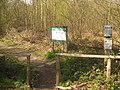 Entrance and Information Panel for East Blean Wood - geograph.org.uk - 1830757.jpg 3,072 × 2,304; 3.39 MB
-
 Entrance to Bragg's Lane Farm Campsite - geograph.org.uk - 1832586.jpg 3,072 × 2,304; 1.91 MB
-
 Farm buildings, Busheyfields Rd - geograph.org.uk - 2786825.jpg 640 × 430; 35 KB
-
 Farm Shop, Canterbury Garden Centre - geograph.org.uk - 2786804.jpg 640 × 430; 38 KB
-
 Farmland near East Blean Wood - geograph.org.uk - 2769337.jpg 640 × 430; 51 KB
-
 Farmland off Ford Road - geograph.org.uk - 4342763.jpg 640 × 480; 53 KB
-
 Farmland off Ford Road - geograph.org.uk - 4342772.jpg 640 × 480; 77 KB
-
 Farmland on the edge of Herne - geograph.org.uk - 2767166.jpg 640 × 430; 27 KB
-
 Farmland south of Broomfield - geograph.org.uk - 2767154.jpg 640 × 430; 44 KB
-
 Farmland, Hawe Farm - geograph.org.uk - 2767156.jpg 640 × 430; 41 KB
-
 Farmland, Ridgeway Farm - geograph.org.uk - 2769314.jpg 640 × 430; 35 KB
-
 Field east of Canterbury Rd - geograph.org.uk - 2783919.jpg 640 × 430; 43 KB
-
 Field near Ridgeway Farm - geograph.org.uk - 3090987.jpg 640 × 480; 103 KB
-
 Field near Ridgeway Farm - geograph.org.uk - 3090989.jpg 640 × 480; 91 KB
-
 Field near Ridgeway Farm - geograph.org.uk - 3090990.jpg 640 × 480; 84 KB
-
 First ^ Last, Herne Common - geograph.org.uk - 4051734.jpg 3,488 × 2,616; 2.35 MB
-
 Footbridge near Banker's Wood - geograph.org.uk - 1832607.jpg 3,072 × 2,304; 2.23 MB
-
 Footbridge near Hoath Wood campsite - geograph.org.uk - 1832562.jpg 2,304 × 3,072; 3.68 MB
-
 Footbridge near Round Wood - geograph.org.uk - 1832621.jpg 3,072 × 2,304; 3.19 MB
-
 Footbridge over A299 Thanet Way - geograph.org.uk - 2439970.jpg 3,072 × 2,304; 1.21 MB
-
 Footbridge over A299 Thanet Way - geograph.org.uk - 2439982.jpg 3,072 × 2,304; 1.33 MB
-
 Footpath along the edge of Herne - geograph.org.uk - 2769284.jpg 640 × 430; 137 KB
-
 Footpath between West Blean Wood and Hoath Wood - geograph.org.uk - 1832568.jpg 3,072 × 2,304; 3.62 MB
-
 Footpath between West Blean Wood and Hoath Wood - geograph.org.uk - 1832573.jpg 3,072 × 2,304; 3.35 MB
-
 Footpath by Braggs Lane, Herne - geograph.org.uk - 5712913.jpg 640 × 480; 131 KB
-
 Footpath crosses Hicks Forstal Road - geograph.org.uk - 1830752.jpg 3,072 × 2,304; 3.32 MB
-
 Footpath crossing a field to Herne - geograph.org.uk - 2767161.jpg 640 × 430; 50 KB
-
 Footpath entrance to East Blean Woods - geograph.org.uk - 1830772.jpg 3,072 × 2,304; 3.65 MB
-
 Footpath from East Blean Wood - geograph.org.uk - 1830492.jpg 2,304 × 3,072; 3.37 MB
-
 Footpath from Hawe Farm - geograph.org.uk - 2767155.jpg 640 × 430; 47 KB
-
 Footpath from Ridgeway Farm - geograph.org.uk - 3090992.jpg 640 × 480; 90 KB
-
 Footpath in East Blean Wood - geograph.org.uk - 2769346.jpg 640 × 430; 111 KB
-
 Footpath in East Blean Woods - geograph.org.uk - 1830500.jpg 2,304 × 3,072; 4.05 MB
-
 Footpath in East Blean Woods - geograph.org.uk - 2772712.jpg 640 × 430; 112 KB
-
 Footpath in East Blean Woods - geograph.org.uk - 2772727.jpg 640 × 430; 146 KB
-
 Footpath in East Blean Woods - geograph.org.uk - 2772735.jpg 640 × 430; 147 KB
-
 Footpath junction in East Blean Woods (2) - geograph.org.uk - 1830525.jpg 3,072 × 2,304; 3.23 MB
-
 Footpath junction in East Blean Woods - geograph.org.uk - 1830519.jpg 3,072 × 2,304; 3.55 MB
-
 Footpath junction near Childs Forstal - geograph.org.uk - 1830800.jpg 3,072 × 2,304; 2.78 MB
-
 Footpath junction on a bridleway near Hawe Shave - geograph.org.uk - 1830297.jpg 3,072 × 2,304; 1.98 MB
-
 Footpath junction on Bragg's Lane - geograph.org.uk - 1832577.jpg 3,072 × 2,304; 2.46 MB
-
-
 Footpath off Busheyfields Rd - geograph.org.uk - 2786812.jpg 640 × 430; 109 KB
-
 Footpath off Canterbury Rd - geograph.org.uk - 2783907.jpg 640 × 430; 42 KB
-
 Footpath off Hicks Forstal Rd - geograph.org.uk - 2776423.jpg 640 × 430; 139 KB
-
 Footpath off Mill Lane - geograph.org.uk - 2761818.jpg 640 × 430; 54 KB
-
 Footpath signpost, Ridgeway Rd - geograph.org.uk - 2789116.jpg 640 × 430; 69 KB
-
 Footpath south off Busheyfields Rd - geograph.org.uk - 2786815.jpg 640 × 430; 121 KB
-
 Footpath through a field of oats - geograph.org.uk - 5836267.jpg 1,024 × 768; 338 KB
-
 Footpath to Banker's Wood - geograph.org.uk - 1832619.jpg 3,072 × 2,304; 1.93 MB
-
 Footpath to Bleangate Bungalow - geograph.org.uk - 1832602.jpg 3,072 × 2,304; 1.6 MB
-
 Footpath to Broomfield - geograph.org.uk - 2439050.jpg 3,072 × 2,304; 2.01 MB
-
 Footpath to Canterbury Road - geograph.org.uk - 1830737.jpg 3,072 × 2,304; 3.83 MB
-
 Footpath to East Blean Wood - geograph.org.uk - 2769327.jpg 640 × 430; 59 KB
-
 Footpath to East Blean Wood - geograph.org.uk - 2769336.jpg 640 × 430; 70 KB
-
 Footpath to Hawe Farm - geograph.org.uk - 2767150.jpg 640 × 430; 123 KB
-
 Footpath to Herne - geograph.org.uk - 2767152.jpg 640 × 430; 111 KB
-
 Footpath to Herne - geograph.org.uk - 2767160.jpg 640 × 430; 105 KB
-
 Footpath to Lower Herne Road - geograph.org.uk - 1827855.jpg 3,072 × 2,304; 1.87 MB
-
 Footpath to Ridgeway Farm - geograph.org.uk - 2769316.jpg 640 × 430; 97 KB
-
 Footpath to Round Wood - geograph.org.uk - 1832601.jpg 3,072 × 2,304; 1.85 MB
-
 Footpath towards Canterbury Road - geograph.org.uk - 1830792.jpg 3,072 × 2,304; 1.6 MB
-
 Footpath towards East Blean Woods - geograph.org.uk - 1830805.jpg 3,072 × 2,304; 1.76 MB
-
 Footpath towards Hicks Forstal Road - geograph.org.uk - 1830542.jpg 3,072 × 2,304; 2.93 MB
-
 Footpath towards the A299 Thanet Way - geograph.org.uk - 2439062.jpg 3,072 × 2,304; 2.68 MB
-
 Footpath, East Blean Wood - geograph.org.uk - 2772716.jpg 640 × 430; 136 KB
-
 Footpath, East Blean Wood - geograph.org.uk - 2772721.jpg 640 × 430; 119 KB
-
 Footpath, East Blean Wood - geograph.org.uk - 2772725.jpg 640 × 430; 122 KB
-
 Footpath, East Blean Wood - geograph.org.uk - 2772731.jpg 640 × 430; 137 KB
-
 Ford Road - geograph.org.uk - 4342776.jpg 640 × 480; 49 KB
-
 Ford Road, Broomfield - geograph.org.uk - 4759749.jpg 2,272 × 1,704; 703 KB
-
-
 Gate across New Rd, West Blean Wood - geograph.org.uk - 1143179.jpg 640 × 430; 127 KB
-
 Gated private road near Bullockstone - geograph.org.uk - 478762.jpg 640 × 480; 66 KB
-
 Georgian farmhouse, Broomfield - geograph.org.uk - 5487761.jpg 1,024 × 722; 124 KB
-

-
 Gorse Lane, Herne Bay - geograph.org.uk - 4759717.jpg 2,272 × 1,704; 731 KB
-
 Hawe Farm - geograph.org.uk - 2767153.jpg 640 × 430; 92 KB
-
 Hawe Farm Way - geograph.org.uk - 2767147.jpg 640 × 430; 43 KB
-
 Hawe Farm Way, Herne Bay - geograph.org.uk - 4759767.jpg 2,272 × 1,704; 773 KB
-
 Hay barn, Ridgeway Farm - geograph.org.uk - 2769323.jpg 640 × 430; 57 KB
-
 Heart in Hand Corner - geograph.org.uk - 2009495.jpg 3,072 × 2,304; 1.36 MB
-
 Heart in Hand Road at the junction of Thanet Way - geograph.org.uk - 5840187.jpg 1,976 × 1,434; 1.33 MB
-
 Heart in Hand Road, Broomfield - geograph.org.uk - 5840185.jpg 2,048 × 1,536; 1.77 MB
-
 Herne - Village Centre - geograph.org.uk - 6632489.jpg 5,152 × 3,864; 5.98 MB
-
 Herne - War Memorial - geograph.org.uk - 6632487.jpg 5,152 × 3,864; 4.93 MB
-
 Herne Junior School - geograph.org.uk - 2761776.jpg 640 × 430; 70 KB
-
 Herne School - geograph.org.uk - 2769283.jpg 640 × 430; 89 KB
-
 Herne Street, Herne - geograph.org.uk - 4051742.jpg 3,488 × 2,616; 3.07 MB
-
 Herne Street, Herne - geograph.org.uk - 4051750.jpg 3,488 × 2,616; 2.55 MB
-
 Herne Village Signs - geograph.org.uk - 4051738.jpg 3,488 × 2,616; 5.6 MB
-
 Herne War Memorial - geograph.org.uk - 2760434.jpg 640 × 430; 111 KB
-
 Herne War Memorial - geograph.org.uk - 4051743.jpg 2,616 × 3,488; 3.84 MB
-
 Herne Windmill - geograph.org.uk - 5916065.jpg 768 × 1,024; 190 KB
-
 Hicks Forstal Rd - geograph.org.uk - 2772736.jpg 640 × 430; 125 KB
-
 Hicks Forstal Rd in East Blean Wood - geograph.org.uk - 2772738.jpg 640 × 430; 132 KB
-
 Hicks Forstal Rd in East Blean Wood - geograph.org.uk - 2772750.jpg 640 × 430; 118 KB
-
 High Pines Care Home - geograph.org.uk - 2439966.jpg 3,072 × 2,304; 1.85 MB
-
 Hillbrow Avenue, Herne Bay - geograph.org.uk - 4759703.jpg 2,272 × 1,704; 760 KB
-
 Hoopers Lane, Broomfield - geograph.org.uk - 4759724.jpg 2,272 × 1,704; 945 KB
-
 House by the A291 - geograph.org.uk - 2783928.jpg 640 × 430; 54 KB
-
 House on Busheyfields Rd - geograph.org.uk - 2786817.jpg 640 × 430; 69 KB
-
 House on Busheyfields Rd - geograph.org.uk - 2786819.jpg 640 × 430; 74 KB
-
 House on School Lane - geograph.org.uk - 2761773.jpg 640 × 430; 82 KB
-

-
 Housing Development off the Old Thanet Way - geograph.org.uk - 6019190.jpg 1,024 × 683; 182 KB
-
 Hunters Chase, Herne Bay - geograph.org.uk - 4759755.jpg 2,272 × 1,704; 742 KB
-
 Hunters Forstal Road, Herne Bay - geograph.org.uk - 4759713.jpg 2,272 × 1,704; 664 KB
-
 Huntsman ^ Horn, Broomfield - geograph.org.uk - 4759742.jpg 2,272 × 1,704; 822 KB
-

-

-
-
 Just turning autumnal - geograph.org.uk - 2767151.jpg 640 × 430; 78 KB
-
 Kingsfield Road, Herne Bay - geograph.org.uk - 4759701.jpg 2,272 × 1,704; 747 KB
-
 Kissing Gate near Herne Bay Golf Course - geograph.org.uk - 1827829.jpg 3,072 × 2,304; 2.56 MB
-
 Links Close, Herne Bay - geograph.org.uk - 4759778.jpg 2,272 × 1,704; 741 KB
-
 Listed building on Mill Lane - geograph.org.uk - 2761815.jpg 640 × 430; 65 KB
-
 Looking west across Margate Road - geograph.org.uk - 4826776.jpg 3,264 × 2,448; 1.92 MB


_-_geograph.org.uk_-_1830311.jpg)


_-_geograph.org.uk_-_1830525.jpg)


_-_geograph.org.uk_-_1830337.jpg)