Category:Hernhill
village and civil parish in Kent, United Kingdom  | |||||
| Upload media | |||||
| Instance of | |||||
|---|---|---|---|---|---|
| Location | Swale, Kent, South East England, England | ||||
 | |||||
Subcategories
This category has the following 6 subcategories, out of 6 total.
Media in category "Hernhill"
The following 200 files are in this category, out of 321 total.
(previous page) (next page)-
 'The Bounds' - geograph.org.uk - 4856752.jpg 640 × 495; 191 KB
-

-

-

-
 A299 Approaching Services - geograph.org.uk - 3722384.jpg 640 × 451; 246 KB
-
 A299 Thanet Way - geograph.org.uk - 2918167.jpg 1,024 × 682; 188 KB
-
 A299 Thanet Way towards Thanet - geograph.org.uk - 5828187.jpg 1,024 × 684; 272 KB
-
 A299 Thanet Way towards Thanet - geograph.org.uk - 5828189.jpg 1,024 × 684; 213 KB
-
 A299 Thanet Way towards Thanet - geograph.org.uk - 5828192.jpg 1,024 × 684; 203 KB
-
 A299, Thanet Way - geograph.org.uk - 3722362.jpg 640 × 480; 269 KB
-
 A299, Thanet Way - geograph.org.uk - 3722439.jpg 640 × 480; 223 KB
-
 Access road to Kemsdale Cottages - geograph.org.uk - 1559255.jpg 640 × 427; 107 KB
-
 Access road to Monkshill Farm - geograph.org.uk - 1559331.jpg 640 × 427; 108 KB
-
 Black cat at Mount Ephraim Gardens - geograph.org.uk - 5486231.jpg 4,000 × 3,000; 4.66 MB
-

-
 Bounds Lane, Boughton-under-Blean - geograph.org.uk - 3757402.jpg 3,488 × 2,616; 2.89 MB
-
 Bounds Lane, Boughton-under-Blean - geograph.org.uk - 3757405.jpg 3,488 × 2,616; 3.17 MB
-
 Box on the Triangle - geograph.org.uk - 2578887.jpg 1,600 × 1,054; 500 KB
-
 Brook Bridge - geograph.org.uk - 3288492.jpg 640 × 426; 48 KB
-
 Bull Lane, Staplestreet - geograph.org.uk - 3756743.jpg 3,488 × 2,616; 2.23 MB
-
 Butlers Hill, Dargate - geograph.org.uk - 5435987.jpg 3,264 × 2,448; 3.88 MB
-
 Butlers Hill, Dargate - geograph.org.uk - 5435992.jpg 3,264 × 2,448; 3.1 MB
-
 Butlers Hill, Dargate - geograph.org.uk - 5435995.jpg 3,264 × 2,448; 3.45 MB
-
 Butlers Hill, Dargate - geograph.org.uk - 5435996.jpg 3,264 × 2,448; 3.4 MB
-
 Butts Hill, Staplestreet - geograph.org.uk - 2991237.jpg 640 × 480; 136 KB
-
 Camellia in Mount Ephraim Wood - geograph.org.uk - 3429255.jpg 640 × 480; 205 KB
-
 Canterbury - Whitstable Services - geograph.org.uk - 4402845.jpg 1,600 × 1,015; 381 KB
-
 Cherry blossom, Mount Ephraim - geograph.org.uk - 5371116.jpg 480 × 640; 144 KB
-
 Church Hill, Hernhill - geograph.org.uk - 3756758.jpg 3,488 × 2,616; 2.14 MB
-
 Church Hill, Hernhill - geograph.org.uk - 3756759.jpg 3,488 × 2,616; 2.18 MB
-
 Church Oast, Hernhill - geograph.org.uk - 5029100.jpg 4,608 × 3,456; 3.36 MB
-
 Crockham Lane - geograph.org.uk - 5705056.jpg 3,264 × 2,448; 3.18 MB
-
 Crockham Lane, Hernhill - geograph.org.uk - 5804894.jpg 640 × 480; 123 KB
-
 Crockham Lane, near Hernhill - geograph.org.uk - 3757387.jpg 3,488 × 2,616; 2.82 MB
-
 Crockham Road, near Hernhill - geograph.org.uk - 3757377.jpg 3,488 × 2,616; 2.59 MB
-
 Crockham Road, near Hernhill - geograph.org.uk - 3757382.jpg 3,488 × 2,616; 2.4 MB
-
 Crossroads near Staplestreet - geograph.org.uk - 1583803.jpg 640 × 427; 69 KB
-
 Denly Hill - geograph.org.uk - 3288497.jpg 640 × 426; 34 KB
-
 Denly Hill - geograph.org.uk - 3288498.jpg 640 × 382; 32 KB
-
 Derelict building - geograph.org.uk - 5367212.jpg 3,264 × 2,339; 2.51 MB
-
 Derelict building, Forge Farm, Staple Street - geograph.org.uk - 5702996.jpg 3,264 × 2,448; 3.66 MB
-
 Derelict shop and red telephone box, Hernhill - geograph.org.uk - 3756776.jpg 3,488 × 2,616; 2.24 MB
-

-
 Dovecote at Mount Ephraim Gardens - geograph.org.uk - 5486240.jpg 4,000 × 3,000; 4.91 MB
-
 Ducks at Mount Ephraim, Hernhill - geograph.org.uk - 6147180.jpg 640 × 431; 127 KB
-
 Dunster House, Goodnestone - geograph.org.uk - 5833274.jpg 2,048 × 1,536; 1.41 MB
-
 Electric Gardens, Mount Ephraim - geograph.org.uk - 2926288.jpg 640 × 480; 47 KB
-

-
 Falconry display at Mount Ephraim - geograph.org.uk - 5371143.jpg 640 × 480; 106 KB
-

-
 Farm track in Monkshill Farm - geograph.org.uk - 1559332.jpg 640 × 427; 96 KB
-
 Fields off Crockham Road - geograph.org.uk - 1971981.jpg 1,024 × 768; 207 KB
-
 Fields off Monks Hill Road - geograph.org.uk - 2051062.jpg 640 × 480; 69 KB
-

-
-

-
 Footpath on Kay's Lane - geograph.org.uk - 1559240.jpg 640 × 427; 90 KB
-
 Forge Farmhouse, Church Hill - geograph.org.uk - 5702985.jpg 2,448 × 3,264; 2.34 MB
-
 Fostall (Hernhill) Village - geograph.org.uk - 1426584.jpg 640 × 480; 117 KB
-

-
 Garage building, Plumpudding Lane - geograph.org.uk - 5705088.jpg 3,264 × 2,448; 2.68 MB
-
 Gate in Butler's Hill - geograph.org.uk - 5804843.jpg 640 × 483; 131 KB
-

-

-
 Graveney Marshes - geograph.org.uk - 3288493.jpg 640 × 426; 36 KB
-
 Graveney Marshes - geograph.org.uk - 3288496.jpg 640 × 426; 37 KB
-
 Graveney Marshes - geograph.org.uk - 3288499.jpg 640 × 386; 32 KB
-
 Graveney Marshes - geograph.org.uk - 3291026.jpg 640 × 426; 37 KB
-
 Grubbed out orchard, Crockham Lane - geograph.org.uk - 5705070.jpg 3,264 × 2,448; 3.93 MB
-
 Gunnera at Mount Ephraim Gardens - geograph.org.uk - 6147188.jpg 454 × 640; 106 KB
-

-
-
 Herbaceous border at Mount Ephraim Gardens - geograph.org.uk - 5025372.jpg 4,608 × 3,456; 3.37 MB
-
 Herbaceous border at Mount Ephraim Gardens - geograph.org.uk - 5025383.jpg 4,608 × 3,456; 3.36 MB
-
 Herbaceous border at Mount Ephraim Gardens - geograph.org.uk - 5450049.jpg 4,000 × 3,000; 4.92 MB
-
 Herbaceous border at Mount Ephraim Gardens - geograph.org.uk - 5450052.jpg 4,000 × 3,000; 4.84 MB
-
 Herbaceous border at Mount Ephraim Gardens - geograph.org.uk - 5450056.jpg 4,000 × 3,000; 4.75 MB
-
 Herbaceous border at Mount Ephraim Gardens - geograph.org.uk - 5450057.jpg 4,000 × 3,000; 4.84 MB
-

-
 Hern Hill Nursery - geograph.org.uk - 1559341.jpg 640 × 427; 84 KB
-
 Hernhill footpath - geograph.org.uk - 611103.jpg 640 × 480; 85 KB
-
 Hernhill from Mount Ephraim - geograph.org.uk - 3429264.jpg 521 × 640; 188 KB
-
 Hernhill village sign - geograph.org.uk - 3756763.jpg 3,488 × 2,616; 2.6 MB
-
 Highstreet Road bridge - geograph.org.uk - 1533023.jpg 640 × 427; 75 KB
-

-
 Highstreet Road, Highstreet - geograph.org.uk - 5436033.jpg 3,264 × 2,448; 3.12 MB
-
 Highstreet Road, Highstreet - geograph.org.uk - 5436037.jpg 3,264 × 2,448; 3.27 MB
-
 Highstreet Road, near Waterham - geograph.org.uk - 5436026.jpg 3,264 × 2,448; 3.42 MB
-
 Holiday accommodation, Church Farm House, Church Hill - geograph.org.uk - 5703012.jpg 2,448 × 3,264; 2.08 MB
-
 Horse Hill and Holly Hill - geograph.org.uk - 1559330.jpg 640 × 427; 67 KB
-

-
 Houses on Dargate Road - geograph.org.uk - 5804793.jpg 640 × 523; 134 KB
-
 Kay's Lane - geograph.org.uk - 1559235.jpg 640 × 427; 110 KB
-
 Kays Lane, Hernhill - geograph.org.uk - 3756772.jpg 3,488 × 2,616; 2.23 MB
-
 Kays Lane, near Hernhill - geograph.org.uk - 5435956.jpg 3,264 × 2,448; 3.3 MB
-
 Kemsdale Road - geograph.org.uk - 1559247.jpg 640 × 427; 106 KB
-
 Kemsdale Road, Fostall - geograph.org.uk - 5435966.jpg 3,264 × 2,448; 3.51 MB
-
 Kemsdale Road, near Fostall - geograph.org.uk - 5435957.jpg 3,264 × 2,448; 3.24 MB
-
 Kemsdale Road, Staplestreet - geograph.org.uk - 3756744.jpg 3,488 × 2,616; 2.23 MB
-
 Kemsdale Road, Staplestreet - geograph.org.uk - 5435951.jpg 3,264 × 2,448; 3.93 MB
-
 Kissing Gate near Hernhill - geograph.org.uk - 1559225.jpg 640 × 427; 89 KB
-
 Kissing Gates near Hernhill - geograph.org.uk - 1559222.jpg 640 × 427; 95 KB
-
 Lane between Butlers Hill and Fostall, near Hernhill - geograph.org.uk - 3757374.jpg 3,488 × 2,616; 2.1 MB
-
 Laurel Place, Staplestreet - geograph.org.uk - 3756750.jpg 3,488 × 2,616; 2.21 MB
-

-
 Looking NE along Church Hill - geograph.org.uk - 5367143.jpg 3,264 × 2,448; 2.7 MB
-

-
 Lorry on A299 Road, Thanet Way - geograph.org.uk - 1821138.jpg 1,024 × 683; 127 KB
-
 Main street through Fostall - geograph.org.uk - 5435982.jpg 3,264 × 2,448; 2.87 MB
-
 Memorial in Hernhill Churchyard - geograph.org.uk - 5029135.jpg 4,608 × 3,456; 3.38 MB
-
 Mint sauce anyone^ - geograph.org.uk - 982435.jpg 480 × 640; 120 KB
-

-

-

-

-
 Monkshill Road - geograph.org.uk - 1559328.jpg 640 × 427; 66 KB
-
 Mount Ephraim fruit farm - geograph.org.uk - 3429256.jpg 480 × 640; 190 KB
-
 Mount Ephraim garden - geograph.org.uk - 5129407.jpg 4,450 × 3,333; 5.69 MB
-
 Mount Ephraim garden - geograph.org.uk - 5129409.jpg 3,456 × 5,184; 6.64 MB
-
 Mount Ephraim garden - geograph.org.uk - 5129414.jpg 3,456 × 5,184; 4.74 MB
-
 Mount Ephraim garden - geograph.org.uk - 5129417.jpg 3,456 × 5,184; 6.18 MB
-
 Mount Ephraim garden - geograph.org.uk - 5129419.jpg 5,000 × 3,333; 6.55 MB
-
 Mount Ephraim Gardens - geograph.org.uk - 3429263.jpg 640 × 480; 197 KB
-
 Mount Ephraim Gardens - geograph.org.uk - 5025301.jpg 4,608 × 3,456; 3.36 MB
-
 Mount Ephraim Gardens - geograph.org.uk - 5025344.jpg 4,608 × 3,456; 3.38 MB
-
 Mount Ephraim Gardens - geograph.org.uk - 5025360.jpg 4,608 × 3,456; 3.36 MB
-
 Mount Ephraim Gardens - geograph.org.uk - 5025452.jpg 4,608 × 3,456; 3.38 MB
-
 Mount Ephraim Gardens - geograph.org.uk - 5025454.jpg 4,608 × 3,456; 3.35 MB
-
 Mount Ephraim Gardens - geograph.org.uk - 5450043.jpg 4,000 × 3,000; 4.73 MB
-
 Mount Ephraim Gardens - geograph.org.uk - 5450048.jpg 4,000 × 3,000; 4.78 MB
-
 Mount Ephraim Gardens, Hernhill - geograph.org.uk - 6147157.jpg 480 × 640; 159 KB
-
 Mount Ephraim Gardens, Hernhill - geograph.org.uk - 6147161.jpg 480 × 640; 147 KB
-
 Mount Ephraim Gardens, Hernhill - geograph.org.uk - 6147170.jpg 480 × 640; 151 KB
-
 Mount Ephraim Gardens, Hernhill - geograph.org.uk - 6147192.jpg 640 × 456; 84 KB
-
 Mount Ephraim Gardens, Hernhill - geograph.org.uk - 6147222.jpg 640 × 458; 124 KB
-
 Mount Ephraim Gardens, Hernhill - geograph.org.uk - 6147227.jpg 640 × 480; 125 KB
-
 Mount Ephraim gardens, near Hernhill - geograph.org.uk - 3963995.jpg 480 × 640; 107 KB
-

-

-

-
 Mount Ephraim House - geograph.org.uk - 5129403.jpg 5,184 × 3,456; 6.79 MB
-
 Mount Ephraim House and Gardens - geograph.org.uk - 4287968.jpg 5,055 × 3,190; 6.19 MB
-
 Mount Ephraim House and Gardens - geograph.org.uk - 4288072.jpg 4,759 × 3,037; 6.75 MB
-
 Mount Ephraim House and Gardens - geograph.org.uk - 4288078.jpg 4,410 × 3,048; 7.34 MB
-
 Mount Ephraim House and Gardens - geograph.org.uk - 4288084.jpg 4,149 × 2,756; 6.91 MB
-
 Mount Ephraim House and Gardens - geograph.org.uk - 4288088.jpg 3,849 × 2,774; 6.88 MB
-
 Mount Ephraim, Boughton-under-Blean - geograph.org.uk - 5371155.jpg 640 × 430; 46 KB
-
 Mount Ephraim, Hernhill - geograph.org.uk - 6173805.jpg 640 × 439; 59 KB
-
 Mount Ephraim, near Hernhill - geograph.org.uk - 3964011.jpg 640 × 480; 125 KB
-
 Mount Farm - geograph.org.uk - 5129416.jpg 5,184 × 3,456; 7.16 MB
-
 New Orchard near Hernhill - geograph.org.uk - 1559221.jpg 640 × 427; 93 KB
-
 Oast House - geograph.org.uk - 5747407.jpg 5,184 × 3,456; 4.52 MB
-
 Oast House - geograph.org.uk - 6125372.jpg 5,184 × 3,456; 1.95 MB
-
 Oast House - geograph.org.uk - 6264530.jpg 4,380 × 2,920; 858 KB
-
 Old house in Hernhill - geograph.org.uk - 1559233.jpg 640 × 427; 65 KB
-
 Open country north-east of Graveney - geograph.org.uk - 3128916.jpg 640 × 427; 79 KB
-
 Orchard at Staplestreet, Kent - geograph.org.uk - 2132433.jpg 1,600 × 1,200; 757 KB
-
 Orchard, Crockham Lane - geograph.org.uk - 5705065.jpg 3,264 × 2,448; 3.71 MB
-
 Orchards along Butler's Hill - geograph.org.uk - 1971978.jpg 1,024 × 768; 158 KB
-
 Orchards near Boughton-under-Blean - geograph.org.uk - 3757399.jpg 3,488 × 2,616; 2.35 MB
-
 Ordnance Survey Flush Bracket S0708 - geograph.org.uk - 4935674.jpg 4,000 × 3,000; 3.65 MB
-
 Part of the Millennium Rose Garden, Mount Ephraim Gardens - geograph.org.uk - 5441374.jpg 4,000 × 3,000; 4.76 MB
-
 Part of the Millennium Rose Garden, Mount Ephraim Gardens - geograph.org.uk - 5450036.jpg 4,000 × 3,000; 4.89 MB
-
 Part of the Rock Garden at Mount Ephraim - geograph.org.uk - 5486233.jpg 4,000 × 3,000; 4.95 MB
-
 Part of the Rock Garden at Mount Ephraim Gardens - geograph.org.uk - 5450060.jpg 4,000 × 3,000; 4.94 MB
-
 Plaque in the tea room at Mount Ephraim Gardens - geograph.org.uk - 5029140.jpg 4,608 × 3,456; 3.53 MB
-

-
 Plumpudding Lane heading to Dargate - geograph.org.uk - 1559209.jpg 640 × 427; 48 KB
-

-
 Plumpudding Lane, Dargate - geograph.org.uk - 5436009.jpg 3,264 × 2,448; 2.61 MB
-

-
 Pond at Mount Ephraim - geograph.org.uk - 3429260.jpg 640 × 480; 197 KB
-
 Ponies at Mount Ephraim - geograph.org.uk - 6147133.jpg 640 × 473; 86 KB
-
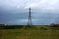 Pylon, Graveney Marshes - geograph.org.uk - 3291028.jpg 640 × 426; 43 KB
-
 Reconstruction of Forge Orchard, Staple Street - geograph.org.uk - 5367218.jpg 3,264 × 2,448; 2.32 MB
-
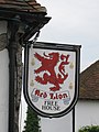 Red Lion sign - geograph.org.uk - 1971975.jpg 768 × 1,024; 180 KB
-
 Red Lion, Hernhill - geograph.org.uk - 1971973.jpg 1,024 × 768; 200 KB
-

-
 Remains of Crockham Farm Oast, Crockham Lane - geograph.org.uk - 5705043.jpg 3,264 × 2,395; 2.84 MB
-
 Residential dwellings, Crockham Farm, Crockham Lane - geograph.org.uk - 5703018.jpg 3,264 × 2,448; 2.88 MB
-
 Residential dwellings, Crockham Farm, Crockham Lane - geograph.org.uk - 5703022.jpg 3,264 × 2,448; 3.63 MB
-
 Road junction in Fostall - geograph.org.uk - 2594390.jpg 640 × 480; 202 KB
-
 Road junction on Highstreet Road - geograph.org.uk - 1559338.jpg 640 × 427; 73 KB
-
 Road junction on Kemsdale Road - geograph.org.uk - 1559243.jpg 640 × 427; 89 KB
-
 Road junction on Kemsdale Road - geograph.org.uk - 1559259.jpg 640 × 427; 75 KB
-
 Road junction, Highstreet - geograph.org.uk - 4272813.jpg 640 × 480; 104 KB
-

-
 Roses at Mount Ephraim Gardens - geograph.org.uk - 6254805.jpg 4,000 × 3,000; 4.83 MB
-

-
 Service Area, Thanet Way - geograph.org.uk - 3722434.jpg 640 × 427; 201 KB
-
 Shady Seat - geograph.org.uk - 1444627.jpg 640 × 480; 119 KB
-
 Sheep and rows of poplar trees - geograph.org.uk - 1559334.jpg 640 × 427; 84 KB
-

-
 Signs of summer - Hernhill - geograph.org.uk - 6147123.jpg 449 × 640; 82 KB
-
 Spot the odd one out - geograph.org.uk - 2431373.jpg 640 × 466; 93 KB
-
 Springfield, Church Hill - geograph.org.uk - 5703001.jpg 2,448 × 3,264; 2.77 MB
-
 St. Michael's Church, Hernhill - geograph.org.uk - 2210835.jpg 1,154 × 780; 435 KB
-
 St. Michael's, Hernhill - geograph.org.uk - 3756767.jpg 3,488 × 2,616; 2.19 MB
-
 Staple Street, near Goodnestone - geograph.org.uk - 5434981.jpg 3,264 × 2,448; 2.91 MB
-
 Staple Street, Staplestreet - geograph.org.uk - 5435948.jpg 3,264 × 2,448; 2.93 MB


_Village_-_geograph.org.uk_-_1426584.jpg)


.jpg)


