Category:Herz Mariä Kirche (Wiener Neustadt)
| Object location | | View all coordinates using: OpenStreetMap |
|---|
parish church .jpg) _Altar.jpg) | |||||
| Upload media | |||||
| Instance of | |||||
|---|---|---|---|---|---|
| Named after | |||||
| Made from material | |||||
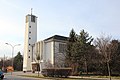
| Location | Wiener Neustadt, Lower Austria, Austria | ||||
| Street address |
| ||||
| Architectural style | |||||
| Diocese | |||||
| Heritage designation | |||||
 | |||||
Media in category "Herz Mariä Kirche (Wiener Neustadt)"
The following 4 files are in this category, out of 4 total.
-
 Pfarrkirche Herz Mariae (Wiener Neustadt) Altar.jpg 2,592 × 1,737; 470 KB
-
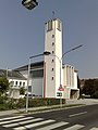 Pfarrkirche Herz Mariae (Wiener Neustadt).jpg 1,944 × 2,592; 754 KB
-
 Wiener Neustadt 4224.JPG 3,456 × 5,184; 5.55 MB
-
 Wiener Neustadt 4227.JPG 5,184 × 3,456; 6.57 MB

