Category:Het Tolhuis, Meppel
| Object location | | View all coordinates using: OpenStreetMap |
|---|
 | |||||
| Upload media | |||||
| Instance of | |||||
|---|---|---|---|---|---|
| Location | Meppel, Drenthe, Netherlands | ||||
| Street address |
| ||||
| Located on street |
| ||||
| Heritage designation |
| ||||
 | |||||
|
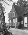
This is a category about rijksmonument number 28639
|
| Address |
|
Media in category "Het Tolhuis, Meppel"
The following 16 files are in this category, out of 16 total.
-
 28639 02 img 1135.jpg 4,752 × 3,168; 6.25 MB
-
 28639 04 img 1137.jpg 3,168 × 4,752; 6.37 MB
-
 Aan de Reest - Meppel - 20153313 - RCE.jpg 1,200 × 812; 302 KB
-
 Achter- en zijgevel - Meppel - 20153317 - RCE.jpg 1,200 × 791; 232 KB
-
 Achtergevel - Meppel - 20153315 - RCE.jpg 1,200 × 781; 220 KB
-
 Achtergevel - Meppel - 20153316 - RCE.jpg 1,200 × 783; 196 KB
-
 Achterzijde - Meppel - 20153321 - RCE.jpg 950 × 1,200; 329 KB
-
 Boerderij "HET TOLhuis" HEINEMAN 7 BLAD 2 - Meppel - 20441408 - RCE.jpg 1,200 × 900; 197 KB
-
 Gesloten bedsteewand - Meppel - 20153323 - RCE.jpg 1,200 × 960; 205 KB
-
 Gesloten bedsteewand - Meppel - 20153324 - RCE.jpg 1,200 × 959; 215 KB
-
 Interieur - Meppel - 20153322 - RCE.jpg 1,200 × 953; 200 KB
-
 Overzicht achtergevel - Meppel - 20351920 - RCE.jpg 1,200 × 794; 232 KB
-
 Voorgevel detail - Meppel - 20153314 - RCE.jpg 1,200 × 792; 193 KB
-
 Voorzijde - Meppel - 20153318 - RCE.jpg 1,200 × 952; 319 KB
-
 Voorzijde - Meppel - 20153319 - RCE.jpg 961 × 1,200; 325 KB
-
 Zijgevel - Meppel - 20153320 - RCE.jpg 1,200 × 958; 345 KB


