Category:Hiking and footpath signs in Styria
Subcategories
This category has only the following subcategory.
*
Media in category "Hiking and footpath signs in Styria"
The following 45 files are in this category, out of 45 total.
-
 15-11-25-Spielfeld-RalfR-WMA 4081.jpg 4,016 × 6,016; 14.62 MB
-
 Am Anstieg zur Handalm.jpg 2,896 × 1,944; 4.55 MB
-
 Deutschlandsberg Wegweiser Wildbachsattel 7 h 2022-10-30.jpg 6,016 × 4,016; 8.61 MB
-
 Eisenerzer Touren in der Hochschwabgruppe.jpg 3,860 × 2,895; 8.8 MB
-
 Donnersbach környéke. Fortepan 55590.jpg 4,538 × 5,381; 5.39 MB
-
 Fuchs am Bründlweg.jpg 4,928 × 3,264; 8.41 MB
-
 Geierwandweg Baummarkierung.jpg 1,200 × 1,600; 276 KB
-
 Geierwandweg Wegweiser.jpg 1,200 × 1,600; 339 KB
-
 Gleinalmsattel-Roßbachkogel Wanderweg 01.jpg 3,888 × 5,184; 7.94 MB
-
 Grimming Wegweiser (20200912 093741).jpg 4,032 × 3,024; 2.73 MB
-
 Gsengscharte 20200622.jpg 2,890 × 4,600; 12.99 MB
-
 Haindlkar trail mark 20200622.jpg 4,305 × 3,039; 9.96 MB
-
 Handalm Schild Felsofen.jpg 2,896 × 1,944; 3.41 MB
-
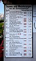
 Hinweistafel "Bergfahrten u. Ausflüge" am Bhf Mariazell.jpg 2,238 × 2,986; 1.66 MB
-
 Hinweistafel "Die Hochschwabgruppe" am Bhf Mariazell.jpg 2,224 × 2,966; 1.76 MB
-
 Hirzmann-Stausee 04.jpg 6,000 × 4,000; 6.93 MB
-
 Hollenegg Stadel Wegweiser.jpg 4,608 × 3,456; 15.96 MB
-
 Johnsbach - Nationalpark Gesäuse - Weitwanderweg 08 - Eisenwurzenweg.jpg 4,935 × 3,290; 5.99 MB
-
 Kaiserwald Unterpremstätten 42.jpg 6,000 × 4,000; 9.59 MB
-
 Kammspitze0103.JPG 3,888 × 2,592; 6.59 MB
-
 Kapellen, Austria - panoramio - Milan Nobonn (23).jpg 4,000 × 3,000; 4.55 MB
-
 Kapellen, Austria - panoramio - Milan Nobonn (29).jpg 4,000 × 3,000; 4.38 MB
-
 Kapellen, Austria - panoramio - Milan Nobonn.jpg 4,000 × 3,000; 5.6 MB
-
 Klafferkessel00038.JPG 2,816 × 2,112; 2.07 MB
-
 Klafferkessel00040.JPG 2,816 × 2,112; 2.05 MB
-
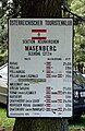 Masenberg ÖTK Wegweiser1975.jpg 1,908 × 2,944; 4.19 MB
-
 Mausegger Graben Schild bei Inschrift.jpg 1,944 × 2,896; 3.51 MB
-
 Mausegger Graben Sporiroaofen Warnschild.jpg 2,896 × 1,944; 1.35 MB
-
 Mesnerhaus-pichl3660.JPG 3,888 × 2,592; 8.28 MB
-
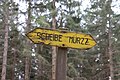
 Murzzuschlag szlak do Kaarlhutte 2.jpg 6,000 × 4,000; 8.07 MB
-
 Murzzuschlag szlak do Kaarlhutte 3.jpg 6,000 × 4,000; 7.4 MB
-
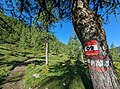
 Murzzuschlag szlak na Grosse Scheibe 01.jpg 6,000 × 4,000; 7.49 MB
-
 Murzzuschlag szlak na Grosse Scheibe 02.jpg 6,000 × 4,000; 8.33 MB
-
 Murzzuschlag szlak na Grosse Scheibe 03.jpg 6,000 × 4,000; 8.88 MB
-
 Murzzuschlag szlak na Grosse Scheibe 08.jpg 6,000 × 4,000; 7.41 MB
-
 Murzzuschlag szlak na Grosse Scheibe 09.jpg 6,000 × 4,000; 5.96 MB
-
 Murzzuschlag szlak na Grosse Scheibe 10.jpg 4,000 × 6,000; 10.31 MB
-
 Murzzuschlag szlak na Grosse Scheibe 11.jpg 6,000 × 4,000; 10.1 MB
-
 Salzsteigweg 09 Beschilderung 20230625a.jpg 3,849 × 2,857; 8.89 MB
-
 Straßegg, pilgrimage 13.jpg 2,840 × 4,256; 5.09 MB
-
 Straßengel GUW.jpg 6,000 × 4,000; 6.22 MB
-
 Tragöß - Sonnschienhütte, Infotafel.JPG 2,334 × 3,937; 7.31 MB
-
 Trasattel Wegweiser 1.jpg 3,648 × 2,736; 3.73 MB
-
 Trasattel Wegweiser 2.jpg 2,736 × 3,648; 5.63 MB
-
 Wegmarkierung zwischen Weberkogel und Handalm.jpg 2,896 × 1,944; 4.31 MB


.jpg)


.jpg)
.jpg)


