Category:Hildenborough
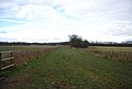
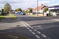
English: Hildenborough is a village and rural parish in the District of Tonbridge and Malling, Kent. It is two miles (three kilometres) north-west of Tonbridge and five miles (eight kilometres) south-east of Sevenoaks. The village lies in the River Medway valley, near the North Downs in an area known as The Weald.
Nederlands: Hildenborough is een plaats en civil parish in het bestuurlijke gebied Tonbridge & Malling, in het Engelse graafschap Kent. De plaats telt 4.600 inwoners.
village in Kent  | |||||
| Upload media | |||||
| Instance of | |||||
|---|---|---|---|---|---|
| Location | Tonbridge and Malling, Kent, South East England, England | ||||
| Said to be the same as | Hildenborough (Wikimedia duplicated page, civil parish) | ||||
 | |||||
Subcategories
This category has the following 5 subcategories, out of 5 total.
H
- Hildenborough War Memorial (2 F)
L
- Leigh Road, Hildenborough (44 F)
O
- Oasts in Hildenborough (62 F)
Media in category "Hildenborough"
The following 200 files are in this category, out of 997 total.
(previous page) (next page)-
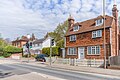 122, 126 and 128 London Road (geograph 7520339).jpg 1,024 × 683; 753 KB
-
 3rd Hole in Nizels Golf Club - geograph.org.uk - 1543046.jpg 640 × 427; 61 KB
-
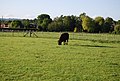 A bullock grazing, Hawden Farm - geograph.org.uk - 1312005.jpg 640 × 430; 96 KB
-
 A field of Buttercups - geograph.org.uk - 1308684.jpg 640 × 430; 72 KB
-
 A Field of Oil seed Rape (2) - geograph.org.uk - 1371632.jpg 640 × 430; 47 KB
-
 A goal by Hilden Farm - geograph.org.uk - 2773214.jpg 640 × 480; 100 KB
-

-
 A line of trees - geograph.org.uk - 3449788.jpg 640 × 336; 30 KB
-

-
 A lone tree - geograph.org.uk - 4008300.jpg 640 × 430; 46 KB
-

-
 A small stand of conifers - geograph.org.uk - 3451620.jpg 640 × 430; 52 KB
-
 A small tributary of the River Medway - geograph.org.uk - 5776156.jpg 4,000 × 3,000; 4.79 MB
-
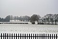 A snowy field - geograph.org.uk - 5752517.jpg 640 × 426; 59 KB
-
 A strip of mud - geograph.org.uk - 3457229.jpg 640 × 430; 64 KB
-
 A tributary of Hilden Brook - geograph.org.uk - 3441919.jpg 640 × 430; 122 KB
-

-
 A very large wheat field, Trench Farm - geograph.org.uk - 1881158.jpg 640 × 430; 124 KB
-
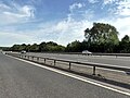
 A21 - 1-2 mile to A225 - geograph.org.uk - 2725164.jpg 640 × 428; 70 KB
-
 A21 - a contrast in signage - geograph.org.uk - 2725181.jpg 640 × 428; 62 KB
-
 A21 - bridges under and over - geograph.org.uk - 2725139.jpg 640 × 428; 78 KB
-
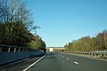
 A21 - geograph.org.uk - 3659197.jpg 640 × 430; 50 KB
-
 A21 near bridge over B2027 - geograph.org.uk - 3448588.jpg 1,621 × 1,024; 756 KB
-
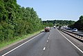
 A21 near Leigh - geograph.org.uk - 5469246.jpg 4,896 × 3,672; 5.94 MB
-
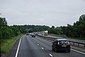
 A21 Tonbridge bypass - geograph.org.uk - 3465319.jpg 1,665 × 984; 879 KB
-
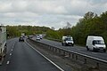
 A21 Tonbridge Bypass northbound - geograph.org.uk - 3485315.jpg 1,990 × 1,206; 1.24 MB
-
 A21, Barnett's Wood Picnic area - geograph.org.uk - 2035001.jpg 640 × 430; 120 KB
-
 A21, Nizels Lane Bridge - geograph.org.uk - 2034982.jpg 640 × 430; 75 KB
-
 A21, northbound - geograph.org.uk - 2583776.jpg 640 × 430; 82 KB
-
 A21, northbound - geograph.org.uk - 2583781.jpg 640 × 430; 87 KB
-
 A21, northbound - geograph.org.uk - 2583792.jpg 640 × 430; 94 KB
-
 A21, northbound - geograph.org.uk - 3304849.jpg 640 × 430; 51 KB
-
 A21, northbound - geograph.org.uk - 3304858.jpg 640 × 430; 52 KB
-
 A21, northbound - geograph.org.uk - 4505848.jpg 640 × 426; 51 KB
-
 A21, Philpots Lane Bridge - geograph.org.uk - 2034991.jpg 640 × 430; 126 KB
-
 A21, southbound - geograph.org.uk - 2034997.jpg 640 × 413; 81 KB
-
 A21, southbound - geograph.org.uk - 2740792.jpg 640 × 400; 67 KB
-
 A21, southbound - geograph.org.uk - 3659402.jpg 640 × 447; 59 KB
-
 A21, southbound - geograph.org.uk - 4569415.jpg 640 × 478; 67 KB
-
 A21, southbound - geograph.org.uk - 5115048.jpg 640 × 426; 61 KB
-
 A21, southbound - geograph.org.uk - 5719467.jpg 640 × 426; 46 KB
-
 A21, southbound layby - geograph.org.uk - 4569419.jpg 640 × 488; 68 KB
-
 Abandoned field, Hawden Farm - geograph.org.uk - 1953592.jpg 640 × 430; 138 KB
-
 Abandoned field, Hawden Farm - geograph.org.uk - 1953593.jpg 640 × 430; 106 KB
-
 Abandoned field, Hawden Farm - geograph.org.uk - 1953596.jpg 640 × 430; 151 KB
-
 Abandoned grassy field, Hawden Farm - geograph.org.uk - 1953606.jpg 640 × 430; 145 KB
-
 Approach to Spring House - geograph.org.uk - 4448074.jpg 4,000 × 3,000; 4.1 MB
-
 Approaching a stile - geograph.org.uk - 1535749.jpg 640 × 430; 145 KB
-
 Ashbourne Court - geograph.org.uk - 1549139.jpg 640 × 427; 50 KB
-
 Ashley Road, Hildenborough - geograph.org.uk - 4866507.jpg 3,264 × 2,448; 1.95 MB
-
 Ashley Road, Hildenborough - geograph.org.uk - 4866508.jpg 3,264 × 2,448; 1.65 MB
-
 B2027 junction with Rings Hill - geograph.org.uk - 4935316.jpg 640 × 480; 122 KB
-
 B245 London Road - geograph.org.uk - 4320908.jpg 800 × 517; 119 KB
-
 B245 past the Half Moon Pub - geograph.org.uk - 4320881.jpg 800 × 506; 122 KB
-
 B246, London Rd - geograph.org.uk - 1312996.jpg 640 × 430; 89 KB
-
 Bales, Hawden Farm - geograph.org.uk - 3462605.jpg 640 × 430; 57 KB
-
 Bank Lane - geograph.org.uk - 1396904.jpg 640 × 480; 142 KB
-
 Bank Lane - geograph.org.uk - 3722569.jpg 2,048 × 1,536; 810 KB
-
 Bank Lane - geograph.org.uk - 4007019.jpg 4,000 × 3,000; 4.17 MB
-
 Bank Lane, near Hildenborough - geograph.org.uk - 4867476.jpg 3,264 × 2,448; 2.69 MB
-
 Bank Lane, near Hildenborough - geograph.org.uk - 4869160.jpg 3,264 × 2,448; 2.73 MB
-
 Bank Lane, near Hildenborough - geograph.org.uk - 4869166.jpg 3,264 × 2,448; 2.92 MB
-
 Barn, Hawden Farm - geograph.org.uk - 1392037.jpg 640 × 430; 133 KB
-
 Barn, Hawden Farm, Hawden Lane - geograph.org.uk - 1312012.jpg 640 × 430; 80 KB
-
 Barn, High Barn Farm - geograph.org.uk - 1877788.jpg 640 × 430; 45 KB
-
 Barn, Hilden Farm - geograph.org.uk - 3457991.jpg 640 × 430; 83 KB
-
 Barn, Leigh Rd (geograph 6737257).jpg 1,024 × 658; 243 KB
-
 Barn, Trench Farm - geograph.org.uk - 1881094.jpg 640 × 430; 114 KB
-
 Barn, Trench Farm - geograph.org.uk - 3451746.jpg 640 × 430; 56 KB
-
 Barrel Horse Jump - geograph.org.uk - 1545420.jpg 640 × 427; 100 KB
-
 Bartella's, Rings Hill - geograph.org.uk - 1312240.jpg 640 × 430; 78 KB
-

-
 Bend in B245 London Road - geograph.org.uk - 4321374.jpg 1,771 × 1,253; 1.53 MB
-
 Bend in Nizels Lane at Mansers - geograph.org.uk - 1536083.jpg 640 × 430; 182 KB
-
 Bend in the path north of Philpots Lane - geograph.org.uk - 1535909.jpg 640 × 430; 194 KB
-
 Birch Close, Hildenborough - geograph.org.uk - 4866526.jpg 3,264 × 2,448; 2.32 MB
-
 Bourne Place Barn, Nizels Lane - geograph.org.uk - 1535999.jpg 640 × 430; 149 KB
-
 Bourne Place Meadow, Nizels Lane - geograph.org.uk - 1536048.jpg 640 × 430; 125 KB
-

-
 Bramble Close, Hildenborough - geograph.org.uk - 4866496.jpg 3,264 × 2,448; 1.48 MB
-
 Brick building, Trench Farm - geograph.org.uk - 3451750.jpg 640 × 430; 61 KB
-
 Brick cottage off London Rd - geograph.org.uk - 1877699.jpg 640 × 479; 105 KB
-
 Bridge Cottage - geograph.org.uk - 4455155.jpg 640 × 294; 48 KB
-
 Bridge over A21 - geograph.org.uk - 2725155.jpg 640 × 428; 73 KB
-
 Bridge over A21 - geograph.org.uk - 3448620.jpg 1,681 × 970; 983 KB
-
 Bridge over the Hilden Brook - geograph.org.uk - 4007049.jpg 4,000 × 3,000; 4.37 MB
-
 Bridge XTD 227 over Leigh Road - geograph.org.uk - 2773284.jpg 640 × 480; 111 KB
-
 Bridleway - geograph.org.uk - 3519007.jpg 640 × 430; 123 KB
-
 Bridleway along hedge - geograph.org.uk - 3519009.jpg 640 × 430; 113 KB
-
 Bridleway east from Coldharbour - geograph.org.uk - 1309235.jpg 640 × 430; 95 KB
-
 Bridleway from Little Trench Farm to Trench Farm - geograph.org.uk - 6208638.jpg 1,024 × 768; 524 KB
-
 Bridleway from Trench Farm - geograph.org.uk - 3457159.jpg 640 × 430; 99 KB
-
 Bridleway heading south - geograph.org.uk - 1880885.jpg 640 × 430; 168 KB
-
 Bridleway south to Hilden Brook - geograph.org.uk - 1880925.jpg 640 × 430; 147 KB
-
 Bridleway through Tinley Lodge Toll - geograph.org.uk - 1576118.jpg 640 × 430; 202 KB
-
 Bridleway to Cataract Cottage - geograph.org.uk - 3519021.jpg 640 × 430; 69 KB
-
 Bridleway to Horns Lodge - geograph.org.uk - 3519013.jpg 640 × 430; 83 KB
-
 Bridleway to Trench Farm - geograph.org.uk - 1545148.jpg 640 × 427; 102 KB
-
 Bridleway to Trench Farm - geograph.org.uk - 1880888.jpg 640 × 430; 136 KB
-
 Bridleway to Trench Farm - geograph.org.uk - 1880939.jpg 640 × 430; 162 KB
-
 Bridleway to Trench Farm - geograph.org.uk - 1880974.jpg 640 × 430; 138 KB
-
 Bridleway to Trench Farm - geograph.org.uk - 1880983.jpg 640 × 430; 144 KB
-
 Bridleway to Trench Farm - geograph.org.uk - 1881039.jpg 640 × 430; 126 KB
-
 Bridleway to Trench Farm - geograph.org.uk - 3457217.jpg 640 × 430; 53 KB
-
 Bridleway, Horns Lodge - geograph.org.uk - 3519014.jpg 640 × 430; 95 KB
-
 Bridleway, Trench Farm - geograph.org.uk - 3457156.jpg 640 × 430; 60 KB
-
 Brook Cottage - geograph.org.uk - 1546156.jpg 640 × 427; 81 KB
-
 Brookmead - geograph.org.uk - 5726264.jpg 640 × 426; 45 KB
-
 Brookmead Road - geograph.org.uk - 1549091.jpg 640 × 427; 62 KB
-
 Brookmead, Hildenborough - geograph.org.uk - 4866491.jpg 3,264 × 2,448; 1.72 MB
-
 Brookmead, Hildenborough - geograph.org.uk - 4866505.jpg 3,264 × 2,448; 1.71 MB
-
 Brookmead, Hildenborough - geograph.org.uk - 4866538.jpg 3,264 × 2,448; 1.61 MB
-
 Bungalow near Bourne Place, Nizels lane - geograph.org.uk - 1536066.jpg 640 × 430; 142 KB
-
 Bus Shelter and Postbox, London Rd - geograph.org.uk - 1313251.jpg 640 × 430; 95 KB
-
 Bus Shelter, London Rd - geograph.org.uk - 1313106.jpg 640 × 430; 90 KB
-

-

-

-
 Buttercup meadow, High Barn Farm - geograph.org.uk - 1877793.jpg 640 × 430; 78 KB
-
-
 By London Rd - geograph.org.uk - 5726278.jpg 640 × 426; 40 KB
-
 Byrneside, Hildenborough - geograph.org.uk - 4866497.jpg 3,264 × 2,448; 2.02 MB
-
 Car Dealer, Hildenborough - geograph.org.uk - 1365651.jpg 640 × 480; 58 KB
-
 Car Dealer, Hildenbrough - geograph.org.uk - 683613.jpg 640 × 480; 67 KB
-
 Car Dealership, London Rd - geograph.org.uk - 1312966.jpg 640 × 430; 47 KB
-
 Cataract Cottage - geograph.org.uk - 3527316.jpg 430 × 640; 117 KB
-
 Cattle, Hawden Farm - geograph.org.uk - 1392042.jpg 640 × 430; 153 KB
-
 Church Road, Hildenborough - geograph.org.uk - 4866614.jpg 3,264 × 2,448; 1.66 MB
-
 Church Road, Hildenborough - geograph.org.uk - 4866624.jpg 3,264 × 2,448; 1.81 MB
-
 Circular woodland - geograph.org.uk - 4008313.jpg 640 × 430; 49 KB
-
 Classic Trabant, Birch Close, Hildenborough - geograph.org.uk - 4866522.jpg 3,264 × 2,448; 2.42 MB
-
 Clubhouse, Nizels Golf Club - geograph.org.uk - 3722194.jpg 2,007 × 1,437; 446 KB
-
 Clubhouse, Nizels Golf Club, Nizels Lane - geograph.org.uk - 1370756.jpg 640 × 430; 124 KB
-
 Clump of Trees west of Mill Lane - geograph.org.uk - 1373029.jpg 640 × 430; 149 KB
-
 Cock Cottages, London Rd, Hildenborough - geograph.org.uk - 1367844.jpg 640 × 430; 107 KB
-
 Cold Harbour Lane - geograph.org.uk - 4007045.jpg 4,000 × 3,000; 4.27 MB
-
 Cold Harbour Lane - geograph.org.uk - 4309439.jpg 640 × 480; 116 KB
-
 Coldharbour Farm, Coldharbour Lane - geograph.org.uk - 1309209.jpg 640 × 430; 78 KB
-
 Coldharbour Lane - geograph.org.uk - 1309061.jpg 640 × 430; 92 KB
-
 Coldharbour Lane - geograph.org.uk - 1309101.jpg 640 × 430; 113 KB
-
 Coldharbour Lane - geograph.org.uk - 3451734.jpg 640 × 430; 103 KB
-
 Coldharbour Lane - geograph.org.uk - 3451738.jpg 640 × 430; 90 KB
-
 Coldharbour Lane - geograph.org.uk - 3451756.jpg 640 × 430; 97 KB
-
 Coldharbour Lane looking NE - geograph.org.uk - 1309078.jpg 640 × 430; 71 KB
-
 Coldharbour Lane looking SW - geograph.org.uk - 1309041.jpg 640 × 430; 94 KB
-
 Coldharbour Lane off London Rd - geograph.org.uk - 1313101.jpg 640 × 430; 104 KB
-
 Coldharbour Lane, Hildenborough - geograph.org.uk - 4866567.jpg 3,264 × 2,448; 2.2 MB
-
 Coldharbour Lane, Hildenborough - geograph.org.uk - 4866579.jpg 3,264 × 2,448; 2 MB
-
 Coldharbour Lane, Hildenborough - geograph.org.uk - 4866595.jpg 3,264 × 2,448; 1.86 MB
-
 Coldharbour Lane, Hildenborough - geograph.org.uk - 4866599.jpg 3,264 × 2,448; 2.69 MB
-
 Coldharbour Lane, Hildenborough - geograph.org.uk - 5097311.jpg 3,264 × 2,448; 2.24 MB
-
 Coldharbour Lane, Hildenborough - geograph.org.uk - 5097319.jpg 3,264 × 2,448; 2.14 MB
-
 Coldharbour Lane, Hildenborough - geograph.org.uk - 5097332.jpg 3,264 × 2,448; 1.9 MB
-
 Coldharbour Lane, Hildenborough - geograph.org.uk - 5097340.jpg 3,264 × 2,448; 1.46 MB
-
 Construction at Oakhill House - geograph.org.uk - 1545238.jpg 640 × 427; 57 KB
-
 Copse Road, Hildenborough - geograph.org.uk - 4866502.jpg 3,264 × 2,448; 1.98 MB
-
 Cottage at Grove Barn - geograph.org.uk - 2482736.jpg 1,794 × 1,344; 1.74 MB
-
 Cottage by the railway line - geograph.org.uk - 1312112.jpg 640 × 430; 69 KB
-
 Cottage by the railway line - geograph.org.uk - 4938717.jpg 640 × 426; 44 KB
-
 Cottage off London Rd - geograph.org.uk - 1312910.jpg 640 × 410; 48 KB
-
 Cottage, Grove Barn - geograph.org.uk - 3360596.jpg 640 × 421; 45 KB
-
 Cottage, Hildenborough Rd - geograph.org.uk - 3458006.jpg 640 × 430; 92 KB
-
 Cottage, Nizels Lane - geograph.org.uk - 1370763.jpg 640 × 430; 144 KB
-

-
 Cottage, Rings Hill - geograph.org.uk - 1312252.jpg 640 × 430; 70 KB
-
 Cottage, Watt's Cross - geograph.org.uk - 1312922.jpg 640 × 430; 76 KB
-
 Cottages north of Trench Farm - geograph.org.uk - 1309096.jpg 640 × 430; 69 KB
-
 Countryside by the railway - geograph.org.uk - 4527333.jpg 640 × 426; 33 KB
-
 Countryside north of Tonbridge - geograph.org.uk - 3519003.jpg 640 × 430; 69 KB
-

-
 Dead tree alongside Lower Street - geograph.org.uk - 4193698.jpg 4,000 × 3,000; 4.04 MB
-
-
 Derby Close, Hildenborough - geograph.org.uk - 4866586.jpg 3,264 × 2,448; 2.07 MB
-
 Derelict building, Home Farm - geograph.org.uk - 1535984.jpg 640 × 430; 138 KB
-

-
 Ducks on the 11th Tee, Nizels Golf Club - geograph.org.uk - 1370794.jpg 640 × 430; 183 KB
-
-
 Elm Grove - geograph.org.uk - 1313245.jpg 640 × 430; 80 KB
-
 Elm Grove, Hildenborough - geograph.org.uk - 2293373.jpg 640 × 480; 78 KB
-
 Elm Grove, Hildenborough - geograph.org.uk - 4866475.jpg 3,264 × 2,448; 1.61 MB
-
 Elm Grove, Hildenborough - geograph.org.uk - 4866480.jpg 3,264 × 2,448; 1.69 MB
-
 Enclosed footpath - geograph.org.uk - 3458004.jpg 640 × 430; 121 KB
-
 Entering Hildenborough, London Rd - geograph.org.uk - 1313001.jpg 640 × 430; 83 KB
-
 Entering Tonbridge on London Road - geograph.org.uk - 2901057.jpg 1,600 × 1,200; 504 KB
-
 Entrance to Fairhill - geograph.org.uk - 6095309.jpg 4,000 × 3,000; 4.8 MB
-

-

-
 ER letterbox TN11 289 - geograph.org.uk - 2971995.jpg 640 × 557; 127 KB
-
 Exiting Tinley Lodge Toll - geograph.org.uk - 3519001.jpg 640 × 430; 129 KB
-
 Factory on London Rd - geograph.org.uk - 1370751.jpg 640 × 430; 131 KB
-
 Fairfield Way - geograph.org.uk - 1313239.jpg 640 × 430; 65 KB
-
 Fallen tree - geograph.org.uk - 3527347.jpg 640 × 430; 151 KB
-
 Fallow field - geograph.org.uk - 3457188.jpg 640 × 430; 72 KB
-
 Farm building, High Barn Farm - geograph.org.uk - 1877798.jpg 640 × 430; 61 KB
-
 Farm building, Trench Farm - geograph.org.uk - 1309094.jpg 640 × 430; 73 KB
-
 Farm Buildings near Coldharbour - geograph.org.uk - 1309106.jpg 640 × 430; 69 KB
-
 Farm buildings, Hawden Farm - geograph.org.uk - 1502824.jpg 640 × 430; 119 KB
-
 Farm buildings, The Shaws - geograph.org.uk - 1536138.jpg 640 × 430; 140 KB
-
 Farmhouse, Hawden Farm - geograph.org.uk - 1392035.jpg 640 × 430; 141 KB
-
 Farmhouse, Hawden Farm - geograph.org.uk - 1877654.jpg 640 × 385; 54 KB
.jpg)


_-_geograph.org.uk_-_1371632.jpg)


.jpg)


_-_geograph.org.uk_-_1309276.jpg)
_-_geograph.org.uk_-_1309278.jpg)


