Category:Hills of England
Wikimedia category | |||||
| Upload media | |||||
| Instance of | |||||
|---|---|---|---|---|---|
| |||||
Subcategories
This category has the following 62 subcategories, out of 62 total.
*
A
- Angletarn Pikes (24 F)
B
C
D
E
G
H
K
L
M
- Mount Judd, Nuneaton (3 F)
N
- Hills of Nottinghamshire (25 F)
O
P
R
- Hills of Rutland (4 F)
S
- Hills of Suffolk (4 F)
T
W
- Hills of Warwickshire (29 F)
Y
Media in category "Hills of England"
The following 161 files are in this category, out of 161 total.
-
 Approach to Beeston Castle keep - geograph.org.uk - 814817.jpg 640 × 480; 86 KB
-
 Arnsbarrow Tarn.jpg 640 × 480; 88 KB
-
 Beacon Hill.jpg 640 × 480; 67 KB
-
 Faulston Dovecote from Faulston Down - geograph.org.uk - 302045.jpg 480 × 640; 103 KB
-
 The Dovecote, Faulston House - geograph.org.uk - 293753.jpg 640 × 427; 109 KB
-
 Blagdon Lake - geograph.org.uk - 602107.jpg 640 × 182; 26 KB
-
 Blake Fell.jpg 600 × 381; 57 KB
-
 Canonbie Road SE23 - geograph.org.uk - 758343.jpg 640 × 480; 92 KB
-
 Carding Mill Valley - panoramio.jpg 2,816 × 2,112; 1.08 MB
-
 Carding Mill Valley1 - panoramio.jpg 2,816 × 2,112; 1.04 MB
-
 Castle Hill (South side), Almondbury - geograph.org.uk - 85669.jpg 640 × 467; 69 KB
-
 CatheringtonDown.JPG 1,600 × 1,200; 910 KB
-
 Clapham cum Newby, UK - panoramio.jpg 800 × 600; 97 KB
-
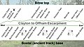 Clayton to Offham escarpment.jpg 960 × 540; 85 KB
-
 Clevedon from the Friary footpath - panoramio (1).jpg 2,448 × 1,624; 2.49 MB
-
 Clevedon from the seawall at Pill. - panoramio.jpg 1,693 × 371; 832 KB
-
 Cold Pike from Great Knott.jpg 1,600 × 1,200; 391 KB
-
 Colmer's Hill.jpg 2,000 × 1,335; 1,007 KB
-
 Coniston view.jpg 640 × 321; 234 KB
-
 Coombe Hill Monument from Butlers Cross - geograph.org.uk - 521156.jpg 640 × 480; 110 KB
-
 Demolished houses and rubble (6466332339).jpg 4,000 × 4,149; 5.7 MB
-
 East flank of Bilston Castle, or Hill.jpg 640 × 480; 146 KB
-
 England hill regions.jpg 1,180 × 1,428; 475 KB
-
 English Hills - panoramio.jpg 2,304 × 1,728; 1.49 MB
-
 Farmland near Ingoldsby Grange - geograph.org.uk - 405180.jpg 640 × 427; 96 KB
-
 From the lane to Moreton Underhill - geograph.org.uk - 138777.jpg 640 × 480; 345 KB
-
 Gordano Valley - panoramio.jpg 3,008 × 2,000; 2.09 MB
-
 Haughley Castle Keep.jpg 640 × 480; 149 KB
-
 HighRigg HelvellynRange.JPG 2,560 × 1,920; 301 KB
-
 Hill Farms under snow.jpg 1,840 × 1,232; 2.74 MB
-
 Hills of south England, Hastings - panoramio (1).jpg 1,600 × 1,200; 1.06 MB
-
 Hills of south England, Hastings - panoramio.jpg 1,600 × 1,200; 1.2 MB
-
 HillyFields1.jpg 1,600 × 1,200; 149 KB
-
 Hoe Hill.JPG 3,872 × 2,592; 2.47 MB
-
 Holcombe hill1.jpg 4,260 × 1,273; 517 KB
-
 Holstein Friesian UK Yorkshire July 2011.jpg 4,000 × 3,000; 2.21 MB
-
 Looking up Farlington Avenue - geograph.org.uk - 639495.jpg 640 × 480; 64 KB
-
 Lower slopes of Charlton Kings Common. - geograph.org.uk - 36772.jpg 640 × 480; 110 KB
-
 Lower Waterstalls Farm.jpg 2,048 × 1,536; 1.4 MB
-
 Mount Judd, Nuneaton (geograph 3355210).jpg 1,024 × 768; 116 KB
-
 Northala TQ1283 157st.jpg 2,616 × 1,194; 599 KB
-
 Northala TQ1383 149.jpg 1,600 × 1,200; 480 KB
-
 Ogden reservoir - panoramio - jim walton (1).jpg 840 × 630; 110 KB
-
 Ogden reservoir - panoramio - jim walton.jpg 840 × 630; 144 KB
-
 Ogden reservoir - panoramio.jpg 840 × 630; 125 KB
-
 Ogden reservoir pendle hill - panoramio.jpg 840 × 630; 121 KB
-
 Pine trees - panoramio.jpg 2,272 × 3,408; 6.97 MB
-
 Quarley Hill - Iron Age Fort - geograph.org.uk - 148433.jpg 640 × 480; 52 KB
-
 River Etherow, Birchen Bank Moss - Peak District - panoramio.jpg 2,792 × 4,192; 2.81 MB
-
 Sheffield's Hill - geograph.org.uk - 613358.jpg 640 × 427; 52 KB
-
 Skiddaw and Little Man .JPG 2,816 × 2,112; 2.29 MB
-
 Spring Gardens Dyneley - geograph.org.uk - 687705.jpg 640 × 427; 54 KB
-

-
 West flank of Bilston Castle, or Hill.png 1,008 × 747; 1.01 MB
-
 A Tight Turn - geograph.org.uk - 279497.jpg 640 × 480; 109 KB
-
 Alvanley - view along the Sandstone Trail - geograph.org.uk - 499646.jpg 640 × 480; 112 KB
-
 Approaching Gawthwaite - geograph.org.uk - 170296.jpg 640 × 480; 69 KB
-
 Bennethead Banks - geograph.org.uk - 101140.jpg 640 × 438; 62 KB
-
 Billinge Hill - geograph.org.uk - 804405.jpg 640 × 427; 118 KB
-
 Black Hill - geograph.org.uk - 524671.jpg 640 × 480; 95 KB
-
 Bracken Hill - geograph.org.uk - 481700.jpg 640 × 480; 62 KB
-
 Brineddin Wood - geograph.org.uk - 298212.jpg 640 × 480; 89 KB
-
 Buck's Hill - geograph.org.uk - 367954.jpg 640 × 482; 76 KB
-
 Cant Hill and the River Camel - geograph.org.uk - 43682.jpg 640 × 427; 48 KB
-
 Carr Hill - geograph.org.uk - 494862.jpg 640 × 480; 71 KB
-
 Carr Lane - geograph.org.uk - 24566.jpg 640 × 480; 74 KB
-
 Catstones End - geograph.org.uk - 38279.jpg 640 × 480; 162 KB
-
 Chaxhill - geograph.org.uk - 140253.jpg 640 × 479; 74 KB
-
 Cheetham Close Southern Slopes - geograph.org.uk - 236209.jpg 640 × 426; 124 KB
-
 Clarke's Hill Hexton - geograph.org.uk - 204550.jpg 640 × 390; 109 KB
-

-
 Coneyburrow Hill, Longdon - geograph.org.uk - 108852.jpg 640 × 479; 77 KB
-
 Coniston fells from Ings Road - geograph.org.uk - 151271.jpg 640 × 480; 92 KB
-
 Crook Peak - geograph.org.uk - 348314.jpg 640 × 512; 46 KB
-
 Crookbarrow Hill - geograph.org.uk - 55309.jpg 640 × 479; 131 KB
-
 Crow Edge - geograph.org.uk - 168375.jpg 640 × 480; 81 KB
-
 Deer on Priest Barrow - geograph.org.uk - 364106.jpg 640 × 480; 71 KB
-
 Descending Loadpot Hill - geograph.org.uk - 175331.jpg 640 × 480; 92 KB
-
 Dovestones Reservoir from Alphin Pike - geograph.org.uk - 2337.jpg 480 × 360; 36 KB
-
 Empty Corral - geograph.org.uk - 602092.jpg 640 × 480; 88 KB
-
 Fence on Galloway Rigg - geograph.org.uk - 713621.jpg 640 × 480; 96 KB
-
 Fields and Pylons - geograph.org.uk - 376835.jpg 640 × 480; 76 KB
-
 Firtree Hill and Wilstead Wood - geograph.org.uk - 516921.jpg 640 × 480; 109 KB
-
 Fortune Hill - geograph.org.uk - 770604.jpg 640 × 480; 100 KB
-
 Fowler's Hill - geograph.org.uk - 188914.jpg 640 × 480; 60 KB
-
 Freebrough Hill - geograph.org.uk - 258923.jpg 640 × 325; 16 KB
-
 Freebrough Hill - geograph.org.uk - 283390.jpg 640 × 427; 35 KB
-
 Freezing Hill - geograph.org.uk - 254895.jpg 640 × 480; 79 KB
-
 From the Road to Tottlebank - geograph.org.uk - 170249.jpg 640 × 480; 68 KB
-
 Gallibury Fields from Fern Bottom - geograph.org.uk - 72191.jpg 640 × 479; 88 KB
-
 Golcar - cobbled hill to Longwood - geograph.org.uk - 169172.jpg 640 × 439; 118 KB
-
 Green Fell End - geograph.org.uk - 594205.jpg 640 × 480; 127 KB
-
 Green Hill - geograph.org.uk - 225488.jpg 640 × 479; 98 KB
-
 Hambleton Hill - geograph.org.uk - 678642.jpg 640 × 480; 97 KB
-
 Herrington Hill - geograph.org.uk - 494866.jpg 640 × 480; 92 KB
-
 Hills East of Hollingworth Lake - geograph.org.uk - 6023.jpg 640 × 228; 23 KB
-
 Hillside below Ibstone - geograph.org.uk - 686089.jpg 640 × 480; 109 KB
-
 Hillside towards Five Ashes - geograph.org.uk - 1413794.jpg 640 × 480; 139 KB
-
 Holcombe Hill - geograph.org.uk - 136364.jpg 640 × 480; 108 KB
-
 Hummersea Cliff - geograph.org.uk - 342733.jpg 640 × 426; 75 KB
-
 Knop Law - geograph.org.uk - 39379.jpg 640 × 443; 98 KB
-
 Knotts - geograph.org.uk - 589934.jpg 640 × 427; 59 KB
-

-

-
 Little Hill in late summer - geograph.org.uk - 44563.jpg 640 × 480; 89 KB
-
 Looking towards Killington Lake - geograph.org.uk - 144259.jpg 640 × 480; 75 KB
-
 Looking up Crooks o' Green Fell - geograph.org.uk - 453741.jpg 640 × 480; 108 KB
-
 Looking west Moorhow Road - geograph.org.uk - 151273.jpg 640 × 480; 100 KB
-
 Lowbury Hill - geograph.org.uk - 526058.jpg 640 × 480; 121 KB
-
 Lowe Hill - geograph.org.uk - 483248.jpg 640 × 480; 102 KB
-
 Lucern Bank - geograph.org.uk - 22763.jpg 640 × 479; 91 KB
-
 Lumpy hillside - geograph.org.uk - 501238.jpg 640 × 480; 106 KB
-
 Malvern Hills at dusk. - geograph.org.uk - 5689.jpg 640 × 480; 20 KB
-
 Man made hill. - geograph.org.uk - 401669.jpg 640 × 480; 57 KB
-
 March Hill - geograph.org.uk - 41823.jpg 640 × 480; 79 KB
-
 Meltham Cop - geograph.org.uk - 35782.jpg 640 × 480; 227 KB
-
 Meon Hill viewed from Lark Stoke - geograph.org.uk - 101888.jpg 640 × 426; 121 KB
-
 Mount Pleasant, Woodingdean - geograph.org.uk - 66322.jpg 640 × 386; 123 KB
-
 Near Tyning's Farm, looking North West - geograph.org.uk - 65844.jpg 640 × 480; 312 KB
-
 North Hill from a house in Handbury Rd - geograph.org.uk - 16339.jpg 640 × 427; 81 KB
-
 On Top of Little Solsbury - geograph.org.uk - 283642.jpg 640 × 480; 73 KB
-
 Overlooking Brown Knowl - geograph.org.uk - 379441.jpg 4,600 × 3,450; 2.25 MB
-
 Parking at the foot of the Wrekin - geograph.org.uk - 92954.jpg 640 × 480; 155 KB
-

-
 Pike Law and Pike End, Rishworth - geograph.org.uk - 52844.jpg 640 × 480; 83 KB
-
 Plucka Tarn on Plucka Hill - geograph.org.uk - 397022.jpg 640 × 480; 80 KB
-
 Portsdown Hill - geograph.org.uk - 423105.jpg 640 × 480; 212 KB
-
 Priest Barrow - geograph.org.uk - 364097.jpg 640 × 480; 59 KB
-
 Quad Bikes on Sandford Hill - geograph.org.uk - 217023.jpg 640 × 480; 110 KB
-
 Raw Head - geograph.org.uk - 562531.jpg 640 × 480; 89 KB
-
 Redgate Hill - geograph.org.uk - 443360.jpg 640 × 480; 116 KB
-
 Revetment below Mariners Park - geograph.org.uk - 318970.jpg 640 × 480; 167 KB
-

-
 Sedgewick Hill off the A19 - geograph.org.uk - 415093.jpg 640 × 480; 97 KB
-

-
 Shutlingsloe viewed from the north-east - geograph.org.uk - 699898.jpg 426 × 640; 111 KB
-
 Steep incline in Woodfield Road - geograph.org.uk - 638209.jpg 640 × 480; 43 KB
-
 Stonehill Down - geograph.org.uk - 19442.jpg 640 × 480; 117 KB
-
 Stormer Hill. - geograph.org.uk - 88567.jpg 640 × 480; 55 KB
-
 Stourton Field - geograph.org.uk - 196082.jpg 403 × 279; 23 KB
-
 Sunrise Over High Marley Hill - geograph.org.uk - 630583.jpg 640 × 384; 163 KB
-
 Swading Hill - geograph.org.uk - 382690.jpg 640 × 481; 85 KB
-
 The 514m top near Low Greygrits - geograph.org.uk - 681681.jpg 640 × 480; 60 KB
-
 The Bankies - geograph.org.uk - 71255.jpg 640 × 480; 71 KB
-
 The Billing - geograph.org.uk - 41158.jpg 640 × 480; 165 KB
-
 The Eponymous Gradient - geograph.org.uk - 87929.jpg 640 × 480; 43 KB
-
 The Malvern Hills from Newland East - geograph.org.uk - 5683.jpg 640 × 480; 61 KB
-
 The Pennines - geograph.org.uk - 236862.jpg 640 × 480; 68 KB
-
 The Pennines - geograph.org.uk - 236871.jpg 640 × 480; 58 KB
-
 Throstle Hill - geograph.org.uk - 425306.jpg 640 × 480; 108 KB
-
 Towards Gaer Stone - geograph.org.uk - 13946.jpg 426 × 640; 118 KB
-
 Upper Whitley Edge - geograph.org.uk - 164164.jpg 640 × 480; 109 KB
-
 View from Bishop Park, Grains Bar - geograph.org.uk - 2322.jpg 512 × 335; 34 KB
-
 View from Hunters Hill, near Diggle - geograph.org.uk - 2394.jpg 512 × 331; 36 KB
-
 View from Whitley Height - geograph.org.uk - 168385.jpg 640 × 480; 85 KB
-
 View upto the Old Lodge - geograph.org.uk - 399197.jpg 640 × 464; 105 KB
-
 Violet Hill - geograph.org.uk - 18884.jpg 640 × 480; 84 KB
-
 Whangdon Hill - geograph.org.uk - 412751.jpg 640 × 480; 98 KB
-
 White Hill Field - geograph.org.uk - 138947.jpg 640 × 426; 102 KB
-
 Wilmslow - view towards Alderley Edge - geograph.org.uk - 256358.jpg 640 × 480; 108 KB
-
 Wolds to the west - geograph.org.uk - 425511.jpg 640 × 480; 140 KB


,_Almondbury_-_geograph.org.uk_-_85669.jpg)


.jpg)


.jpg)


.jpg)


.jpg)


.jpg)


.jpg)


