Category:Historical flag maps of Germany
Media in category "Historical flag maps of Germany"
The following 95 files are in this category, out of 95 total.
-
 Flag map of Germany (separation).svg 512 × 1,284; 645 KB
-
 Flag Map of the German Empire (1918).jpg 4,974 × 2,519; 291 KB
-
 Flag Map of the German Empire, circa 1918.jpg 4,974 × 2,519; 332 KB
-
 Flag map of East Germany (1959–1990).svg 687 × 900; 207 KB
-
 Flag map of West Germany (1949–1990).svg 856 × 1,253; 138 KB
-
 Flag map of Germany (1919).svg 1,048 × 846; 39 KB
-
 Flag map of Germany (1933).svg 1,048 × 846; 39 KB
-
 Flag map of Germany (1935).svg 1,051 × 850; 31 KB
-
 Flag map of Germany (1938).svg 1,052 × 974; 27 KB
-
 Flag map of Germany (1939).svg 1,047 × 996; 26 KB
-
 Flag map of Germany (1943).svg 1,306 × 1,063; 31 KB
-
 Alternative-Großdeutschland.png 753 × 720; 10 KB
-
 BRD-DDR.PNG 200 × 422; 21 KB
-
 BRDDDR ar.png 283 × 597; 35 KB
-
 BRDDDR.png 283 × 597; 48 KB
-
 BRDDDR.PNG 200 × 422; 35 KB
-
 Flag Map of German Kamerun (Cameroon) (1884- 1919).png 2,000 × 2,532; 38 KB
-
 Deutsches.png 1,091 × 695; 40 KB
-
 East & West Germany Flag Map.png 504 × 600; 45 KB
-
 EGKS.png 541 × 717; 67 KB
-
 EGKS-hun.png 541 × 717; 67 KB
-
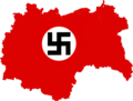 FLAG MAP OF 3RD REICH.png 506 × 384; 32 KB
-
 Flag Map of Allied Occupied Germany.png 2,048 × 2,048; 1.96 MB
-
 Flag map of Allied-occupied Germany (1945-1949).png 2,124 × 2,876; 69 KB
-
 Flag map of Allied-Occupied Germany.png 800 × 947; 16 KB
-
 Flag Map of Allied-Occupied Germany.png 3,492 × 2,966; 899 KB
-
 Flag map of East Berlin (1949-1990).svg 1,393 × 1,906; 46 KB
-
 Flag map of East Germany (1949–1959).svg 687 × 900; 150 KB
-
 Flag map of East Germany (Socialist Unity Party of Germany).png 2,000 × 2,621; 376 KB
-
 Flag Map of Germany (1935).png 2,000 × 1,615; 70 KB
-
 Flag Map of Germany (1940).png 2,478 × 3,564; 131 KB
-
 Flag Map Of Germany After Versailles.png 593 × 389; 10 KB
-
 Flag Map Of Germany Empire.png 282 × 222; 4 KB
-
 Flag Map Of Germany Nazi (Version1).svg 512 × 518; 107 KB
-
 Flag Map Of Germany Nazi (Version2).svg 512 × 511; 76 KB
-
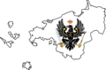
 Flag Map of Kingdom of Italy.png 1,010 × 930; 217 KB
-
 Flag Map of Nazi Germany (1943).png 4,096 × 3,120; 622 KB
-
 Flag Map of Nazi Occupied Europe.png 1,915 × 1,944; 502 KB
-
 Flag map of New Guinea Island (1884-1919).png 655 × 334; 39 KB
-
 Flag map of North German Confederation (1867–1871).png 2,000 × 1,697; 35 KB
-
 Flag map of reichskommissariat moskowen.png 647 × 978; 57 KB
-
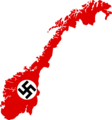 Flag map of Reichskommissariat Norwegen.png 1,905 × 2,048; 59 KB
-
 Flag Map of Teutonic Order (1402).png 1,114 × 948; 25 KB
-
 Flag map of the Austrian Empire (With puppets).png 517 × 588; 36 KB
-
 Flag map of the Duchy of Burgundy (918–1482).png 330 × 275; 56 KB
-
 Flag map of the German Colonial Empire.png 1,079 × 656; 5 KB
-
 Flag map of the Holy Roman Empire in 1792 (with states).png 1,378 × 1,378; 727 KB
-
 Flag map of the Kingdom of Prussia (1701).png 793 × 395; 21 KB
-
 Flag map of the Kingdom of Prussia (1750).png 939 × 805; 40 KB
-
 Flag map of the Kingdom of Prussia (1793).png 798 × 552; 63 KB
-
 Flag map of the Kingdom of Prussia (1795).png 1,426 × 942; 139 KB
-
 Flag Map of the Weimar Republic.jpg 1,000 × 1,080; 89 KB
-
 Flag Map Of Third Reich Occupied Europe.png 1,930 × 2,002; 431 KB
-
 Flag map of USSR-East Germany.svg 554 × 726; 202 KB
-
 Flag Map of Weimar Republic (Germany) 1919 - 1933.png 2,000 × 1,615; 52 KB
-
 Flag map of West & East Germany (1949-1959).png 2,738 × 2,924; 181 KB
-
 Flag map of West & Soviet-Occupied Germany (1949).png 2,298 × 2,924; 214 KB
-
 Flag map of West Berlin (1949-1990).svg 1,539 × 1,658; 39 KB
-
 Flag map of West Germany (proposed Resistance flag).png 2,000 × 2,924; 97 KB
-
 Flag-map of East & West Germany.svg 986 × 1,255; 319 KB
-
 Flag-map of Holy Roman Empire (1154).png 1,270 × 1,710; 330 KB
-
 Flag-map of Holy Roman Empire (1600).svg 163 × 188; 148 KB
-
 Flag-map of Holy Roman Empire (1648).svg 1,930 × 1,720; 1.01 MB
-
 Flag-map of Holy Roman Empire (1779).svg 549 × 485; 168 KB
-
 Flag-map of Saar (1920-1935).svg 602 × 508; 6 KB
-
 Flag-map of Saar (1947-1956).svg 603 × 510; 23 KB
-
 Flag-map of the allied-occupied Germany.svg 591 × 800; 176 KB
-
 Flag-map of the Confederation of the Rhine (1812).svg 698 × 999; 395 KB
-
 Flag-map of the German Empire (1914).svg 887 × 787; 45 KB
-
 Flag-Map of Third Reich (Nazi Germany)-(1942).svg 512 × 519; 124 KB
-
 Flag-map of West Germany (1949–1990).svg 857 × 1,253; 87 KB
-
 Map flag of Nazi Germany in 1942.png 1,133 × 1,162; 302 KB
-
 Flag map of German South-West Africa (1884 - 1915).png 2,100 × 1,900; 26 KB
-
 German South-West Africa Flag Map (1884 - 1915).png 1,000 × 1,000; 92 KB
-
 Flag map of Nauru (German Empire) (1888 - 1919).png 2,100 × 2,100; 27 KB
-
 Flag map of Nauru (German New Guinea) (1888 - 1919).png 2,016 × 1,918; 47 KB
-
 Nazi Germany 1942 Flag Map.png 3,581 × 3,196; 446 KB
-
 Nazi Germany Flag Map in 1942.png 1,088 × 998; 107 KB
-
 Flag Map of German New Guinea (1884 - 1914).png 1,578 × 641; 12 KB
-
 Flag map of German New Guinea (Colonial Flag).png 1,553 × 692; 15 KB
-
 Flag map of German New Guinea (Imperial Flag).png 1,585 × 700; 12 KB
-
 Réunification.png 200 × 422; 42 KB
-
 Silhouette of East Germany.svg 900 × 1,293; 95 KB
-
 Silhouette of German Empire.svg 900 × 747; 87 KB
-
 Silhouette of Holy Roman Empire.svg 900 × 1,224; 179 KB
-
 Silhouette of Third Reich.svg 900 × 683; 43 KB
-
 The Weimar Republic with the War Ensign (1921-33).png 2,021 × 2,048; 465 KB
-
 Flag map of German Togoland (1884 - 1914).png 692 × 1,352; 11 KB
-
 Trans pride East Germany.jpg 643 × 924; 118 KB
-
 Trizone.jpg 411 × 498; 82 KB
-
 Weimar Republic Flag Map.jpg 1,000 × 1,080; 97 KB
-
 Weimar Republic with the de facto War Ensign (1919-21).png 2,021 × 2,048; 626 KB
-
 West Germany & East Germany Flag Map (1948 - 1990).png 2,294 × 2,897; 393 KB
-
 WestGermany.png 180 × 250; 19 KB
-
 Wiedervereinigung.PNG 189 × 389; 18 KB
.jpg)

.svg)
.svg)
.svg)
.svg)
.svg)
.svg)
.svg)
.svg)


_(1884-_1919).png)


.png)


.svg)
.svg)
.png)
.png)
.png)


.svg)
.svg)

.png)

.png)
.png)


.png)
.png)
.png)

.png)
.png)
.png)
.png)
.png)


_1919_-_1933.png)
.png)
.png)
.svg)
.png)

.png)
.svg)
.svg)
.svg)
.svg)
.svg)

.svg)
.svg)
-(1942).svg)
.svg)

.png)
.png)
_(1888_-_1919).png)
_(1888_-_1919).png)


.png)
.png)


.png)
.png)


.png)
.png)


.svg)
.png)