Category:Historical markers in Suffolk County, New York
English: Media relating to Historical markers by other municipalities in Suffolk County, New York, United States
Subcategories
This category has the following 2 subcategories, out of 2 total.
Media in category "Historical markers in Suffolk County, New York"
The following 75 files are in this category, out of 75 total.
-
 Amistad Marker Mtk.jpg 4,032 × 3,024; 4.19 MB
-
 Arthur Dove-Helen Torr HM.jpg 3,648 × 2,736; 2.04 MB
-
 At Long Island 2024 024.jpg 4,640 × 6,960; 21.74 MB
-
 Bay Shore 1st Congregational Church; Historical Marker.JPG 4,000 × 3,000; 2.37 MB
-
 Bayport Aerodrome; Historic Marker.JPG 4,000 × 3,000; 2.45 MB
-
 Bethel AME Church and Manse; Saint John's Episcopal HM.jpg 828 × 733; 296 KB
-
 Blydenberg House Memorial Site.JPG 4,000 × 3,000; 2.3 MB
-
 Brookwood Hall; East Islip, New York-04.jpg 3,648 × 2,736; 2.06 MB
-
 Camp Alvernia Marker.jpg 800 × 600; 340 KB
-
 Carll Burr House; Historical Marker.jpg 3,648 × 2,736; 2.03 MB
-
 Centerport Mill Dam Bridge-2.jpg 3,648 × 2,736; 2.06 MB
-

-
 Constitution Oak Plaque; Old Huntington Town Green HD.JPG 4,000 × 3,000; 2.65 MB
-
 Cross Island Trolley HM; Halesite (NY) FD-1.jpg 3,648 × 2,736; 2.09 MB
-
 Cross Island Trolley HM; Halesite (NY) FD-2.jpg 3,648 × 2,736; 2.13 MB
-
 East Northport Trolley Stop @ Northport LIRR station.jpg 3,648 × 2,736; 2.07 MB
-
 Eastport Heritage Area; ToS Marker.JPG 5,152 × 3,864; 7.62 MB
-
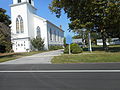
 First Congregational Church historical marker 20180916 080017.jpg 4,048 × 3,036; 3.7 MB
-
 Fort Golgotha and Old Burial Hill; HM and Memorial Rock.jpg 3,648 × 2,736; 2.05 MB
-
 Gibb Patent Plaque; Eastbound.JPG 4,000 × 3,000; 2.34 MB
-
 Gibb Patent Plaque; Westbound.JPG 4,000 × 3,000; 2.32 MB
-
 Great River Depot Plaque; Close-Up.jpg 4,000 × 3,000; 2.64 MB
-
 Great River Depot Plaque; Hawthorne & Connetquot Avenues.jpg 4,000 × 3,000; 2.56 MB
-
 Green House Historical Marker; West Sayville.JPG 4,000 × 3,000; 2.68 MB
-
 Hashamomack Old Families' Burying Ground sign.jpg 1,440 × 2,560; 1.52 MB
-
 Historical Marker of the Treaty of Hartford Boundary (1650).jpg 3,264 × 2,448; 3.08 MB
-
 Huntington Sewing & Trade School(Historic Plaque).jpg 4,000 × 3,000; 2.15 MB
-
 Islip Station Historic Plaque.jpg 1,800 × 1,215; 1.02 MB
-
 J Gardiner Farm Historical Marker.jpg 3,648 × 2,736; 2.09 MB
-
 James Havens Historical Marker 20220820 175013094.jpg 4,080 × 3,072; 3.21 MB
-
 Josiah Woodhull House; November 2017-2.jpg 3,648 × 2,736; 2.02 MB
-
 LaGrange Inn; Before the Move-3.JPG 5,152 × 3,864; 4.07 MB
-
 LaGrange Inn; Before the Move-4.JPG 5,152 × 3,864; 4.15 MB
-
 Landmark badge 20180913 143916.jpg 4,048 × 3,036; 2.76 MB
-
 Long Beach Bar Bug Light NY 25 Marker.JPG 5,152 × 3,864; 7.44 MB
-
 Marker for David Frothingham residence.jpg 4,032 × 3,024; 8.84 MB
-
 May Groot Manson Historical marker 02.jpg 4,895 × 3,268; 3.61 MB
-
 Modern Times HM at Checkers in Brentwood, New York.jpg 3,648 × 2,736; 2.05 MB
-
 Modern Times School; Historic Plaque.JPG 4,000 × 3,000; 2.63 MB
-
 New Suffolk Sub Memorial.JPG 291 × 312; 21 KB
-
 New Suffolk(NY) Sub Base Memorial.jpg 900 × 608; 125 KB
-
 Nissequogue, New York - 4287773436.jpg 1,024 × 768; 204 KB
-
 Nissequogue, New York - 6964015709.jpg 2,816 × 2,112; 994 KB
-
 Northport Historic Library-Plaques.jpg 4,000 × 3,000; 2.18 MB
-
 Northport LIRR Station Memorial-2.jpg 1,168 × 782; 184 KB
-
 NRHP Contributing property - John Jermain mill 10.jpg 3,639 × 2,531; 3.03 MB
-
 NRHP Contributing property 09.jpg 4,032 × 3,024; 3.54 MB
-
 NY Folklore Marker; Mile Marker 30-1.jpg 3,648 × 2,736; 2.06 MB
-
 NY Folklore Marker; Mile Marker 30-2.jpg 3,648 × 2,736; 2.05 MB
-
 NYS Plaque - Pyrrhus Concer Homestead 6576 01.jpg 5,616 × 3,744; 3.93 MB
-
 NYS Plaque - Pyrrhus Concer Homestead 6576 04.jpg 5,616 × 3,744; 4.07 MB
-
 Old '88 Historical Marker; Sayville, New York.JPG 4,000 × 3,000; 2.2 MB
-
 Old Fort Historic marker.jpg 4,032 × 3,024; 9.32 MB
-
 Old Huntington Green Historic Plaque.jpg 4,000 × 3,000; 3.28 MB
-
 Orient NY Congregational Church.JPG 5,152 × 3,864; 7.81 MB
-
 Orient NY Methodist Church.JPG 5,152 × 3,864; 7.8 MB
-
 Orient Point School; Historical Marker.JPG 5,152 × 3,864; 7.97 MB
-
 Peaken's Tavern Historic Plaque.JPG 5,152 × 3,864; 8.16 MB
-
 Poospatuck Historical Marker on Montauk Highway.jpg 3,648 × 2,736; 2.08 MB
-
 Poquatuck Park, Orient, NY.JPG 5,152 × 3,864; 8.15 MB
-
 Quogue Historical District NRHP 04.jpg 5,616 × 3,744; 4.62 MB
-
 Quogue Historical District NRHP 23.jpg 5,616 × 3,744; 3.13 MB
-
 Samuel Greene Home 20211020.jpg 4,032 × 3,024; 2.02 MB
-
 Springs, NY NRHP collection 26.jpg 4,032 × 3,024; 2.33 MB
-
 Springs, NY NRHP collection 27.jpg 4,032 × 3,024; 2.49 MB
-
 St Johns Thrift Store 20211020 180917109.jpg 4,032 × 3,024; 7.15 MB
-
 St. John's Episcopal Church 20211020 180937638.jpg 4,032 × 3,024; 2.27 MB
-
 St. John's Episcopal Church, Oakdale.jpg 4,032 × 3,024; 2.09 MB
-
 St. Johns Historical Marker 20211020 180923005.jpg 4,032 × 3,024; 2.39 MB
-
 St. Johns Historical Marker 20211020 180941310 (1).jpg 4,032 × 3,024; 1.72 MB
-
 St. Johns Thrift Store and hist marker Estb.1765 20211020.jpg 2,959 × 2,148; 2.42 MB
-
 St. John’s Episcopal Church and Cemetery 20211020 180956792.jpg 4,032 × 3,024; 3.31 MB
-
 St. Mary's Church Historic Marker 20211008 150044744.jpg 4,032 × 3,024; 2.44 MB
-
 Thomas James Historical Marker 20180916 075600.jpg 4,048 × 3,036; 4.57 MB
-
 Truman's Beach; Historical Marker.jpg 3,648 × 2,736; 2.05 MB


_FD-1.jpg)
_FD-2.jpg)


.jpg)
.jpg)


_Sub_Base_Memorial.jpg)


.jpg)


