Category:History of Pietermaritzburg
Subcategories
This category has the following 5 subcategories, out of 5 total.
Media in category "History of Pietermaritzburg"
The following 21 files are in this category, out of 21 total.
-
 (1850) Scetch Map of the Natal Colony (compiled from scetches by Dr. Stranger).jpg 2,386 × 1,743; 2.78 MB
-
 Map of the Colony of Natal, South Africa.jpg 2,324 × 3,023; 3.27 MB
-
 1861ca 3d Natal oval 2 Yv9 Mi9C SG11.jpg 500 × 580; 321 KB
-
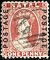 1870ca 1d ovpt oval 2 Yv23 Mi24 SG60 bright red.jpg 493 × 591; 448 KB
-
 1897 Natal Witness newspaper advert Pietermaritzburg.png 487 × 769; 291 KB
-
 Alexandra Park Street Circuit.svg 512 × 731; 6 KB
-
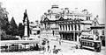
 Elevated view, government or municipal buildings and town square.jpg 1,000 × 757; 145 KB
-

-
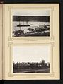
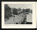
 Natal province - descriptive guide and official hand-book (1911) (14756873681).jpg 3,584 × 2,604; 857 KB
-
 Pietermaritzburg - Church Street.png 1,250 × 923; 1.61 MB
-
 PMB city centre - ca. 1906.jpg 481 × 251; 28 KB
-

-
 The National Archives UK - CO 1069-213-101.jpg 721 × 954; 152 KB
-
 The National Archives UK - CO 1069-213-109.jpg 707 × 949; 127 KB
-
 The National Archives UK - CO 1069-213-110.jpg 712 × 940; 156 KB
-
 The National Archives UK - CO 1069-213-93.jpg 721 × 958; 149 KB
-
 The National Archives UK - CO 1069-214-201.jpg 1,088 × 900; 192 KB
-
 The National Archives UK - CO 1069-223-10.jpg 811 × 1,017; 131 KB
-
 The National Archives UK - CO 1069-224-10.jpg 1,602 × 1,222; 260 KB
-
 The National Archives UK - CO 1069-224-12.jpg 1,616 × 1,229; 227 KB
-

_Scetch_Map_of_the_Natal_Colony_(compiled_from_scetches_by_Dr._Stranger).jpg)


,_RP-F-F01147-47-2.jpg)
_(14756873681).jpg)


_(14761783634).jpg)