Category:Hockliffe
village and civil parish in Bedfordshire, UK  | |||||
| Upload media | |||||
| Instance of | |||||
|---|---|---|---|---|---|
| Location | Central Bedfordshire, Bedfordshire, East of England, England | ||||
 | |||||
English: Hockliffe is a village in Bedfordshire on the crossroads of the A5 road which lies upon the course of the roman road known as Watling Street and the A4012 road.
Nederlands: Hockliffe is een dorp in het Engelse graafschap Bedfordshire. Het dorp ligt in het district South Bedfordshire en telt ca. 730 inwoners.
Subcategories
This category has only the following subcategory.
H
Media in category "Hockliffe"
The following 80 files are in this category, out of 80 total.
-
 A5 heading towards Milton Keynes - geograph.org.uk - 5646755.jpg 640 × 428; 128 KB
-
 A5 Hockliffe - geograph.org.uk - 2304120.jpg 2,272 × 1,704; 696 KB
-
 A5 road at Hockliffe - geograph.org.uk - 1989770.jpg 640 × 480; 136 KB
-
 A5 road, Hockliffe - geograph.org.uk - 1989788.jpg 640 × 480; 143 KB
-
 A5 through Hockliffe - geograph.org.uk - 5646741.jpg 640 × 428; 88 KB
-

-
 Arable land behind McDonald's - geograph.org.uk - 5818073.jpg 1,280 × 960; 315 KB
-
 Bridleway to Tilsworth - geograph.org.uk - 3411404.jpg 1,600 × 1,068; 794 KB
-
 Bridleway to Tilsworth - geograph.org.uk - 3411422.jpg 1,600 × 1,068; 758 KB
-
 Bull farm on the A5, Hockliffe - geograph.org.uk - 2882732.jpg 1,600 × 1,200; 573 KB
-
 Central Bedfordshire , Layby - geograph.org.uk - 5733066.jpg 6,000 × 4,000; 7.72 MB
-
 Central Bedfordshire , Redwings Lodge - geograph.org.uk - 5733071.jpg 6,000 × 4,000; 5.55 MB
-
 Central Bedfordshire , The A5 - geograph.org.uk - 5733056.jpg 6,000 × 4,000; 7.16 MB
-
 Central Bedfordshire , The A5 - geograph.org.uk - 5733057.jpg 6,000 × 4,000; 6.82 MB
-
 Central Bedfordshire - The Hall (geograph 5733068).jpg 5,175 × 3,450; 6 MB
-
 Clifford Close at the junction of Watling Street - geograph.org.uk - 6196605.jpg 1,906 × 1,260; 1.53 MB
-
 Drainage ditch - geograph.org.uk - 5818081.jpg 1,280 × 960; 450 KB
-
 Entrance to Hockliffe Grange - geograph.org.uk - 3182393.jpg 1,600 × 1,067; 732 KB
-
 Farm Entrance - Grange Farm - geograph.org.uk - 2623101.jpg 4,000 × 3,000; 5.13 MB
-
 Former Telephone Repeater Station, Hockliffe (1) - geograph.org.uk - 2856399.jpg 3,072 × 2,304; 1.8 MB
-
 Former Telephone Repeater Station, Hockliffe (2) - geograph.org.uk - 2856410.jpg 3,072 × 2,304; 1.78 MB
-

-

-
 Hedgerow by Little Lane - geograph.org.uk - 3182381.jpg 1,600 × 1,069; 573 KB
-
 Hill Farm, Hockliffe - geograph.org.uk - 2623117.jpg 4,000 × 3,000; 4.73 MB
-
 Hockliffe , Birch's Close - geograph.org.uk - 5733064.jpg 5,793 × 3,861; 7.37 MB
-
 Hockliffe , Harvester - geograph.org.uk - 5733063.jpg 6,000 × 4,000; 7.89 MB
-
 Hockliffe , Houses - geograph.org.uk - 5733061.jpg 6,000 × 4,000; 6.83 MB
-
 Hockliffe , McDonald's - geograph.org.uk - 5733065.jpg 5,647 × 3,764; 6.18 MB
-
 Hockliffe , The A5 - geograph.org.uk - 5733058.jpg 6,000 × 4,000; 6.39 MB
-
 Hockliffe , The A5 - geograph.org.uk - 5733059.jpg 6,000 × 4,000; 6.62 MB
-
 Hockliffe , Woburn Road B5704 - geograph.org.uk - 5733062.jpg 6,000 × 4,000; 5.8 MB
-
 Hockliffe Grounds Lane - geograph.org.uk - 2623095.jpg 4,000 × 3,000; 4.62 MB
-
 Hockliffe Grounds Lane - geograph.org.uk - 3182392.jpg 1,600 × 1,067; 574 KB
-
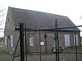
 Hockliffe Telephone Exchange, Beds - geograph.org.uk - 2856386.jpg 3,072 × 2,304; 1.78 MB
-
 Hockliffe, St Nicholas - geograph.org.uk - 5439440.jpg 4,608 × 3,456; 5.44 MB
-
 Hockliffe, Watling Street - geograph.org.uk - 5615320.jpg 1,024 × 768; 170 KB
-
 Houses on Hockliffe Road - geograph.org.uk - 5570249.jpg 2,048 × 1,536; 1.43 MB
-
 Junction of A5 and A4012 at Hockliffe - geograph.org.uk - 1989797.jpg 640 × 480; 133 KB
-
 Layby on the A5 approaching Hockliffe - geograph.org.uk - 2882602.jpg 1,600 × 1,200; 598 KB
-
 Leighton Road, Hockliffe - geograph.org.uk - 5279822.jpg 2,304 × 1,728; 1.23 MB
-
 Little Chef ^ Travelodge - geograph.org.uk - 2633304.jpg 4,000 × 3,000; 4.9 MB
-

-
 McDonald's on Watling Street, Hockliffe - geograph.org.uk - 6196609.jpg 1,886 × 1,228; 1.38 MB
-
 New houses on Watling Street, Hockliffe - geograph.org.uk - 6146717.jpg 1,920 × 1,280; 1.55 MB
-
 Path down to the A5 - geograph.org.uk - 3182369.jpg 1,600 × 1,069; 744 KB
-
 Path to Church End from the A5 - geograph.org.uk - 3182366.jpg 1,600 × 1,068; 819 KB
-
 Path to Hill Farm - geograph.org.uk - 3411425.jpg 1,600 × 1,068; 523 KB
-
 Path to Old Stock Farm - geograph.org.uk - 3182397.jpg 1,200 × 1,600; 841 KB
-
 Ploughed field near Hockliffe - geograph.org.uk - 3182385.jpg 1,200 × 1,600; 582 KB
-
 Public Footpath - geograph.org.uk - 2631440.jpg 4,000 × 3,000; 4.71 MB
-

-
 Roman ring inscribed DEO TOTA.jpg 1,398 × 1,662; 293 KB
-
-
 St. Nicholas Church, Hockliffe Church End - geograph.org.uk - 2623076.jpg 4,000 × 3,000; 5.17 MB
-

-
-

-
 Stanbridgeford and Stanbridge - geograph.org.uk - 5463169.jpg 3,264 × 2,448; 3.42 MB
-
 Stream and Travelodge - geograph.org.uk - 3411408.jpg 1,600 × 1,068; 565 KB
-
 The A5 approaching Hockliffe - geograph.org.uk - 2882600.jpg 1,600 × 1,200; 600 KB
-
 The A5 north of Hockliffe - geograph.org.uk - 2882604.jpg 1,600 × 1,200; 548 KB
-
 The Harvester on Watling Street, Hockliffe - geograph.org.uk - 2882734.jpg 1,600 × 1,200; 595 KB
-
 The Harvester on Watling Street, Hockliffe - geograph.org.uk - 5279821.jpg 2,304 × 1,728; 866 KB
-
 The view eastwards along Church Lane - geograph.org.uk - 2594080.jpg 640 × 480; 80 KB
-
 The view westwards along Church Lane - geograph.org.uk - 2594082.jpg 640 × 480; 83 KB
-
 Tree on Watling Street, Hockliffe - geograph.org.uk - 6146718.jpg 1,872 × 1,204; 2.08 MB
-
 Trees hiding the A5 - geograph.org.uk - 3182373.jpg 1,600 × 1,065; 567 KB
-
 View NNW up the A4012 - geograph.org.uk - 1989806.jpg 640 × 480; 155 KB
-
 Watling Street, Hockliffe - geograph.org.uk - 2882733.jpg 1,600 × 1,200; 579 KB
-
 Animal Farm - geograph.org.uk - 182728.jpg 480 × 640; 93 KB
-
 Chalgrave Parish Sign - geograph.org.uk - 326088.jpg 640 × 480; 144 KB
-
 Footpath through fields near the A5 - geograph.org.uk - 325780.jpg 640 × 480; 107 KB
-
 Hedgerow beside footpath - geograph.org.uk - 326842.jpg 640 × 480; 99 KB
-
 Hill Farm, Hockliffe - geograph.org.uk - 183141.jpg 640 × 267; 51 KB
-
 Manor Avenue, Hockliffe - geograph.org.uk - 171949.jpg 640 × 480; 118 KB
-
 Tilsworth Golf Centre , The Clubhouse - geograph.org.uk - 193765.jpg 640 × 374; 65 KB
-
 Tilsworth Golf Course - geograph.org.uk - 193411.jpg 640 × 480; 60 KB
-
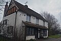
 Trinity Hall Farmhouse - geograph.org.uk - 204364.jpg 640 × 473; 121 KB
-
 Woodcock Lane, Hockliffe - geograph.org.uk - 183438.jpg 640 × 480; 81 KB


.jpg)


_-_geograph.org.uk_-_2856399.jpg)
_-_geograph.org.uk_-_2856410.jpg)


_-_geograph.org.uk_-_2600679.jpg)
_-_geograph.org.uk_-_2600685.jpg)
_-_geograph.org.uk_-_2600691.jpg)


