Category:Hoeksche Waard in the 19th century
Media in category "Hoeksche Waard in the 19th century"
The following 18 files are in this category, out of 18 total.
-
 's-Gravendeel, Gemeenteatlas van Nederland.jpg 2,111 × 2,664; 1.24 MB
-
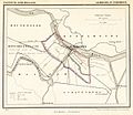 Gemeente Puttershoek 1867.jpg 1,200 × 1,038; 272 KB
-
 Goudswaard 1865.png 1,300 × 1,646; 285 KB
-
 Heinenoord, Gemeenteatlas van Nederland.jpg 2,636 × 2,143; 1.16 MB
-
 Klaaswaal, Gemeenteatlas van Nederland.jpg 2,545 × 2,123; 1.06 MB
-
 Maasdam.gif 1,600 × 1,371; 164 KB
-
 Mijnsheerenland, Gemeenteatlas van Nederland.jpg 2,638 × 2,104; 1.16 MB
-
 Mondingmaas1825.gif 800 × 512; 28 KB
-
 Nieuw-Beijerland, Gemeenteatlas van Nederland.jpg 2,612 × 2,119; 1.11 MB
-
 Numansdorp, Gemeenteatlas van Nederland.jpg 2,584 × 2,095; 1.37 MB
-
 Oud-Beijerland 1866.png 1,300 × 1,649; 205 KB
-
 Piershil 1865.png 1,600 × 1,403; 141 KB
-
 Puttershoek, Gemeenteatlas van Nederland.jpg 2,657 × 2,082; 1.04 MB
-
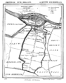
 Strijen 1867.png 1,599 × 1,363; 289 KB
-
 TA ALG 123 Topografische kaart van De Tol bij Hekelingen e.o. 1889-1903 (cropped).jpg 1,480 × 1,398; 722 KB
-
 TA ALG 123 Topografische kaart van Hekelingen e.o. 1889-1903.jpg 4,792 × 2,998; 5.39 MB
-
 Westmaas.gif 1,599 × 1,359; 151 KB
-
 Zuidbeijerland 1865.png 1,627 × 1,428; 265 KB


.jpg)


