Category:Hoge Nieuwstraat 55, Dordrecht
| Object location | | View all coordinates using: OpenStreetMap |
|---|
building in Dordrecht, Netherlands  | |||||
| Upload media | |||||
| Instance of | |||||
|---|---|---|---|---|---|
| Location | Dordrecht, South Holland, Netherlands | ||||
| Street address |
| ||||
| Heritage designation |
| ||||
 | |||||
|
This is a category about rijksmonument number 13464
|
| Address |
|
Media in category "Hoge Nieuwstraat 55, Dordrecht"
The following 6 files are in this category, out of 6 total.
-
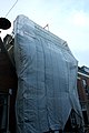 Dordrecht - Hoge Nieuwstraat 55.JPG 3,056 × 4,592; 3.72 MB
-
 Interieur van de gang - Dordrecht - 20062426 - RCE.jpg 958 × 1,200; 155 KB
-
 Interieur van voorkamer - Dordrecht - 20062424 - RCE.jpg 961 × 1,200; 174 KB
-
 Trappenhuis 1e ‚tage - Dordrecht - 20062425 - RCE.jpg 967 × 1,200; 114 KB
-
 Voorgevel - Dordrecht - 20062423 - RCE.jpg 958 × 1,200; 255 KB
-
 Voorgevels - Dordrecht - 20062421 - RCE.jpg 804 × 1,200; 217 KB


