Category:Hoge der A 18 (Groningen)
| Object location | | View all coordinates using: OpenStreetMap |
|---|
building in Groningen, Netherlands  | |||||
| Upload media | |||||
| Instance of | |||||
|---|---|---|---|---|---|
| Location | Groningen, Netherlands | ||||
| Street address |
| ||||
| Heritage designation |
| ||||
 | |||||
|
This is a category about rijksmonument number 18523
|
| Address |
|
Media in category "Hoge der A 18 (Groningen)"
The following 19 files are in this category, out of 19 total.
-
 20100806 Hoge der A 18 Groningen NL.jpg 1,950 × 3,000; 4.29 MB
-
 20100906 Hoge der A 18 Groningen NL.jpg 1,900 × 3,800; 1.76 MB
-
 Exterieur OVERZICHT VOORGEVEL - Groningen - 20275299 - RCE.jpg 960 × 1,200; 318 KB
-
 Exterieur OVERZICHT VOORGEVEL - Groningen - 20275300 - RCE.jpg 960 × 1,200; 285 KB
-
 Exterieur VOORGEVEL, METSELWERK BOVEN RAMEN - Groningen - 20275301 - RCE.jpg 1,191 × 1,200; 302 KB
-
 Gang tussen twee huizen - Groningen - 20093962 - RCE.jpg 798 × 1,200; 166 KB
-
 Groningen Hooge der A 18.jpg 2,176 × 3,566; 2.74 MB
-
 INTERIEUR, GANG, DEURPOST, DETAIL - Groningen - 20275305 - RCE.jpg 1,193 × 1,200; 176 KB
-
 INTERIEUR, GANG, GEHOUTE DEUR, DETAIL - Groningen - 20275303 - RCE.jpg 1,191 × 1,200; 280 KB
-
 INTERIEUR, GANG, GEHOUTE DEUREN - Groningen - 20275302 - RCE.jpg 1,124 × 1,200; 188 KB
-
 INTERIEUR, TRAPOPGANG, GEHOUTE lambrisering - Groningen - 20275304 - RCE.jpg 1,192 × 1,200; 251 KB
-
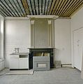 INTERIEUR, VERDIEPING, KAMER ACHTERZIJDE, SCHOUW - Groningen - 20275306 - RCE.jpg 1,192 × 1,200; 219 KB
-
 Kap. voorhuis - Groningen - 20093965 - RCE.jpg 804 × 1,200; 204 KB
-
 Overzicht situering - Groningen - 20355992 - RCE.jpg 1,200 × 1,200; 340 KB
-
 Overzicht voorgevels - Groningen - 20355994 - RCE.jpg 1,200 × 1,200; 310 KB
-
 Overzicht voorgevels - Groningen - 20355996 - RCE.jpg 1,200 × 1,200; 296 KB
-
 Voorgevels - Groningen - 20093963 - RCE.jpg 1,200 × 801; 217 KB
-
 Voorgevels - Groningen - 20093964 - RCE.jpg 813 × 1,200; 217 KB
-
 Voorgevels - Groningen - 20093970 - RCE.jpg 1,200 × 804; 219 KB


