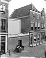
Category:Hogewoerd 160, Leiden
| Object location | | View all coordinates using: OpenStreetMap |
|---|
 | |||||
| Upload media | |||||
| Instance of |
| ||||
|---|---|---|---|---|---|
| Location | Leiden, South Holland, Netherlands | ||||
| Heritage designation |
| ||||
 | |||||
|
This is a category about rijksmonument number 24886
|
| Address |
|
Media in category "Hogewoerd 160, Leiden"
The following 4 files are in this category, out of 4 total.
-
 ErfgoedLeiden LEI001015957 Fotoatelier van J.Goedeljee aan de Hogewoerd nrs 160-162a.jpg 3,896 × 4,947; 3.62 MB
-
 ErfgoedLeiden LEI001015958 Fotoatelier van J.Goedeljee aan de Hogewoerd nrs 160-162a.jpg 3,896 × 4,947; 4.22 MB
-
 Gevels - Leiden - 20136143 - RCE.jpg 808 × 1,200; 183 KB
-
 Leiden - Hogewoerd 160.JPG 2,270 × 3,415; 3.6 MB


