Category:Holme Lacy
village in United Kingdom  | |||||
| Upload media | |||||
| Instance of | |||||
|---|---|---|---|---|---|
| Location | Herefordshire, West Midlands, England | ||||
 | |||||
Cymraeg: Pentref yn Swydd Henffordd, Gorllewin Canolbarth Lloegr, Lloegr ydy Holme Lacy. (→Holme Lacy)
English: Holme Lacy is a village in the English county of Herefordshire. The population of the civil parish was 466 at the 2011 Census. (→Holme Lacy)
Polski: Holme Lacy – wieś w Anglii, w hrabstwie Herefordshire. Leży 7 km na południowy wschód od miasta Hereford i 183 km na zachód od Londynu. (→Holme Lacy)

Subcategories
This category has the following 3 subcategories, out of 3 total.
H
- Holme Lacy House (11 F)
R
- Holme Lacy railway station (11 F)
Media in category "Holme Lacy"
The following 200 files are in this category, out of 331 total.
(previous page) (next page)-
 ... But Seriously - geograph.org.uk - 212230.jpg 640 × 480; 48 KB
-

-
 A font at Holme Lacy Church - geograph.org.uk - 5737857.jpg 960 × 720; 166 KB
-
 A kaleidoscope of ancient glass, Holme Lacy - geograph.org.uk - 4368396.jpg 3,900 × 5,026; 3 MB
-

-
 An organ at Holme Lacy Church - geograph.org.uk - 5737859.jpg 960 × 720; 171 KB
-

-
 Australian Red Indian encampment^ - geograph.org.uk - 1456056.jpg 640 × 426; 55 KB
-
 B4399 at Dinedor Mill - geograph.org.uk - 1458901.jpg 640 × 480; 233 KB
-
-
 Bogmarsh Lane - geograph.org.uk - 1916542.jpg 640 × 480; 211 KB
-
 Bower Farm equine centre, Holme Lacy - geograph.org.uk - 3412728.jpg 640 × 480; 146 KB
-
 Brick Kiln Wood - geograph.org.uk - 1132675.jpg 640 × 426; 82 KB
-
 Bridge Road, Holme Lacy - geograph.org.uk - 4676270.jpg 4,743 × 2,849; 4.43 MB
-
 Call duck, Holme Lacy hotel lake - geograph.org.uk - 6167909.jpg 1,024 × 768; 474 KB
-
 Canondale Farm - geograph.org.uk - 2586247.jpg 1,024 × 768; 320 KB
-
 Caravan Club site, The Paddocks, Bogmarsh - geograph.org.uk - 2585370.jpg 1,024 × 768; 258 KB
-
 Cedars, Holme Lacy - geograph.org.uk - 5464151.jpg 563 × 640; 238 KB
-
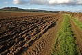
 Cereal land near Dinedor Hill 1 - geograph.org.uk - 1916471.jpg 640 × 480; 211 KB
-
 Cereal land near Dinedor Hill 2 - geograph.org.uk - 1916480.jpg 640 × 480; 237 KB
-
 Cereal land near Dinedor Hill 3 - geograph.org.uk - 1916491.jpg 640 × 480; 212 KB
-

-

-

-

-

-
 Cottage at Bogmarsh - geograph.org.uk - 1916498.jpg 640 × 480; 243 KB
-
 Cotton thistle and ragwort - geograph.org.uk - 910183.jpg 480 × 640; 228 KB
-

-
 Crops under polythene, Holme Lacy - geograph.org.uk - 5217147.jpg 800 × 600; 192 KB
-
 Crops under polythene, Holme Lacy - geograph.org.uk - 5217149.jpg 800 × 600; 138 KB
-

-

-

-
 Detail, East Window,St Cuthbert's church, Holme Lacy - geograph.org.uk - 4112262.jpg 1,888 × 4,928; 4.51 MB
-

-
 Detritus trapped on the bridge parapet - geograph.org.uk - 3134767.jpg 1,200 × 1,037; 622 KB
-
 Dinedor Hill viewed from the south-east - geograph.org.uk - 1135494.jpg 426 × 640; 113 KB
-
 Dismantled railway, south of Holme Lacy - geograph.org.uk - 892170.jpg 640 × 480; 130 KB
-
 Disused Railway Bridge (Holme Lacy) - geograph.org.uk - 5751682.jpg 3,264 × 2,448; 1.76 MB
-
 Disused Railway Line (Holme Lacy) - geograph.org.uk - 5751672.jpg 3,264 × 2,448; 3.37 MB
-
 Dragonfly, Holme Lacy, Herefordshire - geograph.org.uk - 4187484.jpg 640 × 640; 209 KB
-
 Drive and footpath at Holme Lacy - geograph.org.uk - 3615777.jpg 1,024 × 680; 235 KB
-
 Drive to Ramsden Farm - geograph.org.uk - 1135311.jpg 640 × 426; 98 KB
-
 Drystone wall, St Cuthbert's - geograph.org.uk - 891307.jpg 640 × 480; 200 KB
-
 Dutch barn, Holme Lacy - geograph.org.uk - 891274.jpg 640 × 480; 137 KB
-
 Eagle lectern at Holme Lacy Church - geograph.org.uk - 5737984.jpg 960 × 720; 179 KB
-
 East window at Holme Lacy Church - geograph.org.uk - 5737874.jpg 960 × 720; 132 KB
-
 East Window, St Cuthbert's church, Holme Lacy - geograph.org.uk - 4112246.jpg 2,736 × 4,192; 4.75 MB
-
 East Window, St Cuthbert, Holme Lacy - geograph.org.uk - 4368417.jpg 3,824 × 5,496; 3.28 MB
-
 Edge of Ramsden Coppice - geograph.org.uk - 1916484.jpg 640 × 480; 213 KB
-
 Edge of Shepherd's Rough - geograph.org.uk - 6173995.jpg 1,600 × 900; 490 KB
-
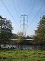
 Electricity pylon, Dinedor - geograph.org.uk - 1132512.jpg 640 × 426; 68 KB
-
 Electricity pylon, near Newtown - geograph.org.uk - 2586240.jpg 768 × 1,024; 142 KB
-
 Electricity pylons near Dinedor - geograph.org.uk - 1132543.jpg 426 × 640; 90 KB
-

-
 Facts poster at Holme Lacy Church - geograph.org.uk - 5737992.jpg 960 × 720; 215 KB
-
 Farm building near Dinedor Mill - geograph.org.uk - 1458905.jpg 640 × 480; 242 KB
-
 Farmland above Bogmarsh - geograph.org.uk - 1132735.jpg 640 × 426; 108 KB
-
 Farmland at Bogmarsh - geograph.org.uk - 1135309.jpg 640 × 426; 114 KB
-
 Farmland at Bolstone - geograph.org.uk - 3978531.jpg 800 × 531; 125 KB
-
 Farmland at Dinedor - geograph.org.uk - 1132493.jpg 640 × 426; 108 KB
-
 Farmland at Holme Lacy - geograph.org.uk - 3618040.jpg 1,024 × 680; 197 KB
-
 Farmland in springtime - geograph.org.uk - 1916528.jpg 640 × 480; 224 KB
-
 Farmland near Bogmarsh - geograph.org.uk - 1132713.jpg 640 × 426; 97 KB
-
 Farmland near Lower Bolstone Wood - geograph.org.uk - 3951440.jpg 800 × 531; 119 KB
-
 Farmland off the Bolstone Road - geograph.org.uk - 892179.jpg 640 × 480; 164 KB
-
 Fast flowing currents - geograph.org.uk - 1003584.jpg 480 × 640; 139 KB
-

-

-
 Field corner, Holme Lacy - geograph.org.uk - 5215989.jpg 1,024 × 768; 389 KB
-
 Flag irises, Holme Lacy hotel lake - geograph.org.uk - 6167919.jpg 1,024 × 768; 207 KB
-
-
 Font detail, St Cuthbert's church, Holme Lacy - geograph.org.uk - 3270515.jpg 2,256 × 1,496; 860 KB
-
 Font, Holme Lacy - geograph.org.uk - 4376521.jpg 3,983 × 5,620; 5.46 MB
-

-

-
 Footpath and field - geograph.org.uk - 3615763.jpg 1,024 × 680; 283 KB
-
 Footpath at Holme Lacy Bridge - geograph.org.uk - 116419.jpg 426 × 640; 127 KB
-
 Footpath on the edge of the field - geograph.org.uk - 4738776.jpg 480 × 640; 99 KB
-
 Footpath passing a couple of trees - geograph.org.uk - 3618081.jpg 1,024 × 680; 261 KB
-
 Footpath to Holme Lacy church - geograph.org.uk - 1916451.jpg 480 × 640; 267 KB
-
 Former railway bridge, Holme Lacy - geograph.org.uk - 2585206.jpg 1,024 × 768; 314 KB
-
 Gate at St. Cuthbert's Church (Holme Lacy) - geograph.org.uk - 5752752.jpg 3,264 × 2,448; 2.02 MB
-
 Gate near Holme Lacy - geograph.org.uk - 5462761.jpg 522 × 640; 294 KB
-
 Green Drive - geograph.org.uk - 1916534.jpg 640 × 480; 248 KB
-
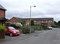 Hardinge Close, Holme Lacy - geograph.org.uk - 564686.jpg 640 × 472; 69 KB
-
 Haymaking near Holme Lacey - geograph.org.uk - 1456047.jpg 640 × 426; 74 KB
-
 Headland footpath to Dinedor - geograph.org.uk - 1132578.jpg 640 × 426; 114 KB
-
 Hedge Trimming - geograph.org.uk - 212128.jpg 640 × 427; 94 KB
-

-
 Herefordshire road sign - geograph.org.uk - 1916444.jpg 640 × 480; 272 KB
-
 High Trees (Holme Lacy) - geograph.org.uk - 5752787.jpg 3,264 × 2,448; 1.57 MB
-
 Hightrees, Holme Lacy - geograph.org.uk - 4368308.jpg 5,498 × 2,800; 1.52 MB
-
 Hillside, Folly Farm - geograph.org.uk - 5215991.jpg 1,024 × 768; 330 KB
-
 Holme Lacy - geograph.org.uk - 4714219.jpg 3,872 × 2,592; 3.96 MB
-
 Holme Lacy Bridge - geograph.org.uk - 5215985.jpg 1,024 × 768; 410 KB
-
 Holme Lacy Campus - geograph.org.uk - 5751563.jpg 3,264 × 2,448; 1.66 MB
-
 Holme Lacy Campus - geograph.org.uk - 5751572.jpg 3,264 × 2,448; 1.45 MB
-
 Holme Lacy Campus - geograph.org.uk - 5751671.jpg 3,264 × 2,448; 1.33 MB
-
 Holme Lacy Campus - geograph.org.uk - 5801137.jpg 4,096 × 2,304; 4.6 MB
-
 Holme Lacy Church (close-up view) - geograph.org.uk - 5737728.jpg 960 × 720; 197 KB
-
 Holme Lacy Church (entrance view) - geograph.org.uk - 5737743.jpg 960 × 720; 217 KB
-
 Holme Lacy church - geograph.org.uk - 3978544.jpg 1,024 × 680; 293 KB
-
 Holme Lacy Church - geograph.org.uk - 5737738.jpg 960 × 720; 144 KB
-
 Holme Lacy Church sign - geograph.org.uk - 5737750.jpg 960 × 720; 244 KB
-
 Holme Lacy Church sign - geograph.org.uk - 5737850.jpg 960 × 720; 179 KB
-
 Holme Lacy College Campus - geograph.org.uk - 3615772.jpg 1,024 × 680; 230 KB
-
 Holme Lacy College Campus - geograph.org.uk - 3615775.jpg 1,024 × 680; 210 KB
-
 Holme Lacy Hotel - geograph.org.uk - 3615783.jpg 1,024 × 680; 221 KB
-
 Holme Lacy Hotel viewed from the rear - geograph.org.uk - 3615779.jpg 1,024 × 680; 232 KB
-
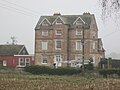
 Holme Lacy Mansion House - geograph.org.uk - 2967456.jpg 1,350 × 898; 231 KB
-
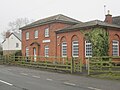
 Holme Lacy Primary School - geograph.org.uk - 3615745.jpg 1,024 × 680; 200 KB
-
 Holme Lacy Village Hall - geograph.org.uk - 5751648.jpg 3,264 × 2,448; 1.76 MB
-
 Holme Lacy Village Hall - geograph.org.uk - 5751654.jpg 3,264 × 2,448; 1.9 MB
-
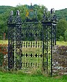
 Impressive wrought iron gate - geograph.org.uk - 891329.jpg 480 × 640; 184 KB
-
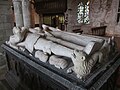
 John and Sibell Scudamore tomb, St Cuthbert's church - geograph.org.uk - 3633611.jpg 3,008 × 2,000; 2.46 MB
-

-
 John Scudamore and wife Sibell, Holme Lacy church - geograph.org.uk - 3272888.jpg 2,256 × 1,496; 701 KB
-
-
 Koi carp, Holme Lacy, Herefordshire - geograph.org.uk - 4187498.jpg 640 × 640; 110 KB
-
 Lane to Holme Lacy - geograph.org.uk - 878017.jpg 640 × 376; 96 KB
-
 Lodge and gates, Holme Lacy - geograph.org.uk - 5462751.jpg 640 × 457; 170 KB
-
 Lone lamb on the embankment - geograph.org.uk - 1004276.jpg 640 × 434; 134 KB
-

-
 Lower Bolstone Wood - detail - geograph.org.uk - 3754466.jpg 800 × 450; 233 KB
-
 Lower Bolstone Wood - geograph.org.uk - 3754202.jpg 800 × 450; 231 KB
-
 Maize crop near Ufton Court - geograph.org.uk - 1916466.jpg 640 × 480; 251 KB
-
 Memorial of James Scudamore III (Holme Lacy) - geograph.org.uk - 5753227.jpg 3,264 × 2,448; 1.6 MB
-
 Memorial of John and Sybil Scudamore (Holme Lacy) - geograph.org.uk - 5755443.jpg 3,264 × 2,448; 1.89 MB
-
 Memorial of Two Scudamore's (Holme Lacy) - geograph.org.uk - 5753229.jpg 3,264 × 2,448; 1.69 MB
-
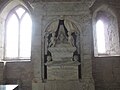
 Memorial to Chandos Scudamore Stanhope, R.N., Holme Lacy - geograph.org.uk - 4368462.jpg 2,356 × 3,785; 1.69 MB
-
 Memorial to James Scudamore - geograph.org.uk - 3633663.jpg 2,000 × 3,008; 2.03 MB
-
 Memorial Tree to Georgina Mary Jones (Holme Lacy) - geograph.org.uk - 5755753.jpg 3,264 × 2,448; 2.53 MB
-

-
 Misericord, St Cuthbert's church, Holme Lacy - geograph.org.uk - 3270508.jpg 2,256 × 1,496; 830 KB
-

-
 Misty farmland - geograph.org.uk - 1916545.jpg 640 × 480; 237 KB
-

-

-
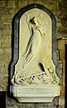
 Monument to Jane Scudamore, Holme Lacy church - geograph.org.uk - 3270687.jpg 1,012 × 1,923; 1.48 MB
-
 Moorhen, Holme Lacy - geograph.org.uk - 6165539.jpg 1,024 × 768; 212 KB
-
 Muddy footpath from Bolstone Lane - geograph.org.uk - 3754464.jpg 800 × 600; 294 KB
-
 New buildings by Widow's Wood - geograph.org.uk - 4771234.jpg 1,600 × 901; 638 KB
-
 Newtown Grove - geograph.org.uk - 2586223.jpg 1,024 × 768; 259 KB
-
 North transept North window, Holme Lacy - geograph.org.uk - 4368467.jpg 3,108 × 5,402; 2.05 MB
-

-
-
 Old farm machinery - geograph.org.uk - 530261.jpg 640 × 490; 123 KB
-
 Old farm machinery - geograph.org.uk - 530265.jpg 640 × 452; 97 KB
-
 Old orchard at Upper Bogmarsh, 1 - geograph.org.uk - 6127733.jpg 1,600 × 835; 660 KB
-
 Old orchard at Upper Bogmarsh, 2 - geograph.org.uk - 6127739.jpg 1,600 × 948; 749 KB
-
 Old orchard at Upper Bogmarsh, 3 - geograph.org.uk - 6127741.jpg 1,600 × 899; 792 KB
-

-
 Old railway trackbed - geograph.org.uk - 5997704.jpg 4,896 × 3,264; 6.52 MB
-
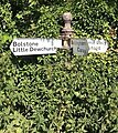
 Old sign to Bolstone and Ballingham - geograph.org.uk - 892166.jpg 480 × 640; 131 KB
-
 One of the lakes at Holme Lacy Hotel - geograph.org.uk - 3928064.jpg 640 × 480; 111 KB
-
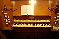 Organ Console, St Cuthbert's church, Holme Lacy - geograph.org.uk - 3270666.jpg 2,256 × 1,496; 734 KB
-
 Organ, St Cuthbert's church, Holme Lacy - geograph.org.uk - 3270664.jpg 1,496 × 2,256; 696 KB
-

-
 Parallel lines - geograph.org.uk - 1004300.jpg 480 × 640; 123 KB
-
 Parkland with Holme Lacy House - geograph.org.uk - 120028.jpg 640 × 480; 130 KB
-

-
 Phone box outside the Village Hall - geograph.org.uk - 530450.jpg 640 × 517; 50 KB
-
 Playing fields, Holme Lacy - geograph.org.uk - 5216193.jpg 800 × 600; 189 KB
-
 Polling Station, Holme Lacy - geograph.org.uk - 1843619.jpg 640 × 480; 194 KB
-
 Pomander worn by Sibell Scudamore on memorial - geograph.org.uk - 3272883.jpg 1,600 × 1,061; 303 KB
-
 Power line - geograph.org.uk - 1004269.jpg 480 × 640; 75 KB
-
 Private track into Widow's Wood - geograph.org.uk - 6127745.jpg 1,600 × 901; 723 KB
-
 Putti on James Scudamore monument - geograph.org.uk - 3633595.jpg 3,008 × 2,000; 2.22 MB
-
 Railway trackbed near Holme Lacy - geograph.org.uk - 5997692.jpg 4,896 × 3,264; 6.63 MB
-
 Ramsden Farm - geograph.org.uk - 1135491.jpg 640 × 426; 105 KB
-
 Rapeseed Field - geograph.org.uk - 2967445.jpg 1,350 × 898; 263 KB
-
 Rapeseed near Holme Lacy - geograph.org.uk - 2967450.jpg 1,350 × 898; 288 KB
-
 Relaying water pipes - geograph.org.uk - 1418896.jpg 640 × 480; 187 KB
-
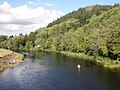
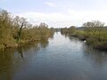
 River Wye and meadowland - geograph.org.uk - 3615750.jpg 1,024 × 680; 214 KB
-
 River Wye at Lechmere's Ley - geograph.org.uk - 373663.jpg 640 × 480; 140 KB
-
 River Wye from Holme Lacy Bridge - geograph.org.uk - 3681768.jpg 2,272 × 1,704; 809 KB
-
 River Wye near Holme Lacy - geograph.org.uk - 2967423.jpg 1,350 × 898; 210 KB
-
 River Wye near Holme Lacy - geograph.org.uk - 3615748.jpg 1,024 × 680; 230 KB
-
 River Wye near Shepherd's Rough - geograph.org.uk - 2405910.jpg 1,024 × 659; 175 KB
-
 River Wye, from Holme Lacy Bridge - geograph.org.uk - 2585144.jpg 1,024 × 768; 208 KB
-
 River Wye, Holme Lacy Bridge - geograph.org.uk - 5215983.jpg 1,024 × 768; 257 KB
-
 River Wye. - geograph.org.uk - 120023.jpg 640 × 480; 93 KB
-
 Road approaching Tump Farm - geograph.org.uk - 3978536.jpg 1,024 × 680; 327 KB
-
 Road bridge over the dismantled railway - geograph.org.uk - 530451.jpg 640 × 478; 120 KB
-
 Road sign and bridge abutments - geograph.org.uk - 5997700.jpg 3,264 × 4,896; 4.52 MB
-
 Road sign at Holme Lacy - geograph.org.uk - 3615769.jpg 680 × 1,024; 303 KB
-
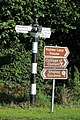
 Road signs in Holme Lacy - geograph.org.uk - 3412722.jpg 640 × 480; 208 KB
-
 Road to Holme Lacy - geograph.org.uk - 892185.jpg 640 × 480; 168 KB
-
 Robert Owen Academy (Holme Lacy) - geograph.org.uk - 5751596.jpg 3,264 × 2,448; 1.8 MB
-
 Robert Owen Academy (Holme Lacy) - geograph.org.uk - 5751669.jpg 3,264 × 2,448; 1.71 MB
-
 Rosebay Willowherb on the verge - geograph.org.uk - 892182.jpg 640 × 480; 230 KB
-
 Scots pines near Holme Lacy - geograph.org.uk - 5464155.jpg 496 × 640; 279 KB
-

-

-
 Screen to the North transept, Holme Lacy - geograph.org.uk - 4368447.jpg 5,114 × 3,400; 4.23 MB
-
 Scudamore coat of Arms on Memorial to John - geograph.org.uk - 3272890.jpg 2,256 × 1,496; 918 KB
-
 Scudamore grave inscription - geograph.org.uk - 4820341.jpg 1,200 × 1,600; 1.44 MB
-
 Scudamore monuments, Holme Lacy - geograph.org.uk - 5462757.jpg 526 × 640; 181 KB


_-_geograph.org.uk_-_5737860.jpg)


_-_geograph.org.uk_-_5755459.jpg)
_-_geograph.org.uk_-_5752856.jpg)
_-_geograph.org.uk_-_5755464.jpg)
_-_geograph.org.uk_-_5752862.jpg)


_-_geograph.org.uk_-_5751682.jpg)
_-_geograph.org.uk_-_5751672.jpg)


_-_geograph.org.uk_-_5752752.jpg)


_-_geograph.org.uk_-_5752787.jpg)


_-_geograph.org.uk_-_5737728.jpg)
_-_geograph.org.uk_-_5737743.jpg)


_-_geograph.org.uk_-_5753227.jpg)
_-_geograph.org.uk_-_5755443.jpg)
_-_geograph.org.uk_-_5753229.jpg)


_-_geograph.org.uk_-_5755753.jpg)
_-_geograph.org.uk_-_5755457.jpg)

_-_geograph.org.uk_-_5755456.jpg)


_-_geograph.org.uk_-_5751596.jpg)
_-_geograph.org.uk_-_5751669.jpg)


_-_geograph.org.uk_-_5752877.jpg)
_-_geograph.org.uk_-_5755451.jpg)