Category:Holsworthy Hamlets
civil parish in Devon, UK | |||||
| Upload media | |||||
| Instance of | |||||
|---|---|---|---|---|---|
| Location | Torridge, Devon, South West England, England | ||||
 | |||||
Subcategories
This category has only the following subcategory.
H
Media in category "Holsworthy Hamlets"
The following 200 files are in this category, out of 211 total.
(previous page) (next page)-
 A3072 crossroads at Burnard's House - geograph.org.uk - 3807713.jpg 800 × 560; 128 KB
-
 A3072 eastbound - geograph.org.uk - 3631171.jpg 1,740 × 1,081; 1,024 KB
-
 A3072 near Anvil Corner - geograph.org.uk - 740246.jpg 640 × 480; 76 KB
-
 A3072 near entrance to Simpson Barton - geograph.org.uk - 3631181.jpg 1,812 × 1,102; 913 KB
-
 A3072 near Higher Weekstone Farm - geograph.org.uk - 3807847.jpg 1,024 × 670; 129 KB
-
 A3072 near Weekstone Farm - geograph.org.uk - 4980328.jpg 3,037 × 1,754; 1.16 MB
-
 A388 at South Arscott - geograph.org.uk - 4921241.jpg 1,920 × 1,079; 508 KB
-
 A388 at South Arscott - geograph.org.uk - 5035828.jpg 1,920 × 1,280; 851 KB
-
 A388 south of Whimble Cross - geograph.org.uk - 682099.jpg 640 × 480; 65 KB
-
 A388 southwest bound - geograph.org.uk - 3127271.jpg 640 × 480; 81 KB
-
 A388 southwest bound - geograph.org.uk - 3127288.jpg 640 × 453; 47 KB
-
 Access gate to landfill site - geograph.org.uk - 2984019.jpg 800 × 600; 501 KB
-
 Access to Soldonmoor Cottage - geograph.org.uk - 602295.jpg 600 × 450; 178 KB
-
 Anvil Corner - geograph.org.uk - 4925070.jpg 1,920 × 1,122; 662 KB
-

-
 Anvil Corner, the chapel - geograph.org.uk - 4912684.jpg 1,600 × 889; 201 KB
-
 Anvil Cross - geograph.org.uk - 5608792.jpg 640 × 427; 174 KB
-
 Approaching Anvil corner on A3072 - geograph.org.uk - 3673633.jpg 1,600 × 993; 190 KB
-
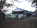 Barns at Mill Farm - geograph.org.uk - 596064.jpg 600 × 450; 129 KB
-
 Barns at Soldon - geograph.org.uk - 2983902.jpg 800 × 600; 457 KB
-

-
 Bend and river bridge - geograph.org.uk - 598125.jpg 600 × 450; 167 KB
-
 Blagdonmoor Cross - geograph.org.uk - 2983983.jpg 640 × 480; 65 KB
-
 Blagdonmoor Cross - geograph.org.uk - 4926081.jpg 1,920 × 1,280; 884 KB
-
 Blagdonmoor Cross - geograph.org.uk - 4926084.jpg 1,920 × 1,280; 758 KB
-
 Burnard's House - geograph.org.uk - 5052073.jpg 2,633 × 1,166; 468 KB
-
 By a tributary of the Deer - geograph.org.uk - 5034254.jpg 3,072 × 2,048; 1.32 MB
-
 Chasty village street - geograph.org.uk - 597933.jpg 600 × 450; 127 KB
-
 Chilsworthy - approach from the north - geograph.org.uk - 596193.jpg 600 × 450; 117 KB
-
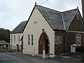 Chilsworthy Chapel - geograph.org.uk - 596196.jpg 600 × 450; 116 KB
-
 Chilsworthy Methodist Church - geograph.org.uk - 6189834.jpg 2,515 × 1,498; 475 KB
-
 Chilsworthy to Holsworthy road - geograph.org.uk - 595982.jpg 600 × 450; 81 KB
-
 Circuit Moor Plantation - geograph.org.uk - 682167.jpg 480 × 640; 109 KB
-
 Classic car at Noteworthy Farm - geograph.org.uk - 4119817.jpg 1,600 × 1,093; 204 KB
-

-
 Container in field, Common Moor - geograph.org.uk - 4919826.jpg 2,761 × 1,898; 1.15 MB
-
 Cottage at Anvil Corner - geograph.org.uk - 4924972.jpg 1,920 × 1,191; 769 KB
-
 Cottage at Chasty - geograph.org.uk - 597930.jpg 600 × 450; 113 KB
-
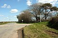
 Country lane - geograph.org.uk - 595745.jpg 640 × 480; 149 KB
-
 Crosspark Cross - geograph.org.uk - 3214028.jpg 640 × 480; 70 KB
-
 Crosspark Cross - geograph.org.uk - 3214118.jpg 640 × 403; 57 KB
-
 Crosspark cross - geograph.org.uk - 4309200.jpg 640 × 480; 42 KB
-
 Curtis Cross road junction and signpost - geograph.org.uk - 2981225.jpg 800 × 600; 435 KB
-

-
 Devon Drizzle - geograph.org.uk - 602341.jpg 600 × 450; 178 KB
-

-
 Driveway north of the A3072 - geograph.org.uk - 595974.jpg 600 × 450; 100 KB
-
 Driveway to Blagdonmoor Wharf - geograph.org.uk - 598135.jpg 600 × 450; 154 KB
-
 Driveway to Thorne Park - geograph.org.uk - 595718.jpg 600 × 450; 102 KB
-
 Entrance to Lamerton Farm - geograph.org.uk - 598131.jpg 600 × 450; 185 KB
-
 Ewe and lambs by the A388 - geograph.org.uk - 4929785.jpg 916 × 690; 153 KB
-
 Farm buildings at Headon - geograph.org.uk - 598441.jpg 600 × 450; 102 KB
-
 Farm Buildings at Thorne Park Farm - geograph.org.uk - 595723.jpg 600 × 450; 104 KB
-
 Farm road to Burscott - geograph.org.uk - 740413.jpg 640 × 480; 121 KB
-
 Farmland at South Arscott - geograph.org.uk - 5034325.jpg 2,491 × 1,864; 995 KB
-
 Farmland at South Arscott - geograph.org.uk - 5035586.jpg 3,072 × 2,048; 1.32 MB
-
 Farmland by Vaglefield Farm - geograph.org.uk - 4926026.jpg 1,920 × 988; 681 KB
-
 Farmland near Chasty - geograph.org.uk - 6189643.jpg 3,264 × 1,832; 887 KB
-
 Farmland near Headon - geograph.org.uk - 4924780.jpg 1,920 × 1,111; 833 KB
-
 Farmland near Honeycroft - geograph.org.uk - 5032958.jpg 2,907 × 1,829; 950 KB
-
 Farmland north of Hoggs Park - geograph.org.uk - 5034218.jpg 3,072 × 2,048; 1.3 MB
-
 Field and farm track, Staddon - geograph.org.uk - 4924894.jpg 3,056 × 1,981; 1.37 MB
-
 Field and house by Staddon Road - geograph.org.uk - 4924906.jpg 2,722 × 1,434; 1,002 KB
-
 Field and wood near Babbington - geograph.org.uk - 5034134.jpg 3,068 × 1,946; 1.16 MB
-
 Field by Crosspark Cross - geograph.org.uk - 3214080.jpg 640 × 457; 84 KB
-
 Field by Staddon Road - geograph.org.uk - 4919890.jpg 1,920 × 1,120; 715 KB
-
 Field by Staddon Road - geograph.org.uk - 4924837.jpg 3,060 × 1,906; 1.33 MB
-
 Field by the A388 - geograph.org.uk - 740479.jpg 640 × 480; 126 KB
-
 Field by the lane to Vognacott - geograph.org.uk - 5033034.jpg 1,920 × 1,280; 802 KB
-
 Field near Babbington - geograph.org.uk - 4921194.jpg 1,920 × 1,234; 734 KB
-
 Field near Babbington - geograph.org.uk - 5033373.jpg 3,072 × 2,048; 1.29 MB
-
 Field near Curtis Cross - geograph.org.uk - 4929432.jpg 1,920 × 1,280; 947 KB
-
 Field near Curtis Cross - geograph.org.uk - 5032425.jpg 2,829 × 1,954; 1.28 MB
-
 Field near Curtis Cross - geograph.org.uk - 5032448.jpg 2,551 × 1,620; 877 KB
-
 Field near Headon - geograph.org.uk - 4924809.jpg 1,920 × 1,280; 647 KB
-
 Field near Honeycroft - geograph.org.uk - 5032933.jpg 1,920 × 1,280; 844 KB
-
 Field near Winscott Cross - geograph.org.uk - 5002878.jpg 1,920 × 1,119; 634 KB
-
 Field of stubble, Thorne Farm - geograph.org.uk - 982994.jpg 640 × 480; 120 KB
-
 Field View near Rhude - geograph.org.uk - 595770.jpg 600 × 450; 120 KB
-
 Forestry near Merryfield - geograph.org.uk - 740351.jpg 640 × 480; 106 KB
-

-
 Gearns Farm - geograph.org.uk - 740512.jpg 640 × 480; 75 KB
-
 Halsdon Plantation - geograph.org.uk - 2983993.jpg 800 × 599; 465 KB
-
 Harvest Cottage self-catering let - geograph.org.uk - 4914018.jpg 1,600 × 1,199; 201 KB
-
 Headon Cross - geograph.org.uk - 4924776.jpg 1,920 × 1,280; 884 KB
-
 High Barrow at Highbarrow Cross - geograph.org.uk - 2981341.jpg 800 × 600; 292 KB
-
 Highbarrow Cross - geograph.org.uk - 2981349.jpg 800 × 600; 361 KB
-
 Higher Chasty - geograph.org.uk - 6189652.jpg 2,794 × 1,697; 660 KB
-
 Holepark - geograph.org.uk - 5033304.jpg 1,920 × 1,280; 894 KB
-
 Holsworthy Beacon - geograph.org.uk - 5032284.jpg 3,072 × 2,048; 1.22 MB
-
 Holsworthy Beacon - geograph.org.uk - 5032350.jpg 3,008 × 1,736; 886 KB
-
 Holsworthy Beacon - geograph.org.uk - 5032354.jpg 3,072 × 1,955; 929 KB
-
 Holsworthy Beacon - geograph.org.uk - 742814.jpg 640 × 480; 77 KB
-
 Honeycroft Cross - geograph.org.uk - 5032571.jpg 3,072 × 2,048; 1.29 MB
-
 Honeycroft Cross - geograph.org.uk - 5032906.jpg 1,920 × 1,280; 933 KB
-
 Honeycroft Cross, road to Honeycroft - geograph.org.uk - 2981326.jpg 800 × 600; 395 KB
-
 House at crossroads in Holsworthy Beacon - geograph.org.uk - 2983953.jpg 800 × 600; 314 KB
-
 Houses at Holsworthy Beacon - geograph.org.uk - 5032273.jpg 2,989 × 1,863; 828 KB
-
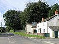
 Houses at the road junction at Burnard's House - geograph.org.uk - 4914004.jpg 1,600 × 1,201; 418 KB
-
 I'm a Geographer, get me out of here^ - geograph.org.uk - 982924.jpg 480 × 640; 132 KB
-
 Lane approaching Babbington - geograph.org.uk - 5033438.jpg 2,048 × 3,072; 1.33 MB
-
 Lane at Babbington - geograph.org.uk - 4929622.jpg 1,920 × 1,280; 932 KB
-
 Lane at Hoggs Park - geograph.org.uk - 4921236.jpg 1,920 × 1,280; 873 KB
-
 Lane at Manworthy Mill - geograph.org.uk - 5036099.jpg 1,920 × 1,280; 734 KB
-
 Lane from Headon Cross - geograph.org.uk - 4924777.jpg 1,920 × 1,173; 653 KB
-
 Lane from Honeycroft Cross - geograph.org.uk - 5032603.jpg 1,920 × 1,179; 911 KB
-
 Lane from Soldon Cross - geograph.org.uk - 507498.jpg 640 × 472; 98 KB
-
 Lane near Parnacott - geograph.org.uk - 6189683.jpg 1,802 × 3,062; 897 KB
-
 Lane near Vognacott - geograph.org.uk - 4921193.jpg 1,920 × 1,280; 906 KB
-
 Lane near Vognacott - geograph.org.uk - 5033147.jpg 1,920 × 1,286; 1.04 MB
-
 Lane past Common Moor - geograph.org.uk - 4919827.jpg 1,920 × 1,280; 994 KB
-
 Lane past New Farm - geograph.org.uk - 6189672.jpg 3,264 × 1,832; 1.42 MB
-
 Lane past Ugworthy Barrows - geograph.org.uk - 6189732.jpg 2,968 × 1,726; 929 KB
-
 Lane to Babbington - geograph.org.uk - 5034141.jpg 3,072 × 2,048; 1.18 MB
-
 Lane to Curtis Cross - geograph.org.uk - 5032507.jpg 3,072 × 2,048; 1.15 MB
-
 Lane to Hoggs Park - geograph.org.uk - 4929670.jpg 1,920 × 1,280; 1.01 MB
-
 Lane to Hoggs Park - geograph.org.uk - 4929728.jpg 2,671 × 1,816; 861 KB
-
 Lane to Holsworthy - geograph.org.uk - 4920907.jpg 3,068 × 1,736; 1.01 MB
-
 Lane to Honeycroft - geograph.org.uk - 5032909.jpg 3,072 × 2,048; 1.23 MB
-
 Lane to Honeycroft - geograph.org.uk - 5033123.jpg 1,860 × 2,283; 1.09 MB
-
 Lane to Honeycroft Cross - geograph.org.uk - 5032949.jpg 1,920 × 1,280; 993 KB
-
 Lane to Manworthy - geograph.org.uk - 5034225.jpg 3,072 × 2,048; 1.3 MB
-
 Lane to Staddon Moor - geograph.org.uk - 4924812.jpg 1,920 × 1,280; 619 KB
-
 Lane to Vognacott - geograph.org.uk - 4921191.jpg 1,920 × 1,280; 957 KB
-
 Lane to Winscott Cross - geograph.org.uk - 6192712.jpg 1,832 × 3,264; 1.46 MB
-
 Lane west from Youldonmoor Cross - geograph.org.uk - 6189852.jpg 2,987 × 1,762; 1.34 MB
-
 Lane, Staddon Moor - geograph.org.uk - 4924821.jpg 1,920 × 1,280; 862 KB
-
 Leafy lane - geograph.org.uk - 602328.jpg 600 × 450; 172 KB
-
 Logs, Holsworthy Woods - geograph.org.uk - 682149.jpg 640 × 480; 101 KB
-
 Looking south west in Devon - geograph.org.uk - 595978.jpg 600 × 450; 101 KB
-
 Lover's Lake valley - geograph.org.uk - 743139.jpg 640 × 302; 50 KB
-
 Lovers Lake Bridge - geograph.org.uk - 2983938.jpg 800 × 600; 524 KB
-
 Manworthy Mill - geograph.org.uk - 4921562.jpg 1,920 × 1,280; 1.08 MB
-
 Memorial at Anvil Corner - geograph.org.uk - 3704248.jpg 640 × 480; 124 KB
-

-

-

-
 New hedge, South Arscott - geograph.org.uk - 5035852.jpg 1,920 × 1,280; 974 KB
-
 North Arscott Cottage - geograph.org.uk - 2981363.jpg 800 × 600; 355 KB
-
 North Arscott Cottage - geograph.org.uk - 410264.jpg 640 × 426; 106 KB
-
 Noteworthy caravan and camping site - geograph.org.uk - 4914009.jpg 1,600 × 1,067; 159 KB
-
 Oak Tree Farm - geograph.org.uk - 4980188.jpg 1,920 × 1,101; 552 KB
-
 Old bathtub - geograph.org.uk - 597920.jpg 600 × 450; 136 KB
-

-

-

-
 Pasture, Manworthy Mill - geograph.org.uk - 5035915.jpg 1,920 × 1,280; 917 KB
-
 Private gateway at Honeycroft - geograph.org.uk - 595751.jpg 600 × 450; 118 KB
-
 Rhude Post - geograph.org.uk - 595773.jpg 600 × 450; 115 KB
-
 Riding School, North Hoggs Park - geograph.org.uk - 131268.jpg 640 × 429; 95 KB
-
 River Deer - geograph.org.uk - 4866107.jpg 3,072 × 2,048; 1.3 MB
-
 River Deer and tributary - geograph.org.uk - 468462.jpg 640 × 480; 136 KB
-
 River Deer at Chilsworthy - geograph.org.uk - 602338.jpg 600 × 450; 173 KB
-
 Road from Blagdonmoor Cross - geograph.org.uk - 4920879.jpg 1,920 × 1,121; 691 KB
-
 Road junction at Holsworthy Beacon - geograph.org.uk - 2981221.jpg 800 × 600; 349 KB
-
 Road junction at Staddon - geograph.org.uk - 598386.jpg 600 × 450; 92 KB
-
 Road junction at Staddon Cross - geograph.org.uk - 3704268.jpg 640 × 480; 67 KB
-
 Road near Brendon - geograph.org.uk - 4926090.jpg 1,920 × 1,247; 583 KB
-
 Road stone - geograph.org.uk - 598388.jpg 600 × 450; 99 KB
-
 Road to Chilsworthy - geograph.org.uk - 595766.jpg 600 × 450; 80 KB
-
 Road to East Cranbury farm - geograph.org.uk - 2983980.jpg 800 × 601; 504 KB
-
 Road to Holsworthy - geograph.org.uk - 507511.jpg 640 × 480; 104 KB
-
 Road to Lana - geograph.org.uk - 595763.jpg 600 × 450; 95 KB
-
 Road to Vaglefield Farm - geograph.org.uk - 2983978.jpg 800 × 601; 344 KB
-
 Road with trees east of Soldon - geograph.org.uk - 602285.jpg 600 × 450; 162 KB
-
 Roundabout on A388 - geograph.org.uk - 5035866.jpg 3,034 × 1,978; 1,020 KB
-
 Roundabout on A388 - geograph.org.uk - 5035874.jpg 1,920 × 1,248; 647 KB
-
 Ruby Way - geograph.org.uk - 4962675.jpg 1,600 × 1,067; 674 KB
-
 Ruby Way - geograph.org.uk - 4962679.jpg 1,600 × 1,067; 803 KB
-
 Ruby Way - geograph.org.uk - 4962684.jpg 1,600 × 1,067; 984 KB
-
 Ruby Way - geograph.org.uk - 4963071.jpg 1,600 × 1,067; 1.17 MB
-
 Sign at Anvil Corner - geograph.org.uk - 2984012.jpg 600 × 800; 512 KB
-
 Signpost at Chilsworthy - geograph.org.uk - 595980.jpg 600 × 450; 105 KB
-
 Signpost at West Ugworthy - geograph.org.uk - 595757.jpg 600 × 450; 117 KB
-
 Simpson Moor or Anvil Corner - geograph.org.uk - 2984002.jpg 800 × 600; 382 KB
-
 Soldon Cottage - geograph.org.uk - 2981378.jpg 800 × 600; 371 KB
-
 Converted chapel at Soldon Cross - geograph.org.uk - 504136.jpg 640 × 480; 86 KB
-
 Soldonmoor Cottage - geograph.org.uk - 2983926.jpg 800 × 600; 431 KB
-
 Staddon Cross - geograph.org.uk - 3704313.jpg 640 × 480; 61 KB
-
 Stile near Soldonmoor - geograph.org.uk - 740991.jpg 640 × 480; 127 KB
-
 Stile near Soldonmoor - geograph.org.uk - 743101.jpg 640 × 480; 138 KB
-
 Stream near Hoggs Park - geograph.org.uk - 4929718.jpg 1,920 × 1,280; 1.13 MB
-
 Stubble field, near Pancrasweek - geograph.org.uk - 983019.jpg 640 × 480; 113 KB
-
 Stubble grazing on Thorne Farm - geograph.org.uk - 982866.jpg 640 × 480; 107 KB
-
 The bridge at Youldon - geograph.org.uk - 4914026.jpg 1,600 × 1,201; 321 KB
-
 The crossroads at Holsworthy Beacon - geograph.org.uk - 3405404.jpg 979 × 734; 115 KB
-
 The Full Gospel Church, Anvil Corner, Holsworthy Hamlets - geograph.org.uk - 1852541.jpg 2,000 × 1,268; 581 KB
-
 The lake on an October evening - geograph.org.uk - 1545174.jpg 640 × 480; 120 KB
-
 The Ruby Way - geograph.org.uk - 3704241.jpg 640 × 480; 107 KB
-
 Thorne Farm entrance - geograph.org.uk - 595977.jpg 600 × 450; 159 KB
-
 Torridge , Wall Building - geograph.org.uk - 4076774.jpg 4,288 × 2,848; 5.38 MB
-
 Towards East Vognacott - geograph.org.uk - 5033309.jpg 3,072 × 2,048; 1.38 MB
-
 Towards the Deer - geograph.org.uk - 5033115.jpg 1,920 × 1,280; 972 KB
-
 Track near Babbington - geograph.org.uk - 4929657.jpg 1,920 × 1,257; 684 KB
-
 Track near Hoggs Park - geograph.org.uk - 5034211.jpg 3,072 × 2,048; 1.33 MB
-
 Track near Honeycroft - geograph.org.uk - 5032939.jpg 3,072 × 2,048; 1.21 MB
-
 Track to Waterloo Farm - geograph.org.uk - 3214105.jpg 640 × 480; 92 KB
-
 Tree lined country road - geograph.org.uk - 597927.jpg 600 × 450; 136 KB
-
 Trees lining the road on Soldonmoor - geograph.org.uk - 2983936.jpg 800 × 600; 552 KB
-
 Ugworthy Barrow (geograph 6189821).jpg 2,305 × 1,300; 501 KB


.jpg)