Category:Hood Canal
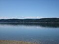
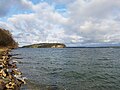
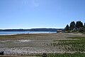
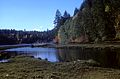
English: Hood Canal in Washington is a fjord, a long narrow inlet of Puget Sound. Despite its name, it is a natural feature, not a canal.
| Object location | | View all coordinates using: OpenStreetMap |
|---|
fjord off of Puget Sound in Washington state, United States of America   | |||||
| Upload media | |||||
| Instance of | |||||
|---|---|---|---|---|---|
| Part of | |||||
| Named after | |||||
| Location |
| ||||
| Connects with | |||||
| Crosses | |||||
| Has part(s) |
| ||||
| Area |
| ||||
| Inflows |
| ||||
 | |||||
Subcategories
This category has the following 3 subcategories, out of 3 total.
H
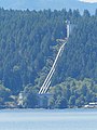
- Hood Canal Bridge (39 F)
M
Media in category "Hood Canal"
The following 105 files are in this category, out of 105 total.
-

-
 160215-N-UD469-019 (24722444169).jpg 4,036 × 2,730; 936 KB
-
 2016-Aug-19-Big-Beef-Bay-Manley-Rd-Seabeck.jpg 4,608 × 3,456; 6 MB
-
 Admiralty Chart No 1947 Admiralty Inlet and Puget Sound, Published 1893, New Edition 1954.jpg 11,081 × 16,207; 71.39 MB
-

-

-

-

-
 Belfair State Park WA.jpg 4,032 × 3,024; 4.94 MB
-
-
 Brinnon, WA - Jackson Cove seen from Bee Mill Road 01.jpg 4,288 × 2,848; 6.28 MB
-
 Brinnon, WA - Jackson Cove seen from Bee Mill Road 02.jpg 4,288 × 2,848; 6.38 MB
-
 Brinnon, WA shore 01.jpg 4,288 × 2,848; 5.8 MB
-
 Bywater bay 2016-09 1778.jpg 3,264 × 2,176; 1.37 MB
-
-

-
 Cushman dam 2.jpg 4,844 × 3,229; 3 MB
-
 Cushman Generating Station and Penstocks.jpg 3,888 × 5,184; 10.71 MB
-
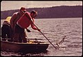
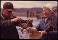
 Digging for clams in the Hood Canal (3575134608).jpg 2,336 × 3,504; 2.45 MB
-
 Distant View 2016-10-10 1770.jpg 3,264 × 2,176; 1.71 MB
-
 Distant View 2016-10-10 1774.jpg 3,264 × 1,832; 1.49 MB
-
 Dosewallips State Park pano 01.jpg 18,065 × 1,840; 11.99 MB
-
 Duckabush River entering Hood Canal, Olympic National Forest (31710516963).jpg 2,816 × 2,112; 1.4 MB
-
 Hood Canal - Washington - 6028493607.jpg 2,816 × 2,112; 584 KB
-
 Hood Canal - Washington - 6028493971.jpg 2,816 × 2,112; 571 KB
-
 Hood Canal - Washington - 6028494401.jpg 2,816 × 2,112; 597 KB
-
 Hood Canal - Washington - 6028494711.jpg 2,816 × 2,112; 711 KB
-
 Hood Canal - Washington - 6028494835.jpg 2,816 × 2,112; 412 KB
-
 Hood Canal - Washington - 6028495145.jpg 2,816 × 2,112; 427 KB
-
 Hood Canal - Washington - 6028495457.jpg 2,816 × 2,112; 339 KB
-
 Hood Canal - Washington - 6028495973.jpg 2,816 × 2,112; 547 KB
-
 Hood Canal - Washington - 6028496499.jpg 2,816 × 2,112; 374 KB
-
 Hood Canal - Washington - 6028497029.jpg 2,816 × 2,112; 585 KB
-
 Hood Canal - Washington - 6028497171.jpg 2,816 × 2,112; 473 KB
-
 Hood Canal - Washington - 6028497309.jpg 2,816 × 2,112; 421 KB
-
 Hood Canal - Washington - 6029046452.jpg 2,816 × 2,112; 618 KB
-
 Hood Canal - Washington - 6029046814.jpg 2,816 × 2,112; 562 KB
-
 Hood Canal - Washington - 6029047196.jpg 2,816 × 2,112; 705 KB
-
 Hood Canal - Washington - 6029047520.jpg 2,816 × 2,112; 425 KB
-
 Hood Canal - Washington - 6029048028.jpg 2,816 × 2,112; 631 KB
-
 Hood Canal - Washington - 6029048242.jpg 2,816 × 2,112; 334 KB
-
 Hood Canal - Washington - 6029048356.jpg 2,816 × 2,112; 344 KB
-
 Hood Canal - Washington - 6029048676.jpg 2,816 × 2,112; 665 KB
-
 Hood Canal - Washington - 6029049096.jpg 2,816 × 2,112; 521 KB
-
 Hood Canal - Washington - 6029049256.jpg 2,816 × 2,112; 475 KB
-
 Hood Canal - Washington - 6029049386.jpg 2,816 × 2,112; 368 KB
-
 Hood Canal - Washington - 6029049648.jpg 2,816 × 2,112; 429 KB
-
 Hood Canal - Washington - 6029049850.jpg 2,816 × 2,112; 510 KB
-
 Hood Canal - Washington - 6029050442.jpg 2,816 × 2,112; 379 KB
-
 Hood Canal - Washington.jpg 2,816 × 2,112; 465 KB
-
 Hood Canal 07771.JPG 2,378 × 1,784; 567 KB
-
 Hood Canal 2016-09 1779.jpg 3,264 × 2,176; 1.32 MB
-
 Hood Canal 8292.JPG 2,848 × 4,272; 3.71 MB
-
 Hood Canal drumlins 01 hillshade color (51149845461).jpg 7,200 × 5,400; 51.71 MB
-
 Hood Canal drumlins 02 photo (51149846466).jpg 7,200 × 5,400; 58.65 MB
-
 Hood Canal drumlins 03 perspective-view hillshade color (51149169842).jpg 5,000 × 2,710; 10.97 MB
-
 Hood Canal Shoreline (16559992216).jpg 5,472 × 3,648; 13.05 MB
-
 Hood Head from Shine Tidelands.jpg 4,032 × 3,024; 4.16 MB
-
 Hoodcanal.jpg 2,272 × 1,704; 949 KB
-
 Hoodsport 5013.jpg 4,608 × 3,072; 3.86 MB
-
 Hoodsport Reach (south) 5007.jpg 8,846 × 2,120; 4.86 MB
-
 Hoodsport Reach 5008.jpg 4,608 × 3,072; 4.53 MB
-
 Hood’s Head from Hood Canal Bridge 01.jpg 4,288 × 2,848; 3.83 MB
-

-
-

-

-
 Jorsted Ck 5032.jpg 4,608 × 3,072; 5.47 MB
-
 Jorsted Ck 5033.jpg 4,608 × 3,072; 2.86 MB
-
 Kitsap-Washington-Lone-Rock-sign-touch-up-2-Aug-2011.jpg 2,048 × 1,536; 724 KB
-
 Lilliwaup ck 5017.jpg 4,608 × 3,072; 3.44 MB
-
 Lilliwaup ck 5019.jpg 4,608 × 3,072; 3.74 MB
-
 Lilliwaup ck 5020.jpg 4,608 × 3,072; 2.5 MB
-
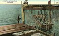
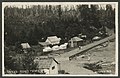
 Lilliwaup Hotel on Hood Canal, ca. 1910 - DPLA - 899a16351249f1aee3866ebc95382ce8.jpg 3,444 × 2,258; 922 KB
-
 Line4366 - Flickr - NOAA Photo Library.jpg 3,917 × 2,594; 4.94 MB
-
 Locmap-hoodcanal-ss.png 802 × 1,043; 103 KB
-
 Lone-Rock-Hood-Canal-Washington-18-Aug-2017.jpg 4,608 × 3,456; 4.01 MB
-
-
 MY BACK YARD - panoramio.jpg 3,264 × 2,448; 2.26 MB
-
 Northern Vindicator 2015 150923-G-LB229-639.jpg 7,360 × 4,912; 16.09 MB
-
 Orca porpoising.jpg 700 × 471; 153 KB
-

-
 Port Gamble, WA - Buena Vista Cemetery 02.jpg 4,288 × 2,848; 6.28 MB
-
 Port Gamble, WA - Buena Vista Cemetery 11.jpg 4,288 × 2,848; 6.39 MB
-
 Port Gamble, WA - Buena Vista Cemetery 17.jpg 4,288 × 2,848; 6.86 MB
-
 Potlatch (steamship) aground in Hood Canal.jpg 792 × 1,043; 261 KB
-
 Skokomish River 07775.JPG 2,560 × 1,920; 1.14 MB
-
 Skokomish River Delta 07772.JPG 2,560 × 1,920; 1.34 MB
-
 Skokomish River Delta 07773.JPG 2,560 × 1,920; 1.24 MB
-

-

-
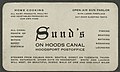 Sund's Resort business card, ca. 1910 - DPLA - 55272e0e277db7b167ea0c2c0f78a2cd.jpg 2,432 × 1,468; 503 KB
-
 Sund's Resort on Hood Canal, ca. 1910 - DPLA - 772716a4e98b3ab473ca4b55ccfe6016.jpg 3,329 × 2,168; 919 KB
-

-
 The Beauties of the state of Washington - a book for tourists (1915) (14776312945).jpg 2,018 × 3,504; 2.82 MB
-
 Tillicum Beach business card, circa 1930s (35501754671).jpg 1,124 × 652; 272 KB
-
 Union City on Hood Canal as seen from the water (CURTIS 1571).jpeg 768 × 634; 54 KB
-
 Union River, Washington.jpg 4,032 × 3,024; 3.55 MB
-

-

-

-

-
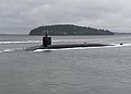 USS Kentucky transits the Hood Canal as they return to their homeport. (35213486331).jpg 6,235 × 4,453; 2.01 MB
-

-
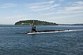 USS Louisiana transits the Hood Canal as it returns to its homeport. (34805850976).jpg 3,244 × 2,155; 960 KB

.jpg)


.jpg)


.jpg)


.jpg)


.jpg)
.jpg)
.jpg)
.jpg)


_aground_in_Hood_Canal.jpg)


.jpg)


_(14776312945).jpg)
.jpg)
.jpeg)

_cruises_toward_homeport_in_the_Hood_Canal_portion_of_the_Puget_Sound.jpg)
_5007.jpg)
_arrives_at_the_Pacific_Northwest_Region_Bangor_Complex.jpg)
.jpg)
.jpg)
.jpg)
_(cropped).jpg)
.jpg)