Category:Horningsea
English: Horningsea is a small village north of Cambridge in Cambridgeshire in England. The parish covers an area of 6.63 km².
village and civil parish in Cambridgeshire, UK  | |||||
| Upload media | |||||
| Instance of | |||||
|---|---|---|---|---|---|
| Location | South Cambridgeshire, Cambridgeshire, East of England, England | ||||
| Population |
| ||||
| Area |
| ||||
| Said to be the same as | Horningsea (Wikimedia duplicated page, civil parish) | ||||
 | |||||
Subcategories
This category has the following 6 subcategories, out of 6 total.
Media in category "Horningsea"
The following 200 files are in this category, out of 625 total.
(previous page) (next page)-
 A bend in the bridle path - geograph.org.uk - 6259901.jpg 1,024 × 683; 933 KB
-
 A bright morning in November - geograph.org.uk - 2709972.jpg 1,024 × 757; 1.25 MB
-
 A corrugated barn near Snout Corner - geograph.org.uk - 5323667.jpg 1,024 × 768; 1.16 MB
-
 A fallen tree by the River Cam - geograph.org.uk - 5677140.jpg 1,024 × 768; 1.06 MB
-
 A farm track in November - geograph.org.uk - 2709987.jpg 1,024 × 768; 1.23 MB
-
 A farm track in The Fens - geograph.org.uk - 5324126.jpg 1,024 × 768; 1.33 MB
-
 A frosty morning in The Fens - geograph.org.uk - 6041240.jpg 1,024 × 683; 758 KB
-
 A jogger by the River Cam - geograph.org.uk - 6532256.jpg 2,500 × 1,667; 1.61 MB
-
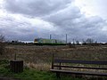
 A King's Lynn train near Horningsea - geograph.org.uk - 4777933.jpg 1,024 × 732; 1.15 MB
-
 A lay-by on Clayhithe Road - geograph.org.uk - 6041172.jpg 1,024 × 768; 943 KB
-
 A man, a dog and four trees by a ditch - geograph.org.uk - 3171530.jpg 1,024 × 742; 989 KB
-
 A pylon at Snout Corner - geograph.org.uk - 6247809.jpg 819 × 1,024; 1.03 MB
-
 A railway once - geograph.org.uk - 6599994.jpg 1,024 × 1,024; 1.63 MB
-
 A runner at Low Fen Drove Way - geograph.org.uk - 3171980.jpg 1,024 × 644; 754 KB
-
 A rutted stretch of Low Fen Drove Way - geograph.org.uk - 5324115.jpg 1,024 × 768; 1.26 MB
-
 A single oak - geograph.org.uk - 5324132.jpg 1,024 × 768; 1.01 MB
-
 A solitary jogger - geograph.org.uk - 6475082.jpg 1,024 × 768; 901 KB
-
 A Sunday-morning fenland walk - geograph.org.uk - 6259908.jpg 1,024 × 731; 940 KB
-
 A view from Snout Corner - geograph.org.uk - 2221732.jpg 800 × 587; 103 KB
-
 A walk in The Fens - geograph.org.uk - 6475095.jpg 1,024 × 768; 899 KB
-
 A walk on Christmas morning - geograph.org.uk - 6713426.jpg 1,024 × 682; 721 KB
-
 A winter walk by the river - geograph.org.uk - 3260332.jpg 800 × 597; 183 KB
-
 A winter walk in The Fens - geograph.org.uk - 6041168.jpg 1,024 × 682; 791 KB
-
 A14 looking west - geograph.org.uk - 5035750.jpg 640 × 426; 73 KB
-
 A14, Cambridge bypass - geograph.org.uk - 4131282.jpg 640 × 399; 35 KB
-
 A14, Fen Ditton - geograph.org.uk - 5500306.jpg 640 × 480; 53 KB
-
 A14, Horningsea Road Bridge - geograph.org.uk - 3842248.jpg 640 × 427; 249 KB
-
 Across a field to Northfields Farm - geograph.org.uk - 2717569.jpg 1,024 × 709; 866 KB
-
 Across the fields to Clayhithe Farm - geograph.org.uk - 2624151.jpg 1,024 × 740; 815 KB
-
 Aerating the Cam - geograph.org.uk - 4123129.jpg 1,600 × 1,200; 680 KB
-
 After harvest at the edge of The Fens - geograph.org.uk - 6247843.jpg 1,024 × 768; 887 KB
-
 An expert at play - geograph.org.uk - 2369524.jpg 640 × 480; 75 KB
-
 Another view towards the River Cam - geograph.org.uk - 5527243.jpg 2,000 × 1,333; 2.92 MB
-

-
 Arable field in Horningsea - geograph.org.uk - 6031164.jpg 4,032 × 3,024; 3.95 MB
-
 At Bottisham Lock - geograph.org.uk - 5842706.jpg 819 × 1,024; 884 KB
-
 Autumn cultivation near Snout Corner - geograph.org.uk - 6599443.jpg 1,024 × 768; 767 KB
-
 Autumn-sown field - geograph.org.uk - 3171496.jpg 1,024 × 768; 1.13 MB
-
 B1047 (Horningsea Road) bridge over A14 - geograph.org.uk - 5972224.jpg 1,600 × 884; 588 KB
-
 Bales and a view towards Horningsea - geograph.org.uk - 6713421.jpg 1,024 × 768; 783 KB
-
 Barley field near Lode - geograph.org.uk - 5987295.jpg 3,264 × 2,448; 2.28 MB
-
 Barn at Eye Hall Farm - geograph.org.uk - 2624214.jpg 1,024 × 735; 686 KB
-
 Barn, Poplar Hall - geograph.org.uk - 5044913.jpg 640 × 426; 79 KB
-
 Barns at Clayhithe Farm - geograph.org.uk - 3787410.jpg 1,200 × 893; 1.27 MB
-
 Barrier above Bottisham Lock - geograph.org.uk - 4342509.jpg 640 × 430; 45 KB
-
 Beet and barley near Snout Corner - geograph.org.uk - 4071003.jpg 1,024 × 731; 1.1 MB
-
 Beet and wheat on the Cambridgeshire Fens - geograph.org.uk - 4071117.jpg 1,024 × 768; 1.04 MB
-
 Ben Hayward Cycles in Horningsea - geograph.org.uk - 2200978.jpg 1,500 × 1,000; 180 KB
-

-
 Between Bottisham Lock and Clayhithe - geograph.org.uk - 6040296.jpg 1,024 × 768; 889 KB
-
 Big tree by the Cam - geograph.org.uk - 4864410.jpg 640 × 426; 105 KB
-
 Biggin Abbey - geograph.org.uk - 32080.jpg 640 × 480; 151 KB
-
 Biggin Abbey - geograph.org.uk - 5035764.jpg 640 × 402; 62 KB
-
 Biggin Abbey - geograph.org.uk - 5040403.jpg 640 × 426; 57 KB
-
 Biggin Abbey - geograph.org.uk - 5040405.jpg 640 × 426; 56 KB
-
 Biggin Abbey entrance - geograph.org.uk - 5527301.jpg 2,000 × 1,333; 2.49 MB
-
 Biggin Abbey entrance drive - geograph.org.uk - 2221718.jpg 800 × 600; 256 KB
-
 Biggin Abbey from a hot-air balloon - geograph.org.uk - 1874938.jpg 640 × 480; 116 KB
-
 Biggin Abbey Lane - geograph.org.uk - 2714465.jpg 4,320 × 3,240; 2.93 MB
-
 Biggin Lane - geograph.org.uk - 5035760.jpg 640 × 426; 107 KB
-
 Biggin Lane in early autumn - geograph.org.uk - 5932422.jpg 1,024 × 732; 927 KB
-
 Black fenland soil - geograph.org.uk - 4342446.jpg 640 × 430; 38 KB
-
 Black Prince, white swans - geograph.org.uk - 5842617.jpg 1,024 × 682; 865 KB
-
 Blue boats at Clayhithe - geograph.org.uk - 4089664.jpg 1,024 × 1,024; 1.33 MB
-
 Blues and greens near Bottisham Lock - geograph.org.uk - 5842661.jpg 1,024 × 768; 845 KB
-
 Boat on the Cam at Clayhithe - geograph.org.uk - 4059219.jpg 640 × 430; 82 KB
-
 Boat on the River Cam - geograph.org.uk - 4864388.jpg 640 × 426; 101 KB
-

-
 Bonfire site near Harcamlow Way - geograph.org.uk - 1264493.jpg 640 × 480; 104 KB
-
 Book exchange, Horningsea - geograph.org.uk - 6004775.jpg 851 × 1,280; 565 KB
-
 Book exchange, Horningsea - geograph.org.uk - 6004777.jpg 851 × 1,280; 373 KB
-
 Bottisham Fen - geograph.org.uk - 4342461.jpg 640 × 430; 32 KB
-
 Bottisham Lock - geograph.org.uk - 3446719.jpg 1,600 × 1,000; 527 KB
-
 Bottisham Lock - geograph.org.uk - 4342450.jpg 640 × 430; 84 KB
-
 Bottisham Lock - geograph.org.uk - 4342495.jpg 640 × 430; 67 KB
-
 Bottisham Lock - geograph.org.uk - 4342503.jpg 640 × 430; 90 KB
-
 Bottisham Lock - geograph.org.uk - 4342519.jpg 640 × 430; 55 KB
-
 Bottisham Lock - geograph.org.uk - 4509111.jpg 6,000 × 4,000; 4.04 MB
-
 Bottisham Lock - geograph.org.uk - 6642637.jpg 768 × 1,024; 137 KB
-
 Bottisham Lock footbridge - geograph.org.uk - 4639277.jpg 2,560 × 1,920; 1.93 MB
-
 Bottisham Lock Lodge - geograph.org.uk - 4342500.jpg 640 × 430; 61 KB
-
 Bottisham Lock, a cottage by the Cam - geograph.org.uk - 6488183.jpg 1,024 × 768; 861 KB
-
 Bottisham Lock, looking upstream - geograph.org.uk - 3641592.jpg 480 × 640; 99 KB
-
 Bottisham Lock, River Cam - geograph.org.uk - 5064651.jpg 640 × 480; 120 KB
-
 Bottisham Lode - geograph.org.uk - 4342427.jpg 640 × 430; 47 KB
-
 Bottisham Lode - geograph.org.uk - 4639293.jpg 2,560 × 1,920; 1.14 MB
-
 Bridge over the A14 - geograph.org.uk - 5035751.jpg 640 × 426; 47 KB
-
 Bridle path to Horningsea - geograph.org.uk - 5300397.jpg 1,024 × 768; 992 KB
-
 Bridle path to Quy and Lode - geograph.org.uk - 2624248.jpg 1,024 × 768; 826 KB
-
 Bridle way to Horningsea - geograph.org.uk - 6299628.jpg 1,024 × 731; 781 KB
-
 Bridleway to Stow cum Quy - geograph.org.uk - 1978421.jpg 1,600 × 1,200; 571 KB
-
 Bright berries at Northfields Farm - geograph.org.uk - 2717655.jpg 1,024 × 768; 1.05 MB
-
 Building work on Dock Lane - geograph.org.uk - 2765426.jpg 1,024 × 749; 939 KB
-
 Burial Ground by Horningsea Rd - geograph.org.uk - 5040364.jpg 640 × 426; 116 KB
-
 Bus stop at Low Fen Drove Way - geograph.org.uk - 6514468.jpg 1,024 × 682; 830 KB
-
 By the Cam below Clayhithe - geograph.org.uk - 6407882.jpg 1,024 × 683; 859 KB
-
 Cam floodplain - geograph.org.uk - 4059269.jpg 640 × 430; 49 KB
-
 Cam reflections below Bottisham Lock - geograph.org.uk - 3313152.jpg 1,200 × 912; 1.33 MB
-
 Cambridge - May Bumps - geograph.org.uk - 373558.jpg 640 × 427; 116 KB
-
 Cambridge - May Bumps - geograph.org.uk - 373570.jpg 640 × 427; 142 KB
-
 Cambridge Country Cottages - geograph.org.uk - 5527262.jpg 2,000 × 1,333; 3.67 MB
-
 Cambridgeshire blues - geograph.org.uk - 6354826.jpg 1,024 × 768; 665 KB
-
 Cattle by the Cam - geograph.org.uk - 6628467.jpg 1,024 × 682; 838 KB
-
 Cereal crop - geograph.org.uk - 5040319.jpg 640 × 426; 68 KB
-
 Church in Horningsea, Cambridgeshire - geograph.org.uk - 4923234.jpg 4,320 × 3,240; 5.85 MB
-
 Church of St Peter, Horningsea - geograph.org.uk - 4864391.jpg 640 × 426; 87 KB
-
 Clayhithe - geograph.org.uk - 4059222.jpg 640 × 430; 87 KB
-
 Clayhithe Bridge - geograph.org.uk - 5453159.jpg 1,024 × 768; 1.05 MB
-
 Clayhithe Bridge - geograph.org.uk - 5677085.jpg 1,024 × 819; 1.2 MB
-
 Clayhithe Bridge on a winter morning - geograph.org.uk - 6040209.jpg 1,024 × 768; 1,005 KB
-
 Clayhithe Bridge reflected - geograph.org.uk - 6665885.jpg 1,024 × 768; 915 KB
-
 Clayhithe Farm - geograph.org.uk - 2623619.jpg 1,024 × 724; 866 KB
-
 Clayhithe Farm - geograph.org.uk - 4059240.jpg 640 × 430; 96 KB
-
 Clayhithe Farm - geograph.org.uk - 4854919.jpg 640 × 426; 92 KB
-
 Clayhithe Farm - geograph.org.uk - 4854922.jpg 640 × 426; 109 KB
-
 Clayhithe Farmhouse - geograph.org.uk - 4059231.jpg 640 × 440; 86 KB
-
 Clayhithe moorings - geograph.org.uk - 5453206.jpg 1,024 × 732; 1.06 MB
-
 Clayhithe moorings in winter - geograph.org.uk - 6041120.jpg 1,024 × 768; 924 KB
-
 Clayhithe Road - geograph.org.uk - 5499173.jpg 640 × 480; 78 KB
-
 Clayhithe Road and Cowslip Cottage - geograph.org.uk - 6592408.jpg 1,024 × 731; 856 KB
-
 Clayhithe Road Bridge - geograph.org.uk - 4059226.jpg 640 × 430; 64 KB
-
 Clayhithe Road Bridge - geograph.org.uk - 4059229.jpg 640 × 430; 73 KB
-
 Clayhithe Road, winter trees - geograph.org.uk - 6344708.jpg 1,024 × 1,024; 1.39 MB
-
 Clayhithe to Bottisham Lode - geograph.org.uk - 2718140.jpg 1,024 × 740; 909 KB
-
 Clayhithe, 1842 and 2016 - geograph.org.uk - 6592285.jpg 819 × 1,024; 1.08 MB
-
 Clayhithe, a frosty morning - geograph.org.uk - 6041136.jpg 1,024 × 682; 732 KB
-
 Clayhithe, a view from the bridge - geograph.org.uk - 6521635.jpg 1,024 × 768; 953 KB
-
 Clayhithe, a walk by the river - geograph.org.uk - 6592097.jpg 1,024 × 682; 833 KB
-
 Clayhithe, across the Cam to The Bridge - geograph.org.uk - 6592386.jpg 1,024 × 731; 968 KB
-
 Clayhithe, becalmed - geograph.org.uk - 4089719.jpg 870 × 1,024; 1.17 MB
-
 Clayhithe, blue sky, blue boats, blue water - geograph.org.uk - 4513639.jpg 1,024 × 732; 1,022 KB
-

-
 Clayhithe, Cam Conservancy moorings - geograph.org.uk - 6344695.jpg 1,024 × 768; 1,013 KB
-
 Clayhithe, cattle by the Cam - geograph.org.uk - 6306439.jpg 1,024 × 732; 759 KB
-
 Clayhithe, chevrons - geograph.org.uk - 2256246.jpg 800 × 586; 505 KB
-
 Clayhithe, cruising upstream - geograph.org.uk - 6592391.jpg 1,024 × 768; 1.08 MB
-
 Clayhithe, downstream in early March - geograph.org.uk - 6407902.jpg 1,024 × 819; 1.03 MB
-
 Clayhithe, flags flying at Cam Sailing Club - geograph.org.uk - 6407894.jpg 1,024 × 731; 904 KB
-
 Clayhithe, footpath to Bottisham Lock - geograph.org.uk - 6665398.jpg 1,024 × 1,024; 1.72 MB
-
 Clayhithe, frost and reflections - geograph.org.uk - 6040957.jpg 1,024 × 768; 1,010 KB
-
 Clayhithe, loft conversion at Clayhithe Cottages - geograph.org.uk - 6666790.jpg 1,024 × 683; 838 KB
-
 Clayhithe, out into the fen - geograph.org.uk - 6344690.jpg 1,024 × 1,024; 1.3 MB
-
 Clayhithe, paddling past the sailing club - geograph.org.uk - 6592279.jpg 1,024 × 731; 952 KB
-
 Clayhithe, please slow down - geograph.org.uk - 6040216.jpg 1,024 × 768; 769 KB
-
 Clayhithe, reeds and cruisers - geograph.org.uk - 3787100.jpg 1,024 × 1,024; 1.37 MB
-
 Clayhithe, reflected trees - geograph.org.uk - 6040222.jpg 1,024 × 768; 1.15 MB
-
 Clayhithe, repairs at the Cam Conservators' House - geograph.org.uk - 6665407.jpg 1,024 × 1,024; 1.52 MB
-
 Clayhithe, roses round the barns - geograph.org.uk - 4514126.jpg 1,024 × 731; 1.05 MB
-
 Clayhithe, still waters - geograph.org.uk - 2764722.jpg 1,024 × 768; 1.08 MB
-
 Clayhithe, the Cam Conservators' quay - geograph.org.uk - 6665905.jpg 1,024 × 768; 901 KB
-
 Clayhithe, The Conservators' House - geograph.org.uk - 2623606.jpg 1,024 × 768; 885 KB
-
 Clayhithe, the River Cam Conservancy slipway - geograph.org.uk - 6344508.jpg 1,024 × 768; 1,012 KB
-
 Clayhithe, willows and reflections - geograph.org.uk - 2764634.jpg 1,024 × 764; 1.25 MB
-
 Combining near Clayhithe - geograph.org.uk - 4089637.jpg 1,024 × 732; 870 KB
-
 Cottages on High Street, Horningsea - geograph.org.uk - 5500293.jpg 640 × 480; 67 KB
-
 Craftsman at work - geograph.org.uk - 2710021.jpg 1,024 × 765; 1.25 MB
-
 Crop of rape seed near Horningsea - geograph.org.uk - 4921265.jpg 4,320 × 3,240; 5.73 MB
-
 Crops by Fen Rivers Way - geograph.org.uk - 5040396.jpg 640 × 426; 65 KB
-
 Crops by Harcamlow Way - geograph.org.uk - 5040394.jpg 640 × 426; 70 KB
-
 Crops by Horningsea Rd - geograph.org.uk - 5035762.jpg 640 × 426; 65 KB
-
 Crops by Horningsea Rd - geograph.org.uk - 5040318.jpg 640 × 426; 82 KB
-
-
 Crossing the Cam at Bottisham Lock - geograph.org.uk - 5996444.jpg 4,032 × 3,024; 2.82 MB
-
 Cycle path beside Horningsea Road - geograph.org.uk - 5500308.jpg 640 × 480; 65 KB
-
 Cyclepath to Waterbeach - geograph.org.uk - 2063340.jpg 1,600 × 1,200; 982 KB
-
 Cycling by the Cam - geograph.org.uk - 5453153.jpg 1,024 × 768; 1.15 MB
-
 Daffodils by Clayhithe Road - geograph.org.uk - 6408021.jpg 1,024 × 1,024; 1.36 MB
-
 Dark fenland soil - geograph.org.uk - 4864396.jpg 640 × 302; 49 KB
-
 Dickerson's Pit, Milton Country Park - geograph.org.uk - 666520.jpg 640 × 480; 123 KB
-
 Dismantled railway - geograph.org.uk - 44606.jpg 640 × 480; 103 KB
-
 Ditch entering the Cam - geograph.org.uk - 4059267.jpg 640 × 430; 97 KB
-
 Ditch, path and winter trees - geograph.org.uk - 2716606.jpg 1,024 × 768; 1.1 MB
-
 Dock Lane, fitting bargeboards - geograph.org.uk - 2718264.jpg 1,024 × 743; 1.1 MB
-
 Dock Lane, Horningsea, plaster and thatch - geograph.org.uk - 3171964.jpg 1,024 × 789; 1.02 MB
-
 Dock Lane, rebuilding continues - geograph.org.uk - 2710029.jpg 1,024 × 793; 1.01 MB
-
 Dock Lane, rebuilt cottage - geograph.org.uk - 2765417.jpg 1,024 × 845; 1.13 MB
-
 Dock Lane, restoration continues - geograph.org.uk - 2710002.jpg 1,024 × 768; 1.12 MB
-
 Dock Lane, work continues - geograph.org.uk - 2718253.jpg 1,024 × 767; 938 KB
-
 Downstream from Bottisham Lock - geograph.org.uk - 2146898.jpg 480 × 640; 74 KB
-
 Downstream from Bottisham Lock - geograph.org.uk - 6347722.jpg 1,024 × 1,024; 1.01 MB
-
 Downstream from Clayhithe - geograph.org.uk - 6040954.jpg 1,024 × 768; 789 KB
-
 Downstream to Bottisham Lock - geograph.org.uk - 5842613.jpg 1,024 × 768; 997 KB
-
 Drain joining the River Cam - geograph.org.uk - 4062277.jpg 640 × 430; 76 KB
-
 Drainage ditch near Horningsea - geograph.org.uk - 4353238.jpg 6,000 × 4,000; 5.93 MB
-
 Due north in the Cambridgeshire Fens - geograph.org.uk - 6620187.jpg 1,024 × 731; 974 KB
-
 Entering Bottisham Lock - geograph.org.uk - 2146908.jpg 480 × 640; 97 KB
-
 Entering Horningsea - geograph.org.uk - 5040375.jpg 640 × 426; 78 KB
-
 Exiting Bottisham Lock - geograph.org.uk - 2146936.jpg 640 × 480; 103 KB
-
 Exiting Horningsea - geograph.org.uk - 5040385.jpg 640 × 426; 65 KB
-
 Exmoor ponies grazing in Horningsea - geograph.org.uk - 6031160.jpg 4,032 × 3,024; 6.35 MB
-
 Farm track and turning leaves - geograph.org.uk - 2624176.jpg 1,024 × 768; 969 KB
-
 Farm track at Clayhithe - geograph.org.uk - 2623628.jpg 1,024 × 709; 612 KB
-
 Farm track near Eye Hall Farm - geograph.org.uk - 2624137.jpg 1,024 × 757; 906 KB
-
 Fen copse - geograph.org.uk - 3171506.jpg 1,024 × 734; 856 KB
-
 Fen Ditton, a scarecrow with a stethoscope - geograph.org.uk - 6439887.jpg 1,024 × 768; 932 KB
-
 Fen Ditton, up to the A14 - geograph.org.uk - 5995780.jpg 1,024 × 683; 805 KB
-
 Fen field and bird scarer - geograph.org.uk - 2623738.jpg 1,024 × 748; 697 KB
-
 Fen fields near Clayhithe - geograph.org.uk - 3787388.jpg 1,200 × 900; 1.32 MB
-
 Fenland field - geograph.org.uk - 2624017.jpg 1,024 × 672; 791 KB
-
 Fenland view near Eye Hall Farm - geograph.org.uk - 2624196.jpg 1,024 × 714; 853 KB


_bridge_over_A14_-_geograph.org.uk_-_5972224.jpg)


