Category:Horwood, Lovacott and Newton Tracey
civil parish in North Devon, England, UK | |||||
| Upload media | |||||
| Instance of |
| ||||
|---|---|---|---|---|---|
| Location | North Devon, Devon, South West England, England | ||||
 | |||||
Subcategories
This category has the following 3 subcategories, out of 3 total.
N
Media in category "Horwood, Lovacott and Newton Tracey"
The following 178 files are in this category, out of 178 total.
-
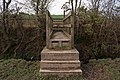
 A footbridge over a stream in Grabbishaw Wood - geograph.org.uk - 3421019.jpg 1,600 × 1,063; 630 KB
-
 A footbridge over a stream in Grabbishaw Wood - geograph.org.uk - 3421030.jpg 1,600 × 1,063; 792 KB
-
 A footbridge over a stream which runs into Langham Lake - geograph.org.uk - 3416721.jpg 1,063 × 1,600; 725 KB
-
 A footbridge over a stream which runs into Langham Lake - geograph.org.uk - 3416725.jpg 1,600 × 1,063; 787 KB
-
 A footbridge over a stream which runs into Langham Lake - geograph.org.uk - 3416734.jpg 1,600 × 1,063; 613 KB
-
 A footpath between Grabbishaw Wood and Kennacott - geograph.org.uk - 3421117.jpg 1,600 × 1,063; 836 KB
-

-

-

-

-

-

-

-

-

-
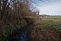
 A stream near Newton Tracey which leads to Langham Lake - geograph.org.uk - 3416233.jpg 1,600 × 1,063; 879 KB
-
 A39 Atlantic Highway - geograph.org.uk - 1303887.jpg 640 × 480; 237 KB
-
 A39 looking south west - geograph.org.uk - 4108192.jpg 640 × 480; 78 KB
-
 A39 looking towards Barnstaple - geograph.org.uk - 1237191.jpg 640 × 480; 53 KB
-
 An unusual property boundary at Newton Cross - geograph.org.uk - 3450198.jpg 1,024 × 768; 192 KB
-
 Approaching Lovacott - geograph.org.uk - 1403102.jpg 640 × 481; 114 KB
-
 B3232 in Newton Tracey - geograph.org.uk - 3450215.jpg 1,024 × 768; 137 KB
-
 Bartridge Bridge - geograph.org.uk - 3450230.jpg 1,024 × 684; 118 KB
-
 Bartridge Bridge as seen from downstream - geograph.org.uk - 3416765.jpg 1,600 × 1,063; 786 KB
-
 Bartridge Bridge as seen from upstream - geograph.org.uk - 3416769.jpg 1,600 × 1,063; 509 KB
-
 Bartridge Common - geograph.org.uk - 600739.jpg 640 × 448; 68 KB
-
 Bartridge Hill - geograph.org.uk - 666844.jpg 640 × 393; 58 KB
-
 Belladown Hill - geograph.org.uk - 599134.jpg 640 × 480; 58 KB
-
 Belladown Hill - geograph.org.uk - 600210.jpg 640 × 411; 45 KB
-
 Bend in lane near Litchardon - geograph.org.uk - 601231.jpg 640 × 480; 117 KB
-
 Bramble Walk, Bickington and beyond - geograph.org.uk - 4846773.jpg 1,277 × 852; 918 KB
-
 Bridge at the south end of Belladown Hill - geograph.org.uk - 3450194.jpg 1,024 × 768; 125 KB
-
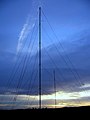 Brookham Wireless Station - geograph.org.uk - 321946.jpg 480 × 640; 60 KB
-
 Brookham Wireless Station - geograph.org.uk - 4108167.jpg 640 × 480; 56 KB
-
 Church Farm Cottage, Horwood (geograph 6336336).jpg 3,567 × 2,347; 858 KB
-
 Countryside east of Grabbishaw - geograph.org.uk - 600709.jpg 640 × 413; 78 KB
-
 Derelict buildings at Grabbishaw - geograph.org.uk - 3421102.jpg 1,600 × 1,063; 681 KB
-
 Derelict buildings at Kennacott - geograph.org.uk - 3421125.jpg 1,600 × 1,063; 695 KB
-
 East Woodlands from Luppincott - geograph.org.uk - 666880.jpg 640 × 429; 50 KB
-
 Farm buildings at Brookham - geograph.org.uk - 4005308.jpg 1,483 × 1,112; 1.32 MB
-
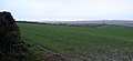 Farm land south of East Barton - geograph.org.uk - 659945.jpg 640 × 294; 39 KB
-
 Farmhouse at Belladown - geograph.org.uk - 3450184.jpg 1,024 × 769; 127 KB
-
 Field and lane from Woodland Cross - geograph.org.uk - 666831.jpg 640 × 480; 92 KB
-
 Field at Woodland Cross - geograph.org.uk - 4719345.jpg 1,600 × 1,200; 1.32 MB
-
 Fremington, Brookham wireless station - geograph.org.uk - 535247.jpg 640 × 427; 141 KB
-
 Fremington, farmhouse at Voscombe - geograph.org.uk - 535259.jpg 640 × 427; 198 KB
-
 Fremington, near Holmacott - geograph.org.uk - 535263.jpg 640 × 427; 137 KB
-
-
 Fremington, Voscombe - geograph.org.uk - 535254.jpg 640 × 427; 197 KB
-
 Grazing land near Budacombe - geograph.org.uk - 678765.jpg 640 × 480; 96 KB
-
 Higher Litchardon - geograph.org.uk - 599124.jpg 640 × 480; 60 KB
-

-
 Houses at Roundswell as seen from the A39 - geograph.org.uk - 4846768.jpg 6,000 × 4,000; 5.31 MB
-
 Inquisitive cattle in a field near Newton Tracey - geograph.org.uk - 3446431.jpg 1,600 × 1,200; 745 KB
-
 Inside St Michael, Horwood (i) - geograph.org.uk - 4584583.jpg 640 × 480; 69 KB
-
 Inside St Michael, Horwood (ii) - geograph.org.uk - 4584592.jpg 640 × 480; 89 KB
-
 Inside St Michael, Horwood (iv) - geograph.org.uk - 4584595.jpg 640 × 480; 68 KB
-
 Inside St Michael, Horwood (ix) - geograph.org.uk - 4584878.jpg 480 × 640; 70 KB
-
 Inside St Michael, Horwood (v) - geograph.org.uk - 4584604.jpg 640 × 480; 91 KB
-
 Inside St Michael, Horwood (vi) - geograph.org.uk - 4584605.jpg 640 × 480; 62 KB
-
 Inside St Michael, Horwood (vii) - geograph.org.uk - 4584607.jpg 640 × 480; 37 KB
-
 Inside St Michael, Horwood (viii) - geograph.org.uk - 4584610.jpg 640 × 480; 60 KB
-
 Inside St Michael, Horwood (x) - geograph.org.uk - 4584611.jpg 640 × 480; 46 KB
-
 Inside St Michael, Horwood (xi) - geograph.org.uk - 4584919.jpg 480 × 640; 47 KB
-
 Inside St Michael, Horwood (xii) - geograph.org.uk - 4584920.jpg 480 × 640; 48 KB
-
 Inside St Michael, Horwood (xiii) - geograph.org.uk - 4584924.jpg 480 × 640; 57 KB
-
 Inside St Michael, Horwood (xiv) - geograph.org.uk - 4584923.jpg 480 × 640; 46 KB
-
 Inside St Michael, Horwood (xv) - geograph.org.uk - 4584927.jpg 480 × 640; 49 KB
-
 Inside St Michael, Horwood (xvi) - geograph.org.uk - 4584937.jpg 480 × 640; 58 KB
-
 Lane to Litchardon - geograph.org.uk - 601345.jpg 640 × 480; 98 KB
-
 Litchardon Cross - geograph.org.uk - 4108165.jpg 640 × 480; 101 KB
-
 Little Knightacott Farm - geograph.org.uk - 4003412.jpg 6,000 × 4,000; 4.13 MB
-
 Looking down a stream from Bartridge Bridge - geograph.org.uk - 3416749.jpg 1,600 × 1,063; 786 KB
-
 Looking up a stream in Grabbishaw Wood - geograph.org.uk - 3421023.jpg 1,600 × 1,063; 829 KB
-

-
 Lovacott Cross - geograph.org.uk - 766864.jpg 640 × 426; 61 KB
-
 Lovacott Gospel Hall - geograph.org.uk - 1402733.jpg 640 × 480; 66 KB
-
 Lovacott Gospel Hall in Lower Lovacott - geograph.org.uk - 6218135.jpg 4,878 × 3,484; 5.57 MB
-
 Lovacott Gospel Hall in Lower Lovacott - geograph.org.uk - 6218136.jpg 3,768 × 2,691; 4.26 MB
-
 Lower Lovacott and surrounding countryside - geograph.org.uk - 1975444.jpg 1,024 × 683; 99 KB
-
 Maize at Woodland Cross - geograph.org.uk - 4719349.jpg 1,600 × 1,200; 1.22 MB
-
 Maize field near Hiscott - geograph.org.uk - 4719369.jpg 1,600 × 1,200; 1.33 MB
-
 Mile Stone - Barnstaple 4 - geograph.org.uk - 5282435.jpg 468 × 640; 139 KB
-
 Mile Stone - Barnstaple 5 - geograph.org.uk - 5282442.jpg 494 × 640; 98 KB
-
 New House Cross - geograph.org.uk - 4108195.jpg 640 × 480; 64 KB
-
 New Kennacott - geograph.org.uk - 600933.jpg 640 × 443; 75 KB
-
 Newton Tracey - geograph.org.uk - 5196052.jpg 4,000 × 3,000; 5.44 MB
-
 Newton Tracey, North Devon - geograph.org.uk - 3421138.jpg 1,600 × 1,067; 432 KB
-
 North Devon , The A39 - geograph.org.uk - 2512452.jpg 4,254 × 2,798; 4.21 MB
-
 North Devon , The A39 - geograph.org.uk - 3359312.jpg 4,288 × 2,848; 4.62 MB
-

-
 Orchard Farm - geograph.org.uk - 4003415.jpg 5,315 × 3,544; 4.47 MB
-
 Ordnance Survey Cut Mark - geograph.org.uk - 4567013.jpg 480 × 640; 109 KB
-
 Ordnance Survey Cut Mark - geograph.org.uk - 4567016.jpg 480 × 640; 119 KB
-
 Pastures, Lovacott - geograph.org.uk - 964419.jpg 640 × 480; 101 KB
-
 Pastures, Lovacott - geograph.org.uk - 964556.jpg 640 × 480; 118 KB
-
 Pastures, Lovacott - geograph.org.uk - 964652.jpg 640 × 480; 122 KB
-
 Pastures, Lovacott - geograph.org.uk - 964734.jpg 640 × 480; 115 KB
-
 Pastures, Lovacott - geograph.org.uk - 964742.jpg 640 × 480; 117 KB
-
 Ploughed field south of Hiscott - geograph.org.uk - 4719366.jpg 1,600 × 1,200; 1.29 MB
-
 Pond at Litchardon - geograph.org.uk - 601240.jpg 640 × 480; 117 KB
-
 Prospect Corner - geograph.org.uk - 4108123.jpg 640 × 480; 39 KB
-
 Road junction - geograph.org.uk - 4108135.jpg 640 × 452; 68 KB
-
 Road north of Voscombe Cross - geograph.org.uk - 4108153.jpg 640 × 480; 99 KB
-
 Rooty Cross - geograph.org.uk - 3450173.jpg 1,024 × 768; 119 KB
-
 Rooty Cross - geograph.org.uk - 4108126.jpg 640 × 480; 62 KB
-

-

-
 St Michael's church, Horwood - geograph.org.uk - 3513369.jpg 640 × 443; 388 KB
-
 St Michael, Horwood, altar - geograph.org.uk - 4584597.jpg 640 × 480; 57 KB
-
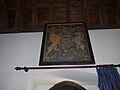
 St Michael, Horwood, banner - geograph.org.uk - 4584917.jpg 480 × 640; 50 KB
-
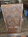
 St Michael, Horwood, bench end (i) - geograph.org.uk - 4584887.jpg 480 × 640; 82 KB
-
 St Michael, Horwood, bench end (ii) - geograph.org.uk - 4584889.jpg 480 × 640; 77 KB
-
 St Michael, Horwood, bench end (iii) - geograph.org.uk - 4584892.jpg 480 × 640; 79 KB
-
 St Michael, Horwood, bench end (iv) - geograph.org.uk - 4584894.jpg 480 × 640; 76 KB
-
 St Michael, Horwood, bench end (v) - geograph.org.uk - 4584896.jpg 480 × 640; 84 KB
-
 St Michael, Horwood, bench end (vi) - geograph.org.uk - 4584902.jpg 480 × 640; 85 KB
-
 St Michael, Horwood, bench end (vii) - geograph.org.uk - 4584904.jpg 480 × 640; 88 KB
-

-
 St Michael, Horwood, churchyard (i) - geograph.org.uk - 4584575.jpg 640 × 480; 76 KB
-
 St Michael, Horwood, churchyard (ii) - geograph.org.uk - 4584576.jpg 640 × 480; 122 KB
-

-
 St Michael, Horwood, churchyard (iv) - geograph.org.uk - 4584578.jpg 640 × 480; 52 KB
-
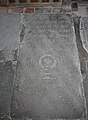
 St Michael, Horwood, coat of arms - geograph.org.uk - 4584579.jpg 640 × 480; 48 KB
-
 St Michael, Horwood, font - geograph.org.uk - 4584883.jpg 480 × 640; 53 KB
-
 St Michael, Horwood, lectern - geograph.org.uk - 4584899.jpg 480 × 640; 61 KB
-
 St Michael, Horwood, lych gate - geograph.org.uk - 4584880.jpg 480 × 640; 72 KB
-
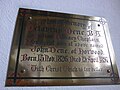
 St Michael, Horwood, memorial (i) - geograph.org.uk - 4584580.jpg 640 × 480; 64 KB
-
 St Michael, Horwood, memorial (ii) - geograph.org.uk - 4584586.jpg 640 × 480; 37 KB
-
 St Michael, Horwood, memorial (iii) - geograph.org.uk - 4584588.jpg 640 × 480; 52 KB
-
 St Michael, Horwood, memorial (iv) - geograph.org.uk - 4584596.jpg 640 × 480; 116 KB
-
 St Michael, Horwood, memorial (ix) - geograph.org.uk - 4584910.jpg 480 × 640; 62 KB
-
 St Michael, Horwood, memorial (v) - geograph.org.uk - 4584598.jpg 640 × 480; 48 KB
-
 St Michael, Horwood, memorial (vi) - geograph.org.uk - 4584602.jpg 640 × 480; 55 KB
-
 St Michael, Horwood, memorial (vii) - geograph.org.uk - 4584603.jpg 640 × 480; 77 KB
-
 St Michael, Horwood, memorial (viii) - geograph.org.uk - 4584881.jpg 480 × 640; 65 KB
-
 St Michael, Horwood, memorial (x) - geograph.org.uk - 4584911.jpg 480 × 640; 92 KB
-
 St Michael, Horwood, memorial (xi) - geograph.org.uk - 4584912.jpg 471 × 640; 70 KB
-
 St Michael, Horwood, memorial (xii) - geograph.org.uk - 4584913.jpg 471 × 640; 83 KB
-
 St Michael, Horwood, memorial (xiii) - geograph.org.uk - 4584914.jpg 640 × 480; 75 KB
-
 St Michael, Horwood, noticeboard - geograph.org.uk - 4497907.jpg 640 × 480; 92 KB
-
 St Michael, Horwood, pulpit - geograph.org.uk - 4584898.jpg 480 × 640; 59 KB
-

-

-

-

-
 St. Thomas-a-Becket church, Newton Tracey - geograph.org.uk - 6176473.jpg 5,472 × 3,648; 4.97 MB
-
 St. Thomas-a-Becket church, Newton Tracey - geograph.org.uk - 6176475.jpg 5,472 × 3,648; 5.31 MB
-
 St. Thomas-a-Becket church, Newton Tracey - geograph.org.uk - 6176476.jpg 5,472 × 3,648; 4.94 MB
-
 St. Thomas-a-Becket church, Newton Tracey - geograph.org.uk - 6176479.jpg 5,472 × 3,648; 4.57 MB
-
 St. Thomas-a-Becket church, Newton Tracey - geograph.org.uk - 6176482.jpg 5,472 × 3,648; 6.13 MB
-
 St. Thomas-a-Becket church, Newton Tracey - geograph.org.uk - 6176487.jpg 5,472 × 3,648; 4.07 MB
-
 The 14th turbine is being erected on Fullabrook Wind Farm - geograph.org.uk - 2468333.jpg 4,099 × 2,732; 6.34 MB
-
 The A39 half way between Barnstaple and Bideford - geograph.org.uk - 4003411.jpg 6,000 × 4,000; 4.15 MB
-
 The B3232 crossing a stream at Bartridge Bridge - geograph.org.uk - 3416745.jpg 1,600 × 1,063; 550 KB
-
 The B3232 crossing a stream at Bartridge Bridge - geograph.org.uk - 3416746.jpg 1,600 × 1,063; 579 KB
-
 The centre of this image is near the A39 by a picnic area - geograph.org.uk - 4846387.jpg 6,000 × 4,000; 5.76 MB
-
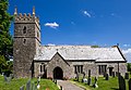
 The church of St Michael at Horwood - geograph.org.uk - 3702448.jpg 4,000 × 3,000; 2.79 MB
-
 The church of St Michael in Horwood - geograph.org.uk - 6218138.jpg 5,472 × 3,648; 4.63 MB
-
 The church of St Michael in Horwood - geograph.org.uk - 6218139.jpg 5,472 × 3,648; 5.26 MB
-
 The church of St Michael in Horwood - geograph.org.uk - 6218141.jpg 5,088 × 3,210; 5.47 MB
-
 The church of St Michael in Horwood - geograph.org.uk - 6218142.jpg 5,472 × 3,648; 4.45 MB
-
 The church of St Michael in Horwood - geograph.org.uk - 6218144.jpg 3,260 × 3,812; 4.57 MB
-
 The church of St Michael in Horwood - geograph.org.uk - 6218145.jpg 5,472 × 3,648; 5.9 MB
-
 The church of St Michael in Horwood - geograph.org.uk - 6218146.jpg 5,472 × 3,648; 4.56 MB
-

-
-
 The Forge, Horwood (geograph 6518593).jpg 4,135 × 2,417; 1.06 MB
-
 The picnic area at Lovacott Cross - geograph.org.uk - 3644340.jpg 1,024 × 768; 139 KB
-
 The road to Glass Water Bridge - geograph.org.uk - 4719354.jpg 1,600 × 1,200; 1.31 MB
-

-
 Valley below Tennacott - geograph.org.uk - 600224.jpg 640 × 335; 35 KB
-

-
 View over Huish Moor - geograph.org.uk - 1303881.jpg 640 × 480; 232 KB
-
 Voscombe Cross - geograph.org.uk - 4108148.jpg 640 × 480; 62 KB
-
 Where footpaths converge at Grabbishaw - geograph.org.uk - 3421108.jpg 1,600 × 1,063; 617 KB
-
 Woodland Cross - geograph.org.uk - 668614.jpg 640 × 480; 79 KB
-
 Woodland Cross crossroads - geograph.org.uk - 4719342.jpg 1,600 × 1,200; 1.19 MB


.jpg)


_-_geograph.org.uk_-_4584583.jpg)
_-_geograph.org.uk_-_4584592.jpg)
_-_geograph.org.uk_-_4584595.jpg)
_-_geograph.org.uk_-_4584878.jpg)
_-_geograph.org.uk_-_4584604.jpg)
_-_geograph.org.uk_-_4584605.jpg)
_-_geograph.org.uk_-_4584607.jpg)
_-_geograph.org.uk_-_4584610.jpg)
_-_geograph.org.uk_-_4584611.jpg)
_-_geograph.org.uk_-_4584919.jpg)
_-_geograph.org.uk_-_4584920.jpg)
_-_geograph.org.uk_-_4584924.jpg)
_-_geograph.org.uk_-_4584923.jpg)
_-_geograph.org.uk_-_4584927.jpg)
_-_geograph.org.uk_-_4584937.jpg)


_-_geograph.org.uk_-_3513382.jpg)


_-_geograph.org.uk_-_4584887.jpg)
_-_geograph.org.uk_-_4584889.jpg)
_-_geograph.org.uk_-_4584892.jpg)
_-_geograph.org.uk_-_4584894.jpg)
_-_geograph.org.uk_-_4584896.jpg)
_-_geograph.org.uk_-_4584902.jpg)
_-_geograph.org.uk_-_4584904.jpg)
_-_geograph.org.uk_-_4584906.jpg)
_-_geograph.org.uk_-_4584575.jpg)
_-_geograph.org.uk_-_4584576.jpg)
_-_geograph.org.uk_-_4584577.jpg)
_-_geograph.org.uk_-_4584578.jpg)


_-_geograph.org.uk_-_4584580.jpg)
_-_geograph.org.uk_-_4584586.jpg)
_-_geograph.org.uk_-_4584588.jpg)
_-_geograph.org.uk_-_4584596.jpg)
_-_geograph.org.uk_-_4584910.jpg)
_-_geograph.org.uk_-_4584598.jpg)
_-_geograph.org.uk_-_4584602.jpg)
_-_geograph.org.uk_-_4584603.jpg)
_-_geograph.org.uk_-_4584881.jpg)
_-_geograph.org.uk_-_4584911.jpg)
_-_geograph.org.uk_-_4584912.jpg)
_-_geograph.org.uk_-_4584913.jpg)
_-_geograph.org.uk_-_4584914.jpg)


_-_geograph.org.uk_-_4584584.jpg)
_-_geograph.org.uk_-_4584918.jpg)
_-_geograph.org.uk_-_4584928.jpg)
_-_geograph.org.uk_-_4584931.jpg)


.jpg)


