Category:Houghton-le-Side
English: Houghton-le-Side is a small village in the borough of Darlington and the ceremonial county of County Durham, England. It is situated a few miles to the south west of Newton Aycliffe.
village in County Durham, United Kingdom | |||||
| Upload media | |||||
| Instance of | |||||
|---|---|---|---|---|---|
| Location | Darlington, County Durham, North East England, England | ||||
 | |||||
Media in category "Houghton-le-Side"
The following 44 files are in this category, out of 44 total.
-
 'Welcome to Houghton-le-Side' sign - geograph.org.uk - 2962187.jpg 1,024 × 806; 145 KB
-
 A68 beside Toytop Plantation - geograph.org.uk - 4820198.jpg 640 × 480; 100 KB
-
 A68 near Toytop Farm - geograph.org.uk - 5850096.jpg 1,024 × 726; 166 KB
-
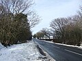
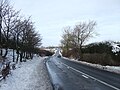
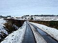
 A68 southbound at Houghton Bank - geograph.org.uk - 5850098.jpg 1,024 × 741; 123 KB
-
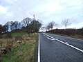 A68 towards West Auckland - geograph.org.uk - 4806051.jpg 640 × 480; 71 KB
-
 A68 towards West Auckland - geograph.org.uk - 4806056.jpg 640 × 480; 75 KB
-
 A68 towards West Auckland - geograph.org.uk - 4820197.jpg 640 × 480; 68 KB
-
 A68 towards West Auckland - geograph.org.uk - 4820202.jpg 640 × 480; 84 KB
-
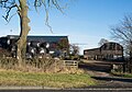 Barns at Elm Grange - geograph.org.uk - 5212242.jpg 1,500 × 1,055; 1.53 MB
-
 Chapel House 2007 at Houghton Bank - geograph.org.uk - 1756736.jpg 2,048 × 1,536; 810 KB
-
 Chapel House on Houghton Bank Lane - geograph.org.uk - 2962118.jpg 1,454 × 1,095; 472 KB
-
 Crossing the A68 near Houghton-le-Side - geograph.org.uk - 2962108.jpg 1,769 × 1,144; 695 KB
-
 Crossroad on Dere Street - geograph.org.uk - 5334285.jpg 3,264 × 2,448; 4.01 MB
-
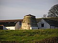 Dovecote , Manor House Farm. - geograph.org.uk - 147735.jpg 640 × 479; 82 KB
-
 Drive to Houghton Grange Farm with public footpath on it - geograph.org.uk - 2677436.jpg 3,648 × 2,736; 2.42 MB
-
 Farm road east from B6275 - geograph.org.uk - 4054048.jpg 1,500 × 1,000; 1.24 MB
-
 Flooded arable field, west of a minor road - geograph.org.uk - 3200645.jpg 1,024 × 768; 161 KB
-
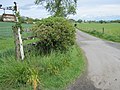
 Footpath to Elm Grange, Houghton-le-Side - geograph.org.uk - 3200628.jpg 1,024 × 768; 176 KB
-
 Gated access to Quarriston - geograph.org.uk - 2962146.jpg 3,648 × 2,736; 3.98 MB
-
 Grass track along field boundary - geograph.org.uk - 3200649.jpg 1,024 × 768; 135 KB
-
 Great Boldearns Hill - geograph.org.uk - 4818866.jpg 640 × 480; 73 KB
-
 Grimshaw Cottage south east of Houghton-le-side - geograph.org.uk - 2678361.jpg 3,648 × 2,736; 2.41 MB
-

-
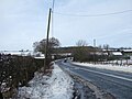
 Houghton Bank - geograph.org.uk - 4818871.jpg 640 × 480; 70 KB
-
 Houghton Bank Lane - geograph.org.uk - 5274133.jpg 1,500 × 788; 1.19 MB
-
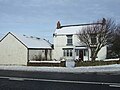
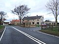
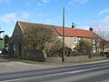
 Houghton-Le-Side, Darlington - geograph.org.uk - 80023.jpg 640 × 480; 79 KB
-
 Looking South from Houghton-le-Side - geograph.org.uk - 131276.jpg 640 × 479; 92 KB
-
 Minor road towards Houghton-le-Side - geograph.org.uk - 4818868.jpg 640 × 480; 75 KB
-
 Minor roads junction in Houghton-le-Side - geograph.org.uk - 2962175.jpg 1,221 × 811; 327 KB
-
 Mount Pleasant Farm - geograph.org.uk - 4806058.jpg 640 × 480; 81 KB
-

-
 Quarriston near Houghton-le-Side - geograph.org.uk - 2962153.jpg 3,648 × 2,736; 4.41 MB
-

-
 Road to Blue House Farm from the A68 - geograph.org.uk - 2429994.jpg 3,648 × 2,736; 3.55 MB
-
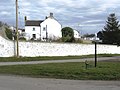
 The Green, Houghton-le-Side - geograph.org.uk - 3200632.jpg 1,024 × 768; 132 KB
-
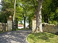
 The Manor House Houghton-le-Side - geograph.org.uk - 1756710.jpg 2,048 × 1,536; 833 KB
-
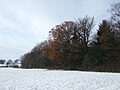
 The northwest flank of Great Boldearns Hill - geograph.org.uk - 3200652.jpg 1,024 × 768; 190 KB
-
 The road to Houghton-le-Side - geograph.org.uk - 3200641.jpg 1,024 × 768; 152 KB
-
 The road to Walworth Gate, Houghton-le-Side - geograph.org.uk - 3200624.jpg 1,024 × 768; 108 KB
-
 Toy Top Farmhouse Houghton Bank Heighington - geograph.org.uk - 1758395.jpg 2,048 × 1,536; 673 KB
-
 Toytop Plantation - geograph.org.uk - 4818874.jpg 640 × 480; 71 KB
-
 Tree shadow on field - geograph.org.uk - 4290085.jpg 1,500 × 926; 1.21 MB
-
 Valley View Houghton-le-Side - geograph.org.uk - 1758417.jpg 2,048 × 1,536; 657 KB
-


