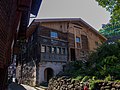
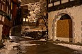
Category:House, Städtli 23, Werdenberg
| Object location | | View all coordinates using: OpenStreetMap |
|---|
 | |||||
| Upload media | |||||
| Instance of | |||||
|---|---|---|---|---|---|
| Location |
| ||||
| Street address |
| ||||
| Heritage designation | |||||
 | |||||
Media in category "House, Städtli 23, Werdenberg"
The following 14 files are in this category, out of 14 total.
-
 Haus23-1 Werdenberg.jpg 1,162 × 778; 682 KB
-
 Haus23-2 Werdenberg.jpg 1,162 × 778; 989 KB
-
 Haus23-3 Werdenberg.jpg 1,162 × 778; 777 KB
-
 Werdenberg. Haus Nr. 23 - 001.jpg 1,984 × 1,488; 631 KB
-
 Werdenberg. Haus Nr. 23 - 002.jpg 1,984 × 1,488; 2.57 MB
-
 Werdenberg. Haus Nr. 23 - 003.jpg 1,984 × 1,488; 1.44 MB
-
 Werdenberg. Haus Nr. 23 - 004.jpg 3,264 × 2,448; 5 MB
-
 Werdenberg. Haus Nr. 23 - 005.jpg 3,264 × 2,448; 6.17 MB
-
 Werdenberg. Haus Nr. 23 - 007.jpg 3,264 × 2,448; 5.56 MB
-
 Werdenberg. Haus Nr. 23 - 008.jpg 2,448 × 3,264; 3.56 MB
-
 Werdenberg. Haus Nr. 23 - 009.JPG 5,184 × 3,456; 9.16 MB
-
 Werdenberg. Haus Nr. 23. 2006-03-18 12-15-45.jpg 2,578 × 2,102; 4.16 MB
-
 Werdenberg. Haus Nr. 23. 2006-05-14 16-39-06.jpg 3,264 × 2,448; 5.69 MB
-
 Werdenberg. Haus Nr. 23. 2019-01-10 21-17-53.jpg 5,760 × 3,840; 19.49 MB


