Category:House "Zum Raben"
| Object location | | View all coordinates using: OpenStreetMap |
|---|
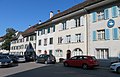
house in Bad Zurzach in the canton of Aargau, Switzerland  | |||||
| Upload media | |||||
| Instance of | |||||
|---|---|---|---|---|---|
| Part of | |||||
| Location | Bad Zurzach, Zurzach, Zurzach District, Aargau, Switzerland | ||||
| Street address |
| ||||
| Located on street |
| ||||
| Heritage designation | |||||
| Inception |
| ||||
 | |||||
Media in category "House "Zum Raben""
The following 3 files are in this category, out of 3 total.
-
 AIMG 0329 Bad Zurzach Hauptstrasse mit Schwanenhaus.jpg 5,184 × 3,888; 4.65 MB
-
 AIMG 0330 Bad Zurzach Hauptstrasse Haus zum Raben in der Mitte.jpg 5,184 × 3,345; 3.48 MB
-
 Zurzach hausname.jpg 2,048 × 1,536; 1.27 MB

