Category:Houses in Ceredigion
Wikimedia category | |||||
| Upload media | |||||
| Instance of | |||||
|---|---|---|---|---|---|
| |||||

Subcategories
This category has the following 11 subcategories, out of 11 total.
A
B
C
- Castle Green House (8 F)
- Cottages in Ceredigion (39 F)
F
- Farmhouses in Ceredigion (29 F)
H
M
N
- Houses in New Quay (20 F)
Media in category "Houses in Ceredigion"
The following 109 files are in this category, out of 109 total.
-
 A sleeper coach on the coastal path - geograph.org.uk - 472487.jpg 640 × 480; 92 KB
-
 Aberaeron harbour - geograph.org.uk - 878953.jpg 640 × 457; 319 KB
-
 Across Cwm Doethie Fawr, Ceredigion - geograph.org.uk - 1418143.jpg 480 × 640; 151 KB
-

-
 Bat Cottage - geograph.org.uk - 627568.jpg 640 × 480; 159 KB
-
 Borth, 26th June 2010 071.jpg 1,024 × 768; 159 KB
-
 Caeryglyn Llandysul.jpg 1,000 × 750; 247 KB
-
 Capel Gwernllwyn - geograph.org.uk - 772353.jpg 640 × 483; 59 KB
-
 Cardigan - panoramio (9).jpg 4,000 × 3,000; 3.59 MB
-
 Cottages in Talybont - geograph.org.uk - 1309089.jpg 640 × 427; 110 KB
-
 Cwara Lodge - geograph.org.uk - 774504.jpg 640 × 394; 75 KB
-
 Cwmerfyn - geograph.org.uk - 1130024.jpg 640 × 402; 90 KB
-
 Cwmsychbant village, Llanwenog - geograph.org.uk - 892504.jpg 640 × 480; 112 KB
-
 Darren Villa.jpg 3,648 × 2,736; 2 MB
-
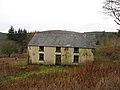
 Derelict House, Bwa-drain farm - geograph.org.uk - 200085.jpg 640 × 480; 186 KB
-

-
 Erosion - geograph.org.uk - 423861.jpg 640 × 480; 92 KB
-
 Ex-isolation hospital beside the Ystwyth - geograph.org.uk - 847919.jpg 640 × 480; 192 KB
-
 Felin Brithdir, Brithdir, Rhydlewis - geograph.org.uk - 54777.jpg 640 × 429; 124 KB
-

-
 Fields and housing, nr. Bow Street - geograph.org.uk - 19632.jpg 640 × 480; 130 KB
-
 Footbridge, Aberaeron - geograph.org.uk - 594017.jpg 640 × 465; 111 KB
-
 Gothic house - geograph.org.uk - 1111680.jpg 640 × 480; 99 KB
-
 Gouallt, Ceredigion - geograph.org.uk - 566043.jpg 508 × 640; 152 KB
-

-
 Harford Row, Lampeter - geograph.org.uk - 1449842.jpg 640 × 480; 55 KB
-
 House from a speeding train - geograph.org.uk - 1439395.jpg 640 × 426; 253 KB
-
 Houses in Priory Street, Cardigan - geograph.org.uk - 1691635.jpg 640 × 474; 123 KB
-
 Houses, Bryngwyn - geograph.org.uk - 745446.jpg 640 × 480; 75 KB
-
 Housing development Llechryd - geograph.org.uk - 447659.jpg 640 × 480; 82 KB
-
 Housing estate, Waun Fawr - geograph.org.uk - 18735.jpg 640 × 480; 131 KB
-
 Ivory House Adpar - geograph.org.uk - 920227.jpg 640 × 480; 73 KB
-
 Lilac house on Church Street Llandysul.jpg 1,000 × 750; 256 KB
-
 Maelgwyn, Rhydlewis - geograph.org.uk - 991616.jpg 640 × 481; 128 KB
-
 Maes-yr-awel, Felin-wynt - geograph.org.uk - 740449.jpg 640 × 433; 68 KB
-
 Maesymeillion, Cardigan - geograph.org.uk - 715841.jpg 640 × 480; 116 KB
-
 Main street, Llwyn-y-groes - geograph.org.uk - 751295.jpg 640 × 428; 98 KB
-
 Minor road near Cynnull-mawr farm - geograph.org.uk - 1774949.jpg 640 × 428; 160 KB
-
 Moel Prysgau - geograph.org.uk - 106078.jpg 640 × 480; 124 KB
-
 Morris Row Adpar - geograph.org.uk - 920247.jpg 640 × 480; 105 KB
-
 Nantsyddion - geograph.org.uk - 153973.jpg 640 × 479; 99 KB
-
 New house near Bryn-maen, Felin-wynt - geograph.org.uk - 740455.jpg 640 × 461; 87 KB
-
 No 1 Bridge Street Llandysul.jpg 900 × 600; 199 KB
-
 Old chapel in Cwmerfyn - geograph.org.uk - 928322.jpg 640 × 480; 240 KB
-
 Old house in Feidrhenffordd - geograph.org.uk - 535696.jpg 640 × 480; 95 KB
-

-
 Pantglas Chapel - geograph.org.uk - 51557.jpg 640 × 480; 164 KB
-

-
 Pentref Cilcennin - Cilcennin Village - geograph.org.uk - 695175.jpg 640 × 480; 112 KB
-
 Pink house near Penffordd - geograph.org.uk - 463732.jpg 640 × 481; 143 KB
-
 Plas Gilfachwen - geograph.org.uk - 765595.jpg 640 × 480; 93 KB
-
 Pont Llangorwen (1).jpg 4,000 × 3,000; 4.6 MB
-
 Portland Place, Aberaeron (geograph 2566658).jpg 640 × 480; 57 KB
-
 Priory Terrace brickwork - geograph.org.uk - 535741.jpg 640 × 480; 101 KB
-
 Priory Terrace in North Road - geograph.org.uk - 535724.jpg 640 × 458; 85 KB
-
 Pryan - geograph.org.uk - 772357.jpg 640 × 482; 134 KB
-
 Public open space, Aberaeron - geograph.org.uk - 1447168.jpg 640 × 480; 108 KB
-
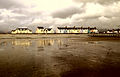
 Reflections, Borth - geograph.org.uk - 1711967.jpg 3,504 × 2,336; 586 KB
-
 Road widening in Capel Bangor - geograph.org.uk - 1110123.jpg 640 × 411; 59 KB
-
 Rocklee Llandysul.jpg 1,000 × 750; 275 KB
-
 Street2218e.JPG 690 × 539; 74 KB
-
 Tanbanc Villa, Llandygwydd - geograph.org.uk - 682752.jpg 640 × 404; 124 KB
-
 Tanybryn Isaf - geograph.org.uk - 962396.jpg 640 × 480; 253 KB
-
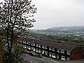
 Terraced housing at Penbanc - geograph.org.uk - 1732243.jpg 800 × 458; 85 KB
-

-

-

-
-
-

-
 Ty'n-ddol, Blaenannerch - geograph.org.uk - 737373.jpg 640 × 506; 178 KB
-
 Up from Adpar - geograph.org.uk - 920239.jpg 640 × 480; 78 KB
-

-

-
 Y Lon. During the heavy snow - geograph.org.uk - 353508.jpg 640 × 480; 71 KB
-
-
 As seen from a speeding train - geograph.org.uk - 1439408.jpg 640 × 426; 293 KB
-

-
 Bryn Salem Road - geograph.org.uk - 762499.jpg 640 × 480; 74 KB
-
 Bryn-einon, Brongwyn - geograph.org.uk - 745447.jpg 640 × 451; 91 KB
-
 Buildings at Castell Pridd - geograph.org.uk - 531381.jpg 640 × 492; 97 KB
-
 Bungalows, Blaenporth - geograph.org.uk - 740477.jpg 640 × 480; 101 KB
-
 Caemelyn, houses near the top - geograph.org.uk - 347772.jpg 640 × 480; 134 KB
-
 Caemorgan Road, Cardigan - geograph.org.uk - 689120.jpg 640 × 480; 74 KB
-
 Cilan, a house at the top of Caemelyn - geograph.org.uk - 347773.jpg 640 × 480; 177 KB
-
 Colourful terrace at Borth - geograph.org.uk - 532223.jpg 640 × 480; 109 KB
-
 Cwmsidan Cottage - geograph.org.uk - 682744.jpg 640 × 480; 145 KB
-
 Cwmtegryd - geograph.org.uk - 757108.jpg 640 × 509; 91 KB
-
 Dol Helyg - geograph.org.uk - 379386.jpg 640 × 480; 104 KB
-
 Dolwen House - geograph.org.uk - 658954.jpg 640 × 480; 73 KB
-
 Ffynnon-wen - geograph.org.uk - 774523.jpg 640 × 396; 48 KB
-
 Glan-y-Mor, Aberaeron - geograph.org.uk - 742574.jpg 640 × 428; 85 KB
-
 Glanffos, Blaenporth - geograph.org.uk - 740466.jpg 640 × 478; 97 KB
-
 Gwion Castle - geograph.org.uk - 700305.jpg 640 × 476; 90 KB
-
 Hen Efail, Blaenannerch - geograph.org.uk - 737371.jpg 640 × 418; 115 KB
-
 House backs, behind Pendre, Cardigan - geograph.org.uk - 206760.jpg 640 × 480; 91 KB
-
 House near Nanteirw, Blaenporth - geograph.org.uk - 740483.jpg 640 × 479; 114 KB
-
 Houses in Maesyderi - geograph.org.uk - 740462.jpg 640 × 451; 78 KB
-
 Houses on the Tywyn Farm estate - geograph.org.uk - 715821.jpg 640 × 394; 66 KB
-
 Llanfair Orllwyn - geograph.org.uk - 774519.jpg 640 × 482; 74 KB
-
 Llanfair Orllwyn Vicarage - geograph.org.uk - 774517.jpg 640 × 470; 99 KB
-
 Lonely house, Landyssul - geograph.org.uk - 581112.jpg 640 × 472; 82 KB
-
 Moelfre, Llangoedmor - geograph.org.uk - 707094.jpg 640 × 445; 123 KB
-
 New Row - geograph.org.uk - 423924.jpg 640 × 480; 76 KB
-
 Penparcau - geograph.org.uk - 656897.jpg 640 × 480; 82 KB
-
 Terfyn Mawr, Cenarth - geograph.org.uk - 683947.jpg 640 × 482; 96 KB
-
 Track leading to Rhos-Cyrnau - geograph.org.uk - 651573.jpg 640 × 427; 61 KB
-
 Villa Frongoch - geograph.org.uk - 345934.jpg 640 × 449; 154 KB
-
 Ynysfach - geograph.org.uk - 340260.jpg 640 × 480; 239 KB


.jpg)


.jpg)
.jpg)


