Category:Houses in Scotland

Wikimedia category | |||||
| Upload media | |||||
| Instance of | |||||
|---|---|---|---|---|---|
| Category combines topics | |||||
 | |||||
Constituent countries of the United Kingdom: England · Northern Ireland · Scotland · Wales – British Crown dependencies: Isle of Man · Jersey
British overseas territories: Bermuda · British Virgin Islands · Turks and Caicos Islands
British overseas territories: Bermuda · British Virgin Islands · Turks and Caicos Islands
Subcategories
This category has the following 42 subcategories, out of 42 total.
- Brick houses in Scotland (1 F)
!
- Ruins of houses in Scotland (4 F)
A
C
D
E
F
G
H
I
L
M
N
O
P
R
S
- St Colmac Manse (7 F)
W
Media in category "Houses in Scotland"
The following 115 files are in this category, out of 115 total.
-
 'The Cottage' - geograph.org.uk - 479775.jpg 640 × 480; 119 KB
-
 46, Main Street.jpg 3,456 × 4,608; 4.58 MB
-
 Ardechive - geograph.org.uk - 219109.jpg 640 × 480; 152 KB
-
 Balachroick Steading - geograph.org.uk - 319295.jpg 640 × 480; 114 KB
-
 Balachroick Steading - geograph.org.uk - 319317.jpg 640 × 480; 104 KB
-
 Ballachrochin from the Daless track - geograph.org.uk - 274805.jpg 640 × 480; 95 KB
-
 Ballieward - geograph.org.uk - 552918.jpg 640 × 384; 72 KB
-
 Balnaspirach, Nairn - geograph.org.uk - 277668.jpg 640 × 480; 180 KB
-
 Balquhidder Station - geograph.org.uk - 202924.jpg 640 × 480; 151 KB
-
 Belmont, Mavis Bank, Selkirk 2.jpg 1,920 × 1,280; 1.52 MB
-
 Belmont, Mavis Bank, Selkirk 3.jpg 1,280 × 1,920; 1.2 MB
-
 Belmont, Mavis Bank, Selkirk.jpg 1,280 × 1,920; 1.56 MB
-
 Boarded Up House and Ruin - geograph.org.uk - 444607.jpg 640 × 480; 67 KB
-
 Bracken - geograph.org.uk - 582884.jpg 640 × 425; 116 KB
-
 Braeside Park, Balloch - geograph.org.uk - 371454.jpg 640 × 427; 75 KB
-
 Brownhill - geograph.org.uk - 687786.jpg 640 × 427; 282 KB
-
 Burnhouse.jpg 1,920 × 1,280; 1.54 MB
-
 Caggan - geograph.org.uk - 362557.jpg 640 × 480; 105 KB
-
 Caldwellhouse.jpg 1,072 × 832; 266 KB
-
 Camps - geograph.org.uk - 264376.jpg 640 × 480; 87 KB
-
 Carbeth Guthrie.png 481 × 342; 136 KB
-
 Carlock House - geograph.org.uk - 698254.jpg 640 × 479; 104 KB
-
 Carlock House - geograph.org.uk - 712093.jpg 640 × 479; 124 KB
-
 Carlock House - geograph.org.uk - 713713.jpg 640 × 479; 104 KB
-
 Church Hill House - geograph.org.uk - 481189.jpg 640 × 480; 102 KB
-
 Clashnamuiach - geograph.org.uk - 506304.jpg 640 × 426; 61 KB
-
 Cluanach - geograph.org.uk - 700521.jpg 640 × 410; 82 KB
-
 Cornharrow, Carsphairn - geograph.org.uk - 534381.jpg 640 × 480; 113 KB
-
 Craigbegg Smithy Cottage - geograph.org.uk - 552045.jpg 640 × 426; 158 KB
-
 Dalnaby, Aviemore - geograph.org.uk - 378127.jpg 640 × 427; 73 KB
-
 Drawing of the manor. Anonymus. No date.jpg 2,525 × 1,675; 626 KB
-
 Drumguish - geograph.org.uk - 714964.jpg 640 × 480; 67 KB
-
 Earlston, Thorn Street, The Thorn, Wash House & Stable Block 2.jpg 1,280 × 1,920; 1.38 MB
-
 Easter Anagach - geograph.org.uk - 552963.jpg 640 × 480; 78 KB
-
 Falkland Terrace - geograph.org.uk - 383736.jpg 640 × 430; 52 KB
-
 Fergushill school house.JPG 2,288 × 1,712; 1.22 MB
-
 Flying the flag - geograph.org.uk - 479490.jpg 640 × 480; 118 KB
-
 Geilsland House 4.JPG 1,712 × 2,288; 1.19 MB
-
 Glenlea, near Straiton - geograph.org.uk - 264617.jpg 640 × 480; 80 KB
-
 Ground Plan of Burke's House.jpg 691 × 1,116; 576 KB
-
 Gutcher - geograph.org.uk - 628286.jpg 640 × 480; 56 KB
-
 Gutcher - geograph.org.uk - 628289.jpg 640 × 480; 77 KB
-
 Gutcher - geograph.org.uk - 629019.jpg 426 × 640; 68 KB
-
 Hall of caldwell.jpg 2,560 × 1,632; 1 MB
-
 Hillock, Lyth - geograph.org.uk - 479383.jpg 640 × 480; 119 KB
-
 House and Barn - geograph.org.uk - 342950.jpg 640 × 480; 82 KB
-
 House and drive at Gersa - geograph.org.uk - 543551.jpg 640 × 480; 145 KB
-
 House and garage - geograph.org.uk - 487262.jpg 640 × 399; 56 KB
-
 House at Broomton farm road-end - geograph.org.uk - 266398.jpg 640 × 480; 156 KB
-
 House at Grantfield - geograph.org.uk - 325604.jpg 597 × 400; 74 KB
-
 House at Newlands of Geise Janetstown - geograph.org.uk - 723992.jpg 640 × 480; 47 KB
-
 House at T-junction - geograph.org.uk - 369553.jpg 640 × 480; 121 KB
-
 House beside Tain Pottery - geograph.org.uk - 277804.jpg 640 × 480; 169 KB
-
 House near Raitcastle - geograph.org.uk - 255920.jpg 640 × 441; 211 KB
-
 House near the Black Isle Brewery - geograph.org.uk - 361315.jpg 640 × 482; 75 KB
-
 Houses at Gashagich - geograph.org.uk - 325567.jpg 400 × 597; 61 KB
-
 Houses at Sanna - geograph.org.uk - 411140.jpg 640 × 480; 61 KB
-
 Houses at Semblister - geograph.org.uk - 567870.jpg 640 × 429; 90 KB
-
 Houses near Tarlogie Wood - geograph.org.uk - 285848.jpg 640 × 480; 191 KB
-
 Houses on A9 - geograph.org.uk - 483288.jpg 640 × 480; 85 KB
-
 Houses on the Coast at Auchmithie - geograph.org.uk - 647973.jpg 640 × 425; 48 KB
-
 Housing at Holm Dell - geograph.org.uk - 375337.jpg 640 × 480; 164 KB
-
 Housing estate above Fort William - geograph.org.uk - 712783.jpg 640 × 480; 64 KB
-
 Inverness Housing Estate - geograph.org.uk - 277018.jpg 640 × 480; 99 KB
-
 Kinrara - geograph.org.uk - 370935.jpg 640 × 480; 135 KB
-
 Lochboisdale01LB.jpg 4,608 × 3,456; 3.82 MB
-
 Low Arkland - geograph.org.uk - 464025.jpg 640 × 480; 95 KB
-
 Lower Largo Beach Front - geograph.org.uk - 34086.jpg 640 × 480; 121 KB
-
 Mar Lodge Summer 1995.jpg 800 × 300; 84 KB
-
 Mid gate lodge.JPG 2,288 × 1,712; 1.39 MB
-
 Millburn lodge eglinton.JPG 2,288 × 1,712; 1.29 MB
-
 Modern housing at Balloch - geograph.org.uk - 315474.jpg 640 × 480; 45 KB
-
 Montgreenan south lodge.JPG 2,288 × 1,712; 1.42 MB
-
 Montgreenan West Lodge.JPG 2,288 × 1,712; 1.28 MB
-
 Motoring aboard (1908) (14596144790).jpg 2,142 × 1,742; 1.21 MB
-
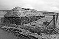
 Na Gearrannan (Garenin) - geograph.org.uk - 203927.jpg 640 × 391; 206 KB
-
 Nethy Bridge - geograph.org.uk - 559992.jpg 640 × 480; 72 KB
-
 New Build, Camerory - geograph.org.uk - 708894.jpg 640 × 480; 98 KB
-
 New house at Ruthven - geograph.org.uk - 274491.jpg 640 × 476; 54 KB
-
 New housing development at Baldow - geograph.org.uk - 370932.jpg 640 × 480; 69 KB
-
 NewLanark02LB.jpg 4,608 × 3,456; 3.99 MB
-
 Newly built house - Easter Culbo - geograph.org.uk - 352518.jpg 640 × 480; 56 KB
-
 Off the grid (49804881072).jpg 5,922 × 3,282; 4.28 MB
-
 Old house, Roag - geograph.org.uk - 1189596.jpg 640 × 427; 148 KB
-
 On the edge of Dallaschyle Wood - geograph.org.uk - 372679.jpg 640 × 480; 134 KB
-

-
 Poyntzfield Mains - geograph.org.uk - 617501.jpg 640 × 480; 96 KB
-
 Robert Little - A remote Scottish house - circa 1890 - Little-97946.jpg 1,301 × 1,950; 533 KB
-

-
 Rumachroy by Newlands of Fleenas Woods. - geograph.org.uk - 300894.jpg 640 × 426; 102 KB
-
 Sandend - geograph.org.uk - 404728.jpg 640 × 427; 64 KB
-
 Scapa Cottage.JPG 2,288 × 1,712; 1.28 MB
-
 Scottish Borders 004.jpg 4,272 × 2,848; 2.95 MB
-
 Sleivemore - geograph.org.uk - 216040.jpg 640 × 480; 96 KB
-
 Stonehavenpano.jpg 22,901 × 2,405; 10.56 MB
-
 Taigh Iain Ois - geograph.org.uk - 1033845.jpg 640 × 480; 51 KB
-
 Taigh Thormoid Dhuibh - geograph.org.uk - 939471.jpg 640 × 360; 56 KB
-
 Taigh Thormoid Dhuibh - geograph.org.uk - 972788.jpg 640 × 480; 69 KB
-
 Taigh Thormoid Dhuibh - geograph.org.uk - 972819.jpg 640 × 480; 65 KB
-
 Taigh Thormoid Dhuibh, Raasay - geograph.org.uk - 935011.jpg 640 × 360; 62 KB
-
 The Fishermans Loft (8016018629).jpg 4,752 × 3,168; 7.73 MB
-
 The house at Lethen Smiddy - geograph.org.uk - 257482.jpg 640 × 480; 160 KB
-
 The road into Seisiadar. - geograph.org.uk - 502999.jpg 640 × 359; 55 KB
-
 The road to Chapelton - geograph.org.uk - 504747.jpg 640 × 480; 102 KB
-
 Tigh Beg - geograph.org.uk - 303673.jpg 640 × 480; 112 KB
-
 Tigh Dubh and peat stack - geograph.org.uk - 388295.jpg 640 × 402; 124 KB
-
 Tigh na Mara - geograph.org.uk - 479665.jpg 640 × 480; 119 KB
-

-
 Tigh-na-Craig - geograph.org.uk - 305486.jpg 600 × 399; 74 KB
-
 Ullinish - geograph.org.uk - 132382.jpg 640 × 480; 99 KB
-

-
 Wester Lairgs - geograph.org.uk - 324534.jpg 640 × 480; 115 KB
-
 Wester Milton - geograph.org.uk - 257470.jpg 640 × 480; 137 KB
-
 Westerloch House - geograph.org.uk - 479281.jpg 640 × 480; 117 KB
-
 Fulhope - geograph.org.uk - 99709.jpg 640 × 480; 112 KB


_(14596144790).jpg)
_-_geograph.org.uk_-_203927.jpg)


.jpg)


.jpg)


_-_geograph.org.uk_-_397148.jpg)


