Category:Houses in Suffolk
Ceremonial counties of England: Bedfordshire · Berkshire · Buckinghamshire · Cambridgeshire · Cheshire · Cornwall · Cumbria · Derbyshire · Devon · Dorset · Durham · East Riding of Yorkshire · East Sussex · Essex · Gloucestershire · Greater London · Greater Manchester · Hampshire · Herefordshire · Hertfordshire · Isle of Wight · Kent · Lancashire · Leicestershire · Lincolnshire · Merseyside · Norfolk · North Yorkshire · Northamptonshire · Northumberland · Nottinghamshire · Oxfordshire · Rutland · Shropshire · Somerset · South Yorkshire · Staffordshire · Suffolk · Surrey · Tyne and Wear · Warwickshire · West Midlands · West Sussex · West Yorkshire · Wiltshire · Worcestershire
City-counties: Bristol · City of London
Former historic counties: Huntingdonshire · Westmorland ·
Other former counties:
City-counties: Bristol · City of London
Former historic counties: Huntingdonshire · Westmorland ·
Other former counties:
Wikimedia category | |||||
| Upload media | |||||
| Instance of | |||||
|---|---|---|---|---|---|
| |||||
Subcategories
This category has the following 80 subcategories, out of 80 total.
*
3
- 32 Church Lane, Sproughton (3 F)
A
B
- The Bell, Lowestoft (2 F)
- Burstall Hall (3 F)
C
- Chalk Hall Farm (4 F)
- Church Farm, Chillesford (5 F)
- Church Farm, Hasketon (5 F)
- Cockfield Hall, Witnesham (1 F)
- Corner Farm, Sibton (3 F)
- Cransford Hall (2 F)
F
- Fishers Farm, Suffolk (2 F)
- The Forge, Huntingfield (3 F)
G
- Gate Cottage, Parham (5 F)
- The Gate House, Witnesham (2 F)
- Gate Lodge, Eriswell (3 F)
- Grove House, Peasenhall (2 F)
- The Grove, Edwardstone (4 F)
H
- Hathaway Cottage, Suffolk (2 F)
- Haven House, Yoxford (2 F)
- Hawkedon House (3 F)
- Hazlewood Hall Farm, Suffolk (2 F)
- Hemley Hall (3 F)
- Holmhill Farm (6 F)
- Hunters Moon, Edwardstone (13 F)
L
- Landwade Hall (2 F)
- Langley View, Babergh (14 F)
- Little Thatch, Edwardstone (1 F)
- Loudham Mill (3 F)
- Low Grange Farm, Suffolk (2 F)
M
- The Maples, Easton (2 F)
- Milestone House, Yoxford (3 F)
- Cherwell House, Suffolk (3 F)
- Moat Farm, Otley (2 F)
N
- North Grange, Suffolk (2 F)
- North Green Farm, Sibton (2 F)
O
- The Old Rectory, Dallinghoo (3 F)
- Old School House, Hasketon (5 F)
- The Old School, Grundisburgh (3 F)
- The Old Shop, Nacton (2 F)
- Orwell Park House (2 F)
P
- Pipps Farm (2 F)
Q
- Quay House, Reydon (5 F)
R
- Red Court, Suffolk (10 F)
- Redhouse Farm, Ashbocking (2 F)
- Round Maple Cottage (1 F)
S
- Smoky House, Suffolk (8 F)
- Swilland Mill (3 F)
T
- Theberton Grange (2 F)
- Tinker's House, Suffolk (6 F)
W
- Walnut Tree Farm, Cookley (5 F)
- Waterloo Farm, Sotterley (2 F)
- Well House, Edwardstone (10 F)
- Westhall Old School (4 F)
- Westhouse Cottage, Suffolk (2 F)
- Wood House, Dallinghoo (5 F)
Media in category "Houses in Suffolk"
The following 200 files are in this category, out of 428 total.
(previous page) (next page)-
 'The Estate Offices' - geograph.org.uk - 1125730.jpg 640 × 480; 85 KB
-
 1030872 - Orford, 117 Castle Hill.jpg 6,000 × 4,000; 9.09 MB
-
 323 High Street.jpg 4,800 × 3,600; 9.19 MB
-
 A house at Withersdale Street - geograph.org.uk - 362458.jpg 640 × 443; 99 KB
-

-

-
 A house on the A140 - geograph.org.uk - 379656.jpg 640 × 480; 58 KB
-
 Abandoned house outside Harkstead - geograph.org.uk - 1384845.jpg 640 × 480; 80 KB
-
 All Hallows Court, Clapgate Lane - geograph.org.uk - 1144143.jpg 640 × 480; 116 KB
-
-
 Barn conversion in progress - geograph.org.uk - 1333702.jpg 640 × 480; 106 KB
-
 Geese on the River Lark, Mildenhall - geograph.org.uk - 1309818.jpg 512 × 640; 128 KB
-
 BealingsOldVicarage.JPG 1,200 × 800; 315 KB
-
 Bedford Lodge Newmarket.jpg 1,013 × 769; 277 KB
-
-
 Blue house - geograph.org.uk - 917927.jpg 640 × 480; 99 KB
-
 Chapel At The Junction - geograph.org.uk - 292970.jpg 640 × 480; 149 KB
-
 Chapel House, Brandeston - geograph.org.uk - 1424573.jpg 640 × 480; 108 KB
-
 Chillesford Lodge - geograph.org.uk - 427023.jpg 640 × 429; 93 KB
-
 Claydon Suffolk House.jpg 600 × 364; 71 KB
-
 Converted barn, Scotland Street - geograph.org.uk - 130621.jpg 640 × 416; 46 KB
-
 Creeting House - geograph.org.uk - 1108155.jpg 640 × 431; 95 KB
-

-
 Dalham smock mill.jpg 2,748 × 1,990; 2.34 MB
-
 Decoy Lodge - geograph.org.uk - 250476.jpg 640 × 480; 110 KB
-
 Demolition in Meeting Lane - geograph.org.uk - 1775857.jpg 640 × 480; 62 KB
-
 Derelict Houses on Benton Street - geograph.org.uk - 628136.jpg 640 × 480; 56 KB
-
 Eagle House, Trimley St Mary 1.jpg 2,516 × 1,987; 995 KB
-
 Elm Hill House - geograph.org.uk - 1303020.jpg 480 × 640; 69 KB
-
 Elm Hill House - geograph.org.uk - 1308528.jpg 640 × 480; 83 KB
-
 Ex RAF housing - geograph.org.uk - 432189.jpg 640 × 481; 106 KB
-
 Fairfield Road, Framlingham - geograph.org.uk - 178427.jpg 640 × 480; 87 KB
-
 Grand houses fronting Aldeburgh beach - geograph.org.uk - 758232.jpg 640 × 421; 91 KB
-
 Groton House - geograph.org.uk - 185892.jpg 640 × 480; 96 KB
-
 Groton Wood Cottage - geograph.org.uk - 1474550.jpg 640 × 429; 85 KB
-
 HardwickHouse.jpg 838 × 620; 127 KB
-
 HardwickHouseEstate.jpg 853 × 600; 113 KB
-
 HardwickHouseStaircase.jpg 650 × 854; 121 KB
-
 Henham Old Hall Tudor frontage.jpg 1,644 × 1,283; 292 KB
-
 Hmoautstei.jpg 500 × 325; 46 KB
-
 Home of author George Orwell, Southwold - geograph.org.uk - 61720.jpg 640 × 426; 102 KB
-
 Horham Rose Farm geograph-3690255-by-Ben-Brooksbank.jpg 2,391 × 1,443; 2.58 MB
-
 House and garage, Offton - geograph.org.uk - 968593.jpg 640 × 438; 96 KB
-
 House and glimpse of Mellis church - geograph.org.uk - 1083138.jpg 640 × 478; 78 KB
-
 House at Bell's Cross - geograph.org.uk - 1333693.jpg 640 × 480; 81 KB
-
 House at Bramford, Suffolk - geograph.org.uk - 221416.jpg 640 × 480; 74 KB
-
 House at Chilton Leys - geograph.org.uk - 957827.jpg 640 × 450; 91 KB
-
 House at Hadleigh Heath - geograph.org.uk - 1474396.jpg 640 × 480; 120 KB
-
 House at High Street Green, Suffolk - geograph.org.uk - 237280.jpg 640 × 480; 96 KB
-
 House at Kersey Vale - geograph.org.uk - 1474438.jpg 640 × 480; 144 KB
-
 House at lane junction, Naughton - geograph.org.uk - 1071426.jpg 640 × 476; 98 KB
-
 House at Monks Eleigh Tye - geograph.org.uk - 724727.jpg 640 × 429; 105 KB
-
 House at Severn Spar Farm - geograph.org.uk - 860028.jpg 640 × 480; 143 KB
-
 House at Stanway Green - geograph.org.uk - 548314.jpg 640 × 480; 171 KB
-

-
 House at Wetherden Upper Town - geograph.org.uk - 1267042.jpg 640 × 448; 96 KB
-
 House at Whatfield - geograph.org.uk - 618517.jpg 640 × 464; 82 KB
-
 House at Withermarsh Green - geograph.org.uk - 301737.jpg 640 × 480; 69 KB
-

-
 House by Finningham churchyard - geograph.org.uk - 1217172.jpg 640 × 434; 83 KB
-
 House by Grove Hill - geograph.org.uk - 1001513.jpg 640 × 368; 72 KB
-
 House by Gulpher Road - geograph.org.uk - 1443333.jpg 640 × 431; 70 KB
-
 House by lane corner near Ringshall - geograph.org.uk - 1076660.jpg 640 × 465; 84 KB
-
 House by Low Street - geograph.org.uk - 1424535.jpg 640 × 427; 93 KB
-
 House by Maskell's Lane - geograph.org.uk - 1070868.jpg 640 × 431; 69 KB
-
 House by the Bacton Hall farm road - geograph.org.uk - 1266949.jpg 640 × 450; 70 KB
-

-
 House frontage, Poystreet Green - geograph.org.uk - 649692.jpg 640 × 524; 125 KB
-
 House in Boot Street - geograph.org.uk - 1213799.jpg 640 × 480; 76 KB
-
 House in South Green - geograph.org.uk - 2708662.jpg 3,072 × 2,304; 1.48 MB
-
 House in the country - geograph.org.uk - 1458839.jpg 640 × 481; 69 KB
-
 House in the trees - geograph.org.uk - 1105645.jpg 640 × 480; 143 KB
-
 House in Upper Layham - geograph.org.uk - 1265651.jpg 451 × 640; 88 KB
-
 House near Bacton Hall - geograph.org.uk - 1266942.jpg 640 × 429; 78 KB
-
 House near Barham Green - geograph.org.uk - 933605.jpg 640 × 493; 133 KB
-
 House near Harkstead Church - geograph.org.uk - 1282816.jpg 640 × 453; 104 KB
-
 House near Jack's Farmhouse - geograph.org.uk - 1162040.jpg 640 × 454; 86 KB
-
 House near Playters New Farm - geograph.org.uk - 978303.jpg 640 × 477; 99 KB
-
 House On Brome Avenue - geograph.org.uk - 1542300.jpg 640 × 480; 140 KB
-
 House on Felixstowe Road - geograph.org.uk - 1097525.jpg 640 × 480; 89 KB
-
 House on Hadleigh High Street - geograph.org.uk - 628164.jpg 640 × 480; 63 KB
-
 House on Henley Road - geograph.org.uk - 1333480.jpg 640 × 480; 97 KB
-
 House on High Street, Walton - geograph.org.uk - 1268605.jpg 640 × 480; 148 KB
-
 House on Hobbies Lane - geograph.org.uk - 889055.jpg 640 × 427; 65 KB
-
 House on Southwold promenade - geograph.org.uk - 1073087.jpg 640 × 427; 89 KB
-
 House on Stowmarket Road - geograph.org.uk - 1277970.jpg 640 × 480; 122 KB
-
 House on the A143 - geograph.org.uk - 313116.jpg 640 × 480; 56 KB
-
 House On The Corner - geograph.org.uk - 1656739.jpg 640 × 480; 62 KB
-

-
 House on Tye Lane, Willisham Tye - geograph.org.uk - 968204.jpg 640 × 528; 101 KB
-
 House opposite start of Jockey's Lane - geograph.org.uk - 549583.jpg 480 × 640; 67 KB
-
 House outside Hasketon - geograph.org.uk - 1280998.jpg 640 × 480; 124 KB
-

-
 House, High Road East - geograph.org.uk - 1325977.jpg 640 × 497; 117 KB
-
 House, Ipswich Road - geograph.org.uk - 1299541.jpg 640 × 410; 90 KB
-
 House, London Road - geograph.org.uk - 1309400.jpg 640 × 480; 122 KB
-
 House, The Street, Hitcham - geograph.org.uk - 1600549.jpg 640 × 443; 103 KB
-
 House, Westerfield Road - geograph.org.uk - 1223055.jpg 640 × 480; 82 KB
-
 Houses across Cliff Road - geograph.org.uk - 1442414.jpg 640 × 434; 86 KB
-
 Houses along Cliff Road - geograph.org.uk - 1326242.jpg 640 × 480; 101 KB
-
 Houses along Ipswich Road - geograph.org.uk - 1351129.jpg 640 × 480; 76 KB
-
 Houses along Old Barrack Road - geograph.org.uk - 1280684.jpg 640 × 480; 86 KB
-
 Houses along Partridge Road - geograph.org.uk - 1348249.jpg 640 × 480; 60 KB
-
 Houses along Shamrock Avenue - geograph.org.uk - 1348230.jpg 640 × 480; 77 KB
-

-
 Houses along Stone Lodge Lane - geograph.org.uk - 1348209.jpg 640 × 480; 60 KB
-
 Houses along the B1066 at Boxted - geograph.org.uk - 1400784.jpg 640 × 480; 84 KB
-
 Houses along Wicklow Road - geograph.org.uk - 1294513.jpg 640 × 458; 100 KB
-
 Houses along Woodpecker Road - geograph.org.uk - 1348254.jpg 640 × 480; 69 KB
-

-
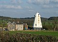
 Houses and windmill - geograph.org.uk - 1183319.jpg 640 × 422; 65 KB
-
 Houses at Barham Green - geograph.org.uk - 933600.jpg 640 × 407; 103 KB
-
 Houses at Bures Green - geograph.org.uk - 373293.jpg 640 × 480; 81 KB
-
 Houses at Creeting Hills - geograph.org.uk - 1746920.jpg 1,024 × 682; 518 KB
-
 Houses at Kersey Tye - geograph.org.uk - 1474540.jpg 640 × 439; 111 KB
-
 Houses at Mill Green - geograph.org.uk - 330907.jpg 640 × 402; 60 KB
-
 Houses at Offton Place - geograph.org.uk - 1737980.jpg 1,024 × 768; 411 KB
-
 Houses at Preston St Mary - geograph.org.uk - 1598435.jpg 640 × 458; 84 KB
-
 Houses at road corner - geograph.org.uk - 1294489.jpg 640 × 436; 87 KB
-
 Houses at Shelland - geograph.org.uk - 998772.jpg 640 × 415; 86 KB
-
 Houses at Shipmeadow - geograph.org.uk - 976492.jpg 640 × 477; 90 KB
-

-
 Houses At Timworth Heath - geograph.org.uk - 1421897.jpg 640 × 480; 66 KB
-
 Houses at Willisham Tye - geograph.org.uk - 968178.jpg 640 × 490; 124 KB
-
 Houses at Workhouse Green, Suffolk - geograph.org.uk - 227981.jpg 640 × 464; 74 KB
-
 Houses at Wortham Ling - geograph.org.uk - 1462699.jpg 640 × 480; 81 KB
-
 Houses beside B1078, Barking - geograph.org.uk - 653698.jpg 640 × 430; 64 KB
-

-
 Houses by Gulpher Road - geograph.org.uk - 1443320.jpg 640 × 472; 84 KB
-
 Houses by Ipswich Road, Claydon - geograph.org.uk - 793739.jpg 640 × 461; 98 KB
-
 Houses by lane west of Ringshall church - geograph.org.uk - 1076665.jpg 640 × 456; 122 KB
-
 Houses by Somerleyton Marina - geograph.org.uk - 1506117.jpg 513 × 640; 114 KB
-

-
 Houses by the B1113 - geograph.org.uk - 1735841.jpg 1,024 × 768; 435 KB
-
 Houses by the lane to Cretingham - geograph.org.uk - 1423676.jpg 640 × 429; 97 KB
-
-
 Houses in Coddenham - geograph.org.uk - 583493.jpg 640 × 480; 85 KB
-
 Houses in Flowton - geograph.org.uk - 1736141.jpg 1,024 × 597; 415 KB
-
 Houses in Mellis - geograph.org.uk - 1083199.jpg 640 × 480; 108 KB
-

-

-
 Houses in Sea Road, Felixstowe - geograph.org.uk - 981662.jpg 640 × 427; 80 KB
-
 Houses in Thrandeston - geograph.org.uk - 1297524.jpg 640 × 453; 106 KB
-
 Houses in Upper Layham - geograph.org.uk - 1265635.jpg 640 × 438; 71 KB
-
 Houses Malting End - geograph.org.uk - 992487.jpg 640 × 480; 93 KB
-
 Houses near Debenham Church - geograph.org.uk - 1230281.jpg 640 × 480; 76 KB
-
 Houses near Debenham Church - geograph.org.uk - 1230308.jpg 640 × 452; 86 KB
-
 Houses near the Combs Ford roundabout - geograph.org.uk - 1715326.jpg 1,024 × 798; 514 KB
-
 Houses near the sea - geograph.org.uk - 1442486.jpg 640 × 379; 66 KB
-
 Houses on Acton Road - geograph.org.uk - 1236465.jpg 640 × 450; 88 KB
-
 Houses on Aldham Road - geograph.org.uk - 1439028.jpg 640 × 490; 110 KB
-
 Houses on Back Lane, Washbrook - geograph.org.uk - 1051014.jpg 640 × 432; 68 KB
-
 Houses on Castle Road - geograph.org.uk - 1439032.jpg 640 × 419; 91 KB
-
 Houses on Greenspire Grove - geograph.org.uk - 1348273.jpg 640 × 480; 58 KB
-
 Houses on Handford Road - geograph.org.uk - 1468375.jpg 640 × 480; 100 KB
-
 Houses on High Road East - geograph.org.uk - 1442317.jpg 640 × 439; 73 KB
-
 Houses on High Road West - geograph.org.uk - 1442313.jpg 640 × 427; 73 KB
-
 Houses on Highfield Road - geograph.org.uk - 1294464.jpg 640 × 438; 75 KB
-
 Houses on Highfield Road - geograph.org.uk - 1294469.jpg 640 × 457; 97 KB
-
 Houses on London Road - geograph.org.uk - 1468387.jpg 640 × 442; 84 KB
-
 Houses on Old Barrack Road - geograph.org.uk - 1183413.jpg 640 × 474; 87 KB
-
 Houses on Roman Way - geograph.org.uk - 1442404.jpg 640 × 449; 116 KB
-

-
 Houses on Stutton Close - geograph.org.uk - 1602497.jpg 640 × 430; 99 KB
-

-
 Houses on the Green - geograph.org.uk - 859087.jpg 640 × 427; 80 KB
-
 Houses on the High Street, Walton - geograph.org.uk - 1442279.jpg 640 × 449; 67 KB
-
 Houses on the outskirts of Claydon - geograph.org.uk - 1251038.jpg 640 × 480; 137 KB
-
 Houses on Walton High Street - geograph.org.uk - 1442295.jpg 640 × 478; 94 KB
-
 Houses on Warren Hill Road - geograph.org.uk - 1183422.jpg 640 × 466; 73 KB
-

-
 Houses set back from Highfield Road - geograph.org.uk - 1294472.jpg 640 × 476; 114 KB
-
 Houses set back from Pinmill Road - geograph.org.uk - 1432804.jpg 640 × 480; 121 KB
-

-
 Houses, 1901 - geograph.org.uk - 1147460.jpg 640 × 363; 55 KB
-
 Houses, Copdock - geograph.org.uk - 1309427.jpg 640 × 377; 58 KB
-
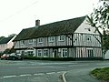
 Ivy League (East Bergholt) - geograph.org.uk - 40579.jpg 640 × 482; 85 KB
-
 Large house in Great Finborough - geograph.org.uk - 1613237.jpg 640 × 461; 106 KB
-
 Large red brick house by Henley Road - geograph.org.uk - 933801.jpg 640 × 463; 70 KB
-
 Leatherfarm Hall, Edwardstone - geograph.org.uk - 185663.jpg 640 × 480; 87 KB
-
 Looking down Bent Hill, Felixstowe, January 2023.jpg 5,184 × 3,456; 6.98 MB
-
 Market Hill Woodbridge - geograph.org.uk - 492974.jpg 640 × 480; 104 KB
-
 Modern houses - geograph.org.uk - 1001545.jpg 640 × 423; 71 KB
-
 Modern houses at the edge of Woolpit - geograph.org.uk - 1625965.jpg 640 × 429; 140 KB
-
 Modern houses in Ringshall - geograph.org.uk - 968268.jpg 640 × 429; 90 KB
-
 Modern houses in Thurston - geograph.org.uk - 1281213.jpg 640 × 426; 86 KB
-
 Modern houses, Henley - geograph.org.uk - 965524.jpg 640 × 424; 74 KB
-

-

-
 Monks Eleigh Tye - geograph.org.uk - 724735.jpg 640 × 504; 101 KB
-
 Mulberry Cottage, Groton - geograph.org.uk - 185888.jpg 640 × 480; 72 KB
-
 New house on Primrose Lane - geograph.org.uk - 978189.jpg 640 × 477; 109 KB
-
 New houses at Barham - geograph.org.uk - 1251043.jpg 640 × 480; 53 KB
-
 New houses in Ashbocking - geograph.org.uk - 1351103.jpg 640 × 480; 73 KB
-
 New houses on Ropers Lane - geograph.org.uk - 971870.jpg 640 × 480; 86 KB
-

-
 New houses, Belstead - geograph.org.uk - 1309512.jpg 640 × 480; 82 KB
-

-
 New housing at Red Lodge - geograph.org.uk - 207914.jpg 640 × 427; 67 KB
-
 New housing development - geograph.org.uk - 1044708.jpg 640 × 528; 91 KB


_-_geograph.org.uk_-_40579.jpg)


