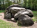
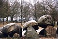
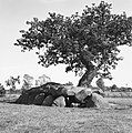
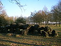
Category:Hunebed D18 in Rolde
| Object location | | View all coordinates using: OpenStreetMap |
|---|
dolmen in the Netherlands  | |||||
| Upload media | |||||
| Instance of | |||||
|---|---|---|---|---|---|
| Part of | |||||
| Location | Rolde, Drenthe, Netherlands | ||||
| Located on street |
| ||||
 | |||||
|
This is a category about rijksmonument number 420185
|
| Address |
|
Media in category "Hunebed D18 in Rolde"
The following 18 files are in this category, out of 18 total.
-
 Hunebed bij Rolde, Bestanddeelnr 254-5163.jpg 2,658 × 2,635; 1.17 MB
-
 Hunebed bij Rolde, Bestanddeelnr 254-5164.jpg 2,658 × 2,623; 1.2 MB
-
 Hunebed bij Rolde, Bestanddeelnr 254-5165.jpg 2,652 × 2,650; 1.36 MB
-
 Hunebed bij Rolde, Bestanddeelnr 254-5167.jpg 2,649 × 2,626; 1.26 MB
-
 Hunebed D18 01.jpg 675 × 1,200; 635 KB
-
 Hunebed D18 02.jpg 1,920 × 1,080; 1.07 MB
-
 Hunebed D18 03.jpg 3,648 × 2,736; 5.34 MB
-
 Hunebed D18 bij Rolde 2008.jpg 2,592 × 1,653; 861 KB
-
 Hunebed D18 bij Rolde.jpg 1,771 × 1,184; 227 KB
-
 Hunebed D18+D17 bij Rolde.jpg 1,772 × 1,192; 239 KB
-
 Hunebed in Rolde (Drenthe) - Nationaal Archief - 255-9894.jpg 2,617 × 2,628; 977 KB
-
 Hunebed met eikeboom en staande man, Drenthe, RP-F-2005-33.jpg 3,932 × 2,540; 1.08 MB
-
 Hunebed Rolde.jpg 11,401 × 2,213; 5.22 MB
-
 Karakteristieke landschappen, hunebedden, Bestanddeelnr 164-0081.jpg 3,302 × 2,374; 1.87 MB
-
 Karakteristieke landschappen, hunnebedden, Bestanddeelnr 164-0078.jpg 2,590 × 2,608; 1.72 MB
-
 P9010133 Hunnenbed.jpg 2,288 × 1,712; 652 KB
-
 Pieterpad-Rolde-hunebedden.jpg 2,048 × 1,536; 1.01 MB
-
 Zicht op hunebed D18,--Archeoregio 1 - Rolde - 20425889 - RCE.jpg 1,200 × 900; 320 KB


_-_Nationaal_Archief_-_255-9894.jpg)


