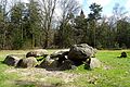
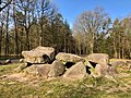
Category:Hunebed D30 in Boswachterij Exloo
| Object location | | View all coordinates using: OpenStreetMap |
|---|
dolmen in the Netherlands  | |||||
| Upload media | |||||
| Instance of | |||||
|---|---|---|---|---|---|
| Part of | |||||
| Location | Exloo, Borger-Odoorn, Drenthe, Netherlands | ||||
| Street address |
| ||||
| Heritage designation |
| ||||
 | |||||
|
This is a category about rijksmonument number 467493
|
| Address |
|
Media in category "Hunebed D30 in Boswachterij Exloo"
The following 17 files are in this category, out of 17 total.
-
 20170405 hunebed D30 Exloo.jpg 5,184 × 3,456; 5.48 MB
-
 20200408 hunebed D30.jpg 4,032 × 3,024; 4.57 MB
-
 20200408 hunebed2 D30.jpg 5,184 × 3,456; 5.74 MB
-
 Borger-Odoorn Exloo - Bodenpad + D30 01 ies.jpg 3,744 × 5,616; 27.64 MB
-
 Borger-Odoorn Exloo - Bodenpad + D30 02 ies.jpg 3,744 × 5,616; 17.92 MB
-
 Borger-Odoorn Exloo - Bodenpad + D30 03 ies.jpg 5,616 × 3,744; 15.04 MB
-
 Borger-Odoorn Exloo - Bodenpad - D30 01 ies.jpg 5,616 × 3,744; 30.11 MB
-
 Borger-Odoorn Exloo - Bodenpad - D30 02 ies.jpg 5,616 × 3,743; 27.21 MB
-
 Borger-Odoorn Exloo - Bodenpad - D30 03 ies.jpg 5,616 × 3,744; 25.6 MB
-
 Borger-Odoorn Exloo - Bodenpad - D30 04 ies.jpg 5,616 × 3,744; 27.53 MB
-
 Borger-Odoorn Exloo - Bodenpad - D30 05 ies.jpg 3,744 × 5,616; 25.95 MB
-
 Borger-Odoorn Exloo - Bodenpad - D30 06 ies.jpg 5,616 × 3,744; 27.84 MB
-
 D30 hunebed 2.jpg 4,608 × 2,592; 7.85 MB
-
 D30 hunebed.jpg 4,608 × 2,592; 7.56 MB
-
 Dafjes en hunebed (19675246052).jpg 1,536 × 1,024; 1.51 MB
-
 Hunebed D30 bij Exloo.jpg 1,205 × 800; 211 KB
-
 Hunebed D30 Goedeljee.jpg 2,000 × 1,542; 508 KB


.jpg)

