Category:Hungry Horse Dam, Montana
arch dam on the South Fork Flathead River in Montana, USA  | |||||
| Upload media | |||||
| Instance of | |||||
|---|---|---|---|---|---|
| Location | Flathead County, Montana | ||||
| Inception |
| ||||
| Nominal power capacity |
| ||||
| Length |
| ||||
| Drainage basin |
| ||||
| Reservoir created |
| ||||
 | |||||
Subcategories
This category has the following 4 subcategories, out of 4 total.
B
G
- Gantry Crane (Hungry Horse Dam) (19 F)
H
- Hungry Horse Reservoir (13 F)
V
- Visitor Center, Hungry Horse Dam (16 F)
Media in category "Hungry Horse Dam, Montana"
The following 170 files are in this category, out of 170 total.
-
 Black Bear, West Side Road, Hungry Horse, MT - 51533723024.jpg 1,830 × 2,440; 1.24 MB
-
 Black Bear, West Side Road, Hungry Horse, MT.jpg 3,444 × 2,583; 4.47 MB
-
 Carolyn’s Cafe Sign, Hungry Horse, MT.jpg 2,622 × 3,277; 3.55 MB
-
 Carolyn’s Cafe Sign, US Highway 2, Hungry Horse, MT.jpg 2,829 × 3,773; 4.36 MB
-
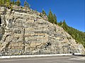 Cliff, Hungry Horse Dam, Hungry Horse, MT.jpg 3,702 × 2,776; 4.52 MB
-
 Dead Trees, Hungry Horse Dam, Hungry Horse, MT - 51533931465.jpg 4,032 × 3,024; 5.57 MB
-
 Dead Trees, Hungry Horse Dam, Hungry Horse, MT.jpg 3,024 × 4,032; 4.66 MB
-
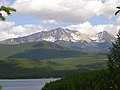 Flathead Range.jpg 2,048 × 1,536; 639 KB
-
 Glory Hole Spillway, Hungry Horse Dam, Hungry Horse, MT - 51532243772.jpg 2,954 × 3,939; 6.37 MB
-
 Glory Hole Spillway, Hungry Horse Dam, Hungry Horse, MT - 51532271602.jpg 2,994 × 3,992; 5.74 MB
-
 Glory Hole Spillway, Hungry Horse Dam, Hungry Horse, MT - 51532271942.jpg 3,024 × 4,032; 7.38 MB
-
 Glory Hole Spillway, Hungry Horse Dam, Hungry Horse, MT - 51533273198.jpg 3,958 × 2,968; 6.85 MB
-
 Glory Hole Spillway, Hungry Horse Dam, Hungry Horse, MT - 51533747444.jpg 2,938 × 3,918; 6.59 MB
-
 Glory Hole Spillway, Hungry Horse Dam, Hungry Horse, MT - 51533759164.jpg 3,912 × 2,934; 6.16 MB
-
 HD.11C.103 (14923557951).jpg 3,200 × 2,560; 1.22 MB
-
 Hngryh.jpg 944 × 705; 106 KB
-
 Hngryh2.jpg 1,239 × 970; 144 KB
-
 Hungry Horse Dam (8618702683).jpg 1,239 × 970; 610 KB
-
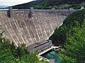
 Hungry Horse Dam Montana1.jpg 4,000 × 2,919; 4.32 MB
-
 Hungry Horse Dam Montana2.jpg 3,000 × 4,000; 4.9 MB
-
 Hungry Horse Dam Montana3.jpg 4,000 × 3,000; 5.37 MB
-
 Hungry Horse Dam under construction 1 - 9-15-1951.jpg 1,680 × 2,560; 1.14 MB
-
 Hungry Horse Dam under construction 2 - 9-15-1951.jpg 1,680 × 2,506; 1.27 MB
-
 Hungry Horse Dam, Hungry Horse, MT - 51532211702.jpg 2,977 × 3,970; 4.92 MB
-
 Hungry Horse Dam, Hungry Horse, MT - 51532213307.jpg 3,883 × 2,912; 5.4 MB
-
 Hungry Horse Dam, Hungry Horse, MT - 51532214222.jpg 2,972 × 3,963; 5.12 MB
-
 Hungry Horse Dam, Hungry Horse, MT - 51532215927.jpg 3,976 × 2,982; 5.32 MB
-
 Hungry Horse Dam, Hungry Horse, MT - 51532216357.jpg 2,988 × 3,985; 5.76 MB
-
 Hungry Horse Dam, Hungry Horse, MT - 51532282892.jpg 2,928 × 3,904; 3.67 MB
-
 Hungry Horse Dam, Hungry Horse, MT - 51532291827.jpg 2,774 × 3,699; 3.85 MB
-
 Hungry Horse Dam, Hungry Horse, MT - 51532300007.jpg 2,950 × 3,934; 4.72 MB
-
 Hungry Horse Dam, Hungry Horse, MT - 51532308697.jpg 2,930 × 3,907; 6.3 MB
-
 Hungry Horse Dam, Hungry Horse, MT - 51532318982.jpg 3,024 × 4,032; 3.85 MB
-
 Hungry Horse Dam, Hungry Horse, MT - 51532319287.jpg 2,751 × 3,668; 2.98 MB
-
 Hungry Horse Dam, Hungry Horse, MT - 51533003521.jpg 2,880 × 3,840; 5.89 MB
-
 Hungry Horse Dam, Hungry Horse, MT - 51533009031.jpg 2,749 × 3,665; 3.37 MB
-
 Hungry Horse Dam, Hungry Horse, MT - 51533011421.jpg 3,024 × 4,032; 5.83 MB
-
 Hungry Horse Dam, Hungry Horse, MT - 51533011716.jpg 4,032 × 3,024; 4.03 MB
-
 Hungry Horse Dam, Hungry Horse, MT - 51533013766.jpg 2,858 × 3,811; 4.12 MB
-
 Hungry Horse Dam, Hungry Horse, MT - 51533025501.jpg 3,888 × 2,916; 4.41 MB
-
 Hungry Horse Dam, Hungry Horse, MT - 51533056586.jpg 2,805 × 3,741; 2.9 MB
-
 Hungry Horse Dam, Hungry Horse, MT - 51533061546.jpg 2,963 × 3,950; 5.09 MB
-
 Hungry Horse Dam, Hungry Horse, MT - 51533066591.jpg 4,032 × 3,024; 5.82 MB
-
 Hungry Horse Dam, Hungry Horse, MT - 51533071536.jpg 4,032 × 3,024; 5.62 MB
-
 Hungry Horse Dam, Hungry Horse, MT - 51533093076.jpg 4,032 × 3,024; 5.43 MB
-
 Hungry Horse Dam, Hungry Horse, MT - 51533096516.jpg 3,000 × 4,000; 4.13 MB
-
 Hungry Horse Dam, Hungry Horse, MT - 51533097601.jpg 2,894 × 3,858; 4.74 MB
-
 Hungry Horse Dam, Hungry Horse, MT - 51533101376.jpg 2,927 × 3,903; 5.58 MB
-
 Hungry Horse Dam, Hungry Horse, MT - 51533108266.jpg 4,032 × 3,024; 7.04 MB
-
 Hungry Horse Dam, Hungry Horse, MT - 51533109166.jpg 3,024 × 4,032; 6.65 MB
-
 Hungry Horse Dam, Hungry Horse, MT - 51533114196.jpg 2,890 × 3,854; 4.27 MB
-
 Hungry Horse Dam, Hungry Horse, MT - 51533115681.jpg 3,886 × 2,914; 2.86 MB
-
 Hungry Horse Dam, Hungry Horse, MT - 51533250123.jpg 2,966 × 3,955; 4.59 MB
-
 Hungry Horse Dam, Hungry Horse, MT - 51533250418.jpg 3,940 × 2,955; 4.56 MB
-
 Hungry Horse Dam, Hungry Horse, MT - 51533257043.jpg 4,032 × 3,024; 5.7 MB
-
 Hungry Horse Dam, Hungry Horse, MT - 51533261283.jpg 2,960 × 3,947; 6.49 MB
-
 Hungry Horse Dam, Hungry Horse, MT - 51533270918.jpg 4,032 × 3,024; 5.05 MB
-
 Hungry Horse Dam, Hungry Horse, MT - 51533337188.jpg 3,978 × 2,984; 4.99 MB
-
 Hungry Horse Dam, Hungry Horse, MT - 51533338383.jpg 2,896 × 3,862; 4.29 MB
-
 Hungry Horse Dam, Hungry Horse, MT - 51533339893.jpg 3,830 × 2,872; 5.82 MB
-
 Hungry Horse Dam, Hungry Horse, MT - 51533341238.jpg 2,890 × 3,854; 5.68 MB
-
 Hungry Horse Dam, Hungry Horse, MT - 51533352448.jpg 3,934 × 2,950; 6.44 MB
-
 Hungry Horse Dam, Hungry Horse, MT - 51533355028.jpg 3,024 × 4,032; 5.21 MB
-
 Hungry Horse Dam, Hungry Horse, MT - 51533357973.jpg 4,032 × 3,024; 5.13 MB
-
 Hungry Horse Dam, Hungry Horse, MT - 51533358953.jpg 3,821 × 2,866; 4.1 MB
-
 Hungry Horse Dam, Hungry Horse, MT - 51533360853.jpg 2,972 × 3,963; 4.81 MB
-
 Hungry Horse Dam, Hungry Horse, MT - 51533363793.jpg 2,828 × 3,771; 3.14 MB
-
 Hungry Horse Dam, Hungry Horse, MT - 51533364928.jpg 2,923 × 3,898; 2.92 MB
-
 Hungry Horse Dam, Hungry Horse, MT - 51533723959.jpg 3,852 × 2,889; 6 MB
-
 Hungry Horse Dam, Hungry Horse, MT - 51533729739.jpg 2,928 × 3,904; 5.02 MB
-
 Hungry Horse Dam, Hungry Horse, MT - 51533732844.jpg 3,919 × 2,939; 5.16 MB
-
 Hungry Horse Dam, Hungry Horse, MT - 51533733429.jpg 2,966 × 3,955; 6.29 MB
-
 Hungry Horse Dam, Hungry Horse, MT - 51533747704.jpg 3,862 × 2,896; 3.82 MB
-
 Hungry Horse Dam, Hungry Horse, MT - 51533747824.jpg 2,808 × 3,744; 3.4 MB
-
 Hungry Horse Dam, Hungry Horse, MT - 51533801309.jpg 3,923 × 2,942; 3.73 MB
-
 Hungry Horse Dam, Hungry Horse, MT - 51533808674.jpg 3,798 × 2,848; 4.2 MB
-
 Hungry Horse Dam, Hungry Horse, MT - 51533811679.jpg 2,829 × 3,773; 4.66 MB
-
 Hungry Horse Dam, Hungry Horse, MT - 51533812254.jpg 2,938 × 3,918; 4.48 MB
-
 Hungry Horse Dam, Hungry Horse, MT - 51533813299.jpg 3,875 × 2,906; 3.92 MB
-
 Hungry Horse Dam, Hungry Horse, MT - 51533815044.jpg 3,934 × 2,950; 5.83 MB
-
 Hungry Horse Dam, Hungry Horse, MT - 51533816739.jpg 2,912 × 3,883; 3.6 MB
-
 Hungry Horse Dam, Hungry Horse, MT - 51533820414.jpg 3,942 × 2,956; 5.48 MB
-
 Hungry Horse Dam, Hungry Horse, MT - 51533831519.jpg 3,024 × 4,032; 5.47 MB
-
 Hungry Horse Dam, Hungry Horse, MT - 51533838744.jpg 3,780 × 2,835; 3.69 MB
-
 Hungry Horse Dam, Hungry Horse, MT - 51533935865.jpg 3,833 × 2,875; 4.17 MB
-
 Hungry Horse Dam, Hungry Horse, MT - 51533937180.jpg 3,841 × 2,881; 4.77 MB
-
 Hungry Horse Dam, Hungry Horse, MT - 51533938450.jpg 3,865 × 2,899; 4.34 MB
-
 Hungry Horse Dam, Hungry Horse, MT - 51533938655.jpg 2,912 × 3,883; 3.79 MB
-
 Hungry Horse Dam, Hungry Horse, MT - 51533941255.jpg 3,948 × 2,960; 6.33 MB
-
 Hungry Horse Dam, Hungry Horse, MT - 51533942170.jpg 3,883 × 2,912; 6.35 MB
-
 Hungry Horse Dam, Hungry Horse, MT - 51533950890.jpg 2,990 × 3,986; 4.74 MB
-
 Hungry Horse Dam, Hungry Horse, MT - 51533952370.jpg 2,880 × 3,840; 3.74 MB
-
 Hungry Horse Dam, Hungry Horse, MT - 51533956820.jpg 3,978 × 2,984; 4.48 MB
-
 Hungry Horse Dam, Hungry Horse, MT - 51533957675.jpg 2,982 × 3,976; 4.54 MB
-
 Hungry Horse Dam, Hungry Horse, MT - 51534000180.jpg 4,032 × 3,024; 5.07 MB
-
 Hungry Horse Dam, Hungry Horse, MT - 51534017045.jpg 3,985 × 2,988; 4.99 MB
-
 Hungry Horse Dam, Hungry Horse, MT - 51534024685.jpg 2,967 × 3,956; 4.94 MB
-
 Hungry Horse Dam, Hungry Horse, MT - 51534037270.jpg 4,032 × 3,024; 5.25 MB
-
 Hungry Horse Dam, Hungry Horse, MT - 51534044075.jpg 3,817 × 2,863; 3.16 MB
-
 Hungry Horse Dam, Hungry Horse, MT - 51534045935.jpg 3,824 × 2,868; 3.11 MB
-
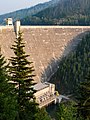
 Hungry Horse Dam, Hungry Horse, MT.jpg 4,032 × 3,024; 5.96 MB
-
 Hungry Horse Dam.jpg 2,048 × 1,365; 574 KB
-
 Hungry Horse Sign, Hungry Horse Dam, Hungry Horse, MT - 51533053311.jpg 4,032 × 3,024; 5.5 MB
-
 Hungry Horse Sign, Hungry Horse Dam, Hungry Horse, MT - 51533773939.jpg 3,800 × 2,850; 3.87 MB
-
 Hungry Horse Sign, Hungry Horse Dam, Hungry Horse, MT - 51533980635.jpg 2,889 × 3,852; 4.31 MB
-
 Hungry Horse Sign, Hungry Horse Dam, Hungry Horse, MT - 51533996955.jpg 3,788 × 2,841; 3.37 MB
-
 Hungry Horse Sign, Hungry Horse Dam, Hungry Horse, MT - 51534012315.jpg 3,894 × 2,920; 4.4 MB
-
 Hungry Horse Sign, Hungry Horse Dam, Hungry Horse, MT.jpg 2,973 × 3,965; 5.14 MB
-
 Hungry Horse Sign, Hungry Horse Dam, Hungry Horse, MTorse Sign, Hu.jpg 3,790 × 2,842; 3.3 MB
-
 Intakes, Hungry Horse Dam, Hungry Horse, MT - 51533325183.jpg 2,850 × 3,800; 3.65 MB
-
 Intakes, Hungry Horse Dam, Hungry Horse, MT - 51534001510.jpg 2,900 × 3,867; 3.43 MB
-
 Intakes, Hungry Horse Dam, Hungry Horse, MT.jpg 3,708 × 2,781; 4.03 MB
-
 Maintenance Access Stair, Hungry Horse Dam, Hungry Horse, MT - 51532322267.jpg 2,899 × 3,866; 4.43 MB
-
 Maintenance Access Stair, Hungry Horse Dam, Hungry Horse, MT - 51533947415.jpg 3,665 × 2,748; 4.9 MB
-
 Maintenance Access Stair, Hungry Horse Dam, Hungry Horse, MT.jpg 2,818 × 3,758; 4.98 MB
-
 Michael G. Booth Art Gallery, US Highway 2, Hungry Horse, MT.jpg 3,816 × 2,862; 5.65 MB
-
 Plaque, Hungry Horse Dam, Hungry Horse, MT.jpg 2,792 × 3,722; 4.21 MB
-
 Power Transmission Lines, Hungry Horse, MT - 51533124061.jpg 2,832 × 3,777; 3.5 MB
-
 Power Transmission Lines, Hungry Horse, MT - 51533363208.jpg 2,795 × 3,726; 3.17 MB
-
 Power Transmission Lines, Hungry Horse, MT.jpg 3,824 × 2,868; 3.35 MB
-
 Powerhouse, Hungry Horse Dam, Hungry Horse, MT - 51532270212.jpg 3,840 × 2,880; 4.27 MB
-
 Powerhouse, Hungry Horse Dam, Hungry Horse, MT - 51532304632.jpg 4,032 × 3,024; 7.34 MB
-
 Powerhouse, Hungry Horse Dam, Hungry Horse, MT - 51533008696.jpg 2,939 × 3,919; 5.74 MB
-
 Powerhouse, Hungry Horse Dam, Hungry Horse, MT - 51533036411.jpg 2,864 × 3,819; 3.83 MB
-
 Powerhouse, Hungry Horse Dam, Hungry Horse, MT - 51533042256.jpg 3,880 × 2,910; 4.64 MB
-
 Powerhouse, Hungry Horse Dam, Hungry Horse, MT - 51533046021.jpg 3,908 × 2,930; 4.75 MB
-
 Powerhouse, Hungry Horse Dam, Hungry Horse, MT - 51533052596.jpg 4,032 × 3,024; 4.82 MB
-
 Powerhouse, Hungry Horse Dam, Hungry Horse, MT - 51533067316.jpg 2,910 × 3,880; 4.77 MB
-
 Powerhouse, Hungry Horse Dam, Hungry Horse, MT - 51533067551.jpg 2,809 × 3,745; 3.85 MB
-
 Powerhouse, Hungry Horse Dam, Hungry Horse, MT - 51533072336.jpg 4,032 × 3,024; 7.22 MB
-
 Powerhouse, Hungry Horse Dam, Hungry Horse, MT - 51533254393.jpg 3,880 × 2,910; 5.15 MB
-
 Powerhouse, Hungry Horse Dam, Hungry Horse, MT - 51533277448.jpg 4,032 × 3,024; 4.8 MB
-
 Powerhouse, Hungry Horse Dam, Hungry Horse, MT - 51533291183.jpg 2,924 × 3,899; 3.88 MB
-
 Powerhouse, Hungry Horse Dam, Hungry Horse, MT - 51533294473.jpg 4,032 × 3,024; 6.02 MB
-
 Powerhouse, Hungry Horse Dam, Hungry Horse, MT - 51533296708.jpg 2,930 × 3,907; 4.55 MB
-
 Powerhouse, Hungry Horse Dam, Hungry Horse, MT - 51533314518.jpg 2,880 × 3,840; 3.51 MB
-
 Powerhouse, Hungry Horse Dam, Hungry Horse, MT - 51533348178.jpg 2,738 × 3,650; 5.67 MB
-
 Powerhouse, Hungry Horse Dam, Hungry Horse, MT - 51533748799.jpg 2,934 × 3,912; 4.02 MB
-
 Powerhouse, Hungry Horse Dam, Hungry Horse, MT - 51533755419.jpg 3,886 × 2,914; 4.36 MB
-
 Powerhouse, Hungry Horse Dam, Hungry Horse, MT - 51533767054.jpg 3,024 × 4,032; 5.22 MB
-
 Powerhouse, Hungry Horse Dam, Hungry Horse, MT - 51533783209.jpg 3,852 × 2,889; 4.03 MB
-
 Powerhouse, Hungry Horse Dam, Hungry Horse, MT - 51533789699.jpg 2,616 × 3,488; 2.71 MB
-
 Powerhouse, Hungry Horse Dam, Hungry Horse, MT - 51533789964.jpg 3,806 × 2,854; 3.74 MB
-
 Powerhouse, Hungry Horse Dam, Hungry Horse, MT - 51533793769.jpg 3,024 × 4,032; 7.31 MB
-
 Powerhouse, Hungry Horse Dam, Hungry Horse, MT - 51533961360.jpg 2,922 × 3,896; 4.09 MB
-
 Powerhouse, Hungry Horse Dam, Hungry Horse, MT - 51533974240.jpg 3,024 × 4,032; 5.62 MB
-
 Powerhouse, Hungry Horse Dam, Hungry Horse, MT - 51533978410.jpg 3,024 × 4,032; 4.98 MB
-
 Powerhouse, Hungry Horse Dam, Hungry Horse, MT.jpg 3,891 × 2,918; 4.38 MB
-
 South Fork Flathead River Gorge, Hungry Horse, MT - 51533032731.jpg 2,896 × 3,862; 5.23 MB
-
 South Fork Flathead River Gorge, Hungry Horse, MT - 51533065426.jpg 2,938 × 3,918; 4.09 MB
-
 South Fork Flathead River Gorge, Hungry Horse, MT - 51533103676.jpg 4,032 × 3,024; 6.55 MB
-
 South Fork Flathead River Gorge, Hungry Horse, MT - 51533279363.jpg 2,912 × 3,883; 5.28 MB
-
 South Fork Flathead River Gorge, Hungry Horse, MT - 51533350668.jpg 3,024 × 4,032; 6.49 MB
-
 South Fork Flathead River Gorge, Hungry Horse, MT - 51533990510.jpg 3,910 × 2,932; 4.05 MB
-
 South Fork Flathead River Gorge, Hungry Horse, MT - 51533996710.jpg 3,024 × 4,032; 4.17 MB
-
 South Fork Flathead River Gorge, Hungry Horse, MT.jpg 3,820 × 2,865; 3.84 MB
-
 Tower Interior, Hungry Horse Dam, Hungry Horse, MT - 51533055936.jpg 3,910 × 2,932; 2.63 MB
-
 Tower Interior, Hungry Horse Dam, Hungry Horse, MT - 51533982265.jpg 2,960 × 3,947; 2.73 MB
-
 Tower Interior, Hungry Horse Dam, Hungry Horse, MT.jpg 3,936 × 2,952; 2.71 MB
-
 Tower, Hungry Horse Dam, Hungry Horse, MT - 51532287187.jpg 3,882 × 2,911; 3.28 MB
-
 Tower, Hungry Horse Dam, Hungry Horse, MT - 51533086136.jpg 2,816 × 3,755; 3.76 MB
-
 Tower, Hungry Horse Dam, Hungry Horse, MT - 51533322963.jpg 2,810 × 3,747; 3.39 MB
-
 Tower, Hungry Horse Dam, Hungry Horse, MT - 51533333243.jpg 2,714 × 3,619; 2.42 MB
-
 Tower, Hungry Horse Dam, Hungry Horse, MT - 51533769929.jpg 3,976 × 2,982; 5.71 MB
-
 Tower, Hungry Horse Dam, Hungry Horse, MT - 51533804294.jpg 2,799 × 3,732; 2.75 MB
-
 Tower, Hungry Horse Dam, Hungry Horse, MT - 51533975725.jpg 2,977 × 3,970; 5.86 MB
-
 Tower, Hungry Horse Dam, Hungry Horse, MT - 51533977095.jpg 3,024 × 4,032; 6.58 MB
-
 Tower, Hungry Horse Dam, Hungry Horse, MT - 51533997785.jpg 3,024 × 4,032; 3.46 MB
-
 Tower, Hungry Horse Dam, Hungry Horse, MT - 51534001980.jpg 3,737 × 2,803; 3.31 MB
-
 Tower, Hungry Horse Dam, Hungry Horse, MT.jpg 3,833 × 2,875; 2.6 MB


.jpg)

.jpg)


