Category:Huntington, Staffordshire
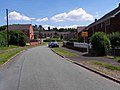
English: Huntington is a civil parish and former mining village in Staffordshire, on the outskirts of Cannock Chase. It lies on the A34 road just north of Cannock and is surrounded by woodland. The village had an estimated population of 3,720 in 2004.cite web
village and civil parish in Staffordshire, England, United Kingdom  | |||||
| Upload media | |||||
| Instance of | |||||
|---|---|---|---|---|---|
| Location | South Staffordshire, Staffordshire, West Midlands, England | ||||
 | |||||
Subcategories
This category has the following 2 subcategories, out of 2 total.
L
P
- Pye Green BT Tower (2 F)
Media in category "Huntington, Staffordshire"
The following 123 files are in this category, out of 123 total.
-
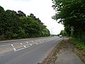
 A34, Huntington - geograph.org.uk - 521377.jpg 640 × 480; 55 KB
-
 A34, Huntington - geograph.org.uk - 794817.jpg 640 × 480; 67 KB
-
 Arable field, Mansty - geograph.org.uk - 2131788.jpg 640 × 480; 110 KB
-
 Arable land beside Mansty Lane - geograph.org.uk - 2131661.jpg 640 × 480; 108 KB
-
 Arable land near Littleton Colliery - geograph.org.uk - 3669860.jpg 1,600 × 1,064; 292 KB
-
 Arable land off Mansty Lane - geograph.org.uk - 2126983.jpg 640 × 480; 122 KB
-
 Badger's Hill bridleway - geograph.org.uk - 3861638.jpg 979 × 734; 385 KB
-
 Badger's Hills - geograph.org.uk - 3858035.jpg 640 × 480; 367 KB
-
 Badger's Hills, Cannock Chase - geograph.org.uk - 225765.jpg 640 × 480; 86 KB
-
 Bridge On Mansty Lane. - geograph.org.uk - 2428377.jpg 640 × 428; 75 KB
-
 Bridleway down to Pottal Pool - geograph.org.uk - 3859691.jpg 734 × 979; 415 KB
-
 Bridleway junction - geograph.org.uk - 3861641.jpg 734 × 979; 350 KB
-
 Cannock - geograph.org.uk - 276625.jpg 640 × 427; 47 KB
-
 Close up, Elizabeth II postbox on Dual Way, Huntington - geograph.org.uk - 6159164.jpg 2,004 × 3,288; 1.4 MB
-
 Clubhouse, The Chase Golf Course - geograph.org.uk - 555428.jpg 640 × 480; 57 KB
-
 Cocksparrow Lane - geograph.org.uk - 2131798.jpg 640 × 480; 135 KB
-
 Colliers Way - geograph.org.uk - 3857987.jpg 640 × 480; 262 KB
-
 Cones in a field - geograph.org.uk - 3857961.jpg 640 × 480; 261 KB
-
 Cycle path, A34 - geograph.org.uk - 3875028.jpg 640 × 480; 327 KB
-
 Disused Railway - geograph.org.uk - 225760.jpg 640 × 480; 109 KB
-
 Disused Railway - geograph.org.uk - 291421.jpg 640 × 480; 151 KB
-
-
 Elizabeth II postbox on Dual Way, Huntington - geograph.org.uk - 6159163.jpg 5,184 × 3,888; 4.38 MB
-
 Entering Huntington - geograph.org.uk - 291420.jpg 640 × 480; 77 KB
-
 Entrance to Pottal Covert - geograph.org.uk - 2899284.jpg 640 × 480; 79 KB
-
 Entrance To Pottal Pool Quarry - geograph.org.uk - 2428280.jpg 640 × 428; 96 KB
-
 Entrance To The Chase Golf Club. - geograph.org.uk - 2435783.jpg 640 × 428; 52 KB
-
 Farm track and field near Huntington Farm - geograph.org.uk - 5399129.jpg 1,469 × 1,102; 702 KB
-
 Farmland and barns at Huntington - geograph.org.uk - 3859685.jpg 1,142 × 857; 338 KB
-
 Farmland north of Cavan's Wood - geograph.org.uk - 3863176.jpg 1,142 × 857; 321 KB
-
 Fence, Shoal Hill - geograph.org.uk - 2132015.jpg 640 × 480; 176 KB
-
 Field beneath Shoal Hill - geograph.org.uk - 2131777.jpg 640 × 480; 117 KB
-
 Field beneath Shoal Hill - geograph.org.uk - 2140003.jpg 640 × 480; 123 KB
-
 Field off Mansty Lane - geograph.org.uk - 2131771.jpg 640 × 480; 113 KB
-
 Footpath in the Littleton Leisure Park - geograph.org.uk - 651986.jpg 640 × 480; 295 KB
-
 Foxfields Way, Dogintree Estate - geograph.org.uk - 3859679.jpg 1,306 × 979; 381 KB
-
 Front of Huntington Junior School - geograph.org.uk - 521372.jpg 640 × 480; 74 KB
-
 Good Friends - geograph.org.uk - 291423.jpg 640 × 480; 119 KB
-
 Grazing Land - geograph.org.uk - 291419.jpg 640 × 480; 108 KB
-
 Great Horsenail Slade - geograph.org.uk - 3669471.jpg 1,600 × 1,064; 545 KB
-
 Heathbank Drive, Huntington - geograph.org.uk - 794812.jpg 640 × 480; 67 KB
-
 Horse Pasture From Cocksparrow Lane - geograph.org.uk - 2453154.jpg 640 × 428; 77 KB
-
 House on Oak Avenue, Huntington - geograph.org.uk - 6158417.jpg 800 × 478; 63 KB
-
 Houses on Dual Way, Huntington - geograph.org.uk - 6158425.jpg 800 × 482; 86 KB
-
 Houses on Limepit Lane, Huntington - geograph.org.uk - 6158441.jpg 800 × 491; 75 KB
-
 Houses, Stafford Road - geograph.org.uk - 3857974.jpg 640 × 480; 298 KB
-
 Huntington - geograph.org.uk - 3106.jpg 640 × 480; 30 KB
-
 Huntington Community Centre - geograph.org.uk - 3863823.jpg 1,142 × 857; 339 KB
-
 Huntington Infants-Nursery School - geograph.org.uk - 521369.jpg 640 × 480; 65 KB
-
 Huntington Sign.jpg 198 × 166; 9 KB
-
 Jacob sheep at Pine Trees Farm - geograph.org.uk - 3859689.jpg 1,142 × 857; 389 KB
-
 Limepit Lane, Huntington - geograph.org.uk - 6158450.jpg 800 × 600; 98 KB
-
 Line of former colliery railway - geograph.org.uk - 650126.jpg 640 × 440; 215 KB
-
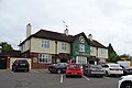
 Littleton Arms, Huntington - geograph.org.uk - 521359.jpg 640 × 480; 73 KB
-
 Littleton Colliery - geograph.org.uk - 144916.jpg 640 × 418; 89 KB
-
 Littleton Colliery - geograph.org.uk - 650111.jpg 640 × 480; 285 KB
-
 Littleton Colliery - geograph.org.uk - 650121.jpg 640 × 460; 199 KB
-
 Littleton Green Community School - geograph.org.uk - 3858002.jpg 640 × 378; 220 KB
-
 Littleton Leisure Park - geograph.org.uk - 3669885.jpg 1,600 × 1,064; 545 KB
-
 Logging road off Pottal Slade - geograph.org.uk - 3858047.jpg 640 × 480; 311 KB
-
 Looking out from Huntington Belt towards Huntington - geograph.org.uk - 4459564.jpg 4,128 × 2,322; 3.18 MB
-
 Looking Up Pottal Slade Road. - geograph.org.uk - 2428265.jpg 640 × 428; 109 KB
-
 Mansty Farm - geograph.org.uk - 2428358.jpg 640 × 428; 58 KB
-
 Newtown - geograph.org.uk - 267985.jpg 640 × 480; 111 KB
-
 No public access to Horsemoor Wood - geograph.org.uk - 683902.jpg 640 × 480; 344 KB
-
 Oak Avenue, Huntington - geograph.org.uk - 6158421.jpg 800 × 600; 91 KB
-

-
-
 OS benchmark - Huntington - geograph.org.uk - 5399144.jpg 1,469 × 1,102; 877 KB
-
 Parkland at Hatherton Hall - geograph.org.uk - 683887.jpg 640 × 480; 234 KB
-
 Pasture land near Littleton Colliery - geograph.org.uk - 3669871.jpg 1,600 × 1,064; 261 KB
-
 Pottal Poll Roundabout - geograph.org.uk - 2452808.jpg 640 × 407; 56 KB
-
 Pottal Valley - geograph.org.uk - 676212.jpg 640 × 480; 113 KB
-
 Pottal Valley - geograph.org.uk - 676213.jpg 640 × 480; 110 KB
-
 Putting Green, The Chase Golf Course - geograph.org.uk - 555431.jpg 640 × 480; 55 KB
-
 Rear of Huntington Junior School - geograph.org.uk - 521374.jpg 640 × 480; 50 KB
-
 Roundabout on the A34, Pottal Pool - geograph.org.uk - 6158407.jpg 800 × 600; 96 KB
-
 Shoal Heath Common - geograph.org.uk - 650404.jpg 640 × 480; 247 KB
-
 Shoal Hill - geograph.org.uk - 164996.jpg 640 × 427; 158 KB
-
-
 Sign for the Littleton, Cannock - geograph.org.uk - 6158434.jpg 599 × 800; 88 KB
-
 Sled Dog Training Area - geograph.org.uk - 2428255.jpg 640 × 428; 118 KB
-
 Slow down into Huntington - geograph.org.uk - 3863178.jpg 1,142 × 857; 322 KB
-
 St Thomas's Church, Huntington - geograph.org.uk - 3859681.jpg 1,142 × 857; 401 KB
-
 Stafford Road (A34), Pottal Pool - geograph.org.uk - 6158413.jpg 800 × 600; 115 KB
-
 The Cottage B^B, Pear Tree Close. - geograph.org.uk - 2435770.jpg 640 × 428; 92 KB
-
 The Farmhouse - geograph.org.uk - 650131.jpg 640 × 480; 219 KB
-
 The last houses in Huntington - geograph.org.uk - 3859683.jpg 1,142 × 857; 377 KB
-
 The Littleton, Cannock - geograph.org.uk - 6158431.jpg 800 × 535; 70 KB
-
 Track and footpaths just north of the former colliery - geograph.org.uk - 5399134.jpg 1,469 × 1,102; 812 KB
-
 Track Diverted By Quarry Extension - geograph.org.uk - 2428270.jpg 640 × 428; 88 KB
-
 Track, Badger's Hills - geograph.org.uk - 3858061.jpg 640 × 480; 351 KB
-
 Track, Badger's Hills - geograph.org.uk - 3875037.jpg 640 × 853; 487 KB
-
 Trackbed of the Huntington branch line - geograph.org.uk - 5399132.jpg 1,102 × 1,469; 1.05 MB
-
 Up the bridleway towards Pye Green - geograph.org.uk - 3859694.jpg 734 × 979; 372 KB
-
 Wheat in field west of Huntington Farm - geograph.org.uk - 5399130.jpg 1,469 × 1,102; 637 KB
-
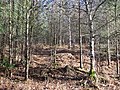
 Woodland, Badger's Hills - geograph.org.uk - 3858071.jpg 640 × 480; 346 KB
-
 Woodland, Pottal Slade - geograph.org.uk - 3858053.jpg 640 × 480; 312 KB
-
 Works units on Cocksparrow Lane - geograph.org.uk - 2453165.jpg 640 × 428; 65 KB
-
 Yew Tree Farm - geograph.org.uk - 278405.jpg 640 × 480; 136 KB
-
 Young woodland, Pottal Slade - geograph.org.uk - 3858058.jpg 640 × 480; 390 KB
-
 Cannock Cemetery - geograph.org.uk - 142221.jpg 640 × 427; 89 KB
-
 Cannock Chase near Pottal Pool - geograph.org.uk - 225767.jpg 640 × 480; 79 KB
-
 Cannock Conduit - geograph.org.uk - 195031.jpg 640 × 480; 122 KB
-
 Cannock Park Golf Course - geograph.org.uk - 164997.jpg 640 × 427; 67 KB
-
 Centre of Cannock Cemetery - geograph.org.uk - 142249.jpg 640 × 427; 126 KB
-
 Dogintree Estate, Huntington - geograph.org.uk - 521366.jpg 640 × 480; 75 KB
-
 Field off Sheepwash Lane - geograph.org.uk - 164990.jpg 640 × 427; 112 KB
-
 Hatherton Hall Farm - geograph.org.uk - 203911.jpg 640 × 480; 86 KB
-
 Hatherton Hall Farm - geograph.org.uk - 203914.jpg 640 × 480; 105 KB
-
 Mansty Lane - geograph.org.uk - 187101.jpg 640 × 427; 77 KB
-
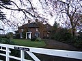
 Parkside House - geograph.org.uk - 203909.jpg 640 × 480; 84 KB
-
 Picnic Area on Edge of Shoal Hill - geograph.org.uk - 164989.jpg 640 × 427; 137 KB
-
 Road to Pottal Pool - geograph.org.uk - 225770.jpg 640 × 480; 89 KB
-
 Shoal Hill Cottage - geograph.org.uk - 650369.jpg 640 × 480; 247 KB
-
 St. Thomas, Huntington - geograph.org.uk - 119833.jpg 640 × 427; 79 KB
-
 Stafford Road, Cannock - geograph.org.uk - 225762.jpg 640 × 480; 76 KB
-

-
 The Barns Restaurant, Huntington - geograph.org.uk - 521382.jpg 640 × 480; 79 KB
-
 The White Hart, Wolverhampton Road - geograph.org.uk - 236291.jpg 640 × 480; 80 KB
-
 Track near Broadhurst Green - geograph.org.uk - 225777.jpg 640 × 480; 99 KB
-
 Traffic island - geograph.org.uk - 161707.jpg 640 × 480; 100 KB
-


.jpg)


,_Pottal_Pool_-_geograph.org.uk_-_6158413.jpg)


