Category:Hydrographic maps of the world
Subcategories
This category has only the following subcategory.
B
- Bathymetric maps of the world (28 F)
Media in category "Hydrographic maps of the world"
The following 25 files are in this category, out of 25 total.
-
 Atlantic Ocean currents (Ocean currents 1943, cropped).png 416 × 246; 127 KB
-
 Dissolved inorganic carbon.png 1,024 × 688; 310 KB
-
 Feature groundwater inline .jpg 1,000 × 642; 330 KB
-
 Groundwater-fluoride-world.svg 940 × 415; 1.49 MB
-
 Hydrography of the world, 1967.jpg 2,883 × 2,148; 967 KB
-
 Major endorheric basins.png 1,477 × 772; 60 KB
-
 Meyers b11 s0411a.jpg 2,048 × 1,577; 624 KB
-
 Meyers b5 s0742a.jpg 2,048 × 1,647; 615 KB
-
 NOAA sea level trend 1993 2010.png 2,425 × 1,337; 1.5 MB
-
 Ocean Current and Sea Ice 3 (cropped).jpg 4,512 × 2,397; 2.11 MB
-
 Ocean Current and Sea Ice 3.jpg 5,485 × 2,653; 2.43 MB
-
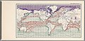
 Ocean currents 1943 (borderless).png 2,577 × 1,306; 2.75 MB
-
 Ocean currents 1943 (borderless)3.png 2,577 × 1,306; 2.41 MB
-
 Ocean currents 1943 for colorblind users.png 2,577 × 1,306; 3.15 MB
-
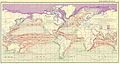 Ocean currents 1943.jpg 2,639 × 1,406; 5.14 MB
-
 Ocean currents 1943.png 2,639 × 1,406; 4.89 MB
-
 Ocean drainage.png 1,256 × 656; 75 KB
-
 Renewable Groundwater Resources in mm per year By WaterGAP Average 1961-1990.jpg 1,540 × 768; 207 KB
-
 River Flow Regime Shifts Until 2050 By WaterGAP.jpg 2,279 × 1,072; 497 KB
-
 Shapemap1.jpg 1,000 × 533; 37 KB
-
 Thermohaline circulation.png 1,600 × 800; 1,001 KB
-

-
 W9 APB Stat map color.jpg 1,316 × 752; 80 KB
-
 WorldWaterAvailability.png 1,357 × 628; 39 KB
-
 Нуурын тархалт газрын зураг.jpg 2,160 × 1,332; 767 KB
.png)


.jpg)

.png)
3.png)


