Category:Ilton-cum-Pott
civil parish in Harrogate, North Yorkshire, England  | |||||
| Upload media | |||||
| Instance of | |||||
|---|---|---|---|---|---|
| Location | Harrogate, North Yorkshire, Yorkshire and the Humber, England | ||||
 | |||||
Subcategories
This category has the following 3 subcategories, out of 3 total.
I
- Ilton Druid's Temple (22 F)
- Ilton, North Yorkshire (3 F)
R
- Roundhill Reservoir (8 F)
Media in category "Ilton-cum-Pott"
The following 200 files are in this category, out of 201 total.
(previous page) (next page)-
 'Centre ville', Ilton - geograph.org.uk - 5880833.jpg 4,320 × 2,923; 2.89 MB
-

-
 A cattle grid on Pott Moor High Road - geograph.org.uk - 3103141.jpg 800 × 600; 79 KB
-
 A line of red, white and black posts - geograph.org.uk - 450622.jpg 640 × 424; 84 KB
-
 A private track towards Pott Moor - geograph.org.uk - 3103192.jpg 800 × 600; 115 KB
-
 Access road to West Summer Side Farm - geograph.org.uk - 4083371.jpg 4,608 × 3,456; 3.35 MB
-
 Access to Grimes Gill House - geograph.org.uk - 3379625.jpg 4,320 × 3,240; 3.88 MB
-
 Across the Burn valley - geograph.org.uk - 3996246.jpg 4,320 × 3,240; 2.82 MB
-
 Agill Beck - geograph.org.uk - 279935.jpg 640 × 480; 88 KB
-
 Agill Beck and Roundhill Reservoir - geograph.org.uk - 5629738.jpg 4,000 × 3,000; 2.74 MB
-
 Agill Bridge - geograph.org.uk - 3602785.jpg 4,000 × 3,000; 2.42 MB
-
 Agill Bridge, Lofthouse to Masham Road - geograph.org.uk - 5568983.jpg 640 × 480; 105 KB
-
 Agill Dam reservoir - geograph.org.uk - 5629733.jpg 4,000 × 3,000; 2.07 MB
-
 All that remains of Summer Side - geograph.org.uk - 3602766.jpg 4,000 × 3,000; 3.44 MB
-
 Altar and Cave, Druid's Temple - geograph.org.uk - 1844599.jpg 480 × 640; 87 KB
-
 Approaching Stott Fold - geograph.org.uk - 3379618.jpg 4,320 × 3,240; 2.66 MB
-
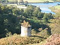 Arnagill Tower - geograph.org.uk - 1525228.jpg 640 × 480; 130 KB
-
 Aygill - geograph.org.uk - 1692466.jpg 1,600 × 1,200; 532 KB
-
 Back lane at Ilton - geograph.org.uk - 5880832.jpg 4,320 × 3,240; 3.18 MB
-
 Below Arnagill Crags - geograph.org.uk - 3378897.jpg 4,320 × 3,240; 4.94 MB
-
 Below Clints Hill - geograph.org.uk - 3378125.jpg 4,320 × 3,240; 5.36 MB
-
 Bench Mark, Pott Hall - geograph.org.uk - 2552353.jpg 480 × 640; 79 KB
-
 Black Barn, near Bolton's Stake - geograph.org.uk - 3499693.jpg 640 × 427; 213 KB
-
 Black Gutter Head - geograph.org.uk - 5065558.jpg 3,000 × 4,000; 2.76 MB
-
 Blooming heather - geograph.org.uk - 4632042.jpg 1,024 × 768; 822 KB
-
 Boundary stone - geograph.org.uk - 37194.jpg 640 × 480; 81 KB
-
 Boundary Stone and the track south into Nidderdale - geograph.org.uk - 4454819.jpg 4,608 × 3,456; 5.9 MB
-
 Boundary Stone at junction of tracks - geograph.org.uk - 612664.jpg 640 × 480; 127 KB
-
 Bridge across Roundhill Reservoir - geograph.org.uk - 5629742.jpg 4,000 × 3,000; 2.64 MB
-
 Bridge across Roundhill Reservoir - geograph.org.uk - 5629743.jpg 4,000 × 3,000; 2.24 MB
-
 Broadmires Farm - geograph.org.uk - 1223177.jpg 640 × 480; 87 KB
-
 Bush Shelter - geograph.org.uk - 4152633.jpg 1,600 × 1,200; 530 KB
-
 Cattle Grid on the Lofthouse-Masham Road - geograph.org.uk - 3378552.jpg 4,320 × 3,240; 4.55 MB
-
 Cattle near Ilton - geograph.org.uk - 2545412.jpg 640 × 480; 86 KB
-
 Colsterdale Sighting Tower, Leighton - geograph.org.uk - 2980022.jpg 1,600 × 1,200; 322 KB
-
 Combs Crags (and Shooting House) - geograph.org.uk - 612680.jpg 640 × 480; 80 KB
-
 Combs Crags on Low Ash Head Moor - geograph.org.uk - 3154424.jpg 3,648 × 2,736; 5.46 MB
-
 Downhill towards the vale - geograph.org.uk - 5922992.jpg 4,320 × 3,240; 2.8 MB
-
 Druid's Plantation - geograph.org.uk - 3499675.jpg 427 × 640; 266 KB
-
 Druid's Plantation - geograph.org.uk - 5369934.jpg 1,024 × 683; 489 KB
-
 Druid's Plantation - geograph.org.uk - 5369938.jpg 1,024 × 683; 493 KB
-
 Druid's Plantation - geograph.org.uk - 727026.jpg 640 × 480; 134 KB
-
 Druid's Plantation folly - geograph.org.uk - 5369931.jpg 1,024 × 683; 318 KB
-
 Druid's Temple - geograph.org.uk - 1844570.jpg 640 × 480; 93 KB
-
 Druid's Temple - geograph.org.uk - 5369872.jpg 1,024 × 683; 338 KB
-
 Druid's Temple - geograph.org.uk - 5369928.jpg 1,024 × 683; 327 KB
-
 Druids' Temple - geograph.org.uk - 5858060.jpg 3,000 × 4,000; 3.86 MB
-
 Dry Stone Wall - geograph.org.uk - 3499689.jpg 640 × 427; 225 KB
-
 End of the Wall - geograph.org.uk - 5065586.jpg 3,000 × 4,000; 3.05 MB
-
 Entrance to Pott Hall Farm - geograph.org.uk - 2552242.jpg 640 × 480; 76 KB
-
 Falafel and other goodies - geograph.org.uk - 1223179.jpg 640 × 480; 99 KB
-
 Farmhouse above Grimes Gill - geograph.org.uk - 490111.jpg 640 × 427; 72 KB
-
 Fields - geograph.org.uk - 153337.jpg 640 × 480; 80 KB
-
 Fields towards Sole Beck - geograph.org.uk - 228402.jpg 640 × 480; 125 KB
-
 Fingerpost at Summer Side - geograph.org.uk - 3378987.jpg 4,320 × 3,240; 3.09 MB
-
 Fingerpost on Lulbeck Head - geograph.org.uk - 3154496.jpg 3,648 × 2,736; 4.47 MB
-
 Footbridge at Grimes Gill - geograph.org.uk - 3156951.jpg 3,872 × 2,592; 2.31 MB
-
 Footpath near Ilton - geograph.org.uk - 2545322.jpg 640 × 480; 71 KB
-
-
 Ford at Fearby Low Moor - geograph.org.uk - 4341259.jpg 3,872 × 2,592; 4.61 MB
-
 From Agill Bridge toward Roundhill reservoir - geograph.org.uk - 4083342.jpg 4,608 × 3,456; 3.73 MB
-
 Gate above Low Knowle Farm - geograph.org.uk - 1419693.jpg 640 × 480; 82 KB
-
 Gate at start of track to Combs Crags - geograph.org.uk - 4449496.jpg 4,608 × 3,456; 6.1 MB
-
 Gateway into pasture near West Summer Side - geograph.org.uk - 3378976.jpg 4,320 × 3,240; 4.3 MB
-
 Gorse near Ilton - geograph.org.uk - 2545312.jpg 640 × 480; 80 KB
-
 Grazing land near Pott Hall - geograph.org.uk - 2552378.jpg 640 × 481; 90 KB
-
 Grazing near Ilton - geograph.org.uk - 2544056.jpg 640 × 480; 79 KB
-
 Grewelthorpe Moor - geograph.org.uk - 228371.jpg 640 × 480; 59 KB
-
 Grimes Gill - geograph.org.uk - 490096.jpg 640 × 427; 73 KB
-
 Grouse moor above Ilton - geograph.org.uk - 5922953.jpg 4,300 × 2,371; 1.83 MB
-
 Grouse, Pott Moor - geograph.org.uk - 2552921.jpg 640 × 480; 118 KB
-
 Heather moorland with trig point at Ouster Bank - geograph.org.uk - 4308910.jpg 1,500 × 1,125; 1.67 MB
-
 High Ash Head (ruin) - geograph.org.uk - 612733.jpg 640 × 480; 90 KB
-
 High Ash Head - geograph.org.uk - 243739.jpg 640 × 480; 65 KB
-
 High Ash Head Moor - geograph.org.uk - 153309.jpg 640 × 480; 63 KB
-
 High Ash Head Moor - geograph.org.uk - 4083330.jpg 4,608 × 3,456; 3.56 MB
-
 Ilton Druids Temple - geograph.org.uk - 3908880.jpg 2,965 × 1,977; 3.39 MB
-
 Ilton Manor farm - geograph.org.uk - 4152641.jpg 1,600 × 1,200; 427 KB
-
 Ilton Moor - geograph.org.uk - 228412.jpg 640 × 480; 65 KB
-
 Junction of lanes at Ilton - geograph.org.uk - 5483130.jpg 4,000 × 3,000; 3.48 MB
-

-
 Junction of tracks on the moor - geograph.org.uk - 5922961.jpg 4,300 × 2,536; 1.72 MB
-
 Knowle Lane - geograph.org.uk - 1419658.jpg 640 × 480; 69 KB
-
 Lane by the Perimeter of Swinton Park - geograph.org.uk - 3117826.jpg 4,320 × 3,240; 4.53 MB
-
 Lane outside Quarry House - geograph.org.uk - 3117864.jpg 4,320 × 3,240; 5.45 MB
-
 Lapwing nest on rough pasture - geograph.org.uk - 4458755.jpg 1,024 × 757; 876 KB
-
 Lapwing, Pott Moor - geograph.org.uk - 2552949.jpg 640 × 480; 111 KB
-
 Leighton Reservoir - geograph.org.uk - 2281697.jpg 640 × 480; 218 KB
-
 Leighton Reservoir - geograph.org.uk - 3103121.jpg 800 × 600; 77 KB
-
 Leighton Reservoir from Pott Bank - geograph.org.uk - 3379750.jpg 4,320 × 3,240; 3.92 MB
-
 Leighton Reservoir, aerial 2016 - geograph.org.uk - 5090667.jpg 640 × 427; 57 KB
-
 Looking across Ilton Moor - geograph.org.uk - 229310.jpg 640 × 480; 68 KB
-
 Looking over towards Shortlick Hill - geograph.org.uk - 228362.jpg 640 × 480; 81 KB
-
 Low Ash Head (ruin) - geograph.org.uk - 612718.jpg 640 × 480; 109 KB
-
 Low Ash Head - geograph.org.uk - 243734.jpg 640 × 480; 102 KB
-
 Low Ash Head - geograph.org.uk - 3154476.jpg 3,648 × 2,736; 4.82 MB
-
 Low Ash Head another ruined farmstead - geograph.org.uk - 4449533.jpg 4,608 × 3,456; 6.7 MB
-
 Low Langwith Cross (2) - geograph.org.uk - 1993829.jpg 2,448 × 3,264; 1.79 MB
-
 Minor road near Ilton - geograph.org.uk - 2545342.jpg 640 × 480; 92 KB
-
 Moles at Colsterdale - geograph.org.uk - 2552782.jpg 640 × 480; 64 KB
-
 Moorland at the watershed - geograph.org.uk - 6133211.jpg 3,648 × 2,736; 1.09 MB
-
 More moorland - geograph.org.uk - 5922982.jpg 4,320 × 2,442; 1.79 MB
-
 Moss on the wall, Ilton - geograph.org.uk - 2544055.jpg 640 × 481; 83 KB
-
 Nearing the crest of Sandy Hill - geograph.org.uk - 5922987.jpg 4,320 × 3,240; 2.36 MB
-
 Old guidepost on Pott Ridge - geograph.org.uk - 296238.jpg 429 × 640; 98 KB
-
 On Clints Moor - geograph.org.uk - 3378143.jpg 4,320 × 3,240; 4.65 MB
-
 On Knowle Lane - geograph.org.uk - 1419665.jpg 640 × 480; 77 KB
-
 Open Access above Leighton Reservoir - geograph.org.uk - 3378139.jpg 4,320 × 3,240; 4.89 MB
-
 Ordnance Survey Cut Mark - geograph.org.uk - 3603992.jpg 4,000 × 3,000; 5.11 MB
-
 Ouster bank. - geograph.org.uk - 2434090.jpg 640 × 480; 60 KB
-
 Over field to Stott Fold - geograph.org.uk - 4454899.jpg 4,608 × 3,456; 5.82 MB
-
 Over fields to Roundhill Reservoir - geograph.org.uk - 4454889.jpg 4,608 × 3,456; 7.68 MB
-
 Pasture to the South of Swinton Park - geograph.org.uk - 3117819.jpg 4,320 × 3,240; 3.83 MB
-
 Path used by The Jubilee walk at Druids Temple - geograph.org.uk - 5483141.jpg 4,000 × 3,000; 4.82 MB
-
 Phone box on the corner - geograph.org.uk - 5880828.jpg 4,320 × 3,240; 2.22 MB
-
 Pile of Stones - geograph.org.uk - 1844576.jpg 480 × 640; 73 KB
-
 Plantation near Ilton - geograph.org.uk - 1844567.jpg 640 × 480; 67 KB
-
 Posh camping at High Knowle - geograph.org.uk - 3996218.jpg 4,193 × 2,371; 2.01 MB
-
 Pott Bank - geograph.org.uk - 3379736.jpg 4,320 × 3,240; 4.1 MB
-
 Pott Hall Farm - geograph.org.uk - 3379745.jpg 4,320 × 3,240; 3.16 MB
-
 Pott Hall Farm on Pott Bank (road) - geograph.org.uk - 3103126.jpg 800 × 600; 100 KB
-
 Pott Moor - geograph.org.uk - 153312.jpg 480 × 640; 122 KB
-
 Pott Moor - geograph.org.uk - 153321.jpg 480 × 640; 87 KB
-
 Pott Moor - geograph.org.uk - 3997860.jpg 3,072 × 2,048; 890 KB
-
 Pott Moor from Agill Bridge - geograph.org.uk - 3103186.jpg 800 × 600; 85 KB
-
 Pott Moor High Road - geograph.org.uk - 4083319.jpg 4,608 × 3,456; 3.45 MB
-
 Pott Moor High Road - geograph.org.uk - 4632045.jpg 1,024 × 768; 623 KB
-
 Pott Moor High Road ascending Grey Ridge - geograph.org.uk - 3603830.jpg 4,000 × 3,000; 3.34 MB
-
 Potts Moor High Road heading southwest - geograph.org.uk - 4083384.jpg 4,608 × 3,456; 3.23 MB
-
 Replanting at Grimes Gill Wood - geograph.org.uk - 4449422.jpg 4,608 × 3,456; 6.58 MB
-
 River Burn near Healey - geograph.org.uk - 2545436.jpg 640 × 480; 76 KB
-
 River Burn near Healey - geograph.org.uk - 2545447.jpg 640 × 480; 96 KB
-
 Road Bridge over the River Burn - geograph.org.uk - 5483147.jpg 4,000 × 3,000; 4.57 MB
-
 Road near to Sykes Wood - geograph.org.uk - 5483136.jpg 4,000 × 3,000; 3.73 MB
-
 Road over Potts Moor from Agill Beck - geograph.org.uk - 4083355.jpg 4,608 × 3,456; 3.58 MB
-
 Rough moorland, Pott Moor - geograph.org.uk - 2553026.jpg 640 × 481; 89 KB
-
 Roundhill Reservoir - geograph.org.uk - 3378910.jpg 4,320 × 3,240; 3.95 MB
-

-
 Rowan tree on the moor - geograph.org.uk - 5922947.jpg 4,320 × 3,240; 2.88 MB
-
 Ruins of Summer Side - geograph.org.uk - 3379612.jpg 4,320 × 3,240; 2.74 MB
-
 Scant remains of Round Hill Farm - geograph.org.uk - 4775859.jpg 3,776 × 2,004; 1.9 MB
-
 Sheep near Ilton - geograph.org.uk - 2545420.jpg 640 × 480; 87 KB
-
 Shooting House below Combs Crags - geograph.org.uk - 243745.jpg 640 × 480; 98 KB
-
 Shooting hut at Combs Crags - geograph.org.uk - 4312550.jpg 1,500 × 1,059; 1.75 MB
-
 Sighting Tower on Ilton Moor - geograph.org.uk - 5629775.jpg 4,000 × 3,000; 1.67 MB
-
 Sign Post for Six Dales Trail - geograph.org.uk - 3602721.jpg 4,000 × 3,000; 3.69 MB
-
 Signpost on The Swinton Estate - geograph.org.uk - 4153385.jpg 1,600 × 1,200; 446 KB
-
 Smoke across the moor - geograph.org.uk - 5624360.jpg 4,320 × 2,718; 1.97 MB
-
 Snowbound Rough Pasture above Roundhill Reservoir - geograph.org.uk - 3378982.jpg 4,320 × 3,240; 3.44 MB
-
 Sole Beck - geograph.org.uk - 2396941.jpg 3,264 × 2,448; 3.08 MB
-
 Sole Beck near Ilton - geograph.org.uk - 2545376.jpg 640 × 480; 114 KB
-
 Sourmire Moor - geograph.org.uk - 490061.jpg 640 × 427; 67 KB
-
 Southeastern arm of Roundhill Reservoir - geograph.org.uk - 5629746.jpg 4,000 × 3,000; 1.74 MB
-
 Steep and slippery - geograph.org.uk - 5624354.jpg 4,320 × 2,972; 2.57 MB
-
 Stile in dry-stone wall - geograph.org.uk - 3237634.jpg 3,648 × 2,736; 612 KB
-
 Stone at junction of moorland tracks Lulbeck Head - geograph.org.uk - 4454825.jpg 4,586 × 3,428; 5.68 MB
-
 Stone on Combs Fell - geograph.org.uk - 243992.jpg 640 × 480; 90 KB
-
 Stone stile and Fingerpost - geograph.org.uk - 3156936.jpg 3,648 × 2,736; 6.37 MB
-
 Stone Wall above Grimes Gill - geograph.org.uk - 3873295.jpg 4,320 × 3,240; 4.02 MB
-
 Stonefold Farm - geograph.org.uk - 1223185.jpg 640 × 480; 94 KB
-
 Swinton Estate Woodlands - geograph.org.uk - 1844564.jpg 640 × 480; 90 KB
-
 Telephone box, Ilton - geograph.org.uk - 2544158.jpg 640 × 481; 84 KB
-
 The entrance to Highfield House - geograph.org.uk - 3102953.jpg 800 × 600; 144 KB
-

-
 The ford at Sole Beck - geograph.org.uk - 3102968.jpg 800 × 600; 180 KB
-
 The River Burn - geograph.org.uk - 2396923.jpg 2,448 × 3,264; 3.14 MB
-
 The Road on Pott Moor looking North East - geograph.org.uk - 3378525.jpg 4,320 × 3,240; 4.85 MB
-
 The Road on Pott Moor looking South West - geograph.org.uk - 3378546.jpg 4,320 × 3,240; 4.37 MB
-
 The road to Broadmires - geograph.org.uk - 3102974.jpg 800 × 600; 176 KB
-
 The road to Masham - geograph.org.uk - 3791578.jpg 640 × 337; 44 KB
-
 The Ruins of Low Ash Head - geograph.org.uk - 3602760.jpg 4,000 × 3,000; 3.3 MB
-
 The way to Grimesgill House - geograph.org.uk - 3103173.jpg 800 × 600; 87 KB
-
 Track across High Ash Head Moor - geograph.org.uk - 612640.jpg 640 × 480; 81 KB
-
 Track across Pott Moor - geograph.org.uk - 612754.jpg 640 × 480; 81 KB
-
 Track beside Roundhill Reservoir - geograph.org.uk - 3378906.jpg 4,320 × 3,240; 4.05 MB
-
 Track descending to cross Grimes Gill from the North East - geograph.org.uk - 3873285.jpg 4,320 × 3,240; 2.94 MB
-
 Track descending to cross Grimes Gill from the South West - geograph.org.uk - 3873292.jpg 4,320 × 3,240; 3.57 MB
-
 Track heading off over Pott Moor - geograph.org.uk - 3378490.jpg 4,320 × 3,240; 4.29 MB
-
 Track Heading Westward over Pott Moor - geograph.org.uk - 3602770.jpg 4,000 × 3,000; 3.7 MB
-
 Track leading to Shooting House at Combs Crag - geograph.org.uk - 3188201.jpg 2,000 × 3,008; 3.44 MB
-
 Track near Colsterdale - geograph.org.uk - 2552825.jpg 640 × 481; 72 KB
-
 Track near Ilton - geograph.org.uk - 2545364.jpg 640 × 481; 81 KB
-
 Track over Arnagill Moor - geograph.org.uk - 243614.jpg 640 × 480; 84 KB
-
 Track to Shooting House at Combs Crags - geograph.org.uk - 4449516.jpg 4,602 × 3,448; 6.14 MB
-
 Track to West Summer Side - geograph.org.uk - 3602779.jpg 4,000 × 3,000; 3.24 MB
-
 Track, Pott Moor - geograph.org.uk - 2552858.jpg 640 × 481; 97 KB
-

-
 View across Cat Gill - geograph.org.uk - 5922943.jpg 4,320 × 2,433; 1.67 MB
-
 View from Druids Temple car park - geograph.org.uk - 399361.jpg 640 × 431; 74 KB
-
 View from Pott Hall Farm - geograph.org.uk - 4081859.jpg 4,608 × 3,456; 3.94 MB
-
 Wall below Clints Hill - geograph.org.uk - 3378119.jpg 4,320 × 3,240; 4.3 MB
-
 Wedge shaped Rock at Combs Crags - geograph.org.uk - 3156956.jpg 2,974 × 2,346; 1.26 MB
-
 West Summer Side Farm - geograph.org.uk - 153315.jpg 640 × 480; 110 KB
-
 Western Arm of Leighton Reservoir - geograph.org.uk - 5569356.jpg 640 × 480; 68 KB
-
 What a view from Low Ash Head Moor - geograph.org.uk - 4449527.jpg 4,490 × 3,294; 4.68 MB
-
 Wide Track leading towards West Summer Side - geograph.org.uk - 3378970.jpg 4,320 × 3,240; 3.67 MB
-
 Yurts, for 'Posh Camping' - geograph.org.uk - 4153375.jpg 1,600 × 1,249; 351 KB
-
 Low Knowle Farm near Ilton. - geograph.org.uk - 134063.jpg 640 × 481; 99 KB
-
 Near Ilton. - geograph.org.uk - 133679.jpg 640 × 481; 150 KB
-
 Stone Barn near Ilton - geograph.org.uk - 229301.jpg 640 × 480; 120 KB


_-_geograph.org.uk_-_612680.jpg)


_-_geograph.org.uk_-_612733.jpg)


_-_geograph.org.uk_-_612718.jpg)


_-_geograph.org.uk_-_1993829.jpg)


_-_geograph.org.uk_-_3103126.jpg)


