Category:Images by Mike Quinn

Media in category "Images by Mike Quinn"
The following 200 files are in this category, out of 8,064 total.
(previous page) (next page)-

-

-

-

-
-

-

-

-

-
-

-
-

-

-

-

-
-

-

-
-

-
-

-
 "Blue Plaque" re Frankie Howerd OBE - geograph.org.uk - 849780.jpg 640 × 480; 92 KB
-

-
 "Camden Lock" railway bridge - geograph.org.uk - 1033730.jpg 640 × 480; 75 KB
-
 "Crossroads" of tracks on Howden Rigg - geograph.org.uk - 451210.jpg 640 × 480; 83 KB
-
-
 "Hush" and pastures near High Shield - geograph.org.uk - 720740.jpg 640 × 480; 85 KB
-
 "Hush" near West End (2) - geograph.org.uk - 720717.jpg 640 × 480; 107 KB
-
 "Hush" near West End (3) - geograph.org.uk - 720739.jpg 640 × 480; 124 KB
-
 "Hush" near West End - geograph.org.uk - 720704.jpg 640 × 480; 105 KB
-
 "Inkpot" octagonal lodge - geograph.org.uk - 1000879.jpg 640 × 480; 105 KB
-
 "Tanks" - geograph.org.uk - 830967.jpg 640 × 480; 65 KB
-

-

-
-
 (A very small part of) Hadrian's Wall - geograph.org.uk - 837908.jpg 640 × 480; 91 KB
-
 (All that remains of) Milecastle 33 - geograph.org.uk - 592666.jpg 640 × 480; 101 KB
-
 (Alleged) ford over the West Allen - geograph.org.uk - 413290.jpg 640 × 480; 142 KB
-
 (And another) boggy bit - geograph.org.uk - 392366.jpg 640 × 480; 112 KB
-
 (And another) old mine shaft - geograph.org.uk - 720656.jpg 640 × 480; 91 KB
-

-

-
 (Another) boggy bit - geograph.org.uk - 391125.jpg 640 × 480; 121 KB
-
 (Another) bracket fungus - geograph.org.uk - 844690.jpg 640 × 480; 121 KB
-

-
 (Another) footbridge over Catton Burn - geograph.org.uk - 635948.jpg 640 × 480; 152 KB
-
 (Another) footbridge over Halgut Burn - geograph.org.uk - 843627.jpg 640 × 480; 154 KB
-
 (Another) old mine building - geograph.org.uk - 417551.jpg 640 × 480; 102 KB
-
 (Another) old mine shaft - geograph.org.uk - 720650.jpg 640 × 480; 88 KB
-
-

-
 (Another) sign for The Bull - geograph.org.uk - 911938.jpg 480 × 640; 68 KB
-
 (Another) sign for The Dolphin - geograph.org.uk - 926191.jpg 640 × 480; 56 KB
-
 (Another) sign for The Fox - geograph.org.uk - 838817.jpg 480 × 640; 68 KB
-
 (Another) waterfall on Rookhope Burn - geograph.org.uk - 728905.jpg 640 × 480; 139 KB
-
-

-

-
-

-

-
 (Disused) quarry near Walltown - geograph.org.uk - 578293.jpg 640 × 480; 102 KB
-
 (Featureless) moorland - geograph.org.uk - 416583.jpg 640 × 480; 105 KB
-

-
-
 (Former) Primitive Methodist Chapel - geograph.org.uk - 626189.jpg 640 × 442; 56 KB
-
 (More) old mine workings - geograph.org.uk - 404295.jpg 640 × 480; 87 KB
-
 (Part of ) Catton - geograph.org.uk - 679213.jpg 640 × 419; 92 KB
-

-

-
 (Part of the) Royal London Hospital - geograph.org.uk - 889260.jpg 640 × 480; 77 KB
-
 (Part of) Allendale Town - geograph.org.uk - 618717.jpg 640 × 382; 54 KB
-
 (Part of) Belsize Avenue - geograph.org.uk - 777816.jpg 640 × 480; 113 KB
-
 (Part of) Bunhill Row, EC1 - geograph.org.uk - 805735.jpg 640 × 480; 120 KB
-
 (Part of) bus destination indicator - geograph.org.uk - 881865.jpg 640 × 480; 57 KB
-
 (Part of) Catton - geograph.org.uk - 691049.jpg 640 × 480; 116 KB
-
 (Part of) Catton Moss - geograph.org.uk - 416575.jpg 640 × 480; 120 KB
-
 (Part of) College Crescent - geograph.org.uk - 776036.jpg 480 × 640; 89 KB
-
 (Part of) Glen Terrace - geograph.org.uk - 806899.jpg 640 × 480; 96 KB
-
 (Part of) Glenloch Road, NW3 - geograph.org.uk - 777808.jpg 640 × 480; 119 KB
-
 (Part of) Great North Road, N2 - geograph.org.uk - 805643.jpg 640 × 480; 75 KB
-
 (Part of) Guilford Street, WC1 - geograph.org.uk - 777742.jpg 640 × 480; 119 KB
-
 (Part of) Hadrian's Wall (2) - geograph.org.uk - 837930.jpg 640 × 480; 104 KB
-
 (Part of) Hadrian's Wall (2) - geograph.org.uk - 837968.jpg 640 × 480; 94 KB
-
 (Part of) Hadrian's Wall - geograph.org.uk - 837919.jpg 640 × 480; 128 KB
-
 (Part of) Hadrian's Wall - geograph.org.uk - 837959.jpg 640 × 480; 114 KB
-

-
 (Part of) Marchmont Street, WC1 - geograph.org.uk - 777679.jpg 640 × 480; 88 KB
-
 (Part of) Muggleswick Common - geograph.org.uk - 525865.jpg 640 × 480; 81 KB
-
 (Part of) Ouston Fell - geograph.org.uk - 420175.jpg 640 × 480; 113 KB
-
 (Part of) Quickcleugh Moss - geograph.org.uk - 752230.jpg 640 × 480; 40 KB
-
 (Part of) Station Road - geograph.org.uk - 692142.jpg 640 × 406; 78 KB
-
 (Part of) the 14th C town walls - geograph.org.uk - 911878.jpg 640 × 480; 123 KB
-

-

-
 (Part of) the East Gate, Chesters Fort - geograph.org.uk - 1032018.jpg 640 × 480; 108 KB
-
-
 (Part of) the West Gate at Chesters Fort - geograph.org.uk - 1020871.jpg 480 × 640; 131 KB
-
 (Part of) Townfoot, Slaley - geograph.org.uk - 499107.jpg 640 × 480; 122 KB
-
 (Part of) Well Rigg - geograph.org.uk - 538768.jpg 640 × 310; 54 KB
-
 (Part of) Woburn Place, WC1 - geograph.org.uk - 777683.jpg 640 × 480; 96 KB
-
 (Part of) Wooley - geograph.org.uk - 531375.jpg 480 × 640; 85 KB
-
-
 (Remains of) the Old Priory, Hexham Abbey - geograph.org.uk - 671633.jpg 640 × 480; 100 KB
-

-
-

-
 (Roman) Temple of Antenociticus (2) - geograph.org.uk - 837881.jpg 640 × 480; 94 KB
-
 (Roman) Temple of Antenociticus (3) - geograph.org.uk - 837888.jpg 640 × 480; 92 KB
-
 (Roman) Temple of Antenociticus - geograph.org.uk - 837874.jpg 640 × 480; 119 KB
-

-
 (The bottom of) Castle Stairs - geograph.org.uk - 1018252.jpg 480 × 640; 84 KB
-
 (The former) Allendale Garage - geograph.org.uk - 627121.jpg 640 × 361; 42 KB
-

-
 (The former) Balham signal box - geograph.org.uk - 899090.jpg 640 × 480; 61 KB
-
 (The former) Wimbledon A signal box - geograph.org.uk - 897819.jpg 640 × 480; 70 KB
-
 (The line of the) lead smelting flue - geograph.org.uk - 603865.jpg 640 × 480; 80 KB
-

-
-

-
-

-
-

-

-

-

-

-

-

-

-

-
 (The site of) Milecastle 27 (2) - geograph.org.uk - 779937.jpg 640 × 480; 58 KB
-
 (The site of) Milecastle 27 - geograph.org.uk - 779926.jpg 640 × 480; 83 KB
-
 (The site of) Milecastle 32 - geograph.org.uk - 592657.jpg 640 × 480; 107 KB
-
 (The site of) Milecastle 34 - geograph.org.uk - 592694.jpg 640 × 427; 98 KB
-
 (The site of) Milecastle 38 (2) - geograph.org.uk - 750626.jpg 640 × 480; 89 KB
-
 (The site of) Milecastle 38 (3) - geograph.org.uk - 750972.jpg 640 × 480; 89 KB
-
 (The site of) Milecastle 38 (4) - geograph.org.uk - 750975.jpg 640 × 480; 70 KB
-
 (The site of) Milecastle 38 - geograph.org.uk - 674778.jpg 640 × 480; 66 KB
-
 (The site of) Milecastle 40 - geograph.org.uk - 610092.jpg 640 × 480; 88 KB
-
 (The site of) Milecastle 41 - geograph.org.uk - 610141.jpg 640 × 480; 123 KB
-
 (The site of) Milecastle 44 - geograph.org.uk - 578353.jpg 640 × 480; 107 KB
-
 (The site of) Milecastle 45 - geograph.org.uk - 578487.jpg 640 × 409; 75 KB
-
 (The site of) Milecastle 47 (2) - geograph.org.uk - 1551268.jpg 640 × 480; 74 KB
-

-
 (The site of) Turret 22a - geograph.org.uk - 1234724.jpg 640 × 480; 86 KB
-
 (The site of) Turret 22b - geograph.org.uk - 1234730.jpg 640 × 480; 83 KB
-
 (The site of) Turret 33a - geograph.org.uk - 592676.jpg 640 × 480; 100 KB
-
 (The site of) Turret 39a - geograph.org.uk - 599514.jpg 640 × 480; 99 KB
-
 (The site of) Turret 39b - geograph.org.uk - 599723.jpg 640 × 480; 124 KB
-
 (The top of) Castle Stairs - geograph.org.uk - 1018249.jpg 480 × 640; 99 KB
-
 (Two small parts of) Hadrian's Wall - geograph.org.uk - 837970.jpg 640 × 480; 110 KB
-
 (Un-named) "hush" near Allenheads (2) - geograph.org.uk - 720658.jpg 640 × 480; 92 KB
-
 (Un-named) "hush" near Allenheads - geograph.org.uk - 453280.jpg 480 × 640; 101 KB
-

-
 (Very) minor road near Bellingham - geograph.org.uk - 493754.jpg 640 × 480; 79 KB
-
 (Very) old railway goods van - geograph.org.uk - 413181.jpg 640 × 480; 121 KB
-

-
 ... and so has Patience's friend - geograph.org.uk - 1032072.jpg 480 × 640; 84 KB
-
 ... and so has Patience's friend - geograph.org.uk - 738746.jpg 480 × 640; 102 KB
-

-
 11, Parkhill Road, NW3 - geograph.org.uk - 1020956.jpg 480 × 640; 115 KB
-
 14 Hallstile Bank - geograph.org.uk - 530298.jpg 640 × 480; 138 KB
-

-

-
 14th C town walls (2) - geograph.org.uk - 911881.jpg 480 × 640; 98 KB
-
 14th C town walls (3) - geograph.org.uk - 911883.jpg 640 × 480; 124 KB
-
 14th C town walls - geograph.org.uk - 911871.jpg 640 × 480; 88 KB
-

-
 15th C houses, Church Lane, E17 (2) - geograph.org.uk - 899237.jpg 640 × 462; 79 KB
-
 15th C houses, Church Lane, E17 - geograph.org.uk - 899229.jpg 640 × 480; 70 KB
-

-

-

-
-

-

-

-

-
-

-

-
 18th C house, Priestpopple - geograph.org.uk - 541672.jpg 640 × 480; 80 KB
-
 1930s houses in Eden Way - geograph.org.uk - 1031608.jpg 640 × 480; 125 KB
-
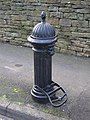
 19th C cast iron water hydrant - geograph.org.uk - 526716.jpg 480 × 640; 140 KB
-
 19th C cast iron water hydrant - geograph.org.uk - 618714.jpg 480 × 640; 124 KB
-
 19th C cast iron water hydrant - geograph.org.uk - 622542.jpg 480 × 640; 139 KB
-
 19th C cast iron water hydrant - geograph.org.uk - 623531.jpg 480 × 640; 133 KB
-
 19th C cast iron water hydrant - geograph.org.uk - 634803.jpg 480 × 640; 104 KB
-
 19th C cast iron water hydrant - geograph.org.uk - 675831.jpg 370 × 640; 77 KB
-
 19th C cast iron water hydrant - geograph.org.uk - 721449.jpg 480 × 640; 124 KB
-
 19th C cast iron water hydrant - geograph.org.uk - 721464.jpg 480 × 640; 126 KB
-

-
 20 Market Street - geograph.org.uk - 572412.jpg 480 × 640; 64 KB
-
 21 Hencotes - geograph.org.uk - 671664.jpg 640 × 479; 68 KB
-
 24 and 26 Hallstile Bank - geograph.org.uk - 530289.jpg 480 × 640; 104 KB
-
 27-31 Hallstile Bank - geograph.org.uk - 572388.jpg 640 × 480; 100 KB
_postbox_-_with_a_George_V_door,_Clayton_Street_-_geograph.org.uk_-_873649.jpg)
_postbox,_Belsize_Grove,_NW3_-_geograph.org.uk_-_762260.jpg)
_postbox,_Boscastle_Road_-_Woodsome_Road,_NW5_-_geograph.org.uk_-_1447147.jpg)
_postbox,_Church_Rise,_SE23_-_geograph.org.uk_-_899842.jpg)
_postbox,_Cromwell_Road,_SW5_-_geograph.org.uk_-_846126.jpg)
_postbox,_Daleham_Gardens,_NW3_-_geograph.org.uk_-_892526.jpg)
_postbox,_Fellows_Road_-_Merton_Rise,_NW3_-_geograph.org.uk_-_881975.jpg)
_postbox,_Fitzjohn%27s_Avenue_-_Maresfield_Gardens,_NW3_-_geograph.org.uk_-_892510.jpg)
_postbox,_Fleet_Road_-_Lawn_Road,_NW3_-_geograph.org.uk_-_889189.jpg)
_postbox,_Fortess_Road_-_Raveley_Street,_NW5_-_geograph.org.uk_-_1440188.jpg)
_postbox,_Lancaster_Drive_-_Belsize_Square,_NW3_-_geograph.org.uk_-_881962.jpg)
_postbox,_Longton_Avenue,_SE26_-_geograph.org.uk_-_900215.jpg)
_postbox,_Lyndhurst_Gardens_-_Wedderburn_Road,_NW3_-_geograph.org.uk_-_1073592.jpg)
_postbox,_Maresfield_Gardens,_NW3_-_geograph.org.uk_-_891966.jpg)
_postbox,_Netherhall_Gardens,_NW3_-_geograph.org.uk_-_891933.jpg)
_postbox,_Nevern_Square,_SW5_-_geograph.org.uk_-_846183.jpg)
_postbox,_Percy_Road,_W14_-_geograph.org.uk_-_890003.jpg)
_postbox,_Primrose_Hill_Road,_NW3_-_geograph.org.uk_-_846904.jpg)
_postbox,_Sunderland_Road,_SE23_-_geograph.org.uk_-_899831.jpg)
_postbox,_Tavistock_Road_-_Tavistock_Crescent,_W11_-_geograph.org.uk_-_883214.jpg)
_postbox,_Vale_of_Health,_NW3_-_geograph.org.uk_-_1071132.jpg)
_postbox,_Warwick_Road,_SW5_-_geograph.org.uk_-_846246.jpg)
_postbox,_Westmoreland_Road_-_Cumberland_Road_-_geograph.org.uk_-_937571.jpg)


_-_geograph.org.uk_-_720717.jpg)
_-_geograph.org.uk_-_720739.jpg)


_Tube_Station_-_geograph.org.uk_-_872621.jpg)

_Hadrian%27s_Wall_(2)_-_geograph.org.uk_-_837912.jpg)
_Hadrian%27s_Wall_-_geograph.org.uk_-_837908.jpg)
_Milecastle_33_-_geograph.org.uk_-_592666.jpg)
_ford_over_the_West_Allen_-_geograph.org.uk_-_413290.jpg)
_boggy_bit_-_geograph.org.uk_-_392366.jpg)
_old_mine_shaft_-_geograph.org.uk_-_720656.jpg)
_the_churchyard_of_St_Mary_The_Virgin,_Walthamstow_-_geograph.org.uk_-_899219.jpg)
_(former)_lock-keeper%27s_cottage_on_the_(former)_Surrey_Canal_-_geograph.org.uk_-_880620.jpg)
_boggy_bit_-_geograph.org.uk_-_391125.jpg)
_bracket_fungus_-_geograph.org.uk_-_844690.jpg)
_firebreak_in_the_forest_below_Black_Knowe_-_geograph.org.uk_-_909469.jpg)
_footbridge_over_Catton_Burn_-_geograph.org.uk_-_635948.jpg)
_footbridge_over_Halgut_Burn_-_geograph.org.uk_-_843627.jpg)
_old_mine_building_-_geograph.org.uk_-_417551.jpg)
_old_mine_shaft_-_geograph.org.uk_-_720650.jpg)
_Penfold_postbox,_Devonshire_Road,_SE23_-_geograph.org.uk_-_873455.jpg)
_Penfold_postbox,_Devonshire_Road,_SE23_-_royal_cipher_and_crest_-_geograph.org.uk_-_873460.jpg)
_sign_for_The_Bull_-_geograph.org.uk_-_911938.jpg)
_sign_for_The_Dolphin_-_geograph.org.uk_-_926191.jpg)
_sign_for_The_Fox_-_geograph.org.uk_-_838817.jpg)
_waterfall_on_Rookhope_Burn_-_geograph.org.uk_-_728905.jpg)
_sheep_hole_above_Middlehope_Burn_-_geograph.org.uk_-_697983.jpg)
_sheephole_in_a_drystone_wall_near_High_Scotch_Hall_-_geograph.org.uk_-_822095.jpg)
_sheephole_in_a_drystone_wall_near_Lonkley_Head_-_geograph.org.uk_-_822173.jpg)
_sheephole_in_drystone_wall_-_geograph.org.uk_-_849028.jpg)
_sheephole_in_drystone_wall_on_Red_Road_-_geograph.org.uk_-_703090.jpg)
_sheephole_near_Lynnshield_-_geograph.org.uk_-_614581.jpg)
_quarry_near_Walltown_-_geograph.org.uk_-_578293.jpg)
_moorland_-_geograph.org.uk_-_416583.jpg)
_lock-keeper%27s_cottage_on_the_(former)_Surrey_Canal_-_geograph.org.uk_-_880611.jpg)
_Notting_Hill_Post_Office,_W11_-_geograph.org.uk_-_873709.jpg)
_Primitive_Methodist_Chapel_-_geograph.org.uk_-_626189.jpg)
_old_mine_workings_-_geograph.org.uk_-_404295.jpg)
_Catton_-_geograph.org.uk_-_679213.jpg)
_Fishermen%27s_Window,_St_Margaret%27s_Church_-_geograph.org.uk_-_913070.jpg)
_house_where_Wilfrid_Wilson_Gibson,_Georgian_Poet,_was_born_-_geograph.org.uk_-_671768.jpg)
_Royal_London_Hospital_-_geograph.org.uk_-_889260.jpg)
_Allendale_Town_-_geograph.org.uk_-_618717.jpg)
_Belsize_Avenue_-_geograph.org.uk_-_777816.jpg)
_Bunhill_Row,_EC1_-_geograph.org.uk_-_805735.jpg)
_bus_destination_indicator_-_geograph.org.uk_-_881865.jpg)
_Catton_-_geograph.org.uk_-_691049.jpg)
_Catton_Moss_-_geograph.org.uk_-_416575.jpg)
_College_Crescent_-_geograph.org.uk_-_776036.jpg)
_Glen_Terrace_-_geograph.org.uk_-_806899.jpg)
_Glenloch_Road,_NW3_-_geograph.org.uk_-_777808.jpg)
_Great_North_Road,_N2_-_geograph.org.uk_-_805643.jpg)
_Guilford_Street,_WC1_-_geograph.org.uk_-_777742.jpg)
_Hadrian%27s_Wall_(2)_-_geograph.org.uk_-_837930.jpg)
_Hadrian%27s_Wall_(2)_-_geograph.org.uk_-_837968.jpg)
_Hadrian%27s_Wall_-_geograph.org.uk_-_837919.jpg)
_Hadrian%27s_Wall_-_geograph.org.uk_-_837959.jpg)
_Hexhamshire_Common_with_heather_in_bloom_-_geograph.org.uk_-_537449.jpg)
_Marchmont_Street,_WC1_-_geograph.org.uk_-_777679.jpg)
_Muggleswick_Common_-_geograph.org.uk_-_525865.jpg)
_Ouston_Fell_-_geograph.org.uk_-_420175.jpg)
_Quickcleugh_Moss_-_geograph.org.uk_-_752230.jpg)
_Station_Road_-_geograph.org.uk_-_692142.jpg)
_the_14th_C_town_walls_-_geograph.org.uk_-_911878.jpg)
_the_churchyard_of_St_Mary_The_Virgin,_Walthamstow_-_geograph.org.uk_-_899217.jpg)
_the_cricket_ground_on_Riding_Haugh_-_geograph.org.uk_-_639038.jpg)
_the_East_Gate,_Chesters_Fort_-_geograph.org.uk_-_1032018.jpg)
_the_tower_of_St_Andrew%27s_Church_-_north_side_-_geograph.org.uk_-_852087.jpg)
_the_West_Gate_at_Chesters_Fort_-_geograph.org.uk_-_1020871.jpg)
_Townfoot,_Slaley_-_geograph.org.uk_-_499107.jpg)
_Well_Rigg_-_geograph.org.uk_-_538768.jpg)
_Woburn_Place,_WC1_-_geograph.org.uk_-_777683.jpg)
_Wooley_-_geograph.org.uk_-_531375.jpg)
_sheephole_near_Pia_Troon_-_geograph.org.uk_-_680764.jpg)
_the_Old_Priory,_Hexham_Abbey_-_geograph.org.uk_-_671633.jpg)
_Penfold_postbox,_Shad_Thames,_SE1_-_geograph.org.uk_-_759727.jpg)
_Penfold_postbox,_Stowell_Street_-_geograph.org.uk_-_911759.jpg)
_Penfold_postbox,_Stowell_Street_-_royal_cipher_and_crest_-_geograph.org.uk_-_911769.jpg)
_Temple_of_Antenociticus_(2)_-_geograph.org.uk_-_837881.jpg)
_Temple_of_Antenociticus_(3)_-_geograph.org.uk_-_837888.jpg)
_Temple_of_Antenociticus_-_geograph.org.uk_-_837874.jpg)
_illiterate_anti-cyclist_notice_-_geograph.org.uk_-_805753.jpg)
_Castle_Stairs_-_geograph.org.uk_-_1018252.jpg)
_Allendale_Garage_-_geograph.org.uk_-_627121.jpg)
_Allendale_railway_station_-_geograph.org.uk_-_650951.jpg)
_Balham_signal_box_-_geograph.org.uk_-_899090.jpg)
_Wimbledon_A_signal_box_-_geograph.org.uk_-_897819.jpg)
_lead_smelting_flue_-_geograph.org.uk_-_603865.jpg)
_Hadrian%27s_Wall_-_Westgate_Road_(2)_-_geograph.org.uk_-_911792.jpg)
_Hadrian%27s_Wall_-_Westgate_Road_-_geograph.org.uk_-_911786.jpg)
_Hadrian%27s_Wall_east_of_Milecastle_33_-_geograph.org.uk_-_592802.jpg)
_Hadrian%27s_Wall_east_of_Milecastle_34_(2)_-_geograph.org.uk_-_948682.jpg)
_Hadrian%27s_Wall_east_of_Milecastle_34_-_geograph.org.uk_-_592773.jpg)
_Hadrian%27s_Wall_near_Shield_on_the_Wall_-_geograph.org.uk_-_592782.jpg)
_Hadrian%27s_Wall_near_Steel_Rigg_car_park_(2)_-_geograph.org.uk_-_747267.jpg)
_Hadrian%27s_Wall_west_of_Milecastle_34_-_geograph.org.uk_-_592767.jpg)
_the_Royal_Pavilion_Tavern_-_geograph.org.uk_-_879705.jpg)
_Condercum_(Benwell)_Roman_Fort_(2)_-_geograph.org.uk_-_837865.jpg)
_Condercum_(Benwell)_Roman_Fort_(3)_-_geograph.org.uk_-_837869.jpg)
_Condercum_(Benwell)_Roman_Fort_-_geograph.org.uk_-_837861.jpg)
_Milecastle_20_(Halton_Shields)_-_geograph.org.uk_-_1377065.jpg)
_Milecastle_22_(Portgate)_-_geograph.org.uk_-_1234711.jpg)
_Milecastle_25_(Codlawhill)_(2)_-_geograph.org.uk_-_1278858.jpg)
_Milecastle_27_(2)_-_geograph.org.uk_-_779937.jpg)
_Milecastle_27_-_geograph.org.uk_-_779926.jpg)
_Milecastle_32_-_geograph.org.uk_-_592657.jpg)
_Milecastle_34_-_geograph.org.uk_-_592694.jpg)
_Milecastle_38_(2)_-_geograph.org.uk_-_750626.jpg)
_Milecastle_38_(3)_-_geograph.org.uk_-_750972.jpg)
_Milecastle_38_(4)_-_geograph.org.uk_-_750975.jpg)
_Milecastle_38_-_geograph.org.uk_-_674778.jpg)
_Milecastle_40_-_geograph.org.uk_-_610092.jpg)
_Milecastle_41_-_geograph.org.uk_-_610141.jpg)
_Milecastle_44_-_geograph.org.uk_-_578353.jpg)
_Milecastle_45_-_geograph.org.uk_-_578487.jpg)
_Milecastle_47_(2)_-_geograph.org.uk_-_1551268.jpg)
_Milecastle_50_(Stone_Wall)_(High_House)_-_geograph.org.uk_-_1356771.jpg)
_Turret_22a_-_geograph.org.uk_-_1234724.jpg)
_Turret_22b_-_geograph.org.uk_-_1234730.jpg)
_Turret_33a_-_geograph.org.uk_-_592676.jpg)
_Turret_39a_-_geograph.org.uk_-_599514.jpg)
_Turret_39b_-_geograph.org.uk_-_599723.jpg)
_Castle_Stairs_-_geograph.org.uk_-_1018249.jpg)
_Hadrian%27s_Wall_-_geograph.org.uk_-_837970.jpg)
_%22hush%22_near_Allenheads_(2)_-_geograph.org.uk_-_720658.jpg)
_%22hush%22_near_Allenheads_-_geograph.org.uk_-_453280.jpg)
_cleugh_feeding_into_Anchey_Sike_-_geograph.org.uk_-_416528.jpg)
_minor_road_near_Bellingham_-_geograph.org.uk_-_493754.jpg)
_old_railway_goods_van_-_geograph.org.uk_-_413181.jpg)
_Tyne_Bridge_-_geograph.org.uk_-_927782.jpg)


_-_geograph.org.uk_-_911881.jpg)
_-_geograph.org.uk_-_911883.jpg)

_-_geograph.org.uk_-_899237.jpg)


_-_geograph.org.uk_-_738794.jpg)
_-_geograph.org.uk_-_738797.jpg)
_-_geograph.org.uk_-_738800.jpg)
_-_geograph.org.uk_-_738803.jpg)
_-_geograph.org.uk_-_738805.jpg)
_-_geograph.org.uk_-_738807.jpg)
_-_geograph.org.uk_-_738808.jpg)
_-_geograph.org.uk_-_738812.jpg)


,_North_Transept,_Hexham_Abbey_-_geograph.org.uk_-_749212.jpg)