Category:Indiana State Road 1
 | number: | (one) |
|---|---|---|
| State highways in Indiana: | 1 · 2 · 3 · 4 · 5 · 7 · 8 · 9 · 10 · 11 · 13 · 14 · 15 · 16 · 17 · 18 · 19 |
state highway in Indiana, United States .jpg)  | |||||
| Upload media | |||||
| Instance of | |||||
|---|---|---|---|---|---|
| Location | Indiana | ||||
| Transport network |
| ||||
| Owned by | |||||
| Maintained by | |||||
| Inception |
| ||||
| Length |
| ||||
| |||||
English: Media related to Indiana State Road 1, a 179.58-mile (289.01 km) north–south state highway in eastern Indiana, United States.
Subcategories
This category has the following 4 subcategories, out of 4 total.
F
I
R
Media in category "Indiana State Road 1"
The following 20 files are in this category, out of 20 total.
-
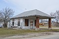 Blooming Grove former gas station.jpg 6,016 × 4,000; 7.31 MB
-
 Brookville Carnegie Library from southwest.jpg 6,016 × 4,000; 6.45 MB
-
 Butler Indiana crossroads.jpg 1,999 × 1,050; 1.35 MB
-
 Cedar Grove Bridge, upstream side.jpg 6,016 × 4,000; 6.39 MB
-
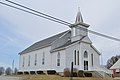 Everton Community Church.jpg 6,016 × 4,000; 5.72 MB
-
 Family Worship Church at Blooming Grove.jpg 6,016 × 4,000; 6.29 MB
-
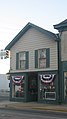
 Farmland Downtown Historic District.jpg 2,816 × 2,112; 2.67 MB
-
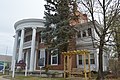 Goodwin-Farquhar House.jpg 6,016 × 4,000; 6.34 MB
-
 IN1 North - Dover (33821424821).jpg 2,400 × 1,600; 2.84 MB
-
 IN1nRoad-Int74-IND-CVG (33108030674).jpg 2,400 × 1,600; 2.03 MB
-
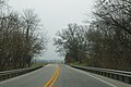 IN1nRoad-WinterTreesOnBothSides (33793808002).jpg 2,400 × 1,600; 2.64 MB
-
 IN1nRoadCurves (33821422711).jpg 2,400 × 1,600; 1.8 MB
-
 IN1nRoadSign-NearInt275 (33793807292).jpg 2,400 × 1,600; 2.14 MB
-
 Indiana 1.svg 601 × 601; 6 KB
-
 Indiana State Road 1.jpg 2,272 × 1,704; 1.12 MB
-
 John Conner Trading Post.jpg 1,584 × 2,816; 931 KB
-
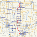 Map of Indiana State Road 1.svg 800 × 800; 662 KB
-
 Reiffsburg former Methodist church.jpg 6,016 × 4,000; 6.1 MB
-
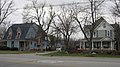 Villa North Historic District.jpg 2,816 × 1,584; 2.16 MB
-
 Wells County Courthouse P4020318.jpg 640 × 853; 63 KB


.jpg)
.jpg)
.jpg)
.jpg)


