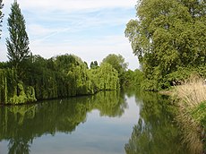
Category:Indre river
Français : L'Indre est un cours d'eau français, qui coule dans les départements du Cher, de l'Indre et d'Indre-et-Loire, en régions Centre-Val de Loire. C'est un affluent de la Loire.
river in France, tributary of the Loire | |||||
| Upload media | |||||
| Instance of | |||||
|---|---|---|---|---|---|
| Location |
| ||||
| Length |
| ||||
| Elevation above sea level |
| ||||
| Mouth of the watercourse | |||||
| Drainage basin |
| ||||
| Tributary |
| ||||
| Different from | |||||
 | |||||
Subcategories
This category has the following 17 subcategories, out of 17 total.
I
- L'Indre à vélo (1 F)
M
- Maps of Indre (river) (4 F)
P
- Pont Saint-Jean-Baptiste (10 F)
R
- Rivière Indre à Ardentes (4 F)
- Rivière Indre à Azay-le-Rideau (17 F)
- Rivière Indre à Châteauroux (2 F)
- Rivière Indre à Cormery (1 F)
- Rivière Indre à Déols (1 F)
- Rivière Indre à Loches (4 F)
- Rivière Indre à Montbazon (8 F)
- Rivière Indre à Monts (1 F)
- Rivière Indre à Rigny-Ussé (1 F)
- Rivière Indre à Truyes (1 F)
V
- Viaduc de l'Indre (4 F)
Media in category "Indre river"
The following 5 files are in this category, out of 5 total.
-
Buzançais - l'Indre (1).jpg 4,032 × 3,024; 3.58 MB
-
Buzançais - l'Indre (2).jpg 4,032 × 3,024; 3.72 MB
-
Fr-Paris--Indre.ogg 0.5 s; 8 KB
-
Rétablir la continuité écologique de la rivière Indre - effacement d'un seuil à Saint-Genou.webm 5 min 6 s, 1,920 × 1,080; 103.63 MB
-
Vacances en indre et loire.jpg 1,920 × 1,080; 874 KB


