Category:Ingatestone
village in Essex, England, UK  | |||||
| Upload media | |||||
| Instance of |
| ||||
|---|---|---|---|---|---|
| Location | Ingatestone and Fryerning, Brentwood, Essex, East of England, England | ||||
 | |||||
Subcategories
This category has the following 7 subcategories, out of 7 total.
H
- Heybridge, Brentwood (2 F)
- High Street, Ingatestone (20 F)
I
- Ingatestone Coaches (2 F)
- Ingatestone railway station (43 F)
M
- Sarah Miles (4 F)
Media in category "Ingatestone"
The following 41 files are in this category, out of 41 total.
-
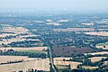
 A12, Ingatestone, Essex - geograph.org.uk - 59065.jpg 640 × 480; 87 KB
-
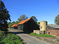 Bacons Farm near Heybridge, Essex - geograph.org.uk - 67879.jpg 640 × 480; 101 KB
-
 Ceramic relief mural, Ingatestone (1969) (geograph 3493960).jpg 1,461 × 2,561; 1.45 MB
-
 Dafodils at Green Street Ingatestone , Essex , March 2012 - panoramio.jpg 3,588 × 2,392; 2.33 MB
-
 Footpath and footbridge on Stock Lane - geograph.org.uk - 753372.jpg 640 × 480; 110 KB
-
 Fryerning Lane enters Ingatestone (geograph 2602514).jpg 640 × 428; 110 KB
-
 Ginge Petre almshouses (1840) (geograph 3493866).jpg 3,591 × 2,174; 2.8 MB
-
 Ginge Petre almshouses (1840) (geograph 3493906).jpg 3,872 × 2,592; 3.56 MB
-
 Ingatestone and Fryerning CC Pavilion (geograph 2481541).jpg 640 × 428; 78 KB
-
 Ingatestone Cricket Pitch (geograph 2481523).jpg 640 × 428; 57 KB
-
 Ingatestone Das Postamt.JPG 2,272 × 1,704; 921 KB
-
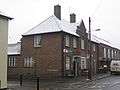
 Ingatestone Post Office (geograph 3498614).jpg 3,872 × 2,592; 2.76 MB
-
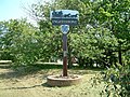 Ingatestone Sign.jpg 640 × 480; 178 KB
-
 Ingatestone sunrise (Hall lane) , April 2012 - panoramio.jpg 3,311 × 2,196; 2.1 MB
-
 Ingatestone Wohnhauser.JPG 2,272 × 1,704; 1.37 MB
-
 Ingatestone.jpg 1,024 × 681; 527 KB
-
 Jowett Jupiter with Armistice Day poppy.jpg 3,130 × 1,805; 1.35 MB
-
 No Gold at the end of this Rainbow....... - panoramio.jpg 3,902 × 1,969; 1.95 MB
-
 Norton Road, Ingatestone - geograph.org.uk - 1358278.jpg 640 × 480; 123 KB
-
 Old Cast Iron Milepost (geograph 4313008).jpg 1,024 × 683; 169 KB
-
 Rape seed at Trueloves Lane , Ingatestone , Essex - panoramio.jpg 3,448 × 2,287; 1.8 MB
-

-
 Stock Lane, heading towards Buttsbury - geograph.org.uk - 753347.jpg 640 × 480; 113 KB
-
 The Co-operative, Ingatestone.jpg 1,306 × 979; 243 KB
-
 The Hyde Chapman.jpeg 1,000 × 635; 477 KB
-
 The railway bridge on Burnthouse Lane - geograph.org.uk - 688735.jpg 640 × 480; 70 KB
-
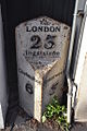 To London 23 (geograph 4313005).jpg 683 × 1,024; 188 KB
-
 Travel Agent in Ingatestone High Street - geograph.org.uk - 1702766.jpg 2,592 × 1,944; 762 KB
-
 United Reformed Church, Ingatestone (geograph 3493941).jpg 3,376 × 2,347; 2.67 MB
-
 United Reformed Church, Ingatestone, Essex (geograph 2040316).jpg 640 × 493; 110 KB
-

-
 Clock Tower, Ingatestone Hall, Essex - geograph.org.uk - 68015.jpg 640 × 480; 105 KB
-
 Cottages, Stock Lane, Ingatestone, Essex - geograph.org.uk - 59117.jpg 640 × 519; 111 KB
-
 Entrance to Ingatestone, Essex - geograph.org.uk - 67998.jpg 640 × 480; 153 KB
-
 Footbridge and footpath, Stock, Essex - geograph.org.uk - 59844.jpg 640 × 480; 136 KB
-
 Footpath to Ingatestone - geograph.org.uk - 752619.jpg 640 × 480; 98 KB
-
 Ford, Buttsbury, Essex - geograph.org.uk - 67880.jpg 640 × 480; 106 KB
-
 Ingatestone Saddlery Centre - geograph.org.uk - 753142.jpg 640 × 441; 60 KB
-
 Part of Hall Lane - geograph.org.uk - 683342.jpg 640 × 476; 54 KB
-
 Stock Lane Bridge, Ingatestone - geograph.org.uk - 59064.jpg 640 × 480; 139 KB
-
 The Remus Memorial Horse Sanctuary - geograph.org.uk - 48329.jpg 640 × 223; 28 KB


_(geograph_3493960).jpg)


.jpg)
_(geograph_3493866).jpg)
_(geograph_3493906).jpg)
.jpg)
.jpg)

.jpg)

_,_April_2012_-_panoramio.jpg)


.jpg)


.jpg)

.jpg)
.jpg)


