Category:Inner Farne Light
| Object location | | View all coordinates using: OpenStreetMap |
|---|
English: Farne Lighthouse
lighthouse in North Sunderland, Northumberland, England  | |||||
| Upload media | |||||
| Instance of | |||||
|---|---|---|---|---|---|
| Made from material | |||||
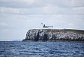
| Location | Farne Islands, North Sunderland, Northumberland, North East England, England | ||||
| Operator | |||||
| Heritage designation |
| ||||
| Service entry |
| ||||
| Inception |
| ||||
| Significant event |
| ||||
| Height |
| ||||
 | |||||
Media in category "Inner Farne Light"
The following 50 files are in this category, out of 50 total.
-

-

-
-

-
 Coastal Northumberland , Inner Farne Lighthouse - geograph.org.uk - 3396845.jpg 1,200 × 1,600; 212 KB
-

-
-
 Distant lighthouse (27363310220).jpg 3,872 × 2,592; 3.61 MB
-
 Diving in the Farne Islands banner.JPG 2,100 × 300; 570 KB
-
 Farewell to Inner Farne - geograph.org.uk - 3547492.jpg 1,024 × 768; 177 KB
-
 Farne island.jpg 6,000 × 4,000; 13.15 MB
-
 Farne Islands - geograph.org.uk - 946629.jpg 640 × 419; 55 KB
-
 Farne Islands banner from Bamburgh Castle.jpg 6,300 × 900; 2.36 MB
-
 Farne Islands from Bamburgh Castle.jpg 6,884 × 2,363; 5.7 MB
-
 Farne Lighthouse (28916637362).jpg 5,268 × 3,517; 1.28 MB
-
 Farne Lighthouse from a boat on a sunny August day.jpg 2,048 × 745; 266 KB
-
 Inner Farne (48397876491).jpg 5,184 × 3,888; 3.59 MB
-
 Inner Farne and lighthouse - geograph.org.uk - 2562975.jpg 640 × 359; 193 KB
-
 Inner Farne Lighthouse (48397906076).jpg 3,888 × 5,184; 2.9 MB
-
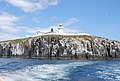
 Inner Farne Lighthouse (48397913441).jpg 5,184 × 3,888; 3.52 MB
-
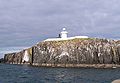
 Inner Farne Lighthouse - geograph.org.uk - 3167348.jpg 3,968 × 2,232; 5.25 MB
-
 Inner Farne Lighthouse - geograph.org.uk - 3230465.jpg 3,008 × 2,000; 651 KB
-
 Inner Farne lighthouse - geograph.org.uk - 4087108.jpg 1,024 × 768; 151 KB
-
 Inner Farne Lighthouse - geograph.org.uk - 5503143.jpg 3,104 × 2,068; 863 KB
-
 Inner Farne Lighthouse - geograph.org.uk - 5516777.jpg 1,600 × 999; 365 KB
-
 Inner Farne lighthouse - geograph.org.uk - 6247044.jpg 640 × 360; 63 KB
-
 Inner Farne lighthouse - geograph.org.uk - 908407.jpg 626 × 640; 63 KB
-
 Inner Farne Lighthouse and Cliff - geograph.org.uk - 2780595.jpg 427 × 640; 247 KB
-
 Inner Farne Lighthouse and Cliffs.jpg 2,021 × 1,405; 118 KB
-
 Inner Farne Wide View.jpg 2,918 × 2,189; 832 KB
-
 Inner Farne, Lighthouse - geograph.org.uk - 5430855.jpg 3,517 × 2,122; 2.23 MB
-
 Lighthouse and cliffs, Inner Farne - geograph.org.uk - 1060065.jpg 640 × 480; 76 KB
-
 Lighthouse Inner Farne - geograph.org.uk - 180343.jpg 640 × 480; 98 KB
-
 Lighthouse on Inner Farne - geograph.org.uk - 2468789.jpg 1,920 × 2,560; 1.79 MB
-
 Lighthouse on Inner Farne - geograph.org.uk - 2691623.jpg 640 × 430; 72 KB
-
 Lighthouse on Inner Farne - geograph.org.uk - 2691630.jpg 640 × 367; 52 KB
-
 Lighthouse on Inner Farne - geograph.org.uk - 42000.jpg 640 × 480; 104 KB
-
 Lighthouse on Inner Farne - geograph.org.uk - 4214258.jpg 640 × 480; 57 KB
-
 Lighthouse on the Inner Farne (27236262676).jpg 2,592 × 1,936; 1.35 MB
-
 Lighthouse, Inner Farne - geograph.org.uk - 1059918.jpg 640 × 480; 32 KB
-
 Lighthouse, Inner Farne - geograph.org.uk - 2678002.jpg 640 × 430; 52 KB
-

-
 Passing south of Inner Farne lighthouse - geograph.org.uk - 1378099.jpg 640 × 426; 108 KB
-
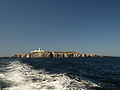
 Seahouses MMB 08 Farne Islands.jpg 4,548 × 2,805; 2.41 MB
-
 Seahouses MMB 10 Farne Islands.jpg 4,446 × 2,514; 1.9 MB
-
 Seahouses MMB 21 Farne Islands.jpg 4,641 × 2,781; 3.06 MB
-
 Seahouses MMB 24 Farne Islands.jpg 4,662 × 2,414; 2.57 MB
-

-
 The lighthouse on Inner Farne - geograph.org.uk - 4053660.jpg 1,600 × 1,200; 271 KB
-
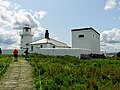
 Path towards the lighthouse - geograph.org.uk - 431984.jpg 640 × 427; 129 KB


.jpg)


.jpg)
.jpg)

.jpg)
.jpg)


.jpg)


