Category:Inver Grove Heights, Minnesota
city in Dakota County, Minnesota, United States .jpg) Vattentornet i Inver Grove Heights  Inver Grove Heights i Dakota County och Minnesota | |||||
| Upload media | |||||
| Instance of | |||||
|---|---|---|---|---|---|
| Location | Dakota County, Minnesota | ||||
| Located in or next to body of water | |||||
| Inception |
| ||||
| Population |
| ||||
| Area |
| ||||
| Elevation above sea level |
| ||||
| official website | |||||
 | |||||
Main Wikipedia article: Inver Grove Heights, Minnesota.
Media in category "Inver Grove Heights, Minnesota"
The following 20 files are in this category, out of 20 total.
-

-
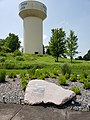 B-52 Memorial Inver Grove Heights.jpg 3,024 × 4,032; 6.23 MB
-
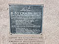 B-52 Memorial Plaque Inver Grove Heights MN.jpg 4,032 × 3,024; 8.55 MB
-
 Bike Trail in Inver Grove Heights, Dakota County, Minnesota (29162556957).jpg 3,913 × 2,800; 11.84 MB
-
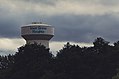 City of Inver Grove Heights, Minnesota Water Tower (35608108604).jpg 3,990 × 2,639; 5.82 MB
-
 Dakota County - Preserved Natural Area Sign (31818833388).jpg 6,016 × 4,016; 11.13 MB
-
 Environment and Natural Resources Trust Fund - Minnesota (31818837808).jpg 5,145 × 3,568; 5.95 MB
-
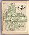
 Inver Grove Heights in 1874.jpg 795 × 768; 137 KB
-
 Inver Hills Fine Arts Building.jpg 1,280 × 960; 340 KB
-
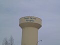 InvergroverheightsMNwatertower.JPG 4,320 × 3,240; 4.31 MB
-
 Jersey's Bar Inver Grove Heights MN.jpg 4,032 × 3,024; 3.83 MB
-
Join the NFR - Judy Smith Trill.webm 1 min 5 s, 1,920 × 1,080; 27.53 MB
-
 Map of Dakota County from the 1874 Minnesota State Atlas.jpg 5,604 × 6,645; 7.63 MB
-
 Map of Inver Grove from the 1874 Minnesota State Atlas (cropped).jpg 1,067 × 1,244; 425 KB
-
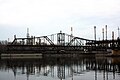 Newport Rail Bridge2.JPG 4,272 × 2,848; 3.03 MB
-
 Ordway Field Station (Macalester College) (31818826678).jpg 5,799 × 3,915; 9.45 MB
-
 Rock Island Swing Bridge.jpg 3,068 × 3,068; 2.04 MB
-
 Salem Church Inver Grove Heights MN.jpg 3,024 × 4,032; 4.67 MB
-
 Schmidt Lake in Inver Grove Heights.jpg 986 × 723; 659 KB
-
 Swing Bridge Inver Grove Heights MN.jpg 3,024 × 4,032; 2.75 MB


.jpg)
.jpg)
.jpg)


.jpg)

_(31818826678).jpg)


