Category:Inverclyde

Council areas (municipalities) of Scotland: Aberdeen · Aberdeenshire · Angus · Argyll and Bute · Clackmannanshire · Dumfries and Galloway · Dundee · East Ayrshire · East Dunbartonshire · East Lothian · East Renfrewshire · Edinburgh · Falkirk · Fife · Glasgow · Highland · Inverclyde · Midlothian · Moray · North Ayrshire · North Lanarkshire · Outer Hebrides · Orkney Islands · Perth and Kinross · Renfrewshire · Scottish Borders · Shetland Islands · South Ayrshire · South Lanarkshire · Stirling · West Dunbartonshire · West Lothian
Main Wikipedia article: Inverclyde.
council area used for local government in Scotland  Seu del Consell d'Inverclyde a la ciutat de Greenock  | |||||
| Upload media | |||||
| Instance of | |||||
|---|---|---|---|---|---|
| Part of |
| ||||
| Location | Scotland | ||||
| Capital | |||||
| Population |
| ||||
| Area |
| ||||
| Different from | |||||
| official website | |||||
 | |||||
Subcategories
This category has the following 26 subcategories, out of 26 total.
Media in category "Inverclyde"
The following 200 files are in this category, out of 335 total.
(previous page) (next page)-
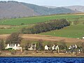 Ardoch - geograph.org.uk - 5257276.jpg 640 × 480; 129 KB
-
 Arran from Bute - geograph.org.uk - 4058601.jpg 640 × 381; 122 KB
-
 Arran from Lunderston Bay - geograph.org.uk - 3502338.jpg 640 × 349; 100 KB
-
 Arran from Lunderston Bay - geograph.org.uk - 3502355.jpg 640 × 336; 91 KB
-
 Arran from Lunderston Bay - geograph.org.uk - 3502366.jpg 640 × 355; 96 KB
-
 Arran from Lunderston Bay - geograph.org.uk - 4058588.jpg 640 × 387; 163 KB
-
 Arran from Lunderston Bay - geograph.org.uk - 4058591.jpg 640 × 321; 107 KB
-
 Arran from Lunderston Bay - geograph.org.uk - 4058626.jpg 640 × 349; 139 KB
-
 Arran from Lunderston Bay - geograph.org.uk - 4249155.jpg 640 × 357; 72 KB
-
 Auchentiber from across Devol Moor - geograph.org.uk - 3335173.jpg 640 × 480; 47 KB
-
 Basalt dyke at Lunderston Bay - geograph.org.uk - 5022164.jpg 640 × 422; 167 KB
-
 Basalt dyke at Lunderston Bay - geograph.org.uk - 5022175.jpg 640 × 480; 197 KB
-
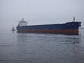
 Battler passing Port Glasgow - geograph.org.uk - 3770181.jpg 640 × 255; 71 KB
-
 Beach hut at Lunderston Bay - geograph.org.uk - 3659908.jpg 640 × 480; 195 KB
-
 Beach hut at Lunderston Bay - geograph.org.uk - 4058100.jpg 640 × 335; 128 KB
-
 Beach huts by Cloch Lighthouse - geograph.org.uk - 3455315.jpg 640 × 480; 248 KB
-
 Beach huts by Cloch Lighthouse - geograph.org.uk - 3455317.jpg 640 × 480; 238 KB
-
 Beach huts by Cloch Lighthouse - geograph.org.uk - 3455318.jpg 640 × 480; 228 KB
-
 Bedrock at Lunderston Bay - geograph.org.uk - 5022158.jpg 640 × 480; 180 KB
-
 Bedrock at Lunderston Bay - geograph.org.uk - 5022178.jpg 640 × 421; 151 KB
-
 Bedrock at Lunderston Bay - geograph.org.uk - 5878444.jpg 1,024 × 768; 358 KB
-
 Ben Bowie from Port Glasgow - geograph.org.uk - 3358298.jpg 480 × 640; 110 KB
-
 Bike & Bens from Old Largs Road - panoramio.jpg 1,280 × 960; 815 KB
-
 Biter passing Port Glasgow - geograph.org.uk - 3770185.jpg 640 × 356; 120 KB
-
 Bogston - geograph.org.uk - 6266062.jpg 1,024 × 520; 245 KB
-
 Bollard at James Watt Dock - geograph.org.uk - 6137561.jpg 1,024 × 768; 336 KB
-
-
 Bruiser passing Port Glasgow - geograph.org.uk - 3770177.jpg 640 × 334; 108 KB
-
 Building site at James Watt Dock - geograph.org.uk - 6137570.jpg 1,024 × 462; 168 KB
-
 Building site at James Watt Dock - geograph.org.uk - 6265892.jpg 1,024 × 711; 242 KB
-
 Burgia approaching Port Glasgow - geograph.org.uk - 4825727.jpg 640 × 480; 70 KB
-
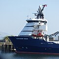
 Cameron on the Clyde - geograph.org.uk - 5253337.jpg 640 × 480; 137 KB
-
 Cardross and Cardross Crematorium - geograph.org.uk - 5257279.jpg 640 × 423; 135 KB
-
 Cardross and the Clyde - geograph.org.uk - 5258370.jpg 640 × 431; 136 KB
-
 Cardross and the Clyde - geograph.org.uk - 5259424.jpg 640 × 418; 141 KB
-

-

-
 Cats Castle - geograph.org.uk - 5257271.jpg 640 × 480; 163 KB
-
 Ceona Amazon detail - geograph.org.uk - 5141804.jpg 1,200 × 1,600; 351 KB
-
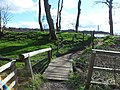
 Coastal path at Lunderston Bay - geograph.org.uk - 2466066.jpg 640 × 480; 144 KB
-
 Coastal path at Lunderston Bay - geograph.org.uk - 4249157.jpg 640 × 480; 191 KB
-
 Coastal path at Lunderston Bay - geograph.org.uk - 4249159.jpg 527 × 640; 179 KB
-
 Coastal path signs at Bogstom - geograph.org.uk - 6266058.jpg 768 × 1,024; 477 KB
-
 Coastline near the Black Rocks - geograph.org.uk - 3493368.jpg 1,920 × 1,280; 1.68 MB
-
 Coat of Arms Inverclyde.svg 461 × 735; 268 KB
-
 Cockle Bank and the Arrochar Alps - geograph.org.uk - 4647492.jpg 640 × 376; 68 KB
-
 Crew Parade - geograph.org.uk - 2502836.jpg 462 × 640; 89 KB
-
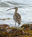 Curlew at Lunderston Bay - geograph.org.uk - 5484303.jpg 561 × 640; 164 KB
-
 Curlew at Lunderston Bay - geograph.org.uk - 5484304.jpg 640 × 480; 150 KB
-
 Cycle Route 75 at Lunderston Bay - geograph.org.uk - 3560646.jpg 1,920 × 1,280; 1.7 MB
-
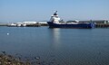
 Disney Magic and MSC Mailn off Greenock - geograph.org.uk - 5907075.jpg 1,024 × 509; 163 KB
-

-
 Douglas Rae Road - geograph.org.uk - 6265888.jpg 1,024 × 697; 260 KB
-
 Douglas Rae Road - geograph.org.uk - 6265890.jpg 1,024 × 449; 151 KB
-
 Dumbarton Rock from Parklea - geograph.org.uk - 5255285.jpg 640 × 426; 143 KB
-
 Dunoon Pier - geograph.org.uk - 2466130.jpg 640 × 392; 97 KB
-
 Dunoon Pier - geograph.org.uk - 4963177.jpg 640 × 407; 153 KB
-
 Dusk at Western Ferries car park Mc Inroys Point - geograph.org.uk - 2691060.jpg 2,560 × 1,920; 1.85 MB
-
 East Hamilton Street - geograph.org.uk - 6265886.jpg 1,024 × 486; 126 KB
-
 East Hamilton Street - geograph.org.uk - 6265894.jpg 1,024 × 496; 150 KB
-
 Finlaystone Burn - geograph.org.uk - 3034174.jpg 640 × 377; 79 KB
-
 Finlaystone Point - geograph.org.uk - 5196403.jpg 640 × 299; 68 KB
-
 Firth of Clyde - geograph.org.uk - 3493366.jpg 1,920 × 1,280; 1.28 MB
-
 Firth of Clyde from the Black Rocks - geograph.org.uk - 2856429.jpg 640 × 480; 89 KB
-
 Footpath at Lunderston Bay - geograph.org.uk - 3502313.jpg 640 × 480; 158 KB
-
 Footpath at Lunderston Bay - geograph.org.uk - 3560680.jpg 1,920 × 1,280; 1.86 MB
-
 Footpath to Inverkip - geograph.org.uk - 3560650.jpg 1,920 × 1,280; 1.68 MB
-
 Footpath to Inverkip - geograph.org.uk - 3560674.jpg 1,920 × 1,280; 1.63 MB
-
 Footpath to Lunderston Bay - geograph.org.uk - 4249187.jpg 480 × 640; 228 KB
-
 Footpath-Cycle Route 75 at Lunderston Bay - geograph.org.uk - 3493350.jpg 1,920 × 1,280; 1.6 MB
-
 Footpath-Cycle Route 75 at Lunderston Bay - geograph.org.uk - 3493364.jpg 1,920 × 1,280; 1.46 MB
-
 Footpath-Cycle Route 75 towards Gourock - geograph.org.uk - 3493347.jpg 1,920 × 1,280; 1.62 MB
-
 Footpath-Cycle Route 75 towards Gourock - geograph.org.uk - 3493359.jpg 1,920 × 1,280; 1.87 MB
-
 Former Glen shipyard - geograph.org.uk - 3358291.jpg 640 × 404; 124 KB
-
 Former Kingston shipyard - geograph.org.uk - 3358253.jpg 640 × 392; 112 KB
-
 Former Kingston shipyard site - geograph.org.uk - 5142125.jpg 640 × 480; 146 KB
-
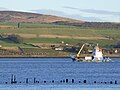
 Gantock lighthouse - geograph.org.uk - 4963181.jpg 640 × 407; 159 KB
-
 Gas pipeline marker - geograph.org.uk - 3659903.jpg 480 × 640; 194 KB
-
 Gas pipeline marker - geograph.org.uk - 5468718.jpg 640 × 480; 149 KB
-
 Great Harbour and the Firth of Clyde - geograph.org.uk - 5146731.jpg 640 × 480; 107 KB
-
 Great Harbour Bailey bridge - geograph.org.uk - 6137579.jpg 1,024 × 398; 141 KB
-
 Great Harbour bridge - geograph.org.uk - 4959585.jpg 640 × 322; 69 KB
-
 Great Harbour, Greenock - geograph.org.uk - 5874315.jpg 1,600 × 1,044; 400 KB
-
 Greenock from Port Glasgow - geograph.org.uk - 3050369.jpg 640 × 374; 119 KB
-
 High tide line at Finlaystone Burn - geograph.org.uk - 5258088.jpg 640 × 480; 178 KB
-
 HMS Defender approaching Greenock - geograph.org.uk - 3770156.jpg 640 × 385; 112 KB
-
 Igneous rock beside the Tinker's Well - geograph.org.uk - 5907783.jpg 1,600 × 1,200; 482 KB
-
 Inchgreen drydock - geograph.org.uk - 4396655.jpg 640 × 395; 112 KB
-
 Inchgreen drydock buildings - geograph.org.uk - 6266044.jpg 1,024 × 485; 174 KB
-
 Inchgreen drydock buildings - geograph.org.uk - 6266051.jpg 1,024 × 768; 261 KB
-
 Inchgreen drydock entrance - geograph.org.uk - 6266047.jpg 1,024 × 530; 192 KB
-
 Inchgreen drydock office building - geograph.org.uk - 6266040.jpg 1,024 × 701; 291 KB
-
 Inverclyde boundary sign - geograph.org.uk - 3190767.jpg 640 × 480; 113 KB
-
 Inverclyde Council 1977.svg 360 × 185; 2 KB
-
 Inverclyde waterfront - geograph.org.uk - 4826545.jpg 640 × 401; 113 KB
-
 Inverclyde waterfront - geograph.org.uk - 4832492.jpg 640 × 321; 89 KB
-
 Inverclyde waterfront - geograph.org.uk - 4832493.jpg 640 × 418; 121 KB
-
 Inverclyde waterfront - geograph.org.uk - 4832495.jpg 640 × 376; 86 KB
-
 Inverclyde waterfront - geograph.org.uk - 4832496.jpg 640 × 321; 80 KB
-
 Inverkip from Innellan - geograph.org.uk - 3086547.jpg 640 × 265; 53 KB
-
 Inverkip Power Station - geograph.org.uk - 5290738.jpg 4,320 × 3,240; 2.91 MB
-
 James Watt Dock - geograph.org.uk - 6137542.jpg 1,024 × 768; 294 KB
-
 James Watt Dock Marina - geograph.org.uk - 5921430.jpg 1,024 × 768; 312 KB
-
 James Watt Dock Marina - geograph.org.uk - 5921437.jpg 1,024 × 768; 309 KB
-
 James Watt Dock Marina - geograph.org.uk - 5921438.jpg 1,024 × 768; 299 KB
-
 James Watt Dock sugar sheds - geograph.org.uk - 6137537.jpg 1,024 × 504; 215 KB
-
 James Watt Dock Titan crane - geograph.org.uk - 6137558.jpg 1,024 × 768; 300 KB
-
 James Watt Marina - geograph.org.uk - 5112923.jpg 640 × 427; 67 KB
-
 Jigging in the Rigging - geograph.org.uk - 2502506.jpg 417 × 640; 106 KB
-
-
 Kingdom of Fife at Greenock - geograph.org.uk - 2216437.jpg 640 × 480; 109 KB
-
 Kingdom of Fife at the Great Harbour - geograph.org.uk - 3585227.jpg 640 × 480; 103 KB
-
 Kirn from Lunderston Bay - geograph.org.uk - 4963199.jpg 640 × 480; 153 KB
-
 Kirn from Lunderston Bay - geograph.org.uk - 4963200.jpg 640 × 440; 121 KB
-
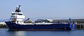
 Kommandor Susan at Greenock - geograph.org.uk - 6137553.jpg 1,024 × 556; 203 KB
-
 Kommandor Susan at Greenock - geograph.org.uk - 6137555.jpg 1,024 × 1,023; 266 KB
-
 Kommandor Susan at Greenock - geograph.org.uk - 6264662.jpg 1,024 × 612; 176 KB
-
 Kommandor Susan at Greenock - geograph.org.uk - 6264663.jpg 1,024 × 446; 122 KB
-
 Leapmoor Forest Path - geograph.org.uk - 3560678.jpg 1,920 × 1,280; 1.59 MB
-
 Louds Island at the Great Harbour - geograph.org.uk - 3190816.jpg 640 × 480; 106 KB
-
 Lunderston Bay - geograph.org.uk - 5022177.jpg 640 × 480; 192 KB
-
 Lunderston Bay - geograph.org.uk - 5022180.jpg 640 × 415; 169 KB
-
 Lunderston Bay - geograph.org.uk - 5022198.jpg 640 × 480; 138 KB
-
 Lunderston Bay - geograph.org.uk - 5288861.jpg 4,253 × 3,146; 1.27 MB
-
 Lunderston Bay - geograph.org.uk - 5288908.jpg 3,009 × 2,250; 635 KB
-
 Lunderston Bay - geograph.org.uk - 5587095.jpg 1,024 × 768; 155 KB
-
 Lunderston Bay - geograph.org.uk - 5607724.jpg 1,024 × 768; 92 KB
-
 Lunderston Bay - geograph.org.uk - 5607736.jpg 1,024 × 768; 172 KB
-
 Lunderston Bay - geograph.org.uk - 6225646.jpg 1,024 × 784; 539 KB
-
 Lunderston Bay - geograph.org.uk - 6225648.jpg 1,024 × 768; 316 KB
-
 Lunderston Bay - geograph.org.uk - 6225649.jpg 1,024 × 768; 348 KB
-

-

-
 Mary Elizabeth off Greenock - geograph.org.uk - 3054479.jpg 640 × 303; 48 KB
-
 Mathernock Battery - geograph.org.uk - 4969343.jpg 640 × 480; 131 KB
-
 Mathernock Battery - geograph.org.uk - 4969360.jpg 640 × 480; 148 KB
-
 Mathernock Battery - geograph.org.uk - 4969447.jpg 640 × 480; 186 KB
-
 Mathernock Battery - geograph.org.uk - 4969448.jpg 640 × 480; 189 KB
-
 Mathernock Battery - geograph.org.uk - 4970817.jpg 640 × 480; 142 KB
-
 Mathernock Battery accommodation camp - geograph.org.uk - 4969336.jpg 640 × 480; 181 KB
-
 Mathernock Battery accommodation camp - geograph.org.uk - 4969373.jpg 640 × 480; 176 KB
-
 Mathernock Battery accommodation camp - geograph.org.uk - 4969417.jpg 640 × 480; 152 KB
-
 Mathernock Battery accommodation camp - geograph.org.uk - 4969419.jpg 640 × 480; 163 KB
-
 Mathernock Battery accommodation camp - geograph.org.uk - 4969421.jpg 640 × 480; 154 KB
-
 Mathernock Battery accommodation camp - geograph.org.uk - 4969424.jpg 640 × 480; 153 KB
-
 Mathernock Battery accommodation camp - geograph.org.uk - 4969425.jpg 640 × 480; 170 KB
-
 Mathernock Battery accommodation camp - geograph.org.uk - 4969429.jpg 640 × 480; 177 KB
-
 Mathernock Battery accommodation camp - geograph.org.uk - 4969430.jpg 640 × 480; 171 KB
-
 Mathernock Battery accommodation camp - geograph.org.uk - 4969440.jpg 640 × 480; 156 KB
-
 Mathernock Battery accommodation camp - geograph.org.uk - 4969442.jpg 640 × 480; 207 KB
-
 Mathernock Battery accommodation camp - geograph.org.uk - 4969443.jpg 640 × 480; 180 KB
-
 Mathernock Battery accommodation camp - geograph.org.uk - 4969445.jpg 640 × 480; 176 KB
-
 McInroy's Point , Ferry Terminal - geograph.org.uk - 2323617.jpg 3,188 × 2,385; 1.65 MB
-
 McInroy's Point ferry Terminal - geograph.org.uk - 2419139.jpg 640 × 430; 66 KB
-
 McInroys Point ferry terminal - geograph.org.uk - 2465486.jpg 640 × 346; 87 KB
-

-

-

-

-

-

-
-

-

-
-

-

-

-

-
-
-
-

-
-
-
-

-
-
-
-

-

-

-

-

-

-

-
-

-

-

-

-

-
 Mist on the Clyde at Port Glasgow - geograph.org.uk - 5627290.jpg 640 × 480; 95 KB
-
 Mist on the Clyde at Port Glasgow - geograph.org.uk - 5627294.jpg 640 × 325; 32 KB
-
 Moonrise over Lunderston Bay - geograph.org.uk - 6263876.jpg 1,024 × 581; 167 KB
-
 Moonrise over Lunderston Bay - geograph.org.uk - 6263878.jpg 1,024 × 683; 230 KB
-
 MPI Adventure at Greenock - geograph.org.uk - 5698526.jpg 640 × 396; 124 KB
-
 MPI Adventure at Greenock - geograph.org.uk - 5698527.jpg 640 × 471; 109 KB
-
 MPI Adventure at Greenock - geograph.org.uk - 5698528.jpg 640 × 480; 152 KB


