Category:Ivonbrook Grange
civil parish in Derbyshire Dales district, Derbyshire, England | |||||
| Upload media | |||||
| Instance of | |||||
|---|---|---|---|---|---|
| Location | Derbyshire Dales, Derbyshire, East Midlands, England | ||||
 | |||||
Subcategories
This category has only the following subcategory.
G
Media in category "Ivonbrook Grange"
The following 19 files are in this category, out of 19 total.
-
 A bend in the B5056 - geograph.org.uk - 3997045.jpg 640 × 480; 64 KB
-
 A source of power - View from B5056 - geograph.org.uk - 1377214.jpg 640 × 480; 78 KB
-
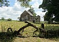 Abandoned farm by Stunstead Lane - geograph.org.uk - 4076540.jpg 2,457 × 1,755; 1.75 MB
-
 Abandoned farm near Stunstead Lane - geograph.org.uk - 4076547.jpg 2,534 × 1,810; 1.61 MB
-
 Entrance to Ivonbrook quarry - geograph.org.uk - 5692505.jpg 1,280 × 719; 401 KB
-

-
 Grangemill - geograph.org.uk - 5017987.jpg 4,517 × 3,355; 1.66 MB
-
 Grass and stone - geograph.org.uk - 2361233.jpg 950 × 608; 313 KB
-
 Grazing north of Grangemill - geograph.org.uk - 3997026.jpg 640 × 480; 85 KB
-
 Ivonbrook Quarry - geograph.org.uk - 272447.jpg 640 × 480; 120 KB
-
 Mill Farm - geograph.org.uk - 3373136.jpg 640 × 488; 262 KB
-
 Millhouse, Grangemill - geograph.org.uk - 4964249.jpg 1,800 × 1,350; 638 KB
-
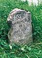 Old Milestone by the B5056, north of Grangemill (geograph 5623728).jpg 1,007 × 1,404; 256 KB
-
 Path to the A5012 from Ivonbrook Quarry - geograph.org.uk - 2361236.jpg 950 × 639; 369 KB
-

-
 Ruin near Stunstead Lane - geograph.org.uk - 2361204.jpg 950 × 610; 375 KB
-
 Tophill Farm - geograph.org.uk - 5017982.jpg 4,689 × 3,153; 1.86 MB
-
 Tophill Farm - geograph.org.uk - 5017984.jpg 5,184 × 3,456; 1.68 MB
-
 Track corner by Ivonbrook quarry - geograph.org.uk - 2361225.jpg 950 × 636; 355 KB


.jpg)


