Category:Jüdischer Friedhof Ahrweiler
| Object location | | View all coordinates using: OpenStreetMap |
|---|
 | |||||
| Upload media | |||||
| Instance of | |||||
|---|---|---|---|---|---|
| Location | Bad Neuenahr-Ahrweiler, Ahrweiler, Rhineland-Palatinate, Germany | ||||
| Heritage designation | |||||
 | |||||
Media in category "Jüdischer Friedhof Ahrweiler"
The following 12 files are in this category, out of 12 total.
-
 Ahrweiler Jüdischer Friedhof 453.JPG 3,776 × 2,520; 5.68 MB
-
 Ahrweiler Jüdischer Friedhof 454.JPG 2,520 × 3,776; 4.28 MB
-
 Ahrweiler Jüdischer Friedhof 457.JPG 3,776 × 2,520; 6.17 MB
-
 Ahrweiler Jüdischer Friedhof 458.JPG 2,520 × 3,776; 4.15 MB
-
 Ahrweiler Jüdischer Friedhof 459.JPG 2,520 × 3,776; 4.27 MB
-
 Jüdischer Friedhof Ahrweiler 136.JPG 3,776 × 2,520; 6.25 MB
-
 Jüdischer Friedhof Ahrweiler 137.JPG 3,776 × 2,520; 5.94 MB
-
 Jüdischer Friedhof Ahrweiler 151.JPG 2,520 × 3,776; 4.16 MB
-
 Jüdischer Friedhof Ahrweiler 155.JPG 3,776 × 2,520; 6.14 MB
-
 Jüdischer Friedhof Ahrweiler Gedenktafel 153.JPG 3,776 × 2,520; 5.98 MB
-
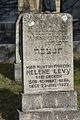 Jüdischer Friedhof Ahrweiler Grabstein 134.JPG 2,520 × 3,776; 4.26 MB
-
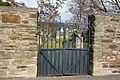 Jüdischer Friedhof Ahrweiler Tor 143.JPG 3,776 × 2,520; 5.94 MB


