Category:Jüdischer Friedhof Levern
| Object location | | View all coordinates using: OpenStreetMap |
|---|
 | |||||
| Upload media | |||||
| Instance of | |||||
|---|---|---|---|---|---|
| Location | Levern, Stemwede, Minden-Lübbecke District, Detmold Government Region, North Rhine-Westphalia, Germany | ||||
| Heritage designation | |||||
 | |||||
| This category shows a heritage building in Germany, located in the North Rhine-Westphalian municipality Stemwede (no. 063). |
Media in category "Jüdischer Friedhof Levern"
The following 21 files are in this category, out of 21 total.
-
 Jüdischer Friedhof Levern, Friedhofstor.JPG 2,822 × 1,922; 3.21 MB
-
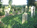 Jüdischer Friedhof Levern, Gesamtansicht.JPG 3,072 × 2,304; 4.18 MB
-
 Jüdischer Friedhof Levern, Grabstein von Abraham Sauer, Rückseite.JPG 2,304 × 3,072; 4.15 MB
-
 Jüdischer Friedhof Levern, Grabstein von Amalie Sauer, Rückseite.JPG 2,304 × 3,072; 4.07 MB
-
 Jüdischer Friedhof Levern, Grabstein von Amalie Sauer, Vorderseite.JPG 2,304 × 3,072; 3.7 MB
-
 Jüdischer Friedhof Levern, Grabstein von Bernhard Löwenstein.JPG 2,304 × 3,072; 3.84 MB
-
 Jüdischer Friedhof Levern, Grabstein von Betty Sauer, Rückseite.JPG 2,304 × 3,072; 4.09 MB
-
 Jüdischer Friedhof Levern, Grabstein von Erich Hurwitz.JPG 2,304 × 3,072; 5.56 MB
-
 Jüdischer Friedhof Levern, Grabstein von Ernestine Boas.JPG 2,304 × 3,072; 3.25 MB
-
 Jüdischer Friedhof Levern, Grabstein von Feibes Boas.JPG 2,304 × 3,072; 3.8 MB
-
 Jüdischer Friedhof Levern, Grabstein von Gella Hurwitz.JPG 2,304 × 3,072; 3.67 MB
-
 Jüdischer Friedhof Levern, Grabstein von Henriette Hurwitz.JPG 2,304 × 3,072; 3.71 MB
-
 Jüdischer Friedhof Levern, Grabstein von Ida Hurwitz.JPG 2,304 × 3,072; 4.15 MB
-
 Jüdischer Friedhof Levern, Grabstein von Jakob Horwitz.JPG 2,304 × 3,072; 3.62 MB
-
 Jüdischer Friedhof Levern, Grabstein von Jettchen Hurwitz.JPG 2,304 × 3,072; 4.19 MB
-
 Jüdischer Friedhof Levern, Grabstein von Johanne Boas.JPG 2,304 × 3,072; 3.16 MB
-
 Jüdischer Friedhof Levern, Grabstein von Julie Löwenstein.JPG 2,304 × 3,072; 4.14 MB
-
 Jüdischer Friedhof Levern, Grabstein von Leberecht Sieger.JPG 2,304 × 3,072; 3.8 MB
-
 Jüdischer Friedhof Levern, Grabstein von Michaelis Eichmann.JPG 2,304 × 3,072; 4.64 MB
-
 Jüdischer Friedhof Levern, Grabstein von Simon Hurwitz.JPG 2,304 × 3,072; 3.9 MB
-
 Jüdischer Friedhof Levern, Grabsteine von Mitgliedern der Familie Sauer.JPG 3,072 × 2,304; 4.35 MB


